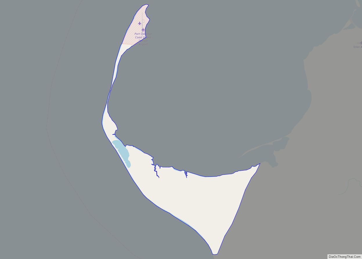
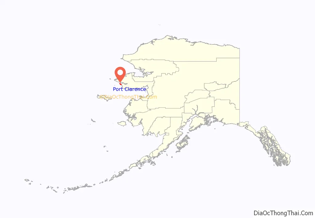
Port Clarence is a census-designated place (CDP) in Nome Census Area, Alaska. The population was 24 at the 2010 census, up from 21 in 2000. It is located on the spit separating Port Clarence Bay from the Bering Strait.
| Name: | Port Clarence CDP |
|---|---|
| LSAD Code: | 57 |
| LSAD Description: | CDP (suffix) |
| State: | Alaska |
| County: | Nome Census Area |
| Elevation: | 16 ft (5 m) |
| Total Area: | 35.02 sq mi (90.71 km²) |
| Land Area: | 34.05 sq mi (88.20 km²) |
| Water Area: | 0.97 sq mi (2.51 km²) |
| Total Population: | 0 |
| Population Density: | 0.00/sq mi (0.00/km²) |
| Area code: | 907 |
| FIPS code: | 0263170 |
| GNISfeature ID: | 1408213 |
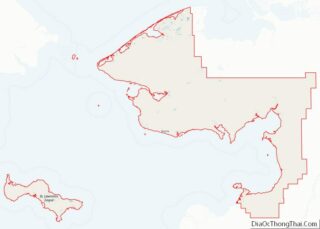
Online Interactive Map
Click on ![]() to view map in "full screen" mode.
to view map in "full screen" mode.
Port Clarence location map. Where is Port Clarence CDP?
History
Missionary Sheldon Jackson’s greatest success with his Teller Reindeer Station at Port Clarence, figured in the Overland Relief Expedition in 1897 to save marooned whalers near Point Barrow.
During the 1898-1899 gold rush in Nome, smaller quantities of both gold and high-grade tin were mined in Port Clarence.
The Harriman Alaska Expedition visited Port Clarence in 1899, making a photographic record of Alaska Natives.
In 1900, the U.S. Coast and Geodetic Survey charted the coastline.
From 1961–2010 Port Clarence was a LORAN-C station administered by the U.S. Coast Guard. The LORAN-C Program was terminated Feb. 8, 2010.
The U.S. Coast Guard commissioned a 1350 ft. (411.48 metre) tall Loran-C tower in 1961. It was the tallest structure in Alaska until its demolition in 2010.
Port Clarence Road Map
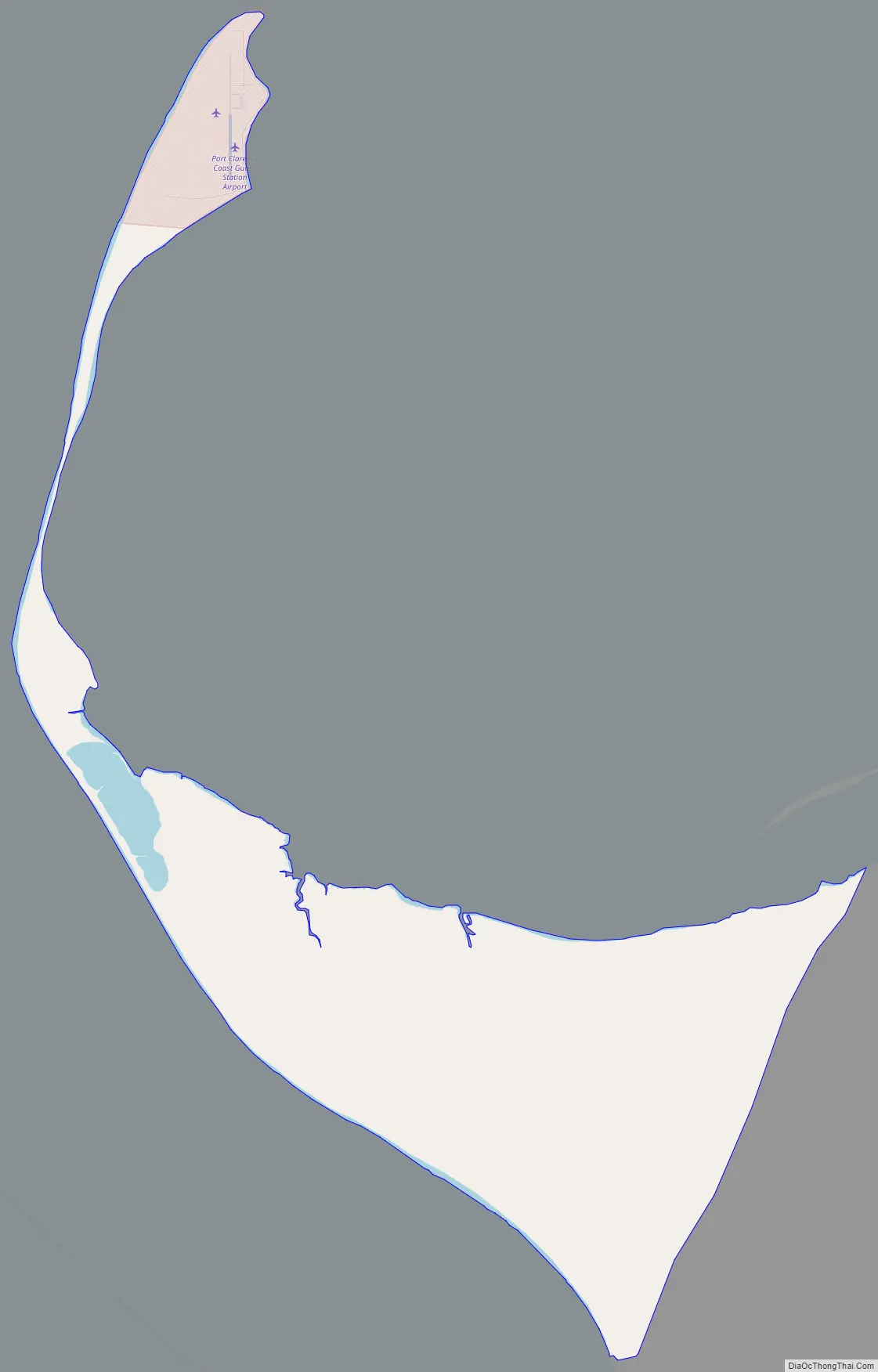
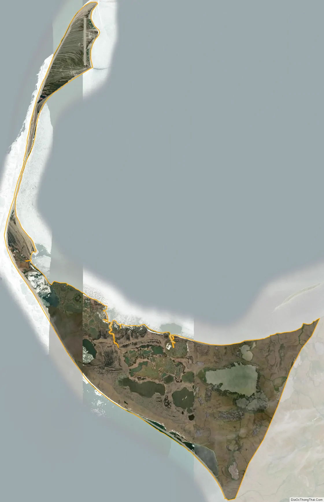
Port Clarence city Satellite Map
Geography
Port Clarence is located at 65°15′58″N 166°51′10″W / 65.26611°N 166.85278°W / 65.26611; -166.85278 (65.265974, -166.852765).
According to the United States Census Bureau, the CDP has a total area of 36.5 square miles (95 km), of which, 35.5 square miles (92 km) of it is land and 1.0 square mile (2.6 km) of it (2.74%) is water.
See also
Map of Alaska State and its subdivision:- Aleutians East
- Aleutians West
- Anchorage
- Bethel
- Bristol Bay
- Denali
- Dillingham
- Fairbanks North Star
- Haines
- Juneau
- Kenai Peninsula
- Ketchikan Gateway
- Kodiak Island
- Lake and Peninsula
- Matanuska-Susitna
- Nome
- North Slope
- Northwest Arctic
- Prince of Wales-Outer Ketchi
- Sitka
- Skagway-Yakutat-Angoon
- Southeast Fairbanks
- Valdez-Cordova
- Wade Hampton
- Wrangell-Petersburg
- Yukon-Koyukuk
- Alabama
- Alaska
- Arizona
- Arkansas
- California
- Colorado
- Connecticut
- Delaware
- District of Columbia
- Florida
- Georgia
- Hawaii
- Idaho
- Illinois
- Indiana
- Iowa
- Kansas
- Kentucky
- Louisiana
- Maine
- Maryland
- Massachusetts
- Michigan
- Minnesota
- Mississippi
- Missouri
- Montana
- Nebraska
- Nevada
- New Hampshire
- New Jersey
- New Mexico
- New York
- North Carolina
- North Dakota
- Ohio
- Oklahoma
- Oregon
- Pennsylvania
- Rhode Island
- South Carolina
- South Dakota
- Tennessee
- Texas
- Utah
- Vermont
- Virginia
- Washington
- West Virginia
- Wisconsin
- Wyoming