Ruby (Koyukon: Tl’aa’ologhe) is an incorporated town in central western Alaska, situated on the south bank of the Yukon River at the northwesternmost tip of the Nowitna National Wildlife Refuge. It is accessible only by boat or air. A formerly sizeable gold-mining and lumbering town servicing the region, at the 2010 census the population was just 166, with only a general store and post office remaining as businesses, down from 188 in 2000.
| Name: | Ruby city |
|---|---|
| LSAD Code: | 25 |
| LSAD Description: | city (suffix) |
| State: | Alaska |
| County: | Yukon-Koyukuk Census Area |
| Incorporated: | September 25, 1973 |
| Elevation: | 249 ft (76 m) |
| Total Area: | 7.03 sq mi (18.19 km²) |
| Land Area: | 7.03 sq mi (18.19 km²) |
| Water Area: | 0.00 sq mi (0.00 km²) |
| Total Population: | 139 |
| Population Density: | 19.79/sq mi (7.64/km²) |
| ZIP code: | 99768 |
| Area code: | 907 |
| FIPS code: | 0265590 |
| GNISfeature ID: | 1408878 |
Online Interactive Map
Click on ![]() to view map in "full screen" mode.
to view map in "full screen" mode.
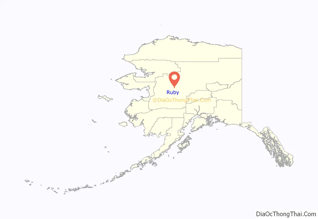
Ruby location map. Where is Ruby city?
History
The town of Ruby was established in 1911 as the result of a gold rush. The amount of gold that is in the Fairbanks district is over 8 million troy ounces (250 tonnes) of gold, lodes have yielded over 4 million ounces. Gold was first discovered at the current townsite in 1906 on Ruby Creek. That discovery brought more prospectors to the area. In 1910 word leaked out about a gold strike on Long Creek, 30 miles south of Ruby, and a stampede was on. Discoveries on other nearby creeks followed and Ruby became the supply point for the mines.
At its peak the population was near 3,000, but by 1918 the town was in steep decline. Many of the men had left to fight in World War I, and several of the towns business people and their families were lost in the sinking of the Canadian passenger liner Sophia. A fire in 1929 destroyed much of the business district and a flood in 1931 took out what was left of buildings on the riverfront.
After World War II, Native Americans from near-by Kokrines relocated to Ruby to take advantage of the abandoned homes. There are currently fewer than 200 people living in Ruby.
The largest gold nugget ever found in Alaska, 294.10 troy ounces (322.67 oz; 9,148 g), was found near Ruby in 1998.
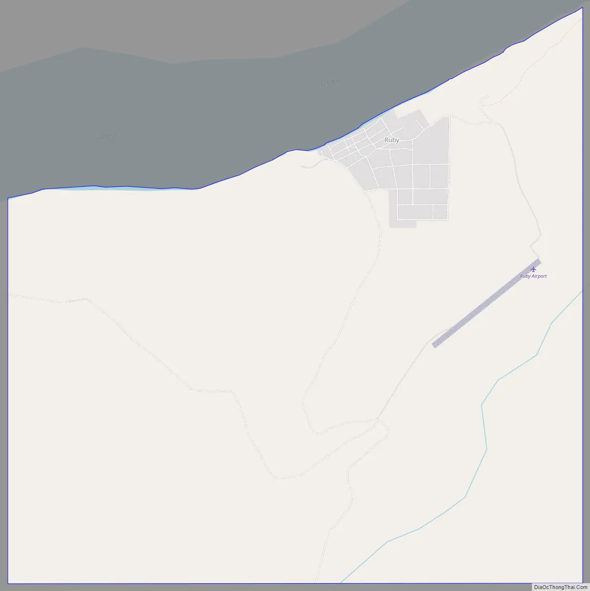
Ruby Road Map
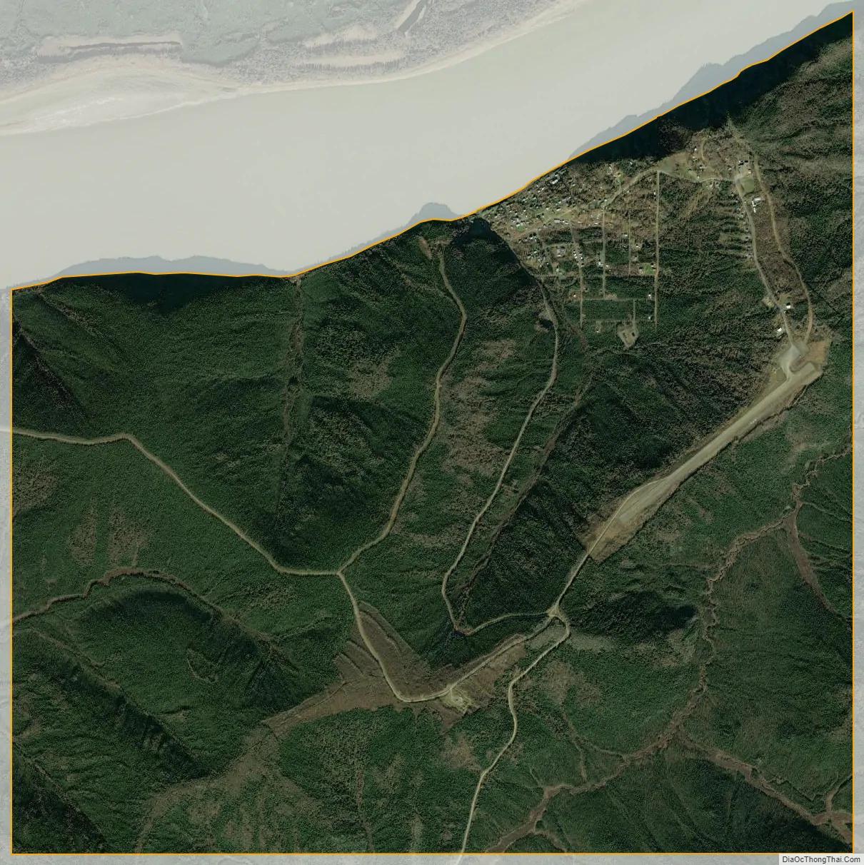
Ruby city Satellite Map
Geography
Ruby is located at 64°44′14″N 155°29′16″W / 64.73722°N 155.48778°W / 64.73722; -155.48778 (64.737306, -155.487693).
According to the United States Census Bureau, the city has a total area of 7.6 square miles (20 km).
See also
Map of Alaska State and its subdivision:- Aleutians East
- Aleutians West
- Anchorage
- Bethel
- Bristol Bay
- Denali
- Dillingham
- Fairbanks North Star
- Haines
- Juneau
- Kenai Peninsula
- Ketchikan Gateway
- Kodiak Island
- Lake and Peninsula
- Matanuska-Susitna
- Nome
- North Slope
- Northwest Arctic
- Prince of Wales-Outer Ketchi
- Sitka
- Skagway-Yakutat-Angoon
- Southeast Fairbanks
- Valdez-Cordova
- Wade Hampton
- Wrangell-Petersburg
- Yukon-Koyukuk
- Alabama
- Alaska
- Arizona
- Arkansas
- California
- Colorado
- Connecticut
- Delaware
- District of Columbia
- Florida
- Georgia
- Hawaii
- Idaho
- Illinois
- Indiana
- Iowa
- Kansas
- Kentucky
- Louisiana
- Maine
- Maryland
- Massachusetts
- Michigan
- Minnesota
- Mississippi
- Missouri
- Montana
- Nebraska
- Nevada
- New Hampshire
- New Jersey
- New Mexico
- New York
- North Carolina
- North Dakota
- Ohio
- Oklahoma
- Oregon
- Pennsylvania
- Rhode Island
- South Carolina
- South Dakota
- Tennessee
- Texas
- Utah
- Vermont
- Virginia
- Washington
- West Virginia
- Wisconsin
- Wyoming


