Shaktoolik (Inupiaq: Saktuliq, IPA: [sɑqtuleq]; Central Yupik: Cagtuleq) is a city in Nome Census Area, Alaska, United States. At the 2010 census the population was 251, up from 230 in 2000. Shaktoolik is one of a number of Alaskan communities threatened by erosion and related global warming effects. The community has been relocated twice.
| Name: | Shaktoolik city |
|---|---|
| LSAD Code: | 25 |
| LSAD Description: | city (suffix) |
| State: | Alaska |
| County: | Nome Census Area |
| Incorporated: | October 7, 1969 |
| Elevation: | 23 ft (7 m) |
| Total Area: | 1.08 sq mi (2.79 km²) |
| Land Area: | 1.07 sq mi (2.77 km²) |
| Water Area: | 0.01 sq mi (0.02 km²) |
| Total Population: | 212 |
| Population Density: | 198.50/sq mi (76.67/km²) |
| ZIP code: | 99771 |
| Area code: | 907 |
| FIPS code: | 0268890 |
| GNISfeature ID: | 1669434 |
Online Interactive Map
Click on ![]() to view map in "full screen" mode.
to view map in "full screen" mode.
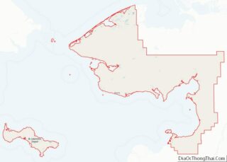
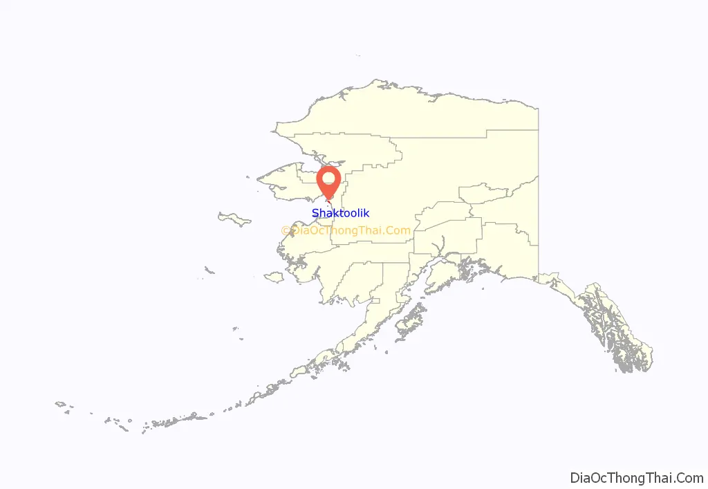
Shaktoolik location map. Where is Shaktoolik city?
History
According to the Alaska Dept. of Community and Economic Development, Shaktoolik was the first and southernmost Malemiut settlement on Norton Sound, occupied as early as 1839. Twelve miles northwest, on Cape Denbigh, is the Iyatayet site that is 6,000 to 8,000 years old, and listed on the National Register of Historic Places. Shaktoolik was first mapped in 1842–1844 by Lt. Lavrenty Zagoskin, Imperial Russian Navy, who called it “Tshaktogmyut.” “Shaktoolik” is derived from an Unaliq word, “suktuliq”, meaning “scattered things”.
Reindeer herds were managed in the Shaktoolik area around 1905. The village was originally located six miles up the Shaktoolik River, and moved to the mouth of the River in 1933. This site was prone to severe storms and winds, however, and the village relocated to its present, more sheltered location in 1967. There are presently only two occupied dwellings at the old townsite. The City was incorporated in 1969.
Shaktoolik Road Map
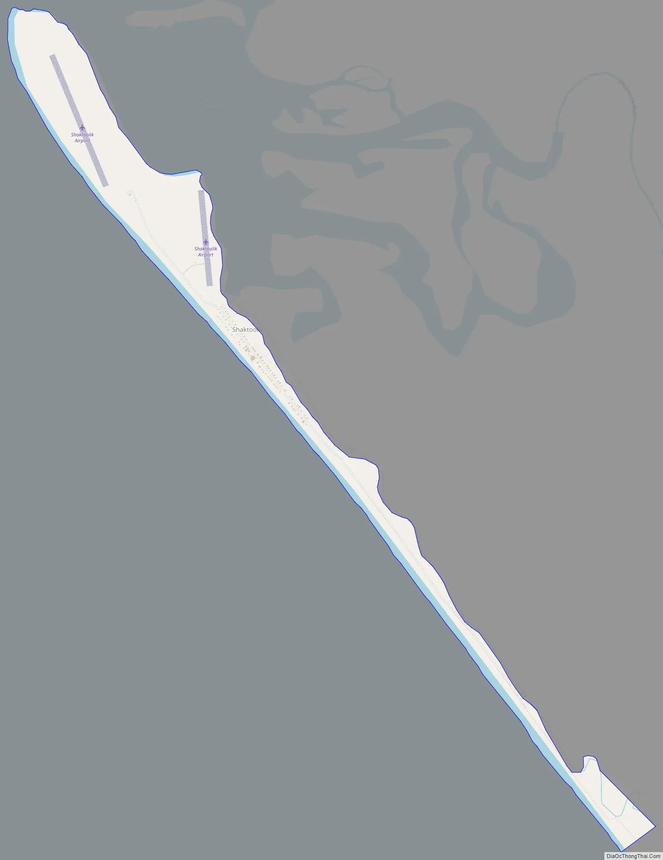
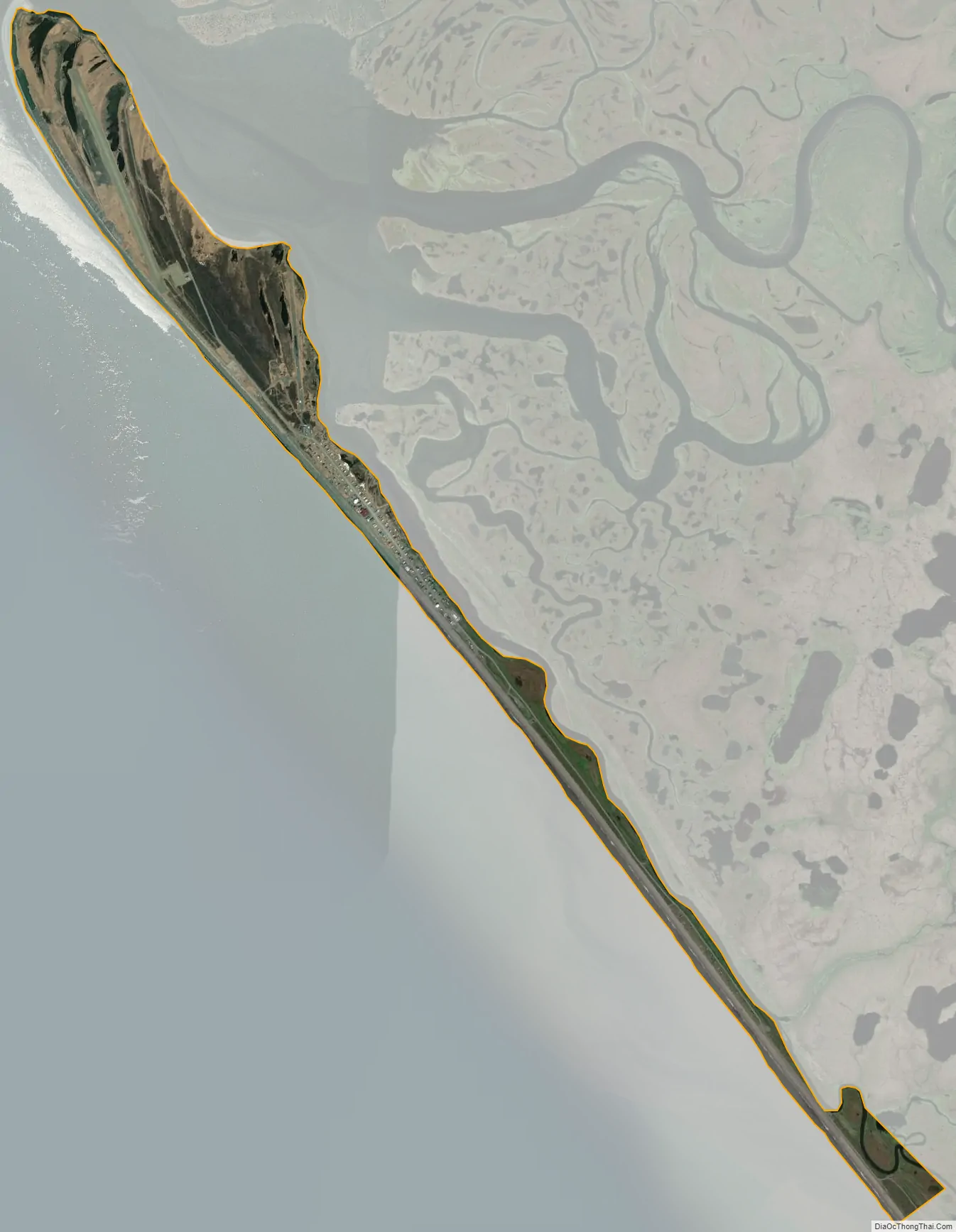
Shaktoolik city Satellite Map
Geography
Shaktoolik is located at 64°21′20″N 161°11′29″W / 64.355612°N 161.191328°W / 64.355612; -161.191328.
According to the United States Census Bureau, the city has a total area of 1.1 square miles (2.8 km), all of it land.
According to the State of Alaska, Department of Community and Economic Development, Shaktoolik is located on the east shore of Norton Sound. It lies 125 miles east of Nome and 33 miles north of Unalakleet. It lies at approximately 64.333890° North Latitude and -161.153890° West Longitude. (Sec. 23, T013S, R013W, Kateel River Meridian.) Shaktoolik has a subarctic climate with maritime influences when Norton Sound is ice-free, usually from May to October. Summer temperatures average 47 to 62; winter temperatures average -4 to 11. Extremes from -50 to 87 have been recorded. Average annual precipitation is 14 inches, including 43 inches of snowfall.
See also
Map of Alaska State and its subdivision:- Aleutians East
- Aleutians West
- Anchorage
- Bethel
- Bristol Bay
- Denali
- Dillingham
- Fairbanks North Star
- Haines
- Juneau
- Kenai Peninsula
- Ketchikan Gateway
- Kodiak Island
- Lake and Peninsula
- Matanuska-Susitna
- Nome
- North Slope
- Northwest Arctic
- Prince of Wales-Outer Ketchi
- Sitka
- Skagway-Yakutat-Angoon
- Southeast Fairbanks
- Valdez-Cordova
- Wade Hampton
- Wrangell-Petersburg
- Yukon-Koyukuk
- Alabama
- Alaska
- Arizona
- Arkansas
- California
- Colorado
- Connecticut
- Delaware
- District of Columbia
- Florida
- Georgia
- Hawaii
- Idaho
- Illinois
- Indiana
- Iowa
- Kansas
- Kentucky
- Louisiana
- Maine
- Maryland
- Massachusetts
- Michigan
- Minnesota
- Mississippi
- Missouri
- Montana
- Nebraska
- Nevada
- New Hampshire
- New Jersey
- New Mexico
- New York
- North Carolina
- North Dakota
- Ohio
- Oklahoma
- Oregon
- Pennsylvania
- Rhode Island
- South Carolina
- South Dakota
- Tennessee
- Texas
- Utah
- Vermont
- Virginia
- Washington
- West Virginia
- Wisconsin
- Wyoming