Shishmaref (/ˈʃɪʃmərɛf/ SHISH-mə-ref; Inupiaq: Qigiqtaq, IPA: [qixiqtaq]; Russian: Шишмарёв, IPA: [ʂɨʂmɐˈrʲɵf]) is a city in the Nome Census Area, Alaska, United States. It is located on Sarichef Island in the Chukchi Sea, just north of the Bering Strait and five miles from the mainland. Shishmaref lies within the Bering Land Bridge National Preserve. The population was 563 at the 2010 census, up from 562 in 2000.
| Name: | Shishmaref city |
|---|---|
| LSAD Code: | 25 |
| LSAD Description: | city (suffix) |
| State: | Alaska |
| County: | Nome Census Area |
| Incorporated: | July 13, 1969 |
| Elevation: | 16 ft (5 m) |
| Total Area: | 7.27 sq mi (18.82 km²) |
| Land Area: | 2.34 sq mi (6.06 km²) |
| Water Area: | 4.93 sq mi (12.76 km²) |
| Total Population: | 576 |
| Population Density: | 246.26/sq mi (95.08/km²) |
| ZIP code: | 99772 |
| Area code: | 907 |
| FIPS code: | 0269770 |
| GNISfeature ID: | 1409434 |
Online Interactive Map
Click on ![]() to view map in "full screen" mode.
to view map in "full screen" mode.
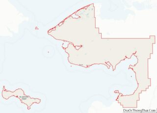
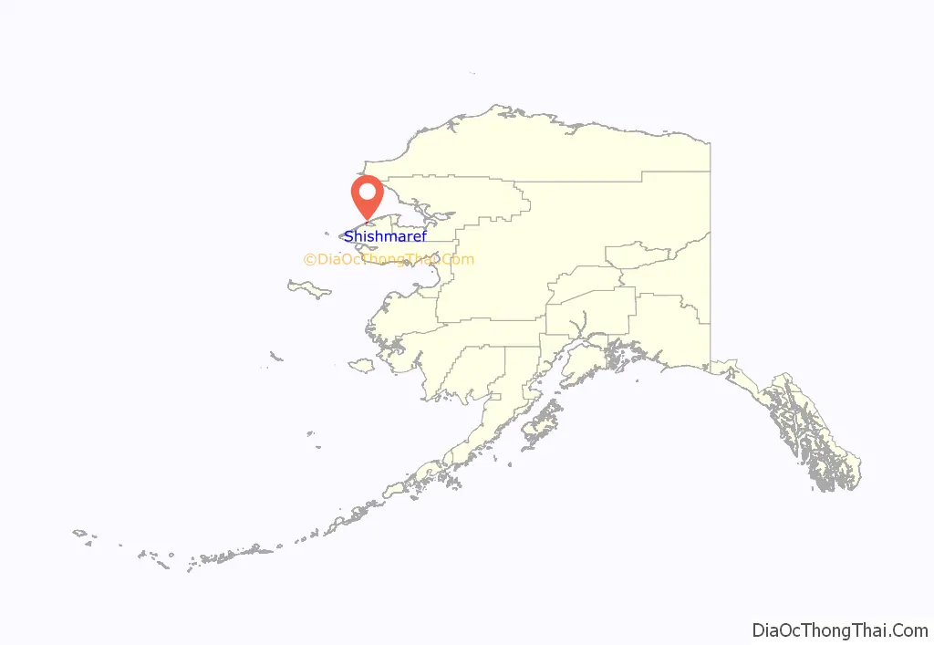
Shishmaref location map. Where is Shishmaref city?
Shishmaref Road Map
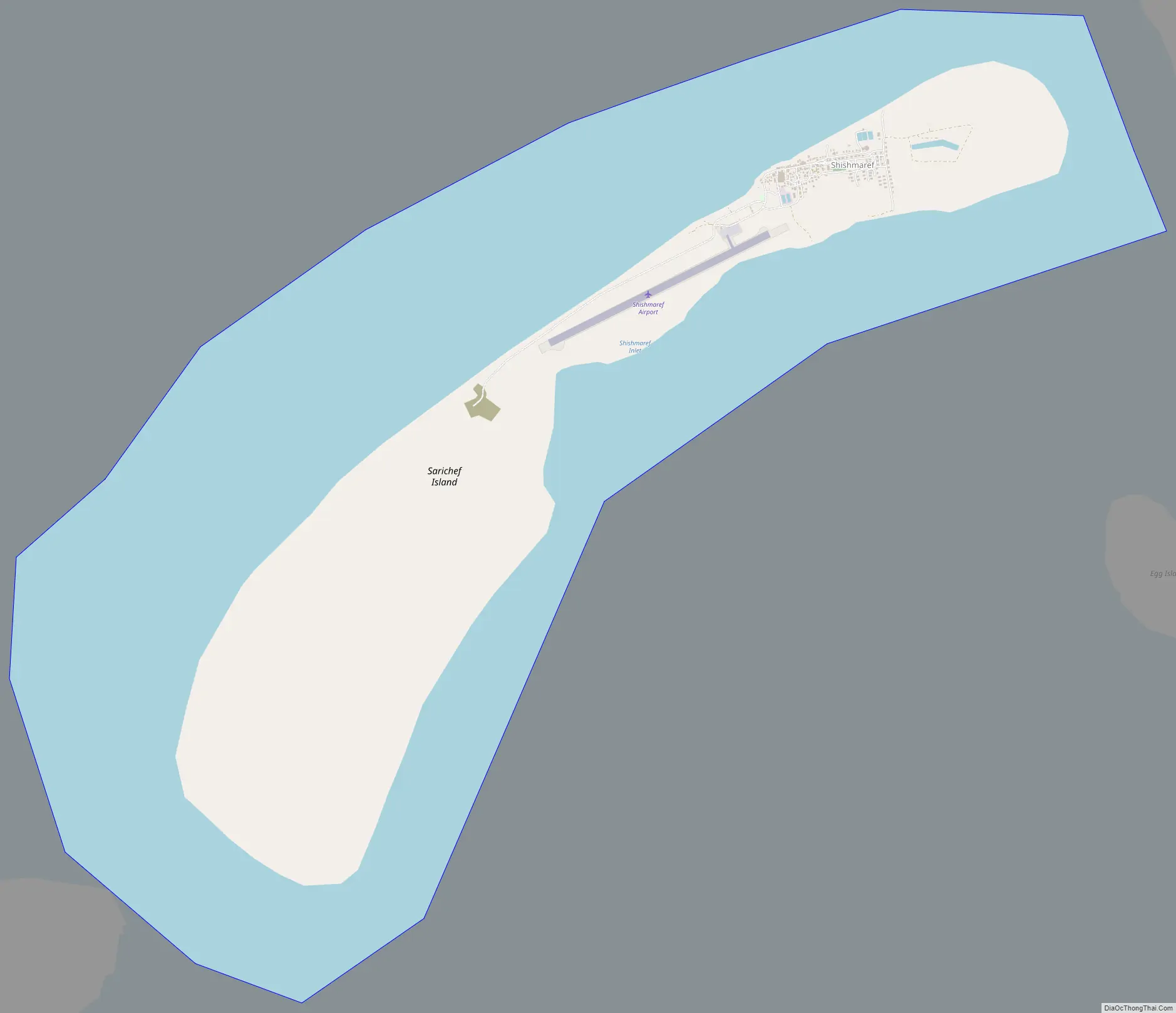
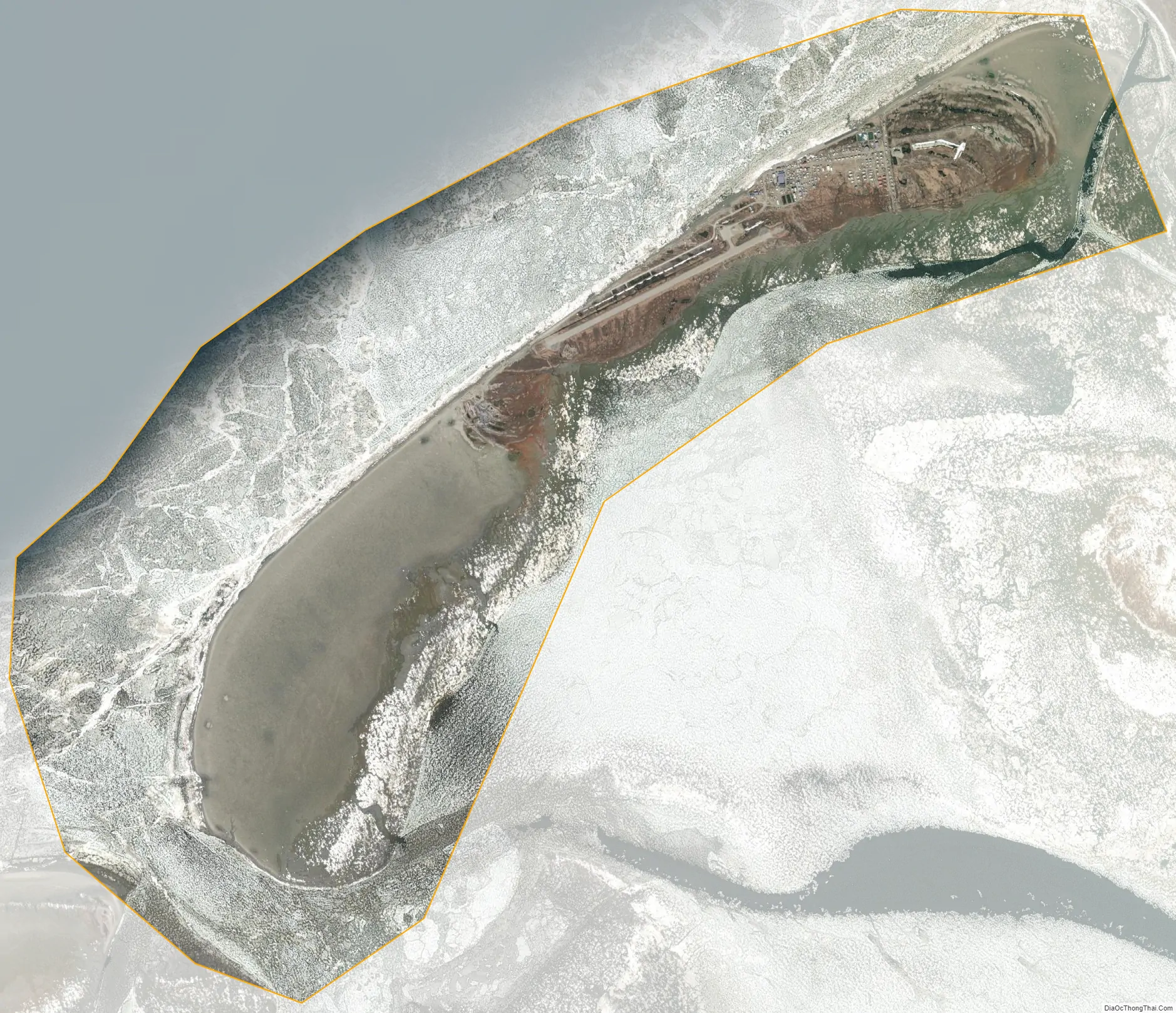
Shishmaref city Satellite Map
Geography
According to the United States Census Bureau, the city has a total area of 7.3 square miles (19 km), of which, 2.8 square miles (7.3 km) of it is land and 4.5 square miles (12 km) of it (61.62%) is water.
Shishmaref was named in 1821 by explorer Lt. Otto von Kotzebue, of the Imperial Russian Navy, after Capt. Lt. Gleb Shishmaryov who accompanied him on his exploration.
Sarichef Island (on which Shishmaref is located) is part of a dynamic, 100 km-long barrier island chain that records human and environmental history spanning the past 2000 years; the oldest subaerial evidence for the formation of this system is about 1700 years before present, according to carbon 14 dating (see References, below). Erosion at Shishmaref is unique along the islands because of its fetch exposure and high tidal prism, relatively intense infrastructure development during the 20th century, and multiple shoreline defense structures built beginning in the 1970s.
Global warming
The effect of global climate change upon Shishmaref is sometimes seen as the most dramatic in the world. Rising temperatures have resulted in a reduction in the sea ice which serves to buffer Shishmaref from storm surges. At the same time, the permafrost that the village is built on has also begun to melt, making the shore even more vulnerable to erosion. In recent years the shore has been receding at an average rate of up to 10 feet (3.3 m) per year. Although a series of barricades has been put up to protect the village, the shore has continued to erode at an alarming rate. The Army Corps of Engineers has built a series of walls but none have been completely effective against waves. The town’s homes, water system and infrastructure are being undermined. Currently, Shishmaref has obtained funds to construct seawalls that protect some of the shoreline.
The village had plans to relocate several miles to the south, on the mainland to the Tin Creek site. However, Tin Creek proved unsuitable for long term settlement due to melting permafrost in the area. The Shishmaref Erosion and Relocation Coalition, made up of the city, the IRA Council and other organizations, is seeking federal, state and private funding for a move elsewhere. The cost of moving Shishmaref is estimated at $180 million, nearly $320,000 per resident. The village was told by the Obama administration that no federal money was available, therefore tensions arose in 2013 when John Kerry announced Vietnam would receive $17 million to deal with climate change.
Erosion rates along the island front exceed (and are not comparable with) those along adjacent sectors. Erosion is occurring along the entire island chain, but it is exacerbated at Sarichef Island in part because of the hydrographic impacts of hard armoring of a sandy shoreface and permafrost degradation that is accelerated by infrastructure. Residents are experiencing the effects of coastal retreat on residential and commercial properties.
Residents voted on town relocation several times, as early as 1975 and then in 2002 which approved it. On August 16, 2016, the village voted to move the town to the mainland. The town’s residents prefer to think of the move to the mainland as an “expansion” rather than a “relocation”, but although a site on the mainland called West Tin-Creek Hills was selected in 2016, there’s still a lot of planning and research to be done before that can be determined viable.
See also
Map of Alaska State and its subdivision:- Aleutians East
- Aleutians West
- Anchorage
- Bethel
- Bristol Bay
- Denali
- Dillingham
- Fairbanks North Star
- Haines
- Juneau
- Kenai Peninsula
- Ketchikan Gateway
- Kodiak Island
- Lake and Peninsula
- Matanuska-Susitna
- Nome
- North Slope
- Northwest Arctic
- Prince of Wales-Outer Ketchi
- Sitka
- Skagway-Yakutat-Angoon
- Southeast Fairbanks
- Valdez-Cordova
- Wade Hampton
- Wrangell-Petersburg
- Yukon-Koyukuk
- Alabama
- Alaska
- Arizona
- Arkansas
- California
- Colorado
- Connecticut
- Delaware
- District of Columbia
- Florida
- Georgia
- Hawaii
- Idaho
- Illinois
- Indiana
- Iowa
- Kansas
- Kentucky
- Louisiana
- Maine
- Maryland
- Massachusetts
- Michigan
- Minnesota
- Mississippi
- Missouri
- Montana
- Nebraska
- Nevada
- New Hampshire
- New Jersey
- New Mexico
- New York
- North Carolina
- North Dakota
- Ohio
- Oklahoma
- Oregon
- Pennsylvania
- Rhode Island
- South Carolina
- South Dakota
- Tennessee
- Texas
- Utah
- Vermont
- Virginia
- Washington
- West Virginia
- Wisconsin
- Wyoming