Venetie (/ˈviːnɪtaɪ/ VEEN-i-ty; Vįįhtąįį in Gwich’in), is a census-designated place (CDP) in Yukon–Koyukuk Census Area, Alaska. At the 2010 census, the population was 166, down from 202 in 2000. It includes the Village of Venetie, a Gwich’in tribal entity designated in the 1971 Alaska Native Claims Settlement Act.
| Name: | Venetie CDP |
|---|---|
| LSAD Code: | 57 |
| LSAD Description: | CDP (suffix) |
| State: | Alaska |
| County: | Yukon-Koyukuk Census Area |
| Total Area: | 23.01 sq mi (59.59 km²) |
| Land Area: | 23.01 sq mi (59.59 km²) |
| Water Area: | 0.00 sq mi (0.00 km²) |
| Total Population: | 205 |
| Population Density: | 8.91/sq mi (3.44/km²) |
| ZIP code: | 99781 |
| Area code: | 907 |
| FIPS code: | 0282420 |
Online Interactive Map
Click on ![]() to view map in "full screen" mode.
to view map in "full screen" mode.
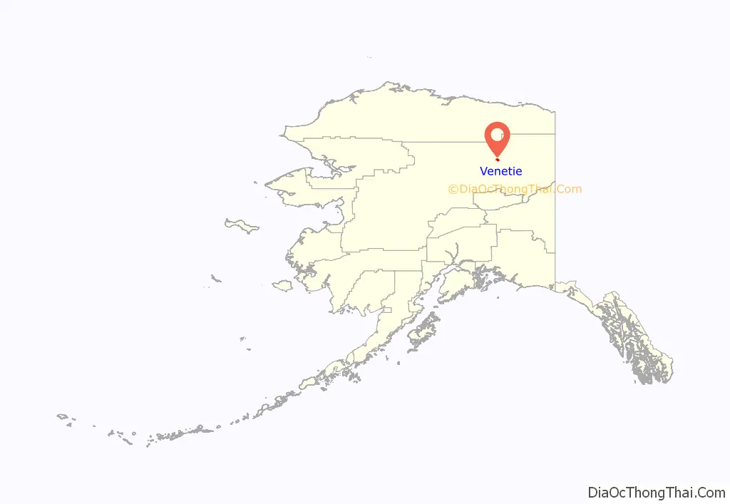
Venetie location map. Where is Venetie CDP?
History
Gwich’in tribal leader John Fredson achieved federal recognition of the larger area of the Venetie Indian Reserve as Alaska Native territory in 1941, before Alaska was admitted to the union as a state. It was the largest reservation in Alaska, with approximately 1.4 million acres (5,700 km) when established.
Under the 1971 Alaska Native Claims Settlement Act, most reservations in Alaska were dissolved and the federal government made payments to tribes for considerable territory, designating areas as tribal lands. The Gwich’in tribal lands were reduced.
The people continued to adapt. In the early 1980s a “unified Venetie/Arctic village tribal government formally codified traditional principles of caribou management into tribal law,” an example of Alaska Native subsistence practices. Anthropologist Steve J. Langdon lauded this action as a way of combining traditional spirituality with secular law demonstrating “the resiliency of the traditional cosmology and behavior and its ability to be flexibly incorporated into contemporary institutions and practice.” A majority of the residents approved limits on the harvest of the Porcupine caribou herd.
In 1987 the Gwich’in tribal council tried to tax a non-native contractor building a school here, saying the council had the right as the government of tribal land. The case went to the United States Court of Appeals for the Ninth Circuit, in San Francisco, which ruled in 1996 “that the natives had the right to tax businesses on their land, about the size of Delaware, because it qualified as Indian Country, much like the reservations in the lower 48 states.”
The state of Alaska appealed that decision, concerned that up to 44 million acres of tribal lands in Alaska might be classified as Indian Country and thus subject to local tribal taxation. (In the Lower 48, by comparison, about 56 million acres are designated as federally recognized, sovereign Indian reservation lands.)
In 1998, the case was heard by the United States Supreme Court, which ruled in Alaska v. Native Village of Venetie Tribal Government. It determined that the tribal council did not have taxing authority on its land, as the terms of the 1971 Alaska Native Claims Settlement Act had done away with almost all reservations in the state. Under that act, the federal government had made payment to the tribes for land claims and designated tribal lands for them. But, under the terms of the act, the tribal lands do not have the same sovereign status as federally recognized Indian reservations in the Lower 48.
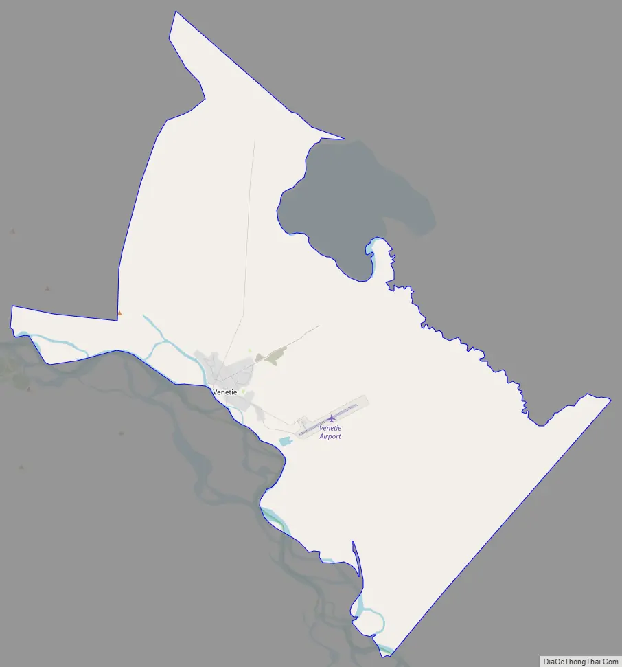
Venetie Road Map
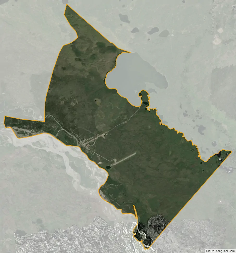
Venetie city Satellite Map
Geography
Venetie is located at 67°3′20″N 146°24′58″W / 67.05556°N 146.41611°W / 67.05556; -146.41611 (67.055639, -146.416052) on the Chandalar River.
According to the United States Census Bureau, the CDP has a total area of 20.8 square miles (54 km), all of it land.
See also
Map of Alaska State and its subdivision:- Aleutians East
- Aleutians West
- Anchorage
- Bethel
- Bristol Bay
- Denali
- Dillingham
- Fairbanks North Star
- Haines
- Juneau
- Kenai Peninsula
- Ketchikan Gateway
- Kodiak Island
- Lake and Peninsula
- Matanuska-Susitna
- Nome
- North Slope
- Northwest Arctic
- Prince of Wales-Outer Ketchi
- Sitka
- Skagway-Yakutat-Angoon
- Southeast Fairbanks
- Valdez-Cordova
- Wade Hampton
- Wrangell-Petersburg
- Yukon-Koyukuk
- Alabama
- Alaska
- Arizona
- Arkansas
- California
- Colorado
- Connecticut
- Delaware
- District of Columbia
- Florida
- Georgia
- Hawaii
- Idaho
- Illinois
- Indiana
- Iowa
- Kansas
- Kentucky
- Louisiana
- Maine
- Maryland
- Massachusetts
- Michigan
- Minnesota
- Mississippi
- Missouri
- Montana
- Nebraska
- Nevada
- New Hampshire
- New Jersey
- New Mexico
- New York
- North Carolina
- North Dakota
- Ohio
- Oklahoma
- Oregon
- Pennsylvania
- Rhode Island
- South Carolina
- South Dakota
- Tennessee
- Texas
- Utah
- Vermont
- Virginia
- Washington
- West Virginia
- Wisconsin
- Wyoming


