White Mountain (Inupiaq: Nasirvik, Nachirvik, or Nachizrvik) is a city in Nome Census Area, Alaska, United States. The population was 190 at the 2010 census, down from 203 in 2000. The city is an Iġaluŋmiut (Fish River tribe) Inupiat village, with historical influences from and relationships with Qawiaraq (Mary’s Igloo Inupiat and Golovin and Elim Yup’iks. 86.2% of the population is Alaska Native or part Native. Subsistence activities are prevalent. White Mountain is the only village on the Seward Peninsula located inland, not on the ocean.
| Name: | White Mountain city |
|---|---|
| LSAD Code: | 25 |
| LSAD Description: | city (suffix) |
| State: | Alaska |
| County: | Nome Census Area |
| Incorporated: | July 15, 1969 |
| Elevation: | 62 ft (19 m) |
| Total Area: | 2.05 sq mi (5.30 km²) |
| Land Area: | 1.82 sq mi (4.73 km²) |
| Water Area: | 0.22 sq mi (0.57 km²) |
| Total Population: | 185 |
| Population Density: | 101.37/sq mi (39.14/km²) |
| Area code: | 907 |
| FIPS code: | 0284070 |
| GNISfeature ID: | 1411989 |
Online Interactive Map
Click on ![]() to view map in "full screen" mode.
to view map in "full screen" mode.
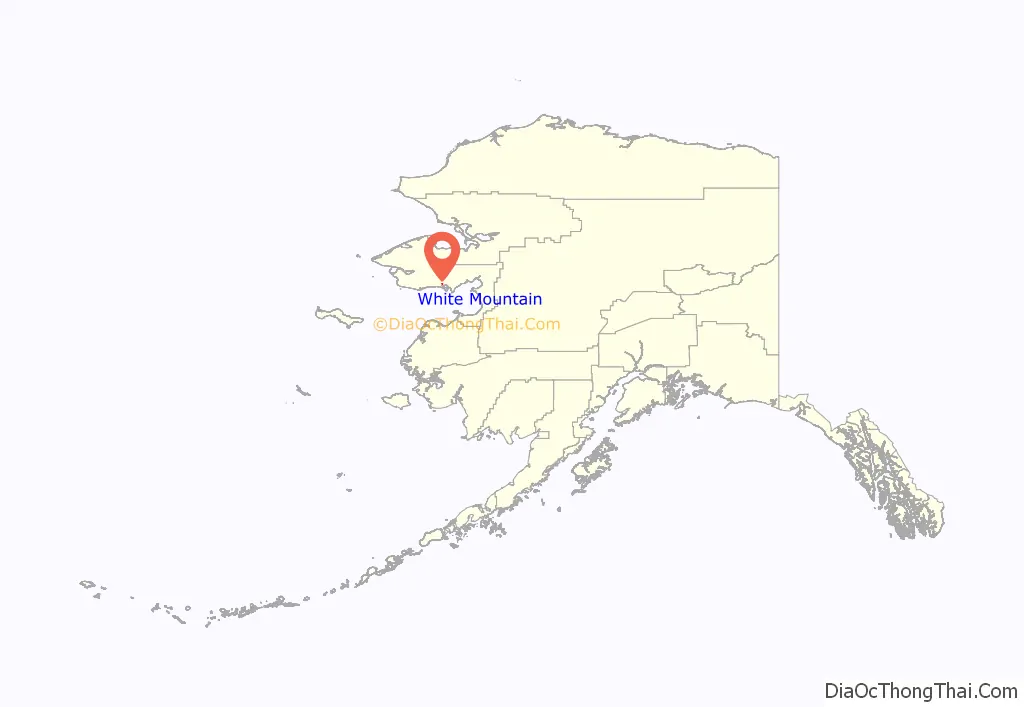
White Mountain location map. Where is White Mountain city?
History
The area that is present day White Mountain began as the Eskimo fish camp Nachirvik which means “mountain look-out point.” The bountiful resources of both the Niukluk and the Fish rivers supported the Native populations there. The community grew with the influx of white prospectors during the Klondike Gold Rush. The first non-Native structure was a warehouse built by the miner Charles D. Lane to store supplies for his claim in the Council District. It was the site of a government-subsidized orphanage, which became an industrial school in 1926. The Covenant Church was built in 1937. A Russian Orthodox Church was built about 1920 (although no longer utilized, the church log cabin building is still standing). A post office was opened in 1932. The tribal government re-organized under the Indian Reorganization Act (IRA) in 1939. The city was incorporated in 1969.
Today, White Mountain is most notable as the last of three mandatory rest stops for teams competing in the annual Iditarod. All mushers are required to take an 8-hour rest stop at White Mountain before making the final push to the end of the race, 77 miles (124 km) away in Nome.
White Mountain Road Map
White Mountain city Satellite Map
Geography
White Mountain is located at 64°40′51″N 163°24′24″W / 64.68083°N 163.40667°W / 64.68083; -163.40667 (64.680856, -163.406538). The city is located on the eastern bank of the Fish River.
According to the United States Census Bureau, the city has a total area of 2.0 square miles (5.3 km), of which 1.8 square miles (4.6 km) is land and 0.2 square miles (0.6 km) (11.82%) is water.
See also
Map of Alaska State and its subdivision:- Aleutians East
- Aleutians West
- Anchorage
- Bethel
- Bristol Bay
- Denali
- Dillingham
- Fairbanks North Star
- Haines
- Juneau
- Kenai Peninsula
- Ketchikan Gateway
- Kodiak Island
- Lake and Peninsula
- Matanuska-Susitna
- Nome
- North Slope
- Northwest Arctic
- Prince of Wales-Outer Ketchi
- Sitka
- Skagway-Yakutat-Angoon
- Southeast Fairbanks
- Valdez-Cordova
- Wade Hampton
- Wrangell-Petersburg
- Yukon-Koyukuk
- Alabama
- Alaska
- Arizona
- Arkansas
- California
- Colorado
- Connecticut
- Delaware
- District of Columbia
- Florida
- Georgia
- Hawaii
- Idaho
- Illinois
- Indiana
- Iowa
- Kansas
- Kentucky
- Louisiana
- Maine
- Maryland
- Massachusetts
- Michigan
- Minnesota
- Mississippi
- Missouri
- Montana
- Nebraska
- Nevada
- New Hampshire
- New Jersey
- New Mexico
- New York
- North Carolina
- North Dakota
- Ohio
- Oklahoma
- Oregon
- Pennsylvania
- Rhode Island
- South Carolina
- South Dakota
- Tennessee
- Texas
- Utah
- Vermont
- Virginia
- Washington
- West Virginia
- Wisconsin
- Wyoming
