Florence (O’odham: S-auppag) is a town, 61 miles (98 km) southeast of Phoenix, in Pinal County, Arizona, United States. Florence, which is the county seat of Pinal County, is one of the oldest towns in that county and is regarded as a National Historic District with over 25 buildings listed on the National Register of Historic Places. The population of Florence was 26,785 at the 2020 census.
| Name: | Florence town |
|---|---|
| LSAD Code: | 43 |
| LSAD Description: | town (suffix) |
| State: | Arizona |
| County: | Pinal County |
| Elevation: | 1,539 ft (469 m) |
| Total Area: | 62.68 sq mi (162.33 km²) |
| Land Area: | 62.64 sq mi (162.23 km²) |
| Water Area: | 0.04 sq mi (0.10 km²) |
| Total Population: | 26,785 |
| Population Density: | 427.62/sq mi (165.11/km²) |
| ZIP code: | 85128, 85132, 85179 |
| Area code: | 520 |
| FIPS code: | 0423760 |
| GNISfeature ID: | 2412633 |
| Website: | http://www.florenceaz.gov/ |
Online Interactive Map
Click on ![]() to view map in "full screen" mode.
to view map in "full screen" mode.
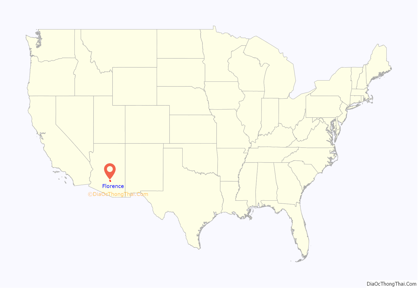
Florence location map. Where is Florence town?
History
The area where the current town of Florence is located was once inhabited by the Hohokam, ancestors of the O’odham people. Prior to the establishment of the town, the Gila River served as a part of the border between the United States and Mexico. In 1853, the Gadsden Purchase extended American territory well south of the Gila.
Levi Ruggles, a veteran of the American Civil War, founded the town of Florence on the south bank of the Gila River. He came to Arizona Territory in 1866 as a U.S. Indian Agent. Recognizing the agricultural potential of the valley, he found an easily fordable crossing on the Gila River and surveyed a townsite there. With the aid of Governor R.C. McCormick, he secured a post office in August of the same year. Ruggles held numerous public offices including that of Territorial Legislator. Florence became the county seat in the newly formed Pinal County. Silver was discovered in 1875 in the nearby mountains which led to the creation of the famous Silver King Mine.
Adamsville
In 1870, Fred Adams founded a farming community two miles west of the original Florence townsite. The farming town had stores, homes, a post office, a flour mill, and water tanks, It was named Adamsville. In the 1900s (decade), the Gila River overflowed after a storm and ran over its banks. Most of the small town was wiped out and the residents moved to Florence. The area where the town was established is now a ghost town and is currently within the boundaries of Florence. At the junction of Highway 79 and 287 there is a historical marker about Adamsville.
A canal was built in the 1880s which enabled water from the Gila River to be diverted for irrigation. Farming and ranching then played a major role in Florence’s economy. All of the federal land transactions for Southern Arizona were conducted in Florence until 1881, when the Federal Land Office was moved to Tucson.
Tunnel Saloon Gabriel-Phy shootout of 1888
One of the most notable gunfights in the Old Southwest occurred in Florence. Sheriff Pete Gabriel hired thirty-nine year old Joseph (Joe) Phy as his deputy in 1883. Gabriel decided to not run for sheriff in 1886 and supported his deputy Phy for the job. Later Gabriel withdrew his support because of personal differences with Phy. The two friends became bitter enemies and had a confrontation on May 31, 1888 in the Tunnel Saloon. A gunfight ensued and spread to the street. Both men received gunshot wounds. Phy died a few hours after the gunfight, but Gabriel survived the encounter and died 10 years later.
Second Pinal County Courthouse
The second Pinal County Courthouse was built in 1891. It was the site where the trials of three notorious women were presented. They were Pearl Heart, Eva Dugan and Winnie Ruth Judd, known as the “Trunk Murderess”. Pearl Hart (birth surname: Taylor) was an outlaw of the American Old West. She committed one of the last recorded stagecoach robberies in the United States; her crime gained notoriety primarily because of her gender. She was tried in 1899 and was acquitted, however the judge ordered a second trial and she was found guilty and sentenced to five years in prison.
In the 1930s Eva Dugan was convicted of murder. She was sentenced to be executed by hanging. However, it resulted in her decapitation and influenced the State of Arizona to replace hanging with the gas chamber as a method of execution.
Winnie Ruth Judd was a Phoenix medical secretary who was found guilty of murdering and dismembering her friends Agnes Anne LeRoi and Hedvig Samuelson over the alleged affections of her lover Jack Halloran. The jury found her guilty of first-degree murder on February 8, 1932. An appeal was unsuccessful. Her trial was marked by sensationalized newspaper coverage and suspicious circumstances. Judd was sentenced to be hanged February 17, 1933, and sent to the Arizona State Prison in Florence. The sentence she received raised debate about capital punishment. Her death sentence was overturned after a ten-day hearing found her mentally incompetent; she was then sent to Arizona State Asylum for the Insane on April 24, 1933.
Tom Mix Monument
In 1940, the cowboy movie star Tom Mix was killed when he lost control of his speeding Cord Phaeton convertible and rolled into a dry wash (now called the Tom Mix Wash) in Florence, Arizona. Mix, who was a regular tenant in the Ross/Fryer–Cushman House, was returning to Florence from Tucson. There is a 2-foot–tall iron statue of a riderless horse with a plaque on the site of the accident.
Florence Road Map
Florence city Satellite Map
Geography
Florence is located at 33°2′32″N 111°23′4″W / 33.04222°N 111.38444°W / 33.04222; -111.38444 (33.042204, −111.384521).
According to the United States Census Bureau, the town has a total area of 8.3 square miles (21 km), all land, situated in the lower Sonoran Desert. The town has the typical hot desert climate of lowland Arizona, with sweltering hot summers and mild winters. Like most of Arizona, Florence receives half of its average summer rainfall in the months of July, August, and September, during the North American monsoon season, with August being the wettest month. Thunderstorms occur in the late afternoon to evening hours, as well as the early night hours, bringing heavy downpours, thunder, lightning, blowing dust, and the risk of flash flooding. The winter months of December, January, and February bring the other half of the yearly rainfall to the town from winter storms that move in from the Pacific Ocean. December is the second wettest month in Florence.
See also
Map of Arizona State and its subdivision: Map of other states:- Alabama
- Alaska
- Arizona
- Arkansas
- California
- Colorado
- Connecticut
- Delaware
- District of Columbia
- Florida
- Georgia
- Hawaii
- Idaho
- Illinois
- Indiana
- Iowa
- Kansas
- Kentucky
- Louisiana
- Maine
- Maryland
- Massachusetts
- Michigan
- Minnesota
- Mississippi
- Missouri
- Montana
- Nebraska
- Nevada
- New Hampshire
- New Jersey
- New Mexico
- New York
- North Carolina
- North Dakota
- Ohio
- Oklahoma
- Oregon
- Pennsylvania
- Rhode Island
- South Carolina
- South Dakota
- Tennessee
- Texas
- Utah
- Vermont
- Virginia
- Washington
- West Virginia
- Wisconsin
- Wyoming
