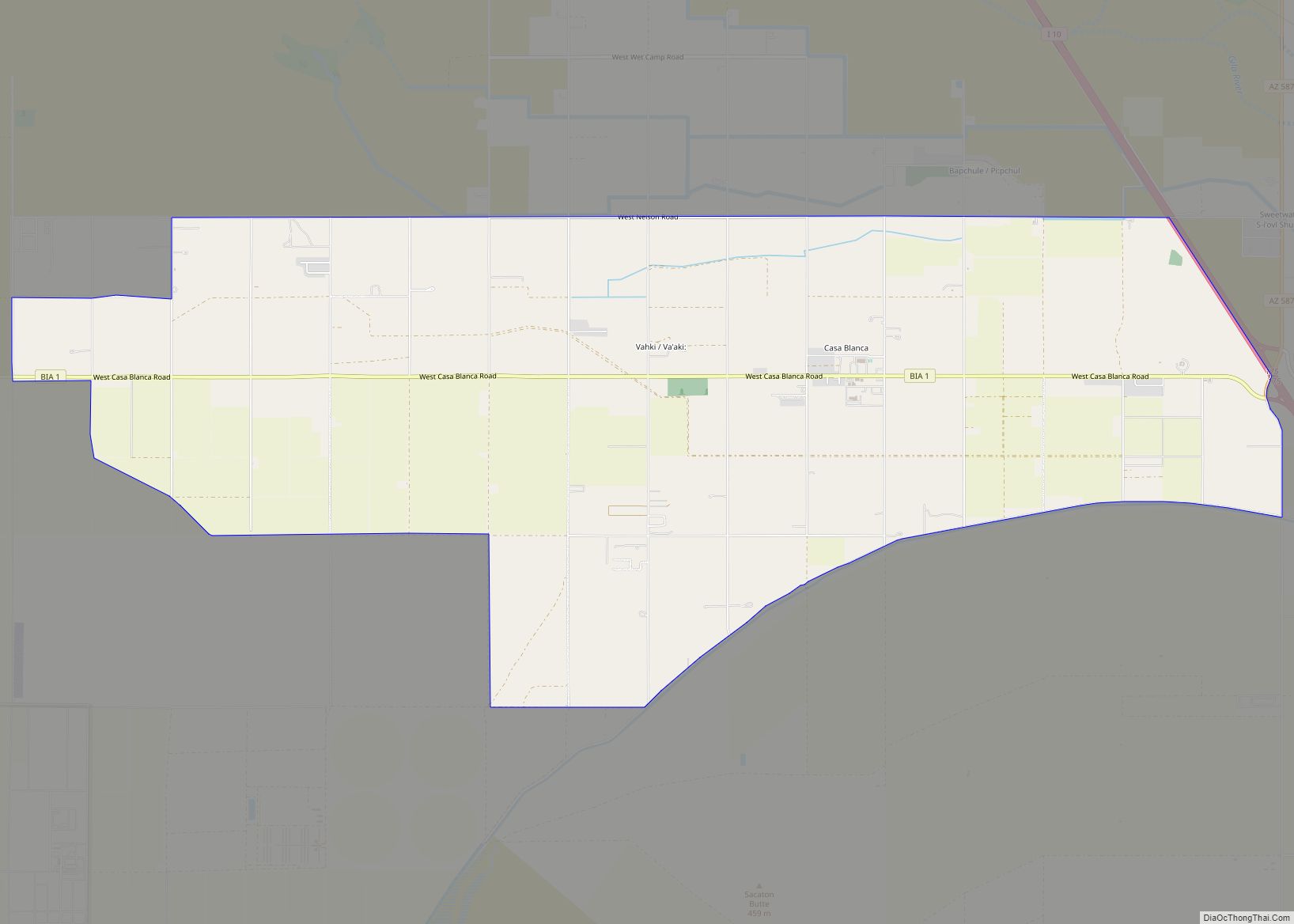
Casa Grande (O’odham: Wainom Wo:g) is a city in Pinal County, approximately halfway between Phoenix and Tucson in the U.S. state of Arizona. According to U.S. Census estimates, the population of the city is 55,653 as of 2020. It is named after the Casa Grande Ruins National Monument, which is actually located in Coolidge. “Casa Grande” is Spanish for “big house”. Among resident English speakers, there is no consensus on how to pronounce the city’s name.
| Name: | Casa Grande city |
|---|---|
| LSAD Code: | 25 |
| LSAD Description: | city (suffix) |
| State: | Arizona |
| County: | Pinal County |
| Founded: | 1879 |
| Elevation: | 1,381 ft (421 m) |
| Total Area: | 112.01 sq mi (290.10 km²) |
| Land Area: | 112.01 sq mi (290.10 km²) |
| Water Area: | 0.00 sq mi (0.00 km²) |
| Total Population: | 53,658 |
| Population Density: | 479.06/sq mi (184.96/km²) |
| ZIP code: | 85122, 85194, 85130, 85193 |
| Area code: | 520 |
| FIPS code: | 0410530 |
| GNISfeature ID: | 2409401 |
| Website: | http://www.casagrandeaz.gov |
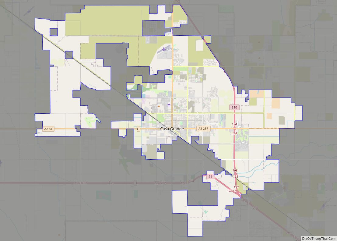
Online Interactive Map
Click on ![]() to view map in "full screen" mode.
to view map in "full screen" mode.
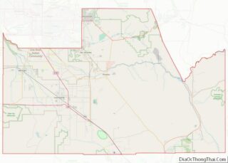
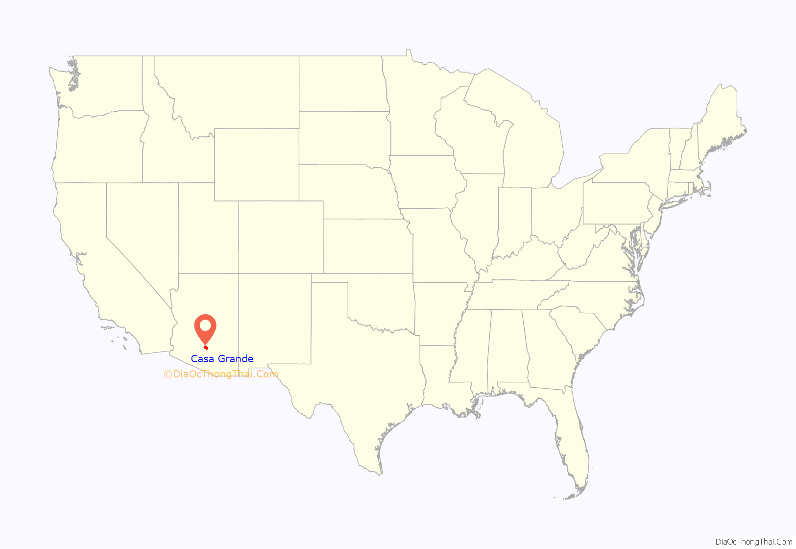
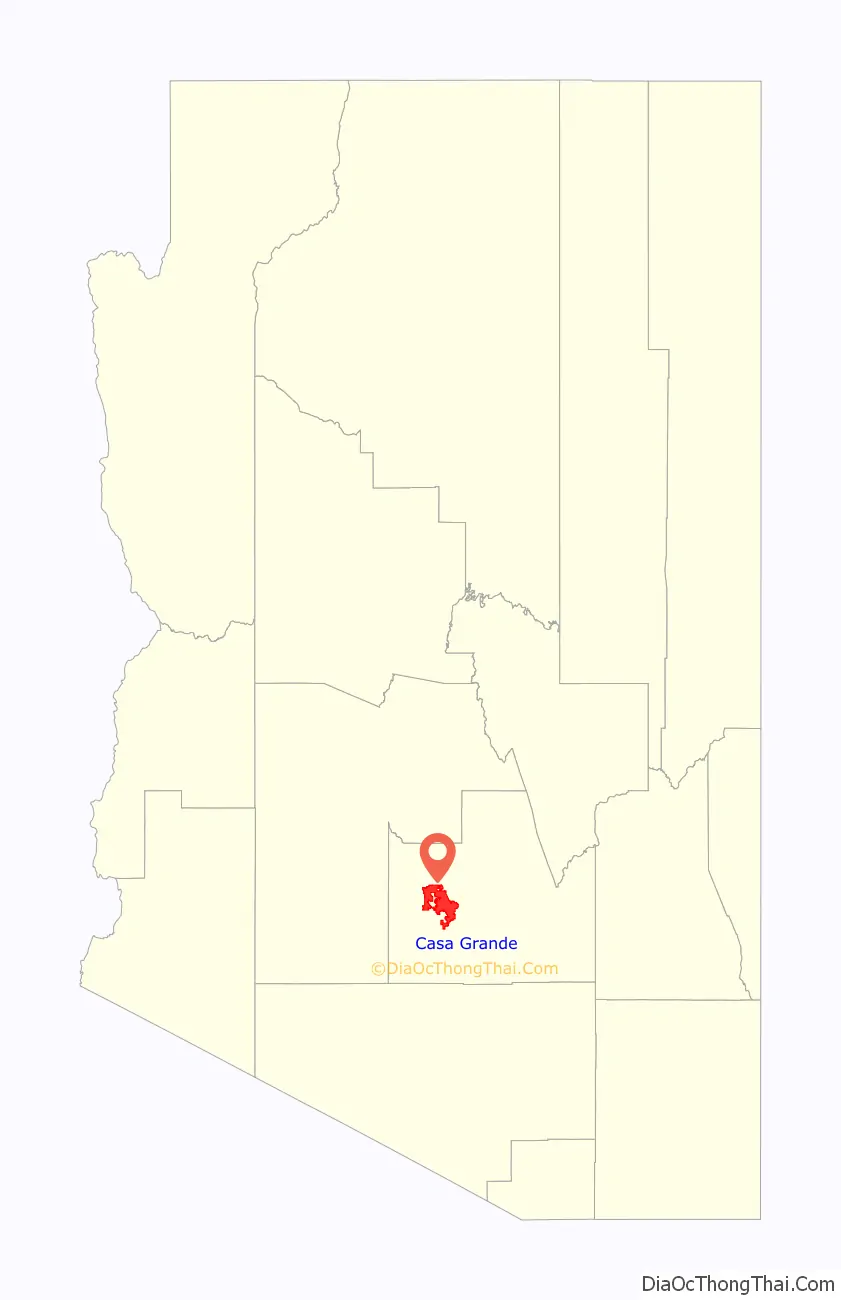
Casa Grande location map. Where is Casa Grande city?
History
Casa Grande was founded in 1879 during the Arizona mining boom, specifically due to the presence of the Southern Pacific Railroad. In January 1880, the community of Terminus, meaning “end-of-the-line,” was established despite consisting of just five residents and three buildings. In September 1880, railroad executives renamed the settlement Casa Grande, after the Hohokam ruins at the nearby Casa Grande Ruins National Monument. Casa Grande grew slowly, and suffered several setbacks both in 1886 and 1893, when fires ravaged the town, destroying all wooden housing structures within it. When the mining boom slowed in the 1890s, the town was nearly abandoned, but with the advent of agriculture, the town remained alive and well, and was eventually incorporated in 1915.
One of the founding fathers of Casa Grande was Thompson Rodney Peart. Peart Road, Peart Park, and the Peart Center, all of which are notable fixtures of Casa Grande, are named after him.
Casa Grande was home to a collective farm society which was part of the Farm Security Administration.
According to historian David Leighton, during World War II, from 1942 to 1945, a Japanese-American relocation camp was set up outside of Casa Grande, known as the Gila River War Relocation Center. Two notable people that were interned there were future actor Pat Morita and baseball player Kenichi Zenimura, who constructed a baseball field and set up a league in the relocation camp.
Casa Grande is home to Francisco Grande Hotel & Golf Resort, former spring training location for the San Francisco Giants. Then owner, Horace Stoneham, began developing the property in 1959. The first exhibition game was played in Casa Grande in 1961, with Willie Mays hitting a 375-foot (114 m) home run. The San Francisco Giants no longer play at Francisco Grande, but the pool in a baseball bat and ball shape remains in memory of the past ballgames.
During the Cold War, Casa Grande was the location of the Casa Grande Photogrammetric Test Range. These targets consisted of concrete arrows located in and to the south of the city, which calibrated aerial cartographic cameras.
Casa Grande has also played a prominent role in semi-pro and collegiate baseball. The Casa Grande Cotton Kings, who were founded in 1948, qualified to play in the National Baseball Congress World Series ten straight times by winning Arizona state championships in the 1940s and 1950s, and were reactivated in the 2000s. They are now members of the Pacific Southwest Baseball League.
Casa Grande Road Map

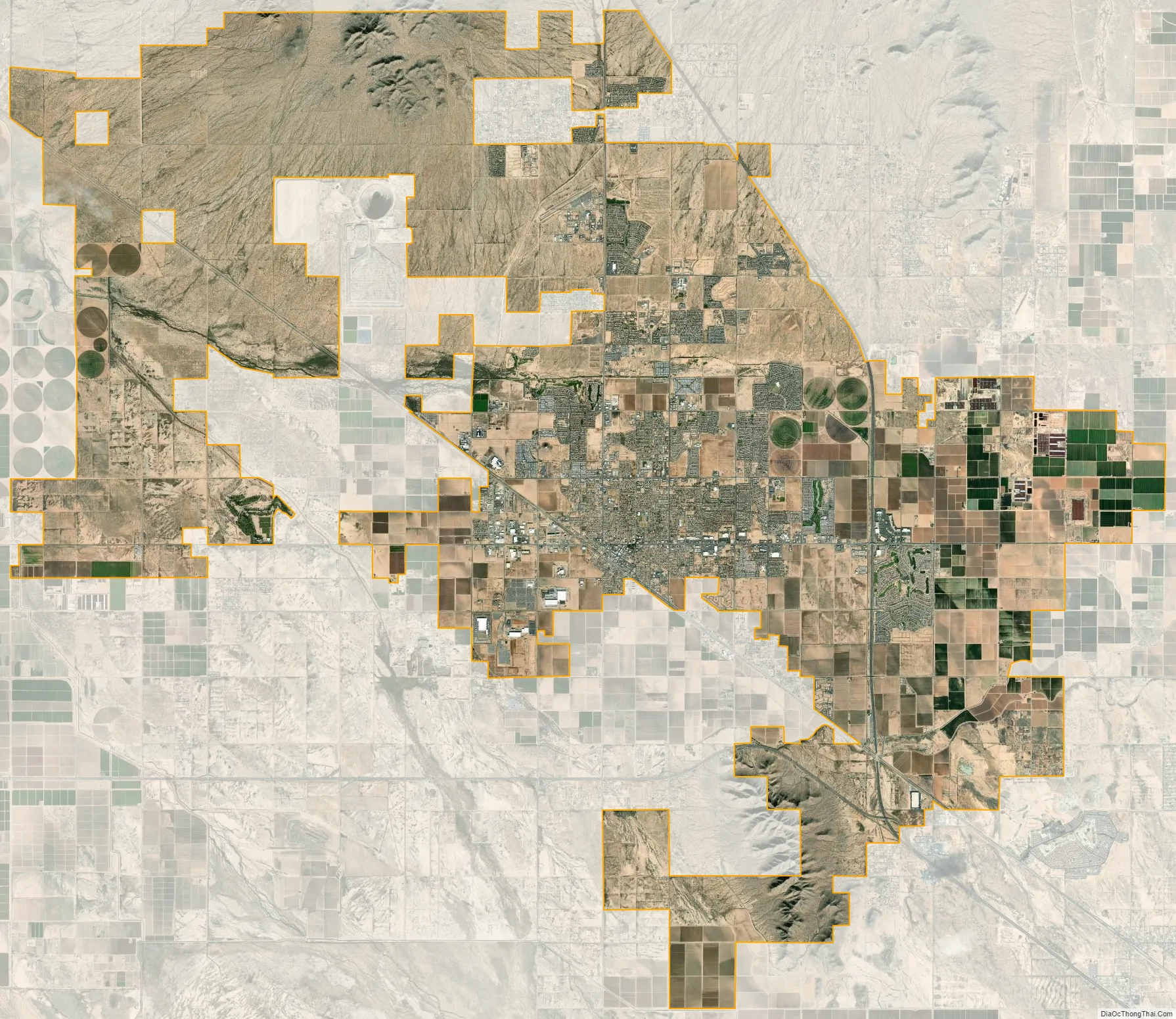
Casa Grande city Satellite Map
Geography
According to the United States Census Bureau, Casa Grande has a total area of 112.01 square miles (290.1 km), all land.
See also
Map of Arizona State and its subdivision: Map of other states:- Alabama
- Alaska
- Arizona
- Arkansas
- California
- Colorado
- Connecticut
- Delaware
- District of Columbia
- Florida
- Georgia
- Hawaii
- Idaho
- Illinois
- Indiana
- Iowa
- Kansas
- Kentucky
- Louisiana
- Maine
- Maryland
- Massachusetts
- Michigan
- Minnesota
- Mississippi
- Missouri
- Montana
- Nebraska
- Nevada
- New Hampshire
- New Jersey
- New Mexico
- New York
- North Carolina
- North Dakota
- Ohio
- Oklahoma
- Oregon
- Pennsylvania
- Rhode Island
- South Carolina
- South Dakota
- Tennessee
- Texas
- Utah
- Vermont
- Virginia
- Washington
- West Virginia
- Wisconsin
- Wyoming