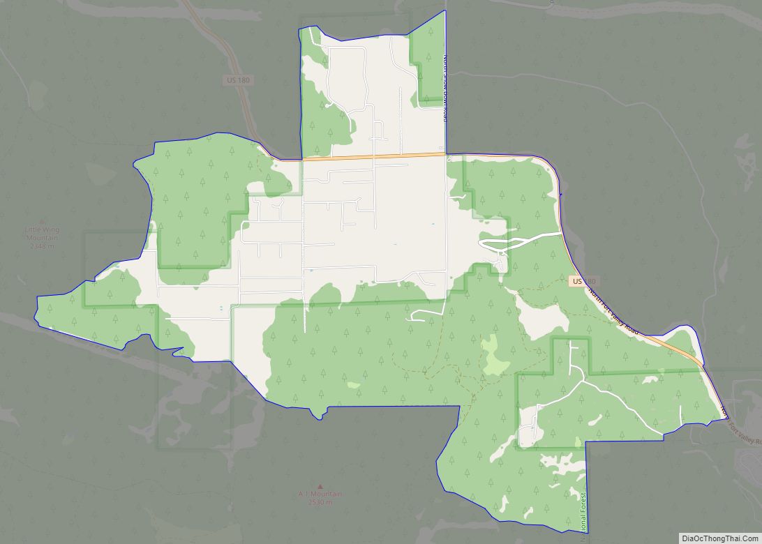
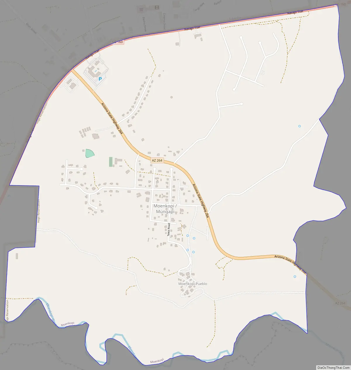
Moenkopi (Hopi: Mùnqapi, Navajo: Oozéí Hayázhí) is a census-designated place (CDP) in Coconino County, Arizona, United States, adjacent to the southeast side of Tuba City off U.S. Route 160. The population was 964 at the 2010 census.
A Hopi community, it was founded in 1870 as a summer farming area by people from the Hopi Third Mesa village of Oraibi. It is 40 miles (64 km) west of Third Mesa and is divided into the villages of Upper Moenkopi and Lower Moenkopi. It lies in a 250.306 km (96.644 sq mi) exclave of the Hopi Reservation which is separated from the main part of the reservation which lies to the east. Both parts are surrounded by Navajo Nation territory. The smaller section comprises only 3.8 percent of the Hopi Reservation’s land area and 13.2 percent (916 persons) of its population.
| Name: | Moenkopi CDP |
|---|---|
| LSAD Code: | 57 |
| LSAD Description: | CDP (suffix) |
| State: | Arizona |
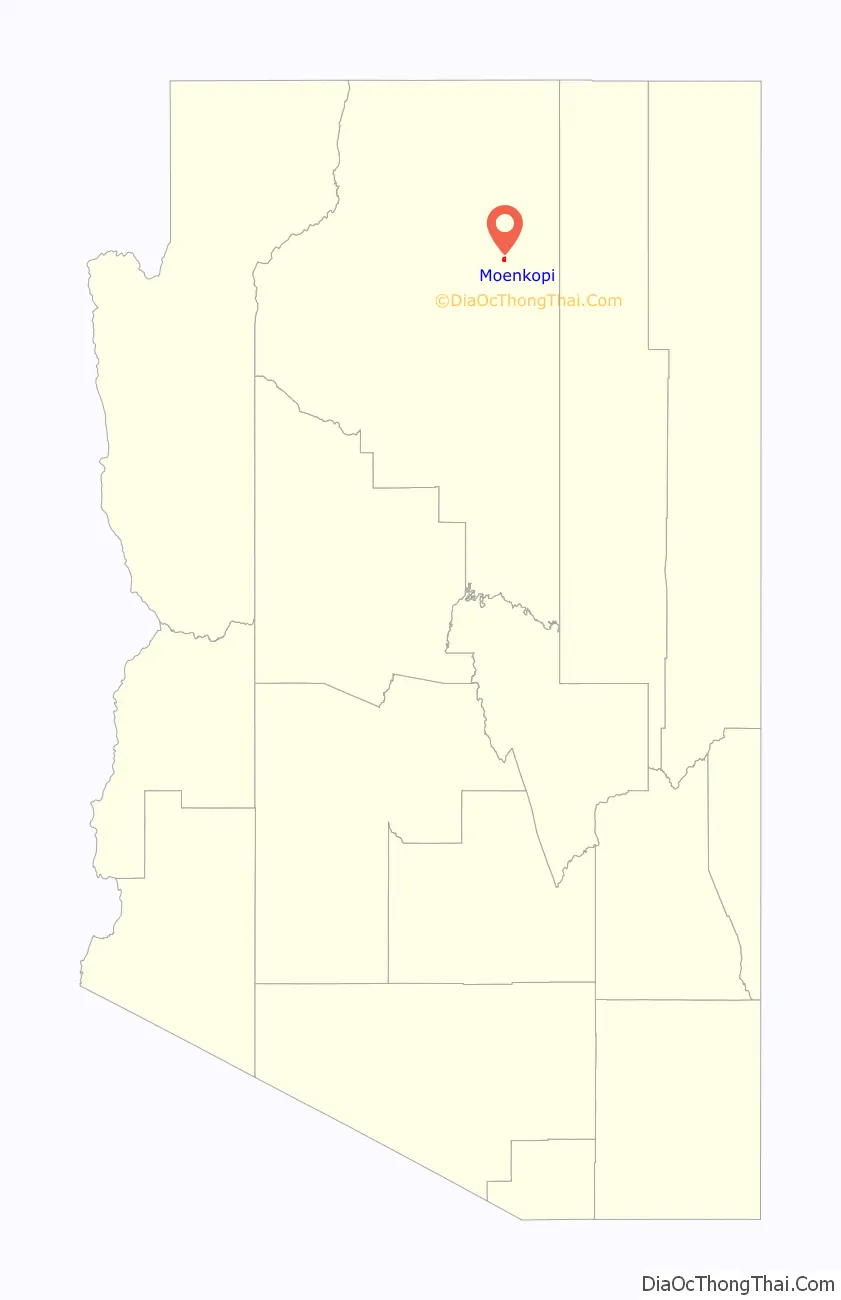
| County: | Coconino County |
| Elevation: | 4,777 ft (1,456 m) |
| Total Area: | 1.50 sq mi (3.89 km²) |
| Land Area: | 1.50 sq mi (3.89 km²) |
| Water Area: | 0.00 sq mi (0.00 km²) |
| Total Population: | 771 |
| Population Density: | 512.97/sq mi (198.04/km²) |
| ZIP code: | 86045 |
| Area code: | 928 |
| FIPS code: | 0447330 |
| GNISfeature ID: | Moenkopi |
Online Interactive Map
Click on ![]() to view map in "full screen" mode.
to view map in "full screen" mode.
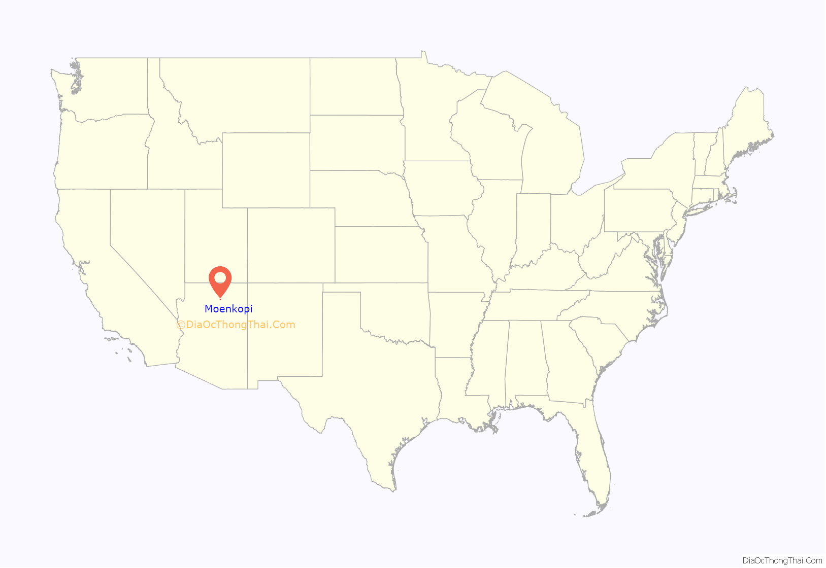
Moenkopi location map. Where is Moenkopi CDP?
Moenkopi Road Map
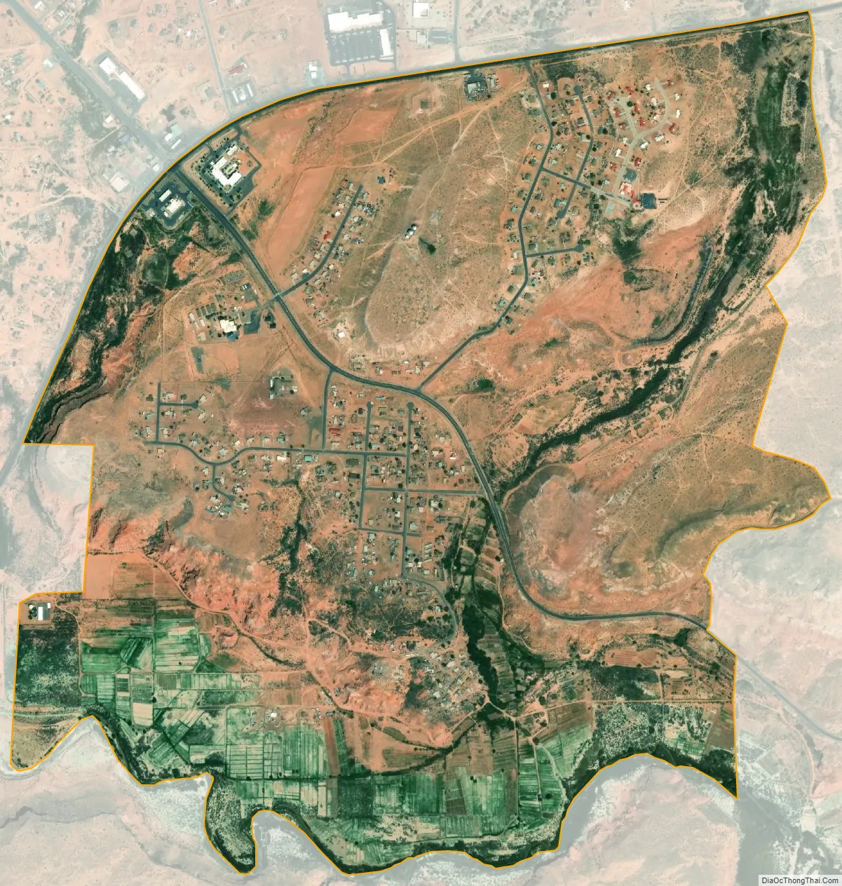
Moenkopi city Satellite Map
Geography
Located in the center of a wide valley, Moenkopi is located at 36°6′42″N 111°13′15″W / 36.11167°N 111.22083°W / 36.11167; -111.22083 (36.111741, -111.220699).
According to the United States Census Bureau, the CDP has a total area of 1.6 square miles (4.1 km), all land.
See also
Map of Arizona State and its subdivision: Map of other states:- Alabama
- Alaska
- Arizona
- Arkansas
- California
- Colorado
- Connecticut
- Delaware
- District of Columbia
- Florida
- Georgia
- Hawaii
- Idaho
- Illinois
- Indiana
- Iowa
- Kansas
- Kentucky
- Louisiana
- Maine
- Maryland
- Massachusetts
- Michigan
- Minnesota
- Mississippi
- Missouri
- Montana
- Nebraska
- Nevada
- New Hampshire
- New Jersey
- New Mexico
- New York
- North Carolina
- North Dakota
- Ohio
- Oklahoma
- Oregon
- Pennsylvania
- Rhode Island
- South Carolina
- South Dakota
- Tennessee
- Texas
- Utah
- Vermont
- Virginia
- Washington
- West Virginia
- Wisconsin
- Wyoming