Peridot (Western Apache: Tséé Dotłʼizh “Blue Rock”) is an unincorporated community and census-designated place (CDP) in Gila and Graham counties in the U.S. state of Arizona. The population was 1,350 at the 2010 census.
Peridot is named for the mineral peridot, found in basalt flows nearby.
| Name: | Peridot CDP |
|---|---|
| LSAD Code: | 57 |
| LSAD Description: | CDP (suffix) |
| State: | Arizona |
| County: | Gila County, Graham County |
| Elevation: | 2,625 ft (800 m) |
| Total Area: | 5.46 sq mi (14.15 km²) |
| Land Area: | 5.46 sq mi (14.14 km²) |
| Water Area: | 0.00 sq mi (0.00 km²) |
| Total Population: | 1,308 |
| Population Density: | 239.52/sq mi (92.49/km²) |
| ZIP code: | 85542 |
| Area code: | 928 |
| FIPS code: | 0454190 |
| GNISfeature ID: | 9325 |
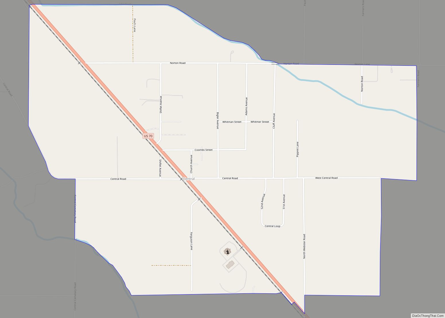
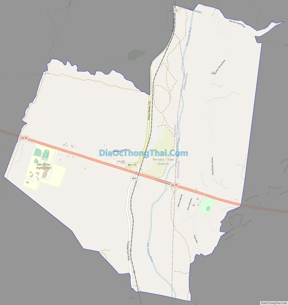
Online Interactive Map
Click on ![]() to view map in "full screen" mode.
to view map in "full screen" mode.
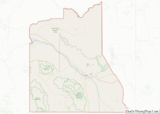
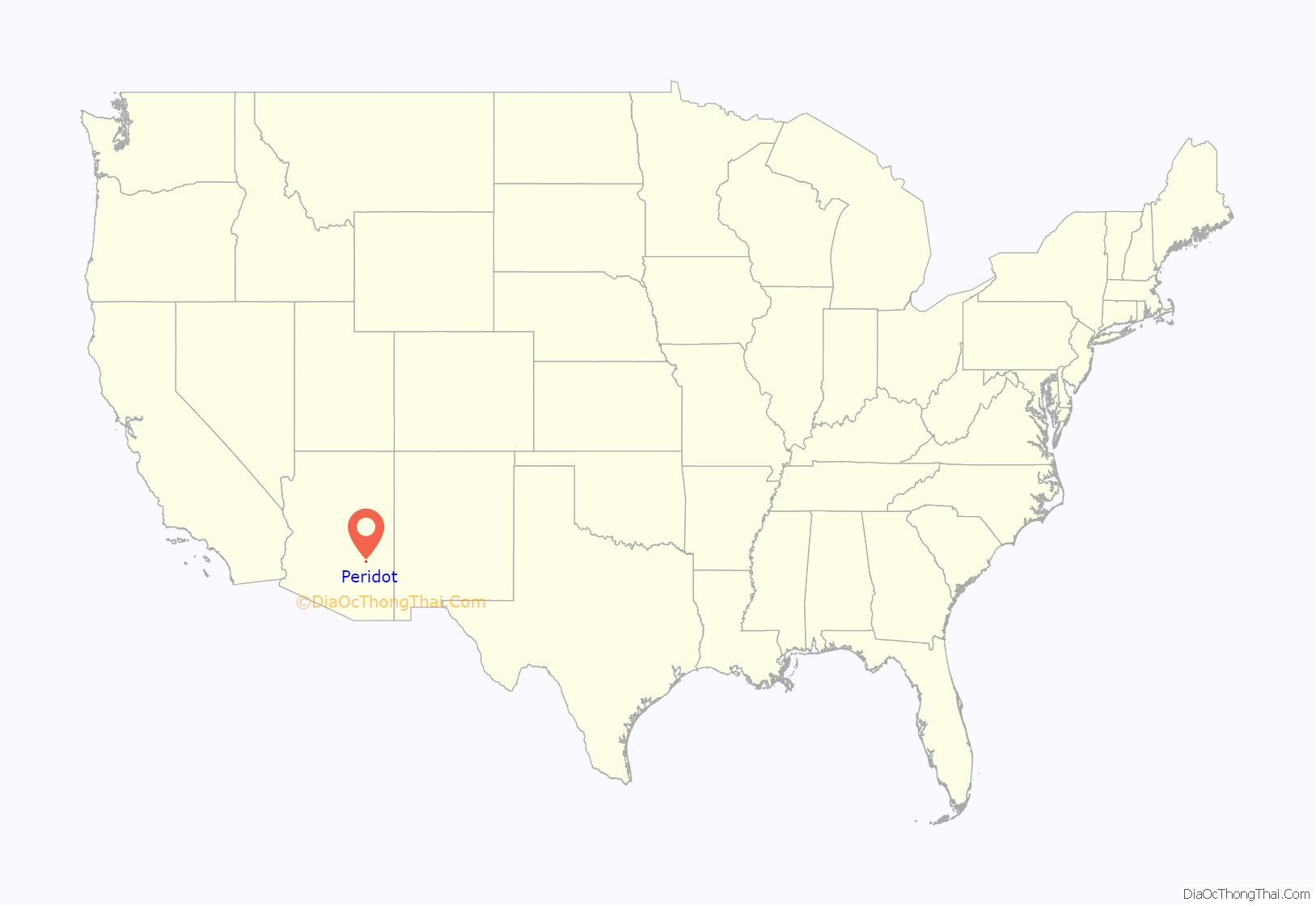
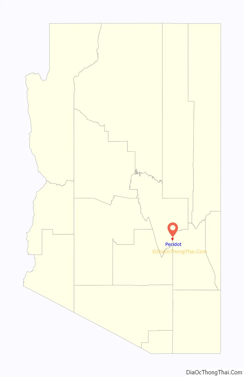
Peridot location map. Where is Peridot CDP?
Peridot Road Map
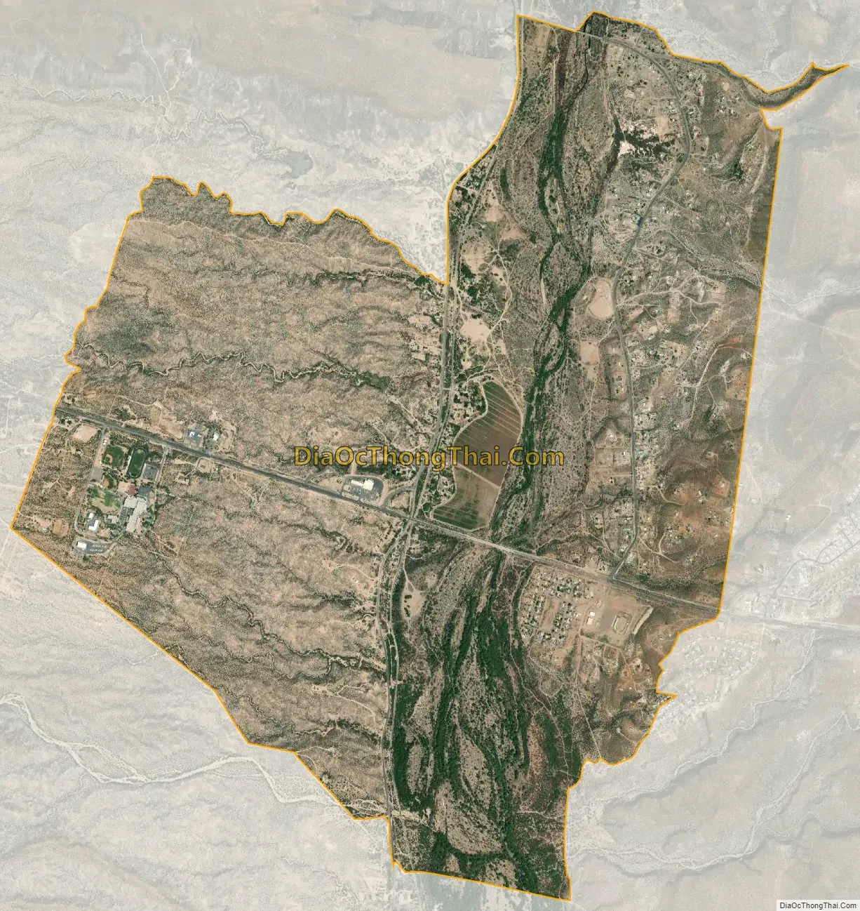
Peridot city Satellite Map
Geography
Peridot is located in southeastern Gila County and northwestern Graham County at 33°18′14″N 110°27′18″W / 33.30389°N 110.45500°W / 33.30389; -110.45500 (33.303884, -110.455046), within the San Carlos Apache Indian Reservation. U.S. Route 70 passes through the community, leading west 20 miles (32 km) to Globe, the Gila County seat, and southeast 57 miles (92 km) to Safford, the Graham County seat. The San Carlos River, a tributary of the Gila River, flows southward through the CDP and forms the county boundary. Coolidge Dam, forming San Carlos Lake on the Gila and San Carlos rivers, is 11 miles (18 km) to the south.
According to the United States Census Bureau, the Peridot CDP has a total area of 5.2 square miles (13.4 km), all land.
See also
Map of Arizona State and its subdivision: Map of other states:- Alabama
- Alaska
- Arizona
- Arkansas
- California
- Colorado
- Connecticut
- Delaware
- District of Columbia
- Florida
- Georgia
- Hawaii
- Idaho
- Illinois
- Indiana
- Iowa
- Kansas
- Kentucky
- Louisiana
- Maine
- Maryland
- Massachusetts
- Michigan
- Minnesota
- Mississippi
- Missouri
- Montana
- Nebraska
- Nevada
- New Hampshire
- New Jersey
- New Mexico
- New York
- North Carolina
- North Dakota
- Ohio
- Oklahoma
- Oregon
- Pennsylvania
- Rhode Island
- South Carolina
- South Dakota
- Tennessee
- Texas
- Utah
- Vermont
- Virginia
- Washington
- West Virginia
- Wisconsin
- Wyoming