Tuba City (Navajo: Tó Naneesdizí) is an unincorporated town in Coconino County, Arizona, on the Navajo Nation, United States. It is the second-largest community in Coconino County. The population of the census-designated place (CDP) was 8,611 at the 2010 census.
It is the most populous community within the Navajo Nation, slightly larger than Shiprock, New Mexico, and the site of the headquarters of the Western Navajo Agency. The Hopi village of Moenkopi lies directly to its southeast, and Hopi also live in the city.
European Americans named the town in honor of chief Tuuvi, a Hopi man from Oraibi who converted to the Church of Jesus Christ of Latter-day Saints and allowed Mormon migrants to settle in the area. The Navajo name for this community, Tó Naneesdizí, translates as “tangled waters”. It likely refers to the many below-ground springs that are the source of several reservoirs.
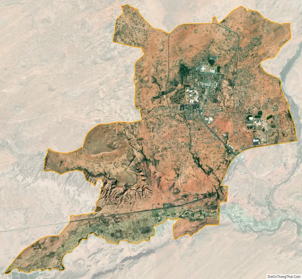
Tuba City is located within the Painted Desert near the western edge of the Navajo Nation. Tuba City is located approximately 50 miles (80 km) from the eastern entrance to Grand Canyon National Park and approximately 78 miles (126 km) from Flagstaff. Most of Tuba City’s residents are Navajo, with a small Hopi minority.
| Name: | Tuba City CDP |
|---|---|
| LSAD Code: | 57 |
| LSAD Description: | CDP (suffix) |
| State: | Arizona |
| County: | Coconino County |
| Elevation: | 4,961 ft (1,512 m) |
| Total Area: | 8.97 sq mi (23.24 km²) |
| Land Area: | 8.97 sq mi (23.24 km²) |
| Water Area: | 0.00 sq mi (0.00 km²) |
| Total Population: | 8,072 |
| ZIP code: | 86045 |
| Area code: | 928 |
| FIPS code: | 0476010 |
| GNISfeature ID: | 12802 |
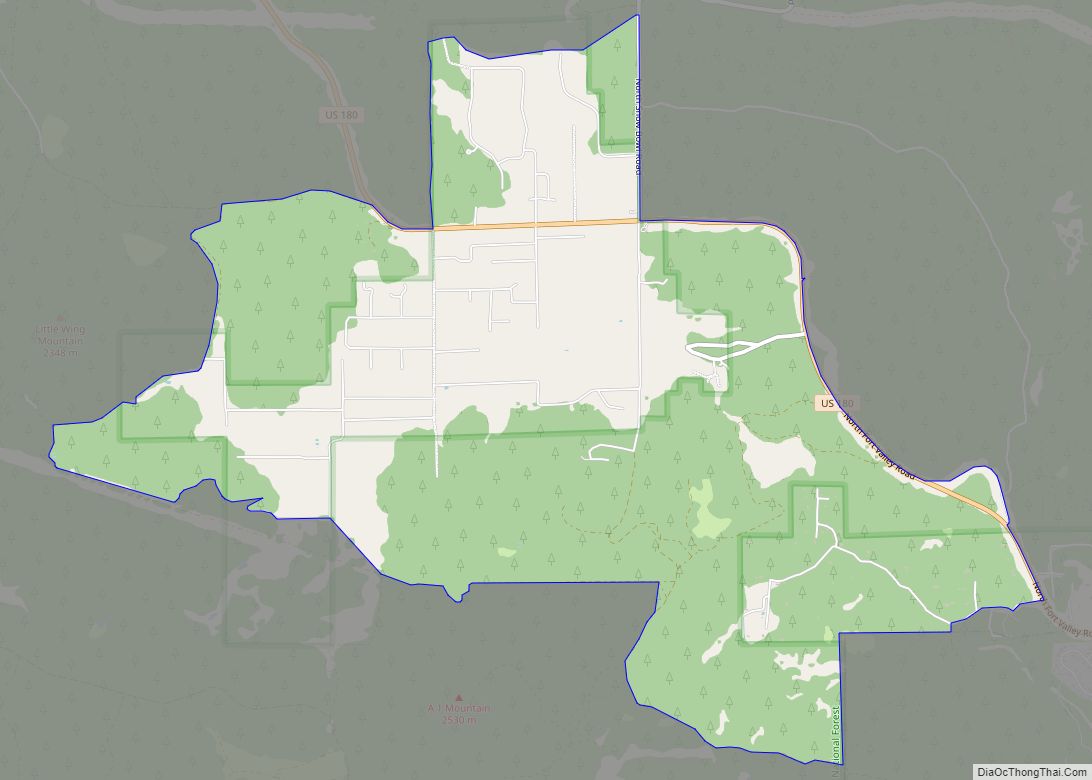
Online Interactive Map
Click on ![]() to view map in "full screen" mode.
to view map in "full screen" mode.
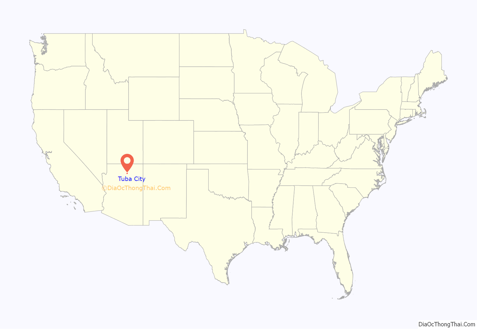
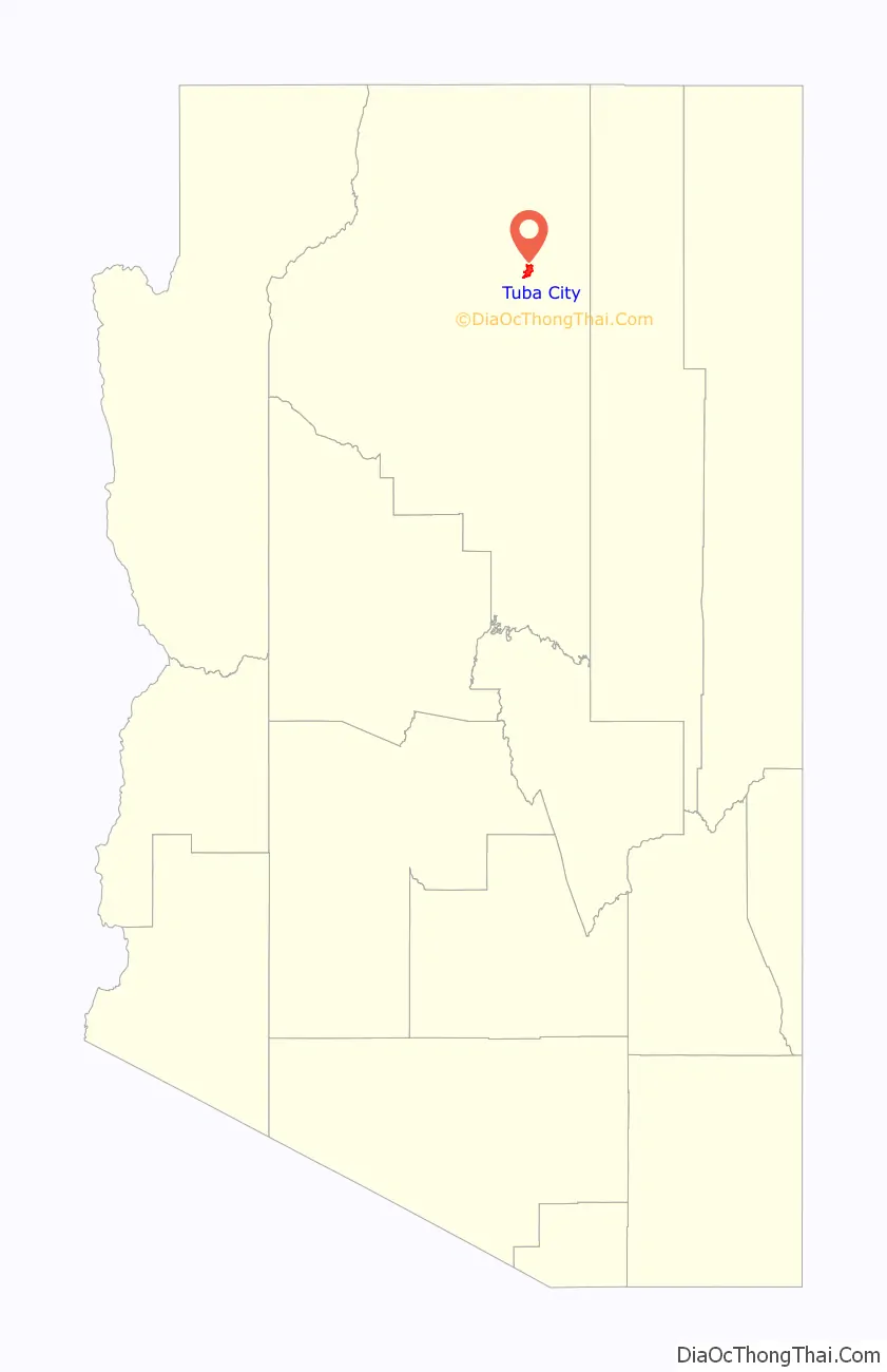
Tuba City location map. Where is Tuba City CDP?
History
The Tuba City area was the territory of indigenous peoples for thousands of years. The community was first documented by Spanish explorers: Father Francisco Garcés visited the area in 1776, and recorded that the Hopi Indians were cultivating crops.
European-American migrants came as part of the Mormon movement to the West in the late 19th century. They named the town after Tuuvi, a Hopi man who converted to Mormonism circa 1870. He had invited the Mormons to settle near his village of Moenkopi without requiring them to gain individual permission. The Tuba City Trading Post was established in 1870, dealing with the Navajo and Paiute who came to the area for the natural springs, as well as the Hopi already in the area. European-American Mormon emigrants claimed to found Tuba City in 1872.
In 1956, uranium began to be mined near Tuba City. The regional office for the Rare Metals Corporation was established here, which founded a mill for processing. The Atomic Energy Commission had an office here as well. The mill closed in 1966. Reclamation of the millsite and tailings pile was completed in 1990 because the tailings had high radioactive content and were environmentally hazardous waste products that had to be cleared.
The Tuba City Regional Health Care Corporation hospital is located in Tuba City. It is a non-profit, Native American-run health care corporation that employs 1,200 people. The next nearest hospital is in Flagstaff.
Tuba City Road Map
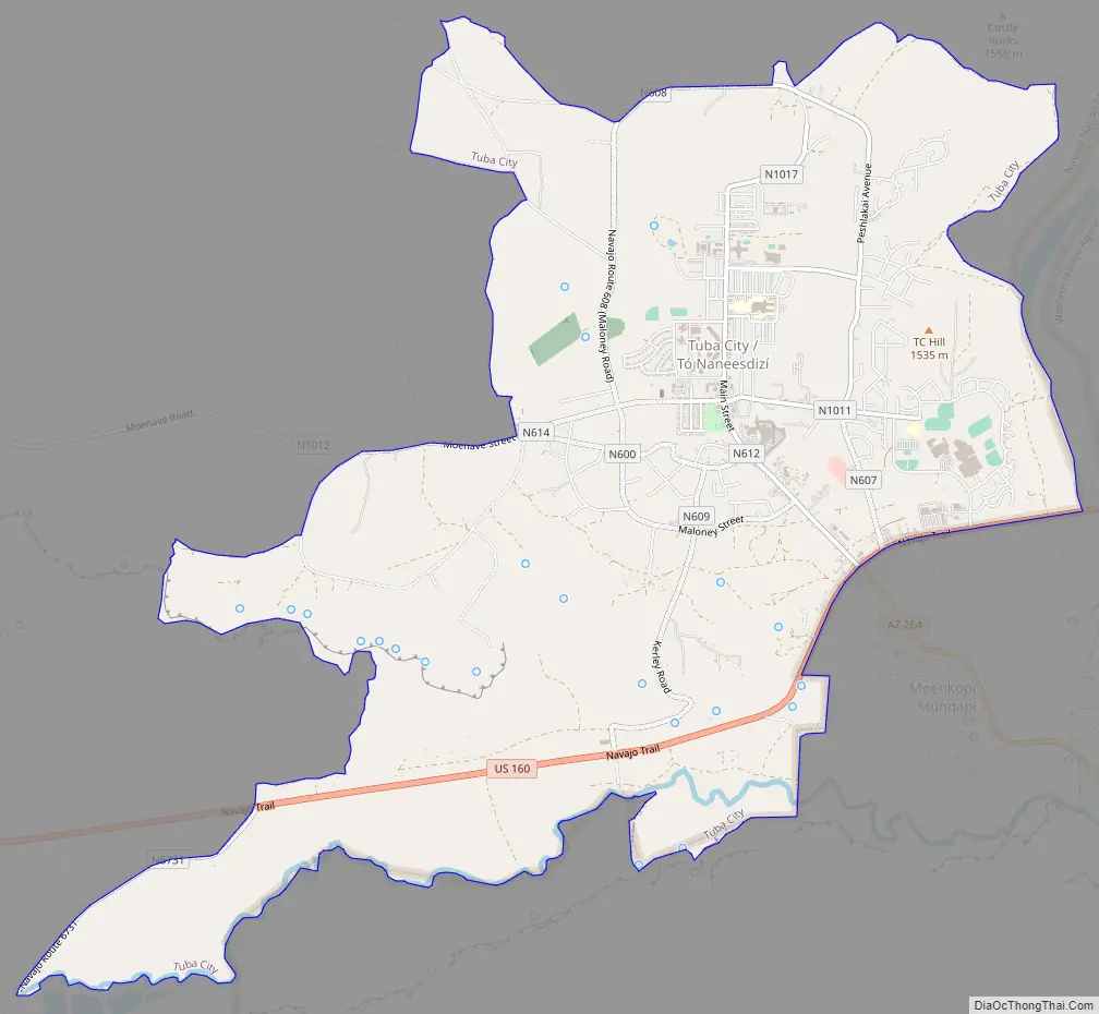
Tuba City city Satellite Map
Geography
According to the United States Census Bureau, the CDP has a total area of 8.9 square miles (23 km), all land.
Geologically, Tuba City is sited about the Glen Canyon Group from the early Jurassic (about 180–210 Ma) and on modern superficial Quaternary deposits.
It is located within the Painted Desert near the western edge of the Navajo Nation. The town is served by U.S. Route 160, near the junction with Arizona State Route 264. Tuba City is located approximately 50 miles (80 km) from the eastern entrance to Grand Canyon National Park and approximately 78 miles (126 km) from Flagstaff.
Arizona does not observe Daylight Saving Time, but the Navajo Nation does within its boundaries. In practice elements of Tuba City vary in practices: tribal offices and schools observe DST, while most private businesses conform to state practice and do not.
Tuba City is located in the rain shadow of the Mogollon Rim, which keeps out moisture from the Gulf of California. It has a cold desert climate (Köppen BWk) with hot, dry summers – though less hot than Phoenix – and cold, dry winters. Frosts are normal from October to April. The majority of winters do not have measurable snowfall due to the dryness of the air descending from mountains to the south.
See also
Map of Arizona State and its subdivision: Map of other states:- Alabama
- Alaska
- Arizona
- Arkansas
- California
- Colorado
- Connecticut
- Delaware
- District of Columbia
- Florida
- Georgia
- Hawaii
- Idaho
- Illinois
- Indiana
- Iowa
- Kansas
- Kentucky
- Louisiana
- Maine
- Maryland
- Massachusetts
- Michigan
- Minnesota
- Mississippi
- Missouri
- Montana
- Nebraska
- Nevada
- New Hampshire
- New Jersey
- New Mexico
- New York
- North Carolina
- North Dakota
- Ohio
- Oklahoma
- Oregon
- Pennsylvania
- Rhode Island
- South Carolina
- South Dakota
- Tennessee
- Texas
- Utah
- Vermont
- Virginia
- Washington
- West Virginia
- Wisconsin
- Wyoming