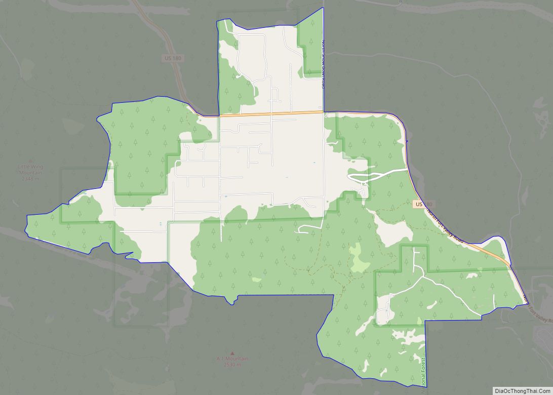
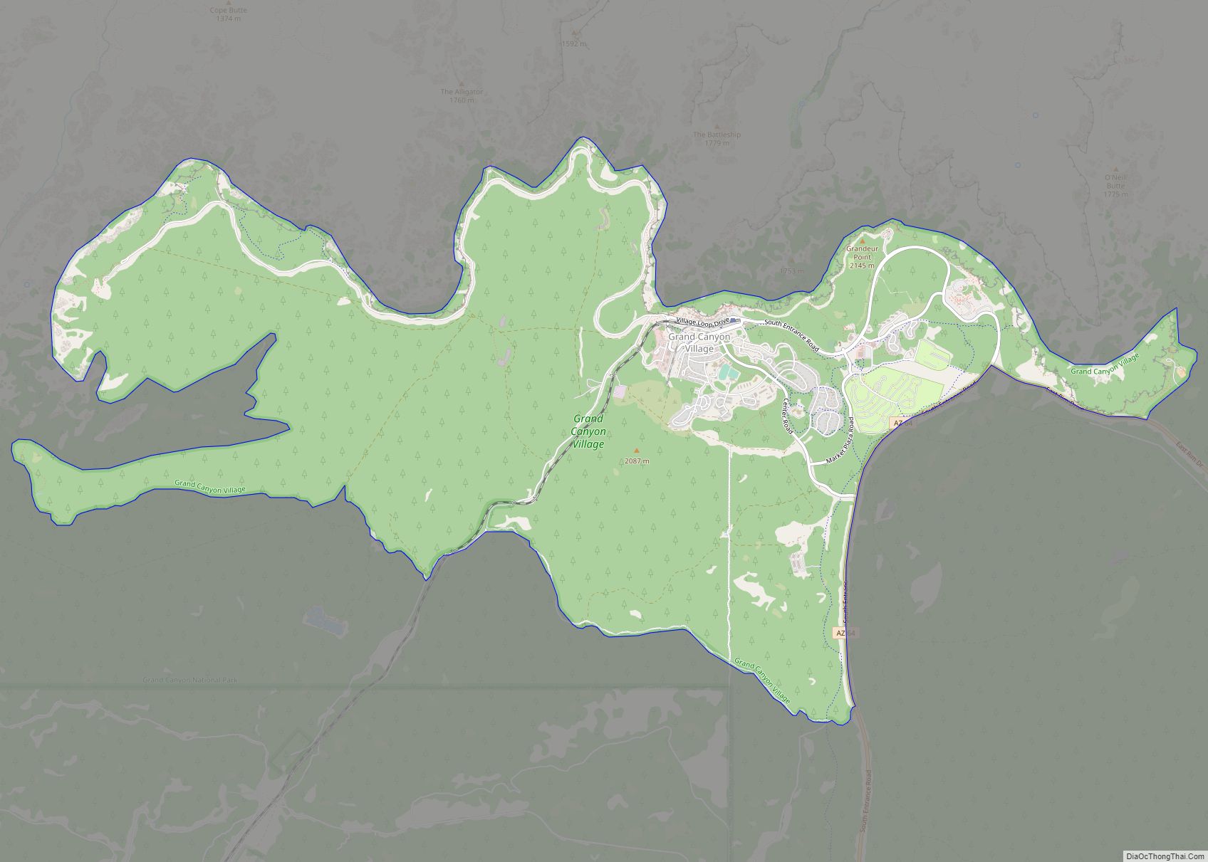
Tusayan is a town, but was a census-designated place during the 2010 census. It is located in Coconino County, Arizona, United States. It was incorporated in 2010. A resort town near the south entrance to Grand Canyon National Park, Tusayan is served by Grand Canyon National Park Airport. The population was 558 at the 2010 census.
| Name: | Tusayan town |
|---|---|
| LSAD Code: | 43 |
| LSAD Description: | town (suffix) |
| State: | Arizona |
| County: | Coconino County |
| Incorporated: | 2010 |
| Elevation: | 6,612 ft (2,015 m) |
| Total Area: | 16.82 sq mi (43.58 km²) |
| Land Area: | 16.82 sq mi (43.58 km²) |
| Water Area: | 0.00 sq mi (0.00 km²) |
| Total Population: | 603 |
| Population Density: | 35.84/sq mi (13.84/km²) |
| ZIP code: | 86023 |
| Area code: | 928 |
| FIPS code: | 0477490 |
| GNISfeature ID: | 0042842 |
Online Interactive Map
Click on ![]() to view map in "full screen" mode.
to view map in "full screen" mode.
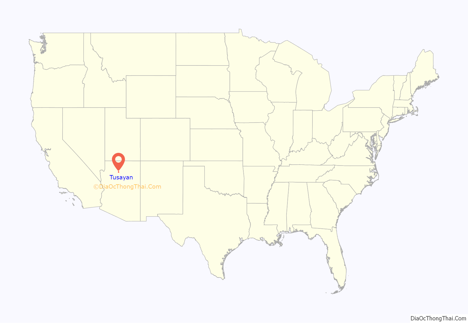
Tusayan location map. Where is Tusayan town?
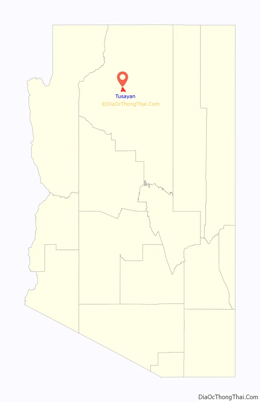
Tusayan Road Map
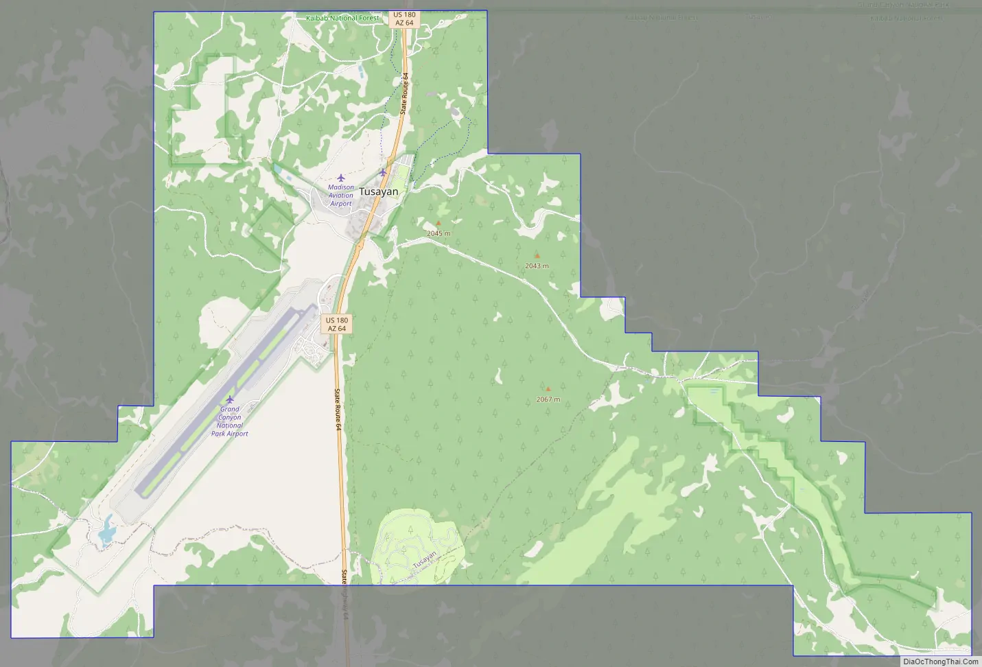
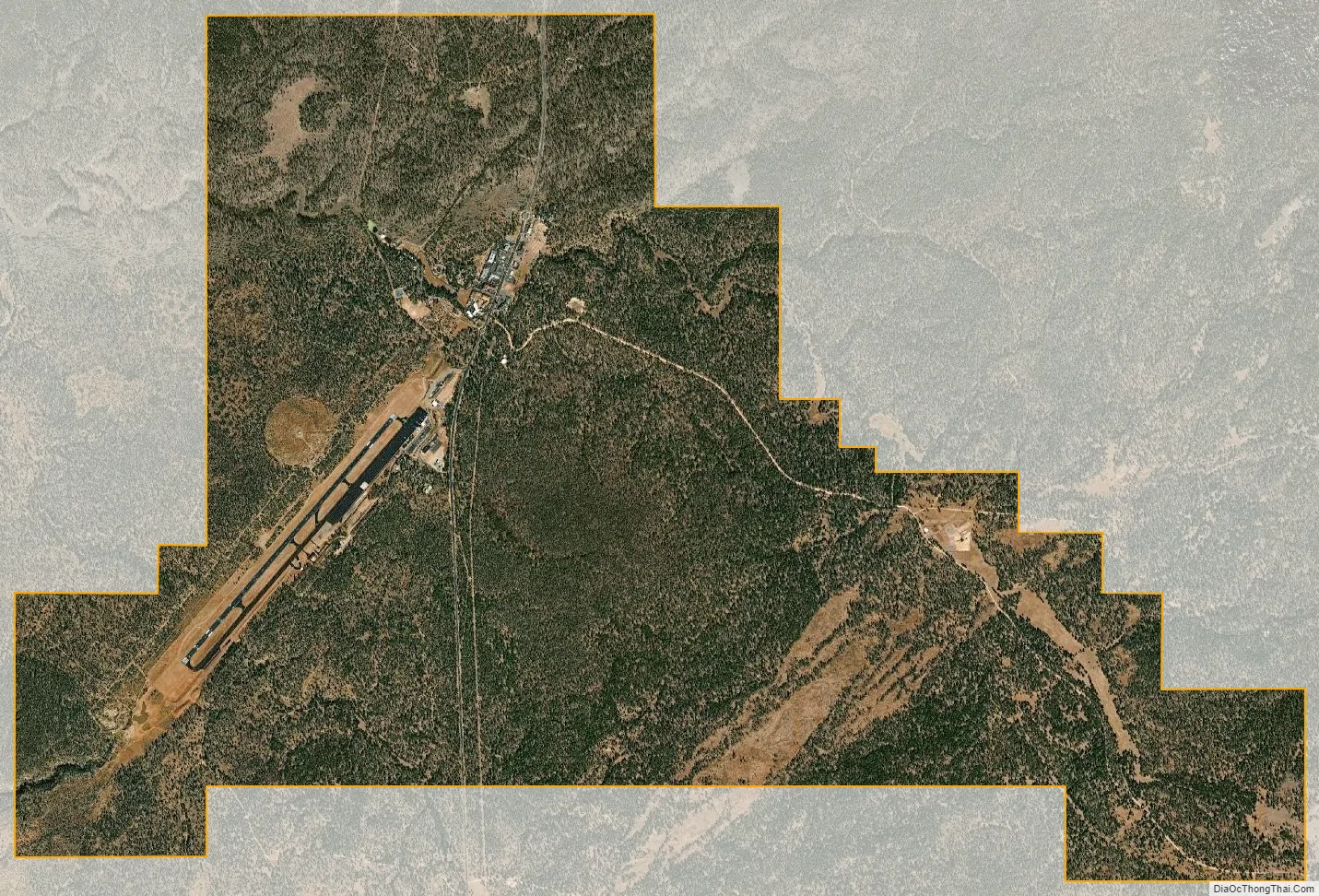
Tusayan city Satellite Map
Geography
Tusayan is located at 35°58′32″N 112°7′45″W / 35.97556°N 112.12917°W / 35.97556; -112.12917 (35.975674, -112.129046).
As an incorporated town, Tusayan has a land area of only 144 acres (58 ha), or 0.225 square miles (0.58 km), making it the smallest town in Arizona by area.
According to the United States Census Bureau, the census-designated place (CDP) in 2000 had a total area of 28.6 square miles (74 km), of which 28.6 square miles (74 km) is land and 0.04% is water.
See also
Map of Arizona State and its subdivision: Map of other states:- Alabama
- Alaska
- Arizona
- Arkansas
- California
- Colorado
- Connecticut
- Delaware
- District of Columbia
- Florida
- Georgia
- Hawaii
- Idaho
- Illinois
- Indiana
- Iowa
- Kansas
- Kentucky
- Louisiana
- Maine
- Maryland
- Massachusetts
- Michigan
- Minnesota
- Mississippi
- Missouri
- Montana
- Nebraska
- Nevada
- New Hampshire
- New Jersey
- New Mexico
- New York
- North Carolina
- North Dakota
- Ohio
- Oklahoma
- Oregon
- Pennsylvania
- Rhode Island
- South Carolina
- South Dakota
- Tennessee
- Texas
- Utah
- Vermont
- Virginia
- Washington
- West Virginia
- Wisconsin
- Wyoming