Yuma (Cocopah: Yuum) is a city in and the county seat of Yuma County, Arizona, United States. The city’s population was 93,064 at the 2010 census, up from the 2000 census population of 77,515.
Yuma is the principal city of the Yuma, Arizona, Metropolitan Statistical Area, which consists of Yuma County. According to the United States Census Bureau, the 2020 estimated population of the Yuma MSA is 203,247. According to Guinness World Records, Yuma is the “Sunniest City on Earth,” promising “sunshine and warm weather at least 91% of the year.” Anywhere from 70,000 to over 85,000 out-of-state visitors make Yuma their winter residence.
Yuma’s weather also makes it an agricultural powerhouse, growing over 175 types of crops, the largest of which is lettuce. Yuma County provides 90% of all leafy vegetables grown from November to March in the United States. Yuma is also known for its large military population due to several military bases, including the Marine Corps Air Station.
Yuma is in the state’s southwest corner, in the Sonoran Desert, Yuma Desert sub-region.
| Name: | Yuma city |
|---|---|
| LSAD Code: | 25 |
| LSAD Description: | city (suffix) |
| State: | Arizona |
| County: | Yuma County |
| Incorporated: | 1914 |
| Elevation: | 141 ft (43 m) |
| Land Area: | 120.77 sq mi (312.79 km²) |
| Water Area: | 0.07 sq mi (0.18 km²) 0.07% |
| Population Density: | 791.18/sq mi (305.47/km²) |
| ZIP code: | 85364–85367, 85369, 85350 |
| Area code: | 928 |
| FIPS code: | 0485540 |
| Website: | www.yumaaz.gov |
Online Interactive Map
Click on ![]() to view map in "full screen" mode.
to view map in "full screen" mode.
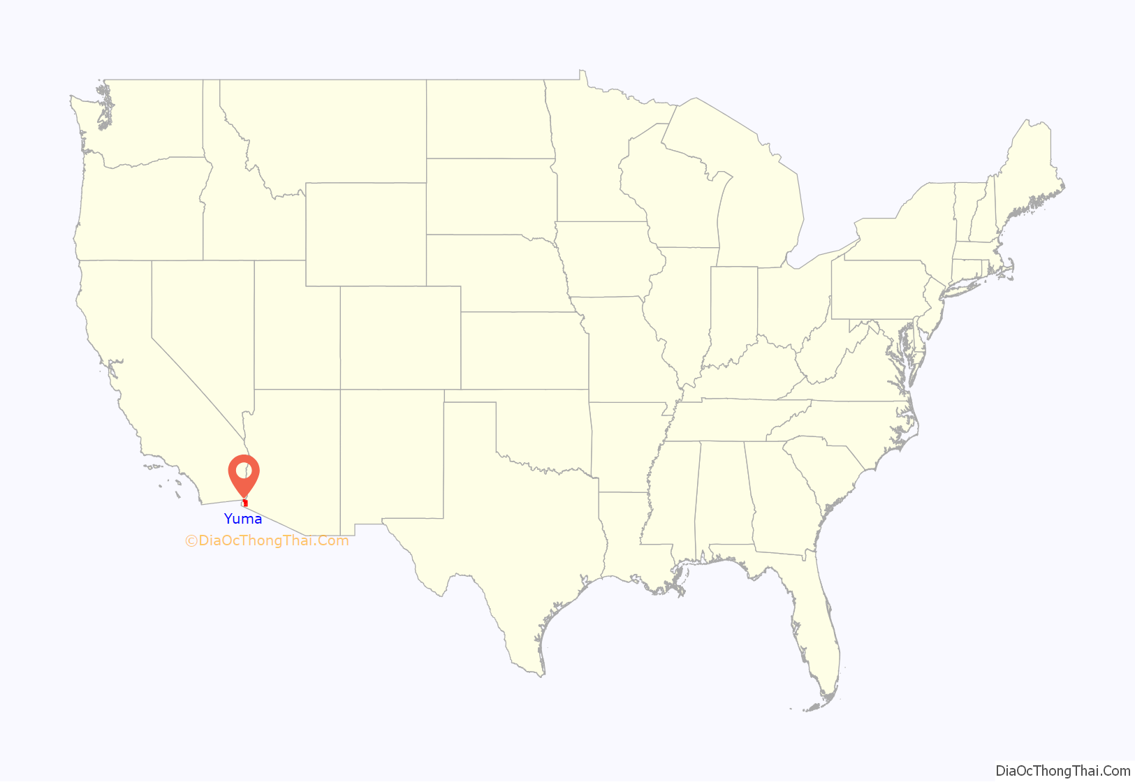
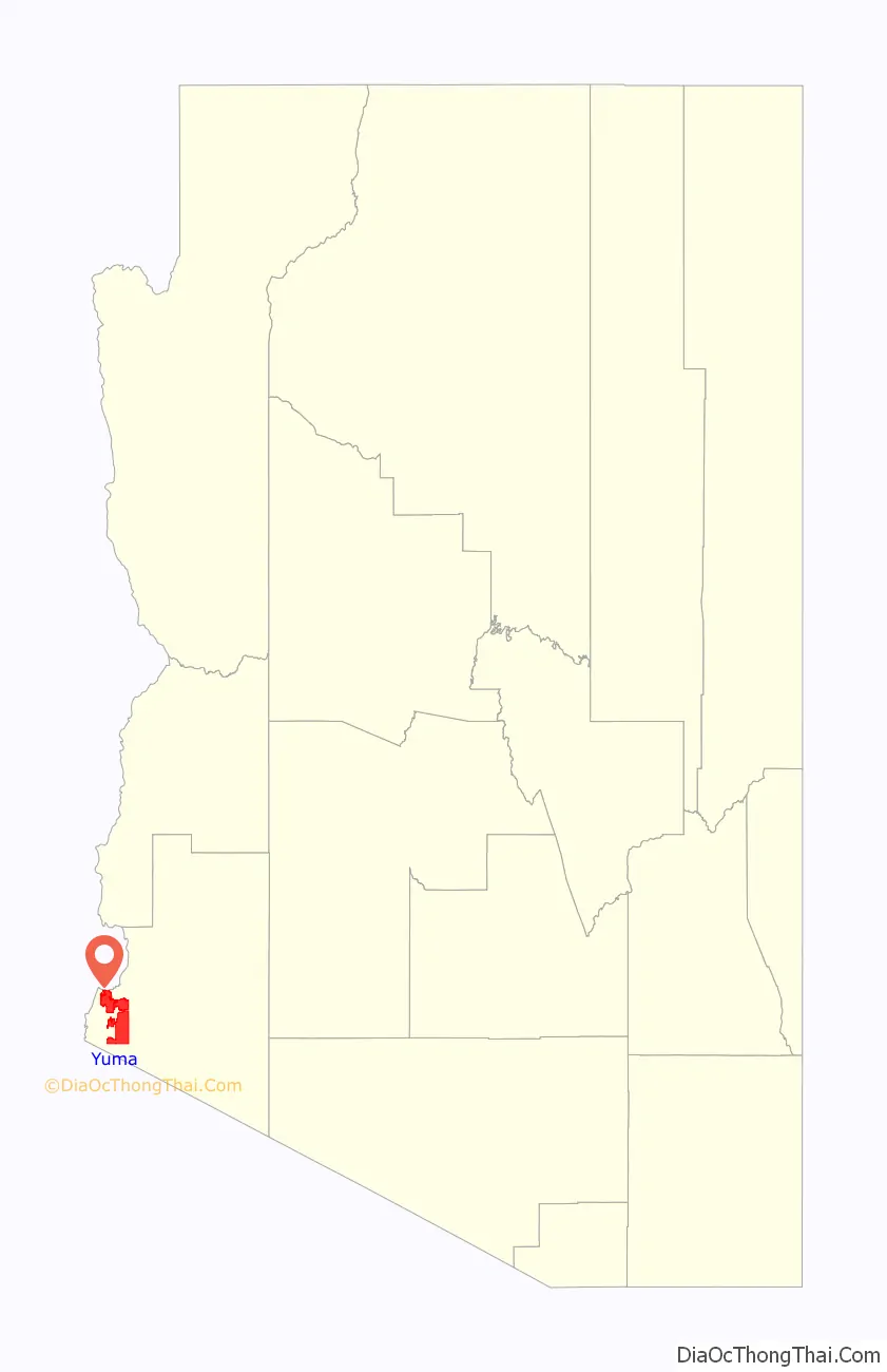
Yuma location map. Where is Yuma city?
History
The area’s first settlers for thousands of years were Native American cultures and historic tribes. Their descendants now occupy the Cocopah and Quechan reservations.
In 1540, Spanish colonial expeditions under Hernando de Alarcón and Melchior Díaz visited the area and immediately recognized the natural crossing of the Colorado River as an ideal spot for a city. The Colorado River narrows to slightly under 1,000 feet (300 m) wide in one area. Military expeditions that crossed the Colorado River at the Yuma Crossing include Juan Bautista de Anza (1774), the Mormon Battalion (1848) and the California Column (1862).
During and after the California Gold Rush to the late 1870s, the Yuma Crossing was known for its ferry crossings for the Southern Emigrant Trail. This was considered the gateway to California, as it was one of the few natural spots where travelers could cross the otherwise very wide Colorado River.
First settlements
Following the United States establishing Fort Yuma, two towns developed one mile downriver. The one on the California side was called Jaeger City, named after the owner of Jaeger’s Ferry, which crossed the river there. It was for a time the larger of the two, with the Butterfield Overland Mail office and station, two blacksmiths, a hotel, two stores, and other dwellings.
The other was called Colorado City. Developed on the south side of the river in what is now Arizona by speculator Charles Poston, it was the site of the custom house. When started, it was just north of the border between Mexican-ruled Sonora, Mexico and California. After the Gadsden Purchase by the United States, the town bordered on the Territory of New Mexico. This area was designated as the Territory of Arizona in 1863. The Colorado City site at the time was duly registered in San Diego; both banks of the Colorado River just below its confluence with the Gila were recognized as being within the jurisdiction of California. The county of San Diego collected taxes from there for many years.
From 1853 a smaller settlement, Arizona City, grew up on the high ground across from the fort and was organized under the name of its post office in 1858. It had adobe dwellings, two stores and two saloons. Colorado City and Jaeger City were almost completely destroyed by the Great Flood of 1862 and had to be rebuilt on higher ground. At that time Colorado City became part of Arizona City. It took the name Yuma in 1873.
Early development
From 1854, Colorado City was the major steamboat stop for traffic up and down the Colorado River. After the 1862 flood, it became part of Arizona City. The steamboats transported passengers and equipment for the various mines and military outposts along the Colorado; Colorado City was the terminus of wagon traffic up the Gila River into New Mexico Territory. They offloaded the cargo from ships at the mouth of the Colorado River at Robinson’s Landing and from 1864 at Port Isabel. From 1864, the Yuma Quartermaster Depot, today a state historic park, supplied all forts in present-day Arizona, as well as large parts of Colorado and New Mexico. After Arizona became a separate territory, Yuma became the county seat for Yuma County in 1871, replacing La Paz, the first seat.
The Southern Pacific Railroad bridged the river in 1877, and acquired George Alonzo Johnson’s Colorado Steam Navigation Company, the only steamboat company on the river. Yuma became the new base of navigation on the river, ending the need for Port Isabel, which was abandoned in 1879. The warehouses and shipyard there were moved to Yuma.
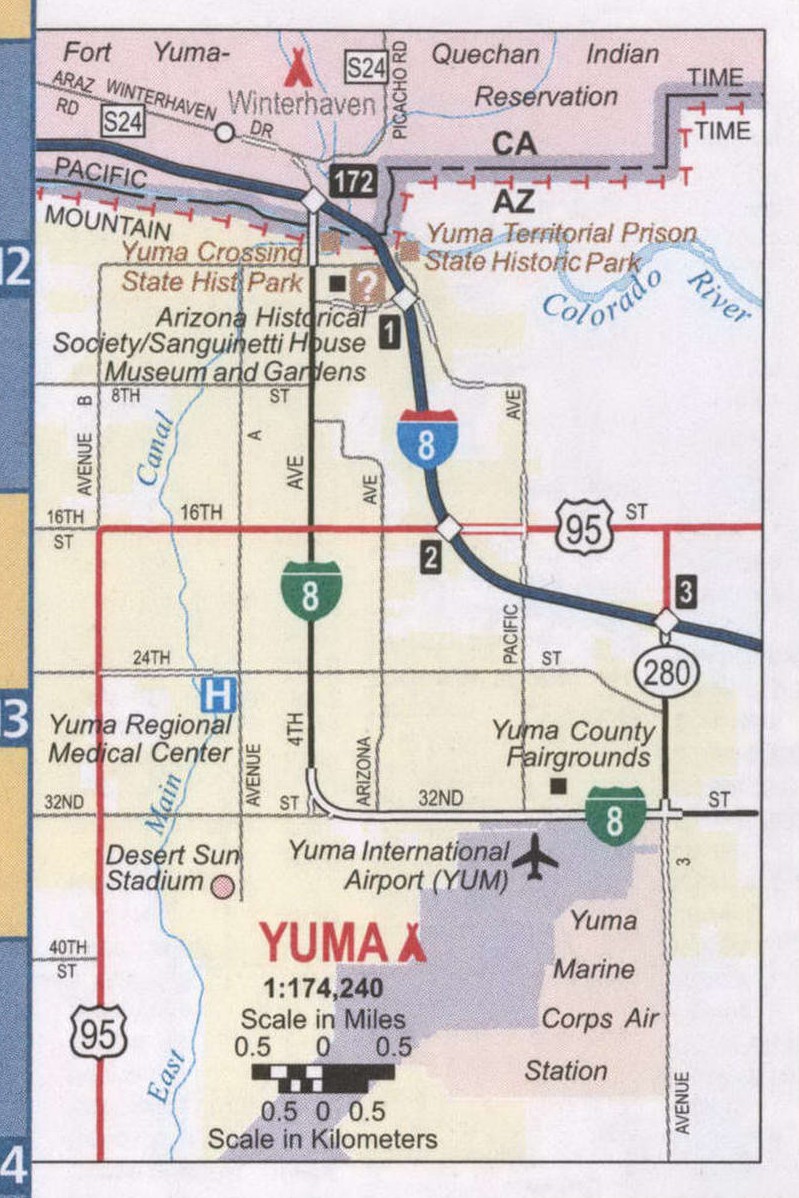
Yuma Road Map
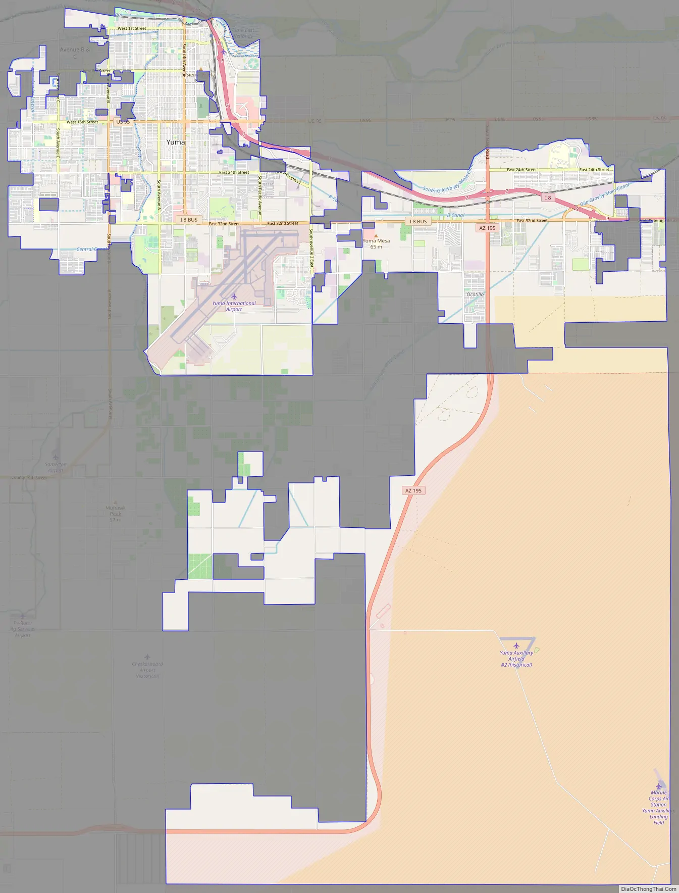
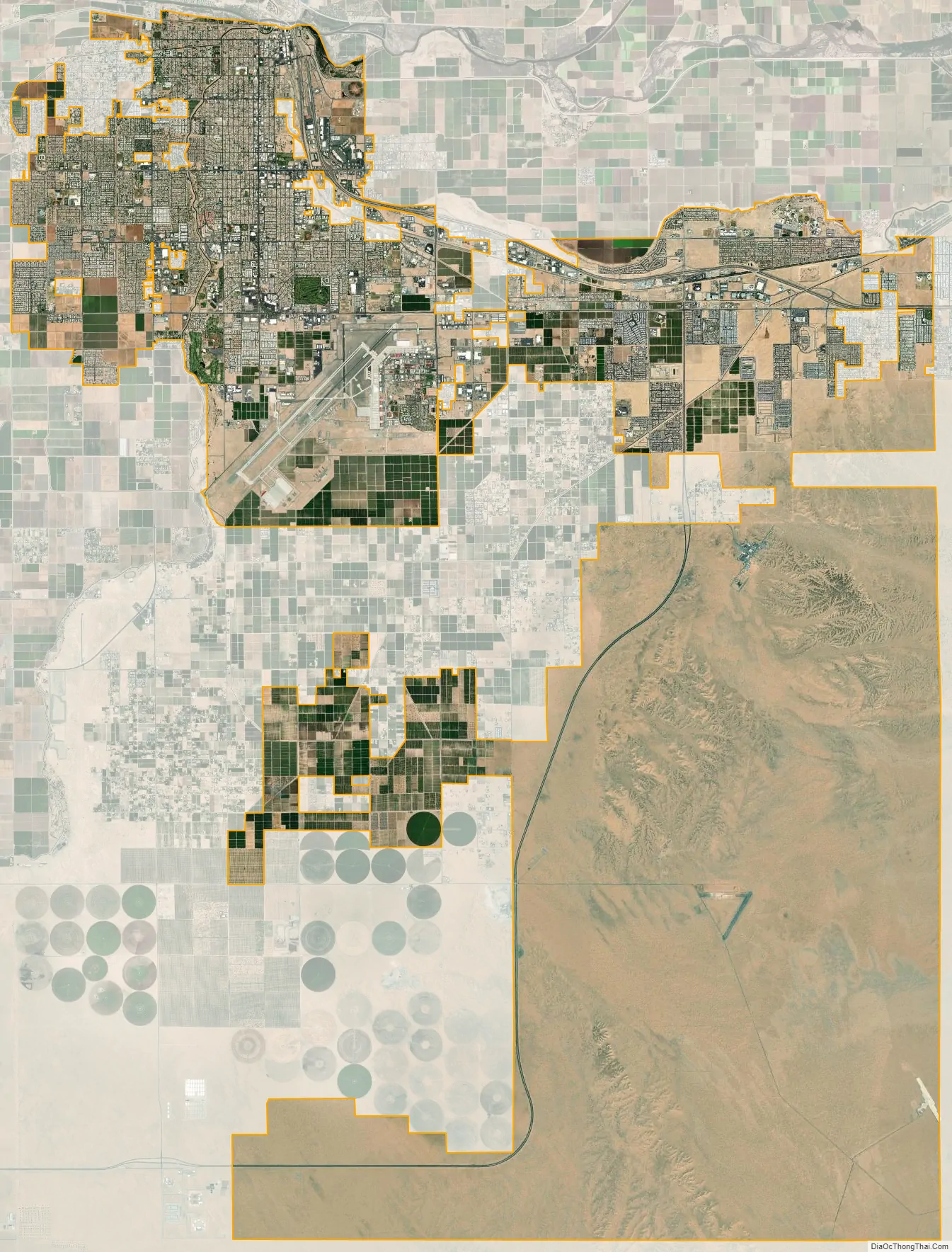
Yuma city Satellite Map
Geography
Yuma is near the borders of California to the west and Mexico to the south, and just west of the Gila River’s confluence with the Colorado. The city is approximately 60 miles (100 km) from the Gulf of California (Sea of Cortez), a branch of the Pacific.
According to the United States Census Bureau, the city has a total area of 106.7 square miles (276 km), of which 106.6 square miles (276 km) is land and 0.1 square miles (0.26 km) (0.07%) is water.
Climate
Yuma is noted for its weather extremes. Of any populated place in the contiguous United States, Yuma is the driest, the sunniest, and the least humid, has the lowest frequency of precipitation, and has the highest number of sunny days per year—175—with a daily maximum temperature of 90 °F (32 °C) or higher.
Yuma features a hot desert climate (Köppen climate classification BWh), with extremely hot summers and warm winters. Atmospheric humidity is usually very low, except during what are called “Gulf surges”, when a maritime tropical air mass from the Gulf of California is drawn northward, usually in connection with the summer monsoon or the passage of a tropical storm to the south.
The sun is said to shine during about 90% of the daylight hours, making Yuma one of the sunniest places in the world. The city receives the most recorded mean sunshine of anywhere on Earth, although the equipment used by the United States tends to provide higher sunshine estimates than the traditional Campbell–Stokes recorder.
On average, Yuma receives 3.36 inches (85 mm) of rain annually. Even in the wettest year of 2005, only 7.39 in (188 mm) fell. The driest year at Yuma Airport was 2007, with only 0.15 in (3.8 mm) recorded. On average, the wettest months of the year are during the monsoon months of August and September, and December, when moisture from winter storms arrives from the Pacific Ocean. June is the driest month, with drought virtually absolute.
In 1995, Yuma recorded its all-time high temperature of 124 °F (51 °C). The lowest recorded temperature was in the Yuma-Mesa area in January 2007. The temperature fell to 21 °F (−6 °C) for approximately two hours, harming many crops grown in and around Yuma. Citrus suffered the most, particularly the lemon crop. According to an Arizona Department of Agriculture report in February 2007, there was a 75% to 95% loss of crop and trees. On average (according to the 1991-2020 climate period), the temperature reaches freezing point in one year in fifteen, and there are 117 days per year during which the temperature reaches or exceeds 100 °F (38 °C), usually from April through October. During July and August, the temperature fails to reach 100 °F (38 °C) on only one and two days on average, respectively.
In 1997, the desert city sustained a full tropical storm after Hurricane Nora made landfall at the mouth of the Colorado River and quickly moved due north along it. This rare event cut power to 12,000 customers in Yuma, and dropped 3.59 inches (91 mm) of rain at Marine Corps Air Station Yuma. The last time a hurricane had hit near Yuma was in mid-August 1977, when similar rainfalls were recorded.
Snow in Yuma has only been recorded on December 12, 1932, when a light coating of snow covered the city for the first and only time in its history. A few flakes fell in January 1937 and December 1967, mixed with rain.
See also
Map of Arizona State and its subdivision: Map of other states:- Alabama
- Alaska
- Arizona
- Arkansas
- California
- Colorado
- Connecticut
- Delaware
- District of Columbia
- Florida
- Georgia
- Hawaii
- Idaho
- Illinois
- Indiana
- Iowa
- Kansas
- Kentucky
- Louisiana
- Maine
- Maryland
- Massachusetts
- Michigan
- Minnesota
- Mississippi
- Missouri
- Montana
- Nebraska
- Nevada
- New Hampshire
- New Jersey
- New Mexico
- New York
- North Carolina
- North Dakota
- Ohio
- Oklahoma
- Oregon
- Pennsylvania
- Rhode Island
- South Carolina
- South Dakota
- Tennessee
- Texas
- Utah
- Vermont
- Virginia
- Washington
- West Virginia
- Wisconsin
- Wyoming


