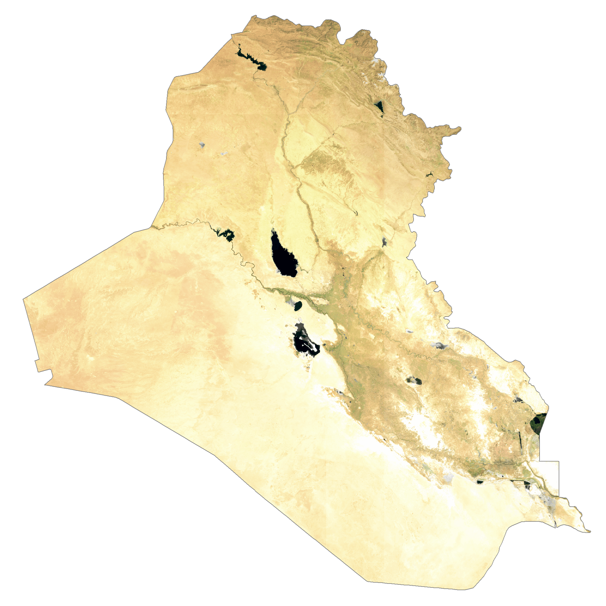
With an area of 437,072 sq. km, Iraq is the 58th largest country in the world.
The country exhibits four major physiographic regions as mentioned below.
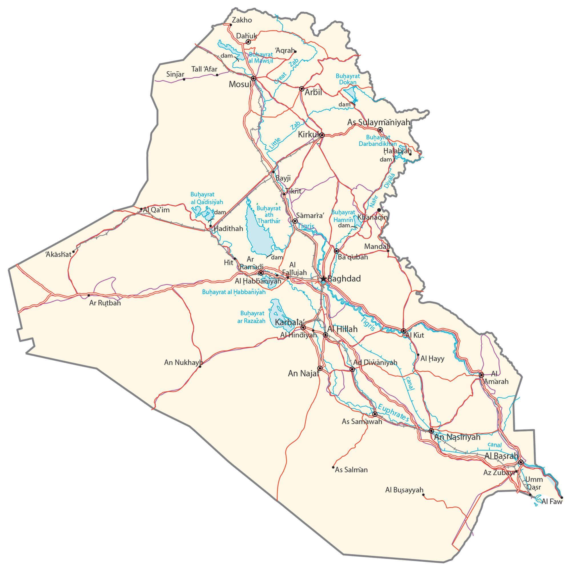
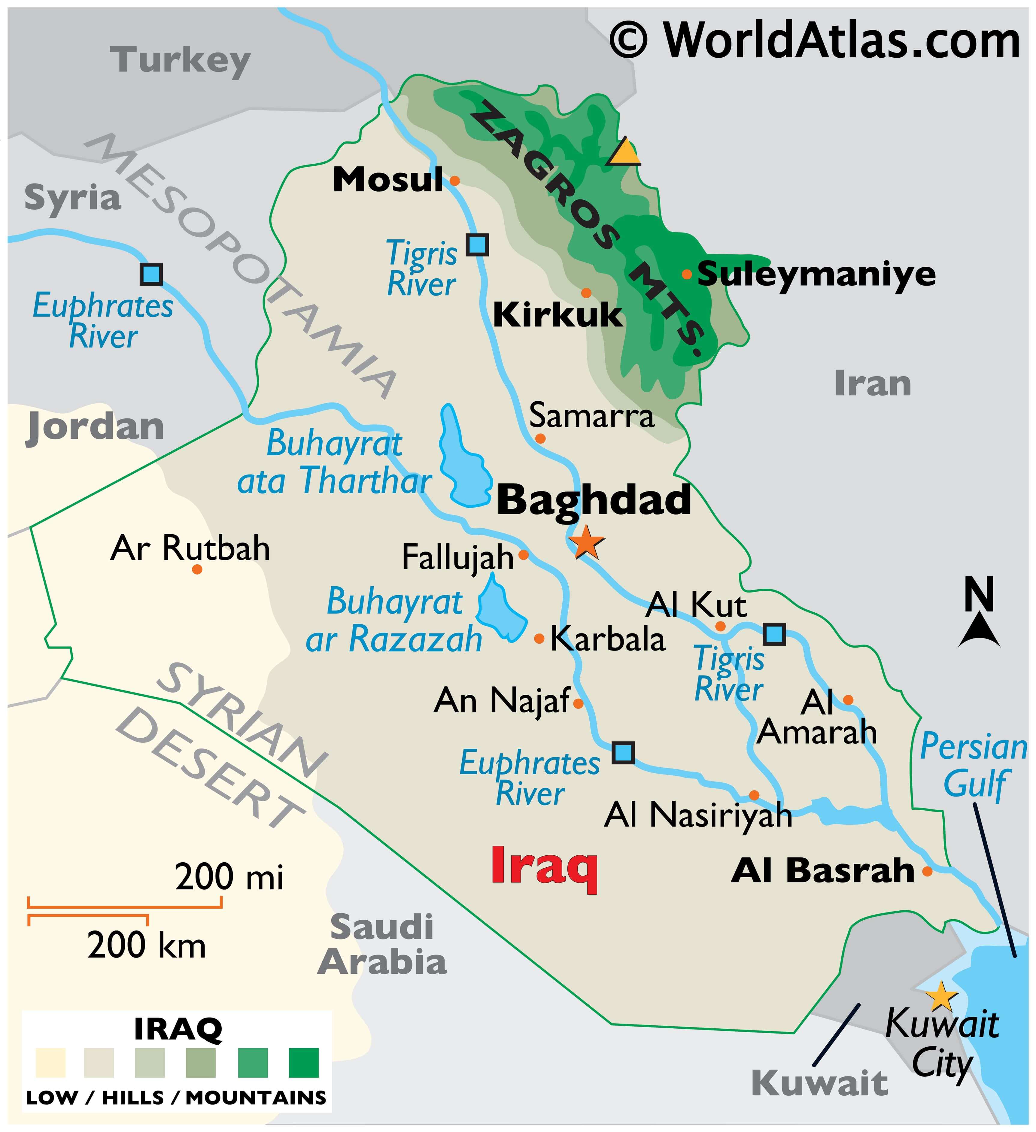
The alluvial plains cover about one-third of the country’s area in the central and southeastern parts. The elevation of land here is generally below 300 feet (100 m). As observed on the physical map of Iraq, this region also features several lakes.
The Al-Jazīrah is an upland region to the north of the alluvial plains and between the Tigris and Euphrates Rivers. The Sinjār Mountains is found here.
Iraq is mountainous further to the north and northeast, as the Zagros Mountains front its borders with Iran and Turkey. The country’s highest point is located there, an unnamed peak rising 11,847 ft (3,611 m).
The Syrian Desert lies to the extreme west of Iraq.
Two of the most significant rivers in all of Asia, the Euphrates and Tigris Rivers, drain the land.
The lowest point in Iraq is at 0 ft (0 m) in the Persian Gulf.
| Flag: |  |
|---|---|
| Legal Name: | Republic of Iraq |
| Capital Value: | Baghdad |
| Official languages: |
|
| Demonym(s): | Iraqi |
| Government: | Federal parliamentary republic |
| Legislature: | Council of Representatives |
| Total Area: | 438,317 km² |
| Land Area: | 437,367 km² |
| Water Area: | 950 km² |
| Population: | 39,309,783 |
| Density: | 82.7/km (214.2/sq mi) (125th) |
| GDP: | $234.09 Billion |
| GDP Per Capita: | $5,955.11 |
| Currency Value: | Iraqi dinars (IQD) |
| Driving side: | right |
| Calling code: | +964 |
| Internet TLD: | .iq |
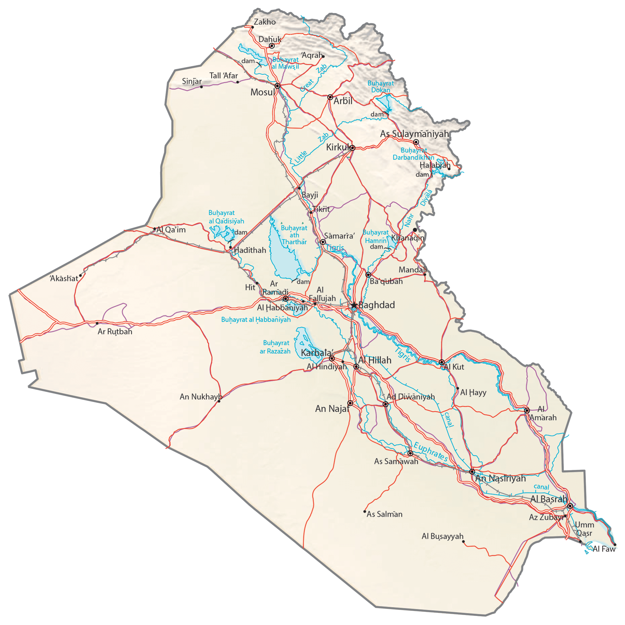
Explore the geographical features of Iraq with this interactive map. From the rich agricultural lands of the Tigris-Euphrates river valley to the Zagros Mountains, there is much to discover. See the major cities, towns, roads, lakes, and rivers across the country, as well as the desert-covered landscape of the Zagros mountain range. Satellite imagery provides an up-close look at the terrain and topography of Iraq.
Online Interactive Political Map
Click on ![]() to view map in "full screen" mode.
to view map in "full screen" mode.
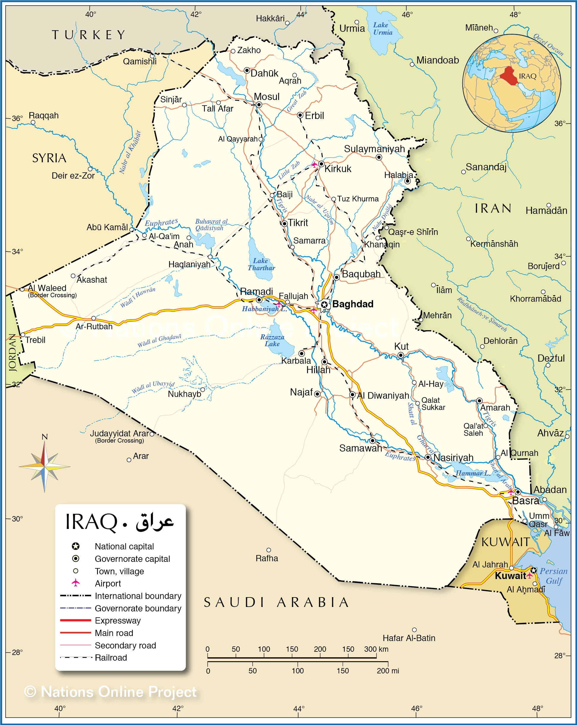
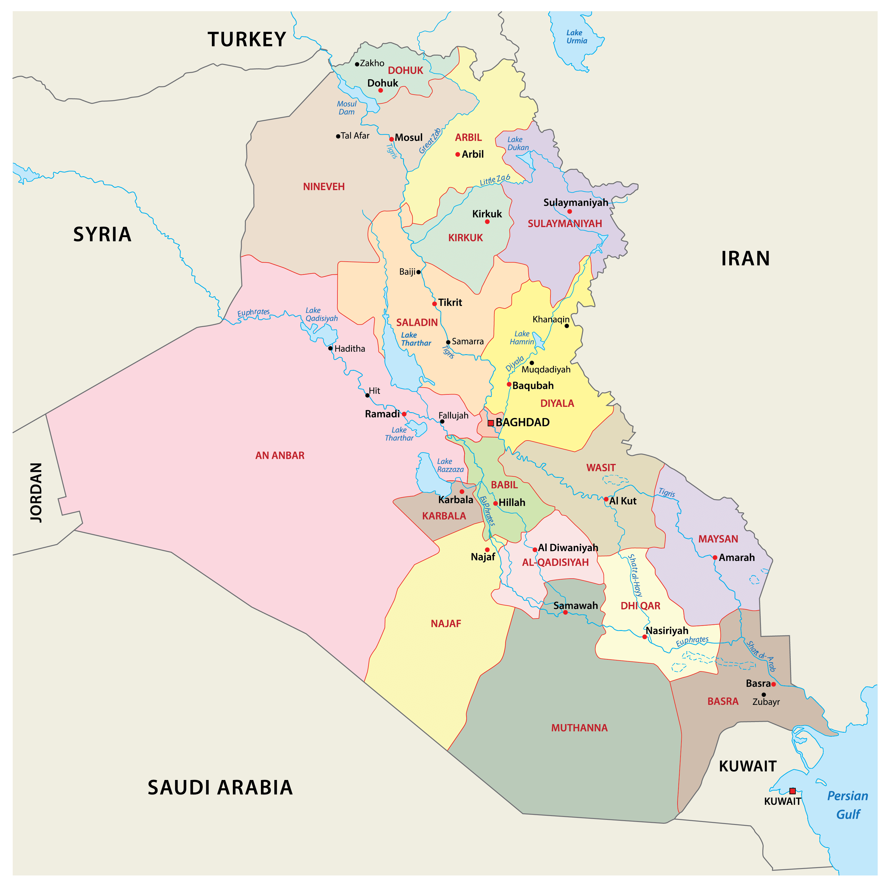
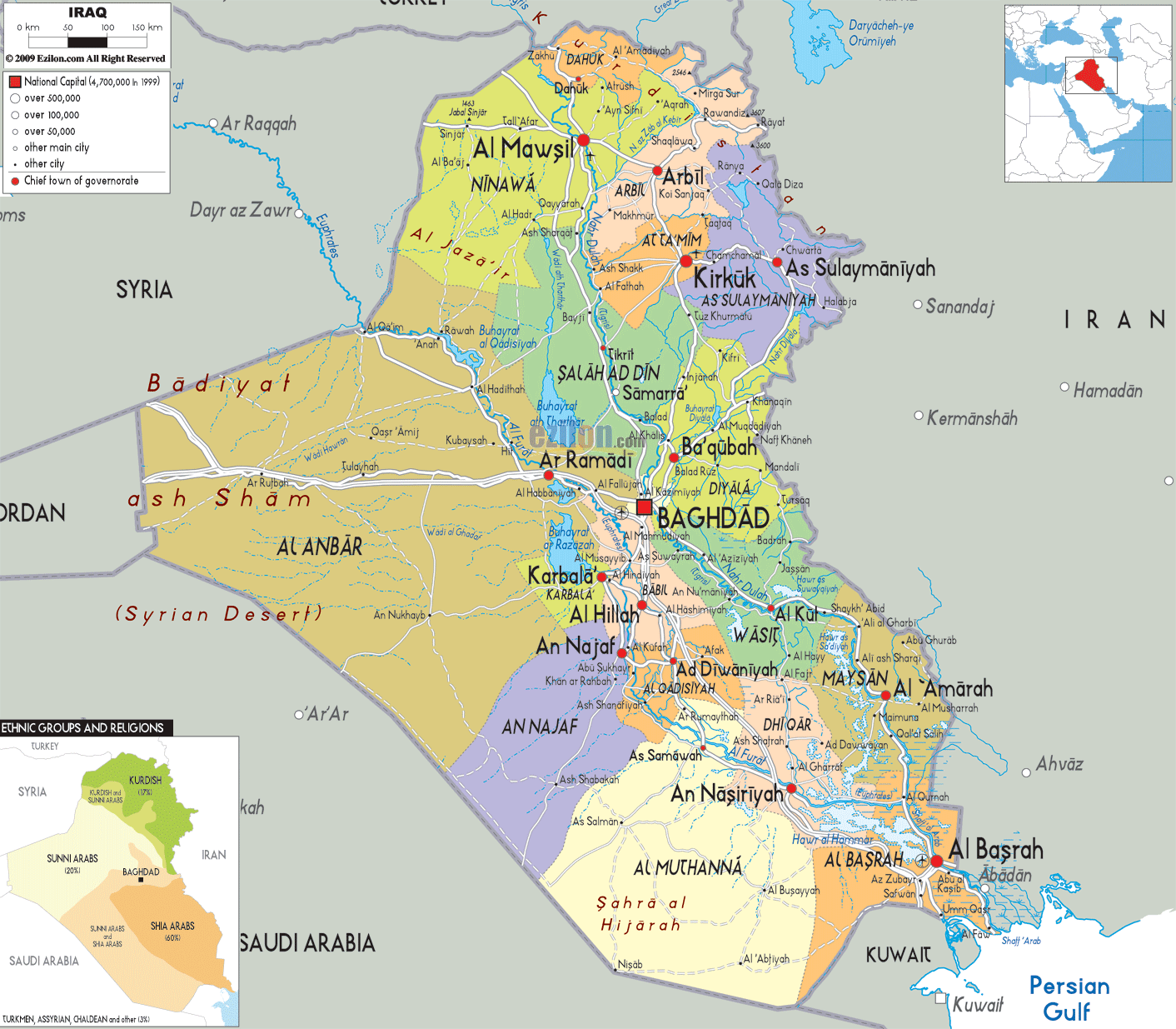
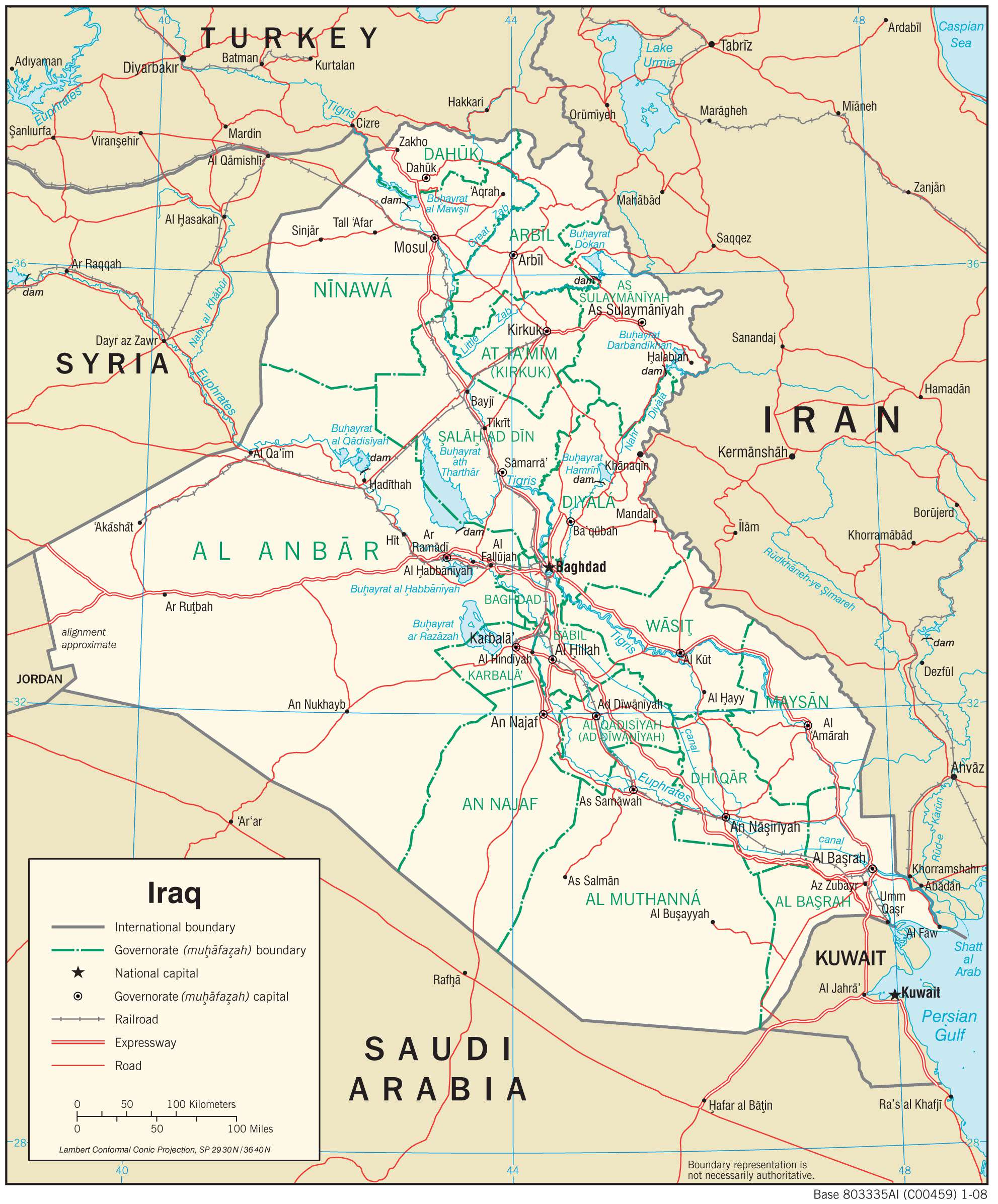
Iraq (officially, Republic of Iraq) is divided into 18 governorates (muhafazat, sing- muhafazah) and 1 autonomous region. In alphabetical order, these governorates are: Al Anbar, Babil, Baghdad, Al Basrah, DiQar, Al Qadisiyah, Diyala, Dahuk, Erbil, Hewler (Halabja), Karbala, Kirkuk, Maysan, Al Muthanna, An Najaf, Ninawa (Nineveh), Salahad Din and Wasit. Kurdistan (Kurdistan Region) is an autonomous region in Iraq. These governorates are further subdivided into districts (qadhas) and sub districts (nawahi).
Baghdad is the capital city of the Republic of Iraq. It is located in the center of the country, in the northern part of the Arabian Peninsula. Located along both the banks of the Tigris River, the city is the largest in entire Southwest Asia. Baghdad is the most populous city as well as the cultural, commercial and economic center of Iraq.
Location Maps
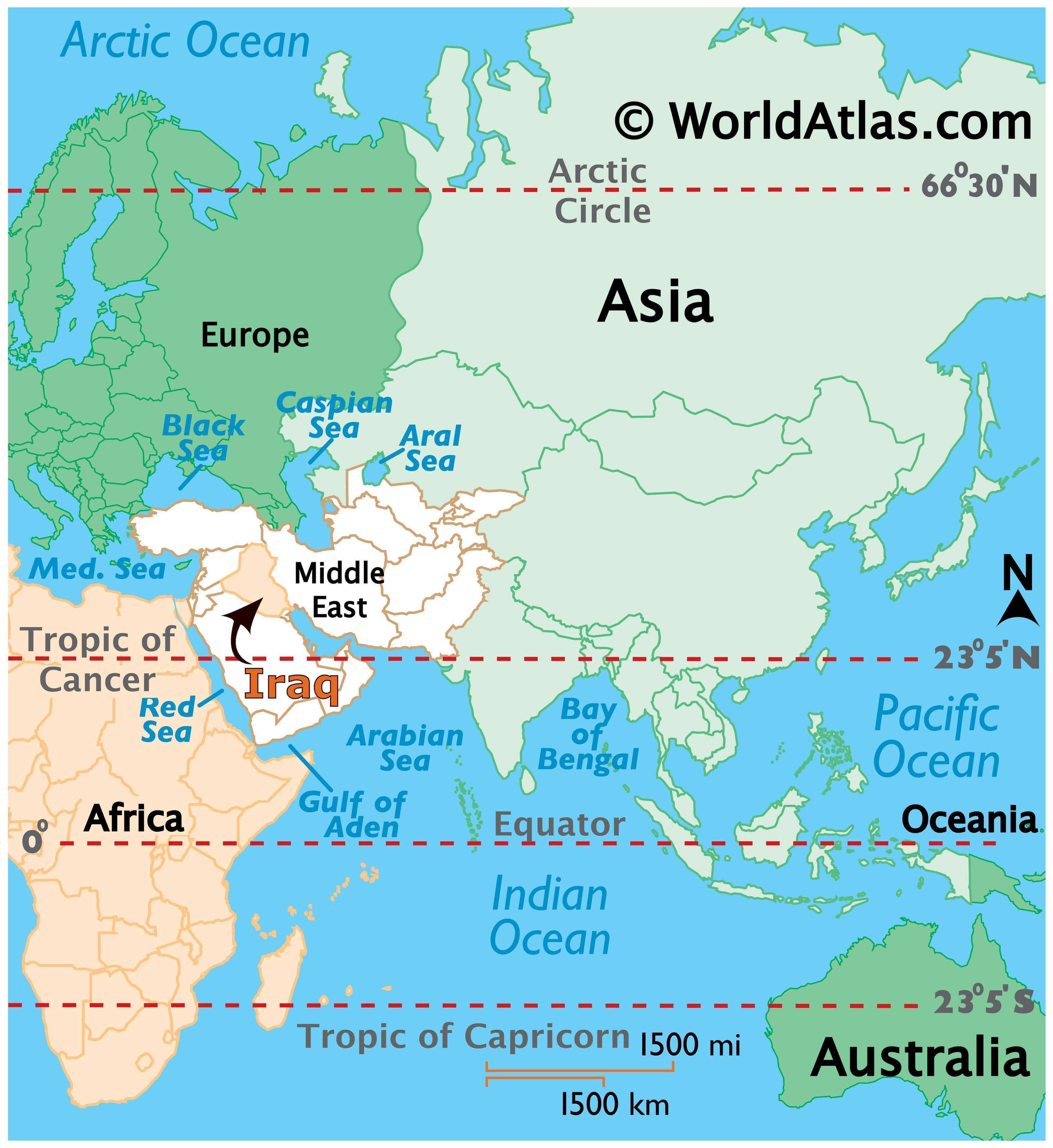
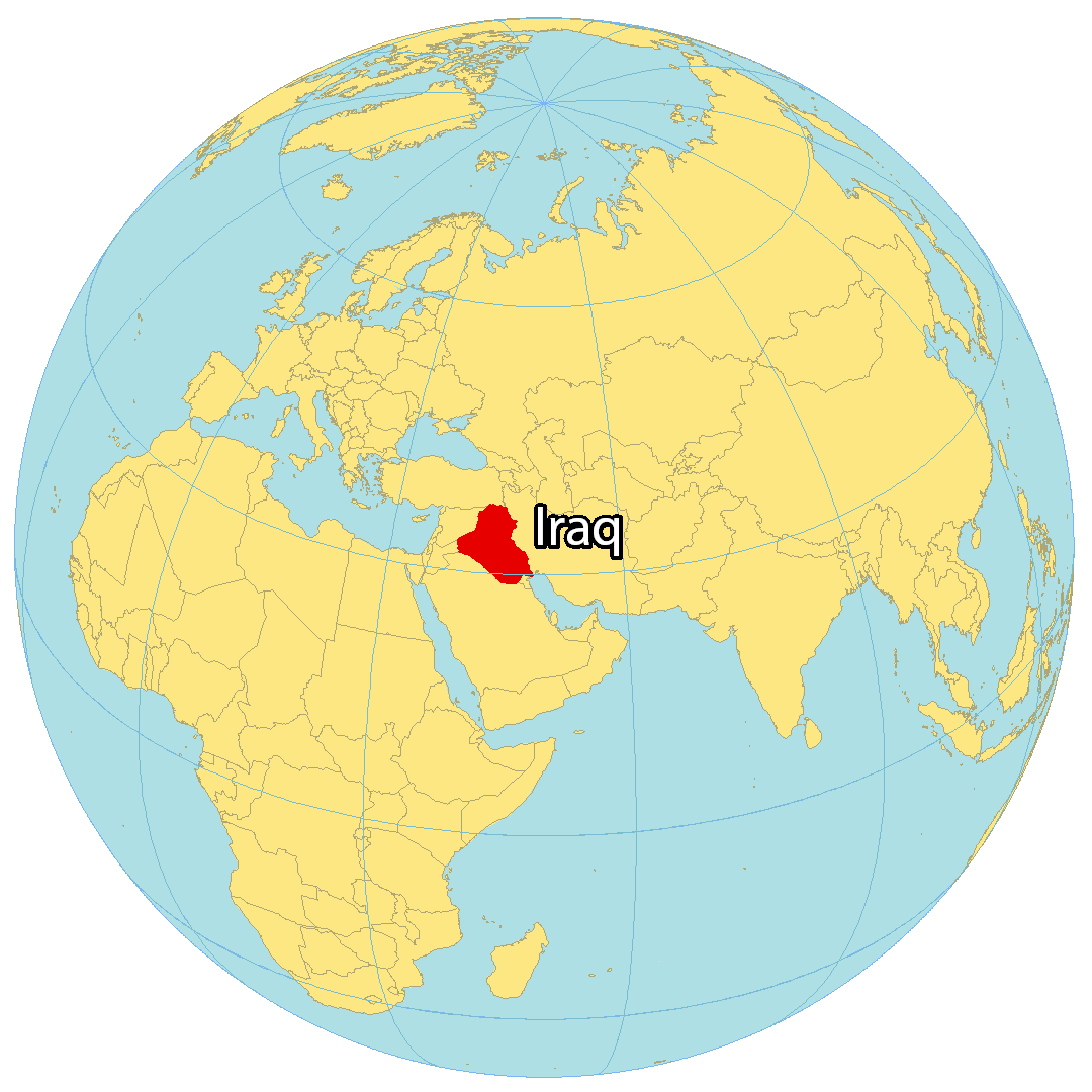
Where is Iraq?
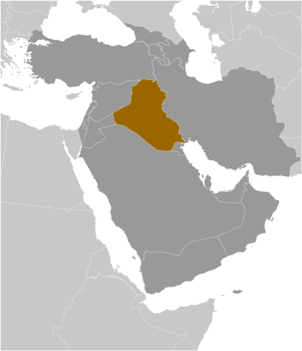
Iraq is situated in the Middle East, just off the coast of the Persian Gulf. It is bordered by Iran to the east, Syria to the west, Kuwait, Jordan, Turkey, and Saudi Arabia. Iraq has a coastline of 58 kilometers (36 mi) on the northern Persian Gulf, and is the fourth-most populous country in the Middle East. Baghdad is the capital and largest city of Iraq.
The Fertile Crescent is the region where Iraq is located, and it has been important since early civilizations developed there. The Tigris and Euphrates rivers flow through Iraq, and these rivers played a major role in the growth of these civilizations.
High Definition Political Map of Iraq
Physical Map of Iraq

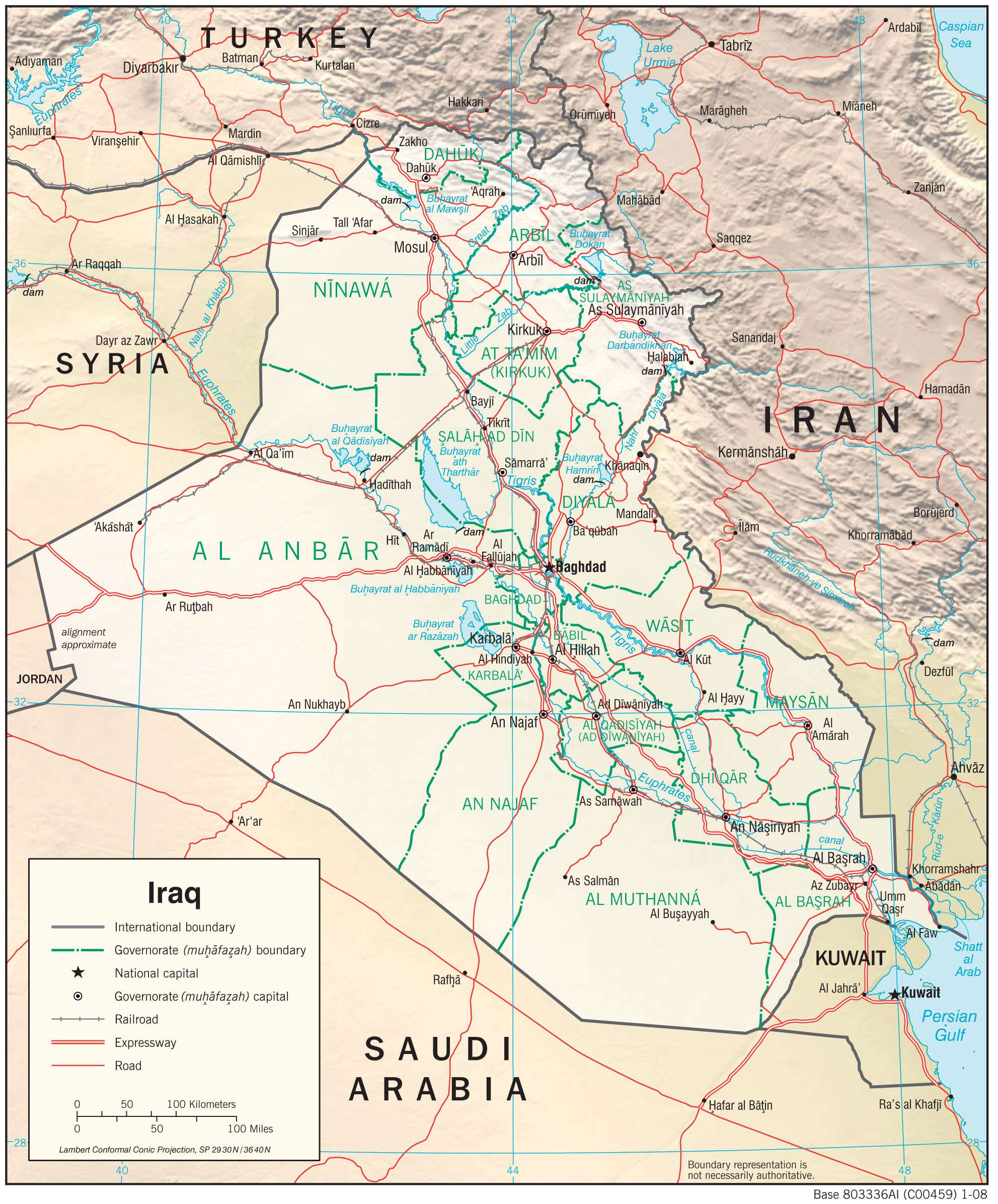
Transportation Map of Iraq
Iraq Satellite Map