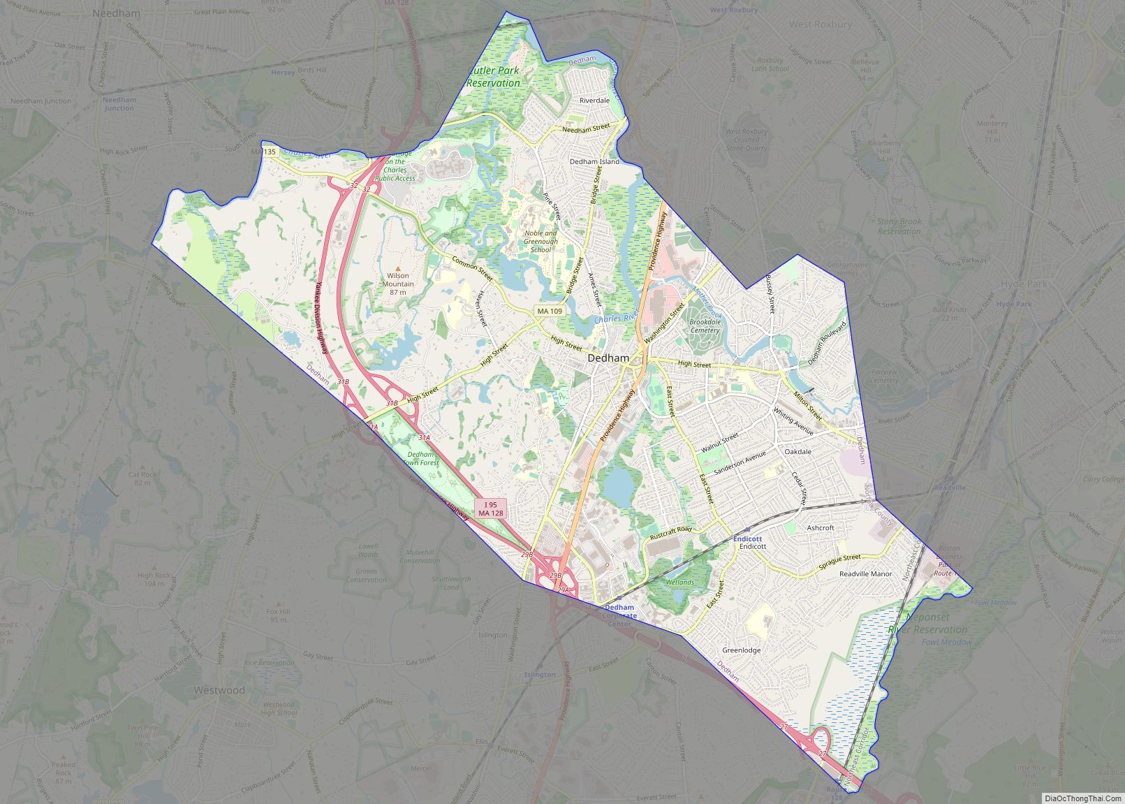
Dedham (/ˈdɛdəm/ DED-əm) is a town in and the county seat of Norfolk County, Massachusetts. The population was 25,364 at the 2020 census. It is located on Boston‘s southwest border. On the northwest it is bordered by Needham, on the southwest by Westwood, and on the southeast by Canton. The town was first settled by European colonists in 1635.
| Name: | Dedham CDP |
|---|---|
| LSAD Code: | 57 |
| LSAD Description: | CDP (suffix) |
| State: | Massachusetts |
| County: | Norfolk County |
| Incorporated: | 1636 |
| Elevation: | 120 ft (37 m) |
| Total Area: | 10.6 sq mi (27.6 km²) |
| Land Area: | 10.5 sq mi (27.1 km²) |
| Water Area: | 0.2 sq mi (0.5 km²) |
| Total Population: | 25,364 |
| Population Density: | 2,415.62/sq mi (935.94/km²) |
| ZIP code: | 02026 (02027 for P.O. Boxes) |
| Area code: | 781 / 339 |
| FIPS code: | 2516530 |
| GNISfeature ID: | 0618318 |
| Website: | http://www.dedham-ma.gov |
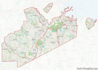
Online Interactive Map
Click on ![]() to view map in "full screen" mode.
to view map in "full screen" mode.
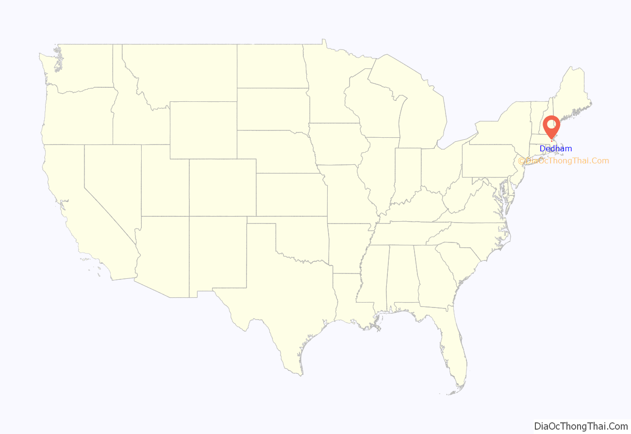
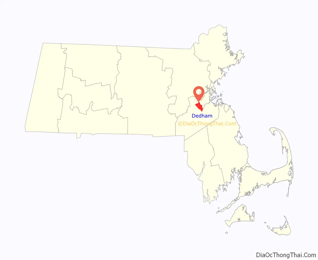
Dedham location map. Where is Dedham CDP?
History
17th century
Settled in 1635 by people from Roxbury and Watertown, Dedham was incorporated in 1636. It became the county seat of Norfolk County when the county was formed from parts of Suffolk County on March 26, 1793. When the Town was originally incorporated, the residents wanted to name it “Contentment.” The Massachusetts General Court overruled them and named the town after Dedham, Essex in England, where some of the original inhabitants were born. The boundaries of the town at the time stretched to the Rhode Island border.
At the first public meeting on August 15, 1636, eighteen men signed the town covenant. They swore that they would “in the fear and reverence of our Almighty God, mutually and severally promise amongst ourselves and each to profess and practice one truth according to that most perfect rule, the foundation whereof is ever lasting love.”
They also agreed that “we shall by all means labor to keep off from us all such as are contrary minded, and receive only such unto us as may be probably of one heart with us, [and such] as that we either know or may well and truly be informed to walk in a peaceable conversation with all meekness of spirit, [this] for the edification of each other in the knowledge and faith of the Lord Jesus…” The covenant also stipulated that if differences were to arise between townsmen, they would seek arbitration for resolution and each would pay his fair share for the common good.
18th century
Just 15 months after asking for their own church, 40 men living on the north side of the Charles River suddenly asked the General Court to separate them from Dedham. Their petition cited the inadequate services provided, namely schools and churches. They also said that, if they were simply to be made a precinct instead of a separate town, that they would suffer political reprisals. Dedham agreed that the services were inadequate and did not oppose the separation, but did try to reduce the amount of land the separatists were seeking. Dedham also asked for a delay of one year. The General Court agreed with the petitioners, however, and created the new town of Needham with the original boundaries requested. Those who remained in Dedham still held rights to the unallotted lands in Needham, however, and any decrease in taxes would be offset by a decrease in expenditures. There may have also been some satisfaction in separating themselves from those on the other side of the 1704 power struggle.
In November 1798, David Brown led a group in Dedham protesting the federal government; they set up a liberty pole, as people had before the American Revolution. It carried the words, “No Stamp Act, No Sedition Act, No Alien Bills, No Land Tax, downfall to the Tyrants of America; peace and retirement to the President; Long Live the Vice President,” referring to then-President John Adams and Vice President Thomas Jefferson. Brown was arrested in Andover but because he could not afford the $4,000 bail, he was taken to Salem for trial. Brown was tried in June 1799. Although he wanted to plead guilty, Justice Samuel Chase urged him to name those who had helped him or subscribed to his writings in exchange for freedom. Brown refused, was fined $480, and sentenced to eighteen months in prison. It was the most severe sentence up to then imposed under the Alien and Sedition Acts.
Dedham is home to the Fairbanks House, the oldest surviving timber-frame house in the United States, scientifically dated to 1637. On January 1, 1643, by unanimous vote, Dedham authorized the first taxpayer-funded public school, “the seed of American education.” Its first schoolmaster, Rev. Ralph Wheelock, a Clare College graduate, was paid 20 pounds annually to instruct the youth of the community. Descendants of these students would become presidents of Dartmouth College, Yale University and Harvard University.
The first man-made canal in North America, Mother Brook, was created in Dedham in 1639. It linked the Charles River to the Neponset River. Although both are slow-moving rivers, they are at different elevations. The difference in elevation made the canal’s current swift enough to power several local mills.
19th century
In 1818, though citizens were still taxed for the support of ministers and other “public teachers of religion,” Dedham set a precedent toward the separation of church and state. Residents of the town selected a minister different than that chosen by the church members; the selection by residents was confirmed by the Supreme Judicial Court. This decision increased support for the disestablishment of the Congregational churches.
The local Endicott Estate burned to the ground in 1904 after the local volunteer fire department, responding to three separate fires burning simultaneously, reached the Endicott fire last. By the time they arrived, only ashes remained. It is said that the estate’s owner, Henry Bradford Endicott (also founder of the Endicott Johnson Corporation) took the burning of the homestead as a divine command to rebuild (which he did). The rebuilt Endicott Estate is listed on the National Register of Historic Places. The estate and surrounding grounds are open to the public, upholding Henry’s stepdaughter Katherine’s wish to use the house and property for “educational, civic, social and recreational purposes.”
20th century
In 1921, the historic Sacco and Vanzetti trial was held in the Norfolk County Courthouse in Dedham. Dedham Pottery is a cherished class of antiques, characterized by a distinctive crackle glaze, blue-and-white color scheme, and a frequent motif of rabbits and other animals. Dedham is sometimes called the “mother of towns” because 14 present-day communities were included within its original broad borders.
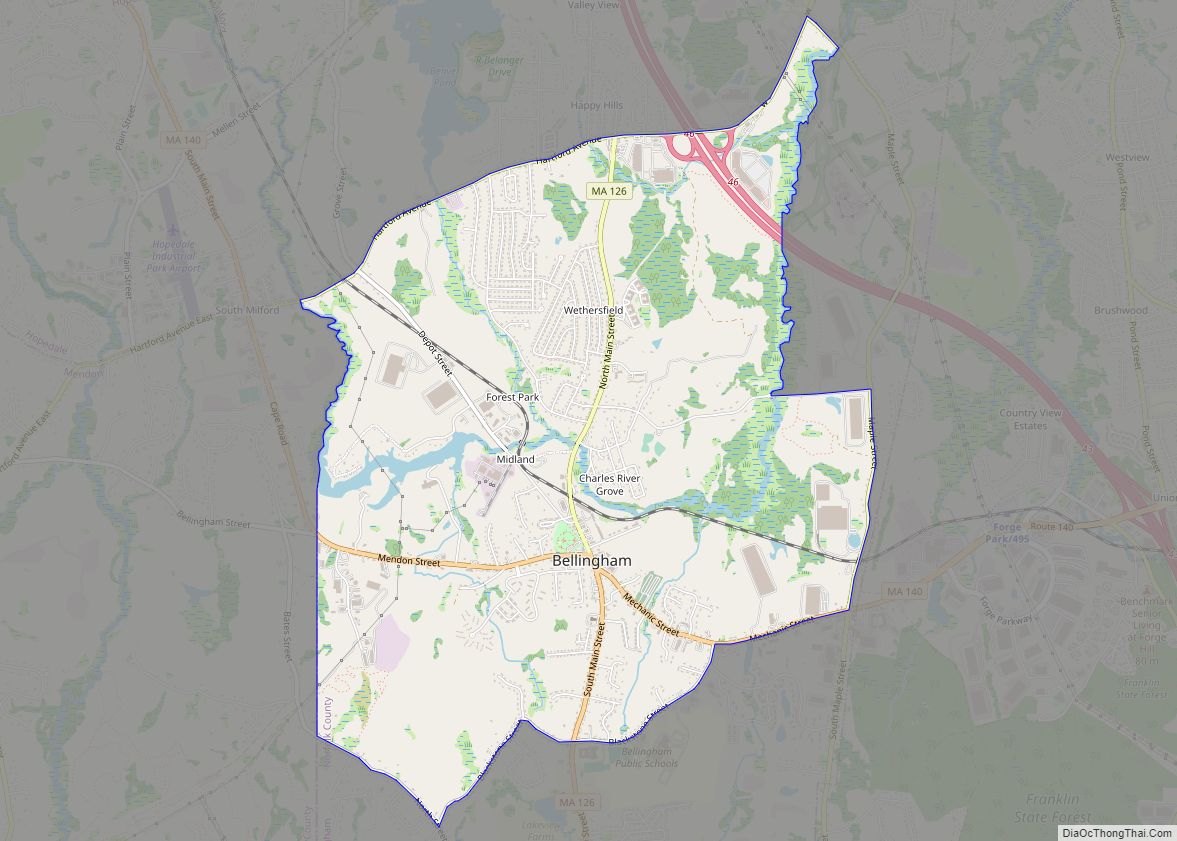
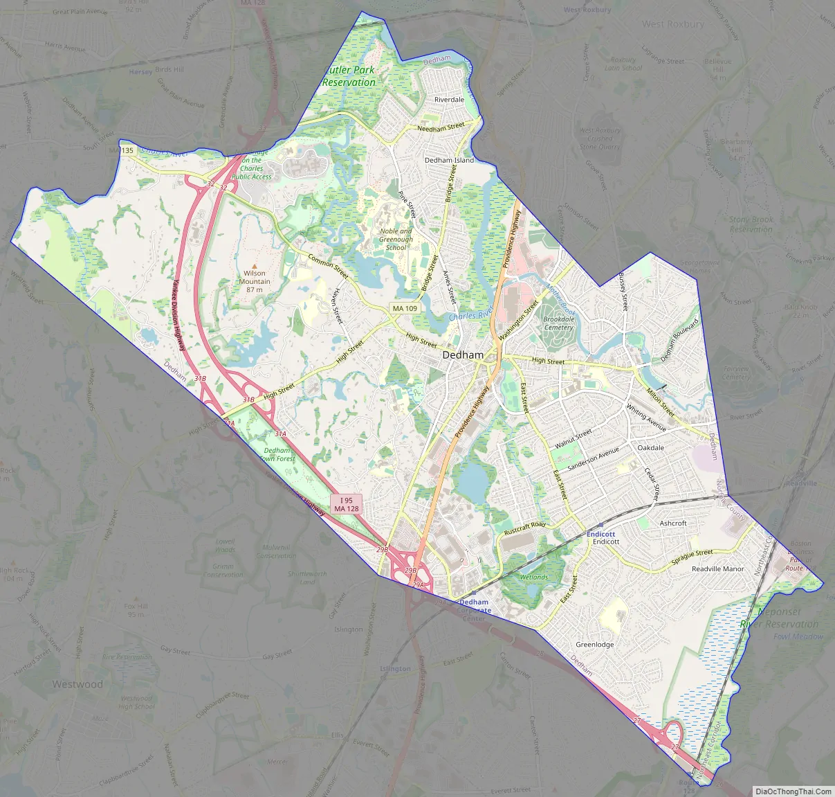
Dedham Road Map
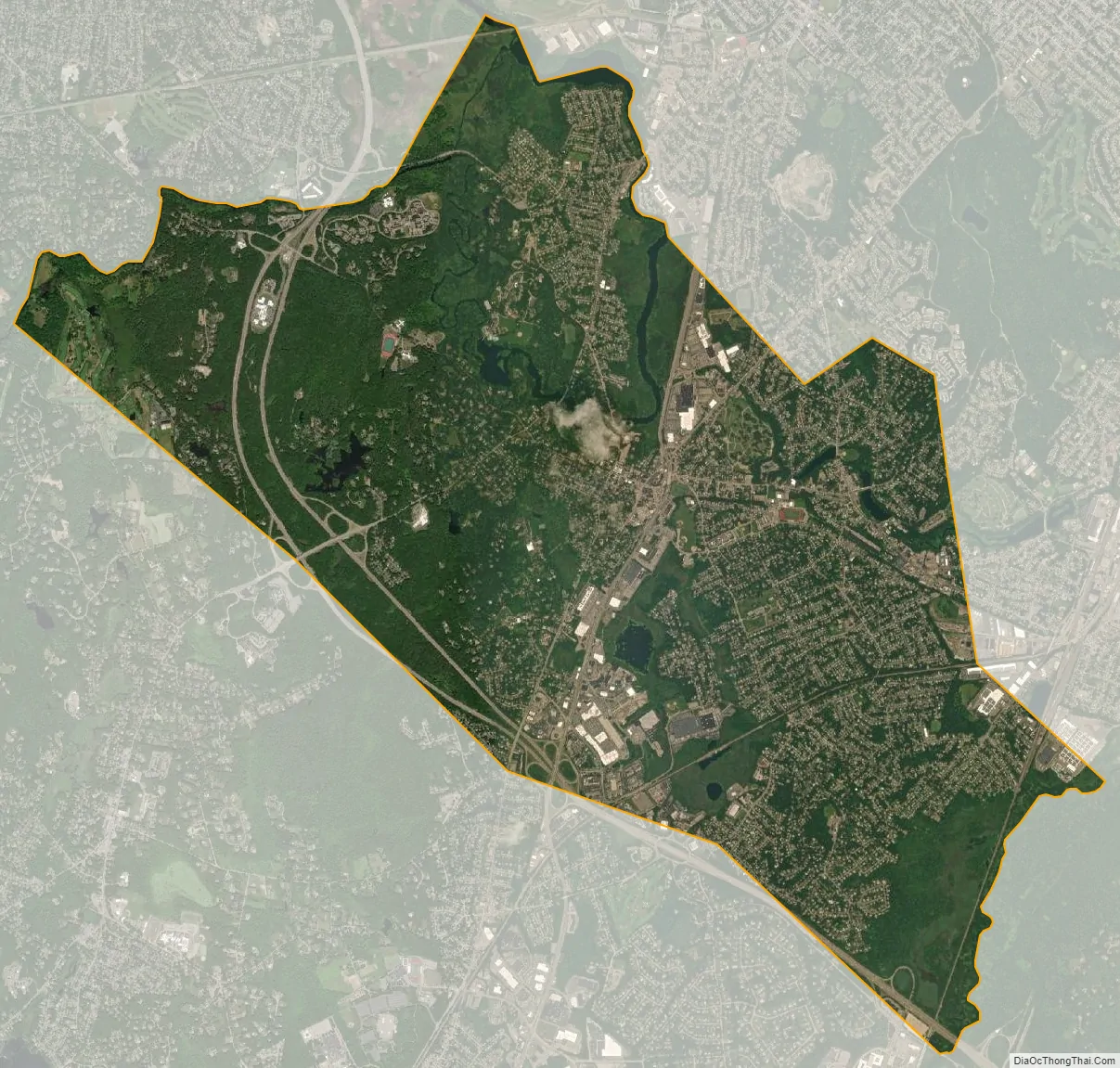
Dedham city Satellite Map
Geography
Dedham is located at 42°14′40″N 71°9′55″W / 42.24444°N 71.16528°W / 42.24444; -71.16528 (42.244609, −71.165531). On the northeast corner of High Street and Court Street the U.S. Coast & Geodetic Survey, now the U.S. National Geodetic Survey, has placed a small medallion into a granite block showing an elevation of 112.288 feet.
Dedham is made up of a number of neighborhoods:
- In the geographical center of town is Oakdale. It is roughly defined by East Street to the west, Cedar Street to the south and east, and Whiting Ave to the north. The houses in the area around Woodleigh Road, which was declared to be one of the best streets in Greater Boston, have many homes designed by Henry Bailey Alden, who also designed the Endicott Estate. Nearby the subdivision consisting of Morse Avenue, Fulton Street, and Edison Avenue, is named Whiting Park.
- Riverdale is an island surrounded by the Charles River and Long Ditch.
- Greenlodge runs along the axis of Greenlodge Street and the area between Greenlodge Street and East Street.
- The Manor comprises the neighborhood south of Sprague Street.
- East Dedham falls between Mother Brook and the Boston line.
- Precinct One, or Upper Dedham, is in the northwest corner of the town, between High Street and Common Street and the Westwood and Needham lines.
- Ashcroft is the neighborhood between Cedar Street and Sprague Street. It includes Paul Park and the Capen School.
- Fairbanks is the neighborhood between East Street and Wigwam Pond.
According to the United States Census Bureau, the town has a total area of 10.6 square miles (27 km), of which 10.4 square miles (27 km) is land and 0.2 square miles (0.52 km) (1.79%) is water.
Climate
Dedham has a warm-summer humid continental climate (Dfb under the Köppen climate classification system), with high humidity and precipitation year-round.
See also
Map of Massachusetts State and its subdivision: Map of other states:- Alabama
- Alaska
- Arizona
- Arkansas
- California
- Colorado
- Connecticut
- Delaware
- District of Columbia
- Florida
- Georgia
- Hawaii
- Idaho
- Illinois
- Indiana
- Iowa
- Kansas
- Kentucky
- Louisiana
- Maine
- Maryland
- Massachusetts
- Michigan
- Minnesota
- Mississippi
- Missouri
- Montana
- Nebraska
- Nevada
- New Hampshire
- New Jersey
- New Mexico
- New York
- North Carolina
- North Dakota
- Ohio
- Oklahoma
- Oregon
- Pennsylvania
- Rhode Island
- South Carolina
- South Dakota
- Tennessee
- Texas
- Utah
- Vermont
- Virginia
- Washington
- West Virginia
- Wisconsin
- Wyoming