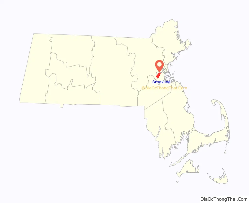
Brookline /ˈbrʊklaɪn/ is a town in Norfolk County, Massachusetts, in the United States, and part of the Boston metropolitan area. Brookline borders six of Boston‘s neighborhoods: Brighton, Allston, Fenway–Kenmore, Mission Hill, Jamaica Plain, and West Roxbury. The city of Newton lies to the west of Brookline. Brookline was first settled in 1638 as a hamlet in Boston, known as Muddy River; it was incorporated as a separate town in 1705.
At the time of the 2020 United States Census, the population of the town was 63,191. It has been the most populous municipality in Massachusetts to have a town (rather than city) form of government since Framingham changed to a city in 2018 following a 2017 referendum.
| Name: | Brookline CDP |
|---|---|
| LSAD Code: | 57 |
| LSAD Description: | CDP (suffix) |
| State: | Massachusetts |
| County: | Norfolk County |
| Incorporated: | 1705 |
| Elevation: | 50 ft (15 m) |
| Total Area: | 6.8 sq mi (17.7 km²) |
| Land Area: | 6.8 sq mi (17.6 km²) |
| Water Area: | 0.1 sq mi (0.1 km²) |
| Total Population: | 63,191 |
| Population Density: | 9,292.8/sq mi (3,590.4/km²) |
| Area code: | 617/857 |
| FIPS code: | 2509210 |
| GNISfeature ID: | 0619456 |
| Website: | www.brooklinema.gov |
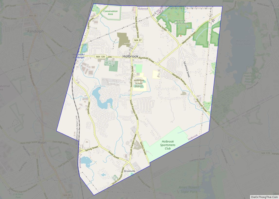
Online Interactive Map
Click on ![]() to view map in "full screen" mode.
to view map in "full screen" mode.
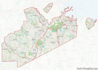
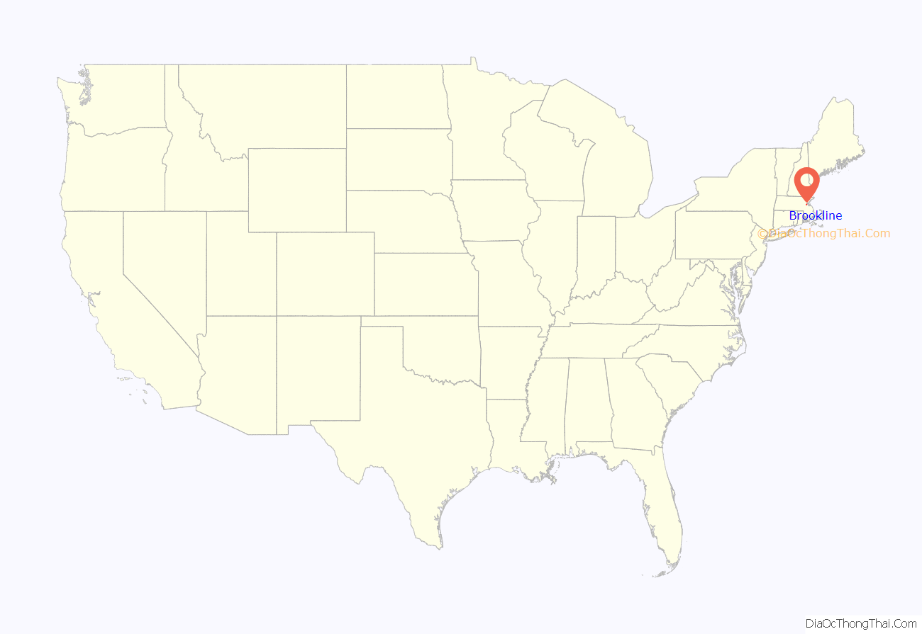
Brookline location map. Where is Brookline CDP?
History
Once part of Algonquian territory, Brookline was first settled by European colonists in the early 17th century. The area was an outlying part of the colonial settlement of Boston and known as the hamlet of Muddy River. In 1705, it was incorporated as the independent town of Brookline. The northern and southern borders of the town were marked by two small rivers or brooks, which is the town’s namesake. The northern border with Brighton (which was itself part of Cambridge until 1807) was Smelt Brook. (That name appears on maps starting at least as early as 1852, but sometime between 1888 and 1925 the brook was covered over.) The southern boundary, abutting Boston, was the Muddy River.
In 1843, deeds in Brookline forbade resale of property to “any negro or native of Ireland.”
The Town of Brighton was merged with Boston in 1874, and the Boston-Brookline border was redrawn to connect the new Back Bay neighborhood with Allston-Brighton. This merger created a narrow strip of land along the Charles River belonging to Boston, cutting Brookline off from the shoreline. It also put certain lands north of the Muddy River on the Boston side, including what are now Kenmore Square and Packard’s Corner. The current northern border follows Commonwealth Avenue, and on the northeast, St. Mary’s Street. When Frederick Law Olmsted designed the Emerald Necklace of parks and parkways for Boston in the 1890s, the Muddy River was integrated into the Riverway and Olmsted Park, creating parkland accessible by both Boston and Brookline residents.
Throughout its history, Brookline has resisted being annexed by Boston, in particular during the Boston–Brookline annexation debate of 1873. The neighboring towns of West Roxbury and Hyde Park connected Brookline to the rest of Norfolk County until they were annexed by Boston in 1874 and 1912, respectively, putting them in Suffolk County. Brookline is now separated from the remainder of Norfolk County.
Brookline has long been regarded as a pleasant and verdant environment. In the 1841 edition of the Theory and Practice of Landscape Gardening, Andrew Jackson Downing described the area this way:
Brookline residents were among the first in the country to propose extending the vote to women. Benjamin F. Butler, in his 1882 campaign for Governor, advocated the idea.
Transportation history
Two branches of upper Boston Post Road, established in the 1670s, passed through Brookline. Brookline Village was the original center of retail activity. In 1810, the Boston and Worcester Turnpike, now Massachusetts Route 9, was laid out, starting on Huntington Avenue in Boston and passing through the village center on its way west.
Steam railroads came to Brookline in the middle of the 19th century. The Boston and Worcester Railroad was constructed in the early 1830s, and passed through Brookline near the Charles River. The rail line is still in active use, now paralleled by the Massachusetts Turnpike. The Highland branch of the Boston and Albany Railroad was built from Kenmore Square to Brookline Village in 1847, and was extended into Newton in 1852. In the late 1950s, this would become the Green Line D branch.
The portion of Beacon Street west of Kenmore Square was laid out in 1850. Streetcar tracks were laid above ground on Beacon Street in 1888, from Coolidge Corner to Massachusetts Avenue in Boston, via Kenmore Square. In 1889, they were electrified and extended over the Brighton border at Cleveland Circle. They would eventually become the Green Line C branch.
Thanks to the Boston Elevated Railway system, this upgrade from horse-drawn carriage to electric trolleys occurred on many major streets all over the region, and made transportation into downtown Boston faster and cheaper. Much of Brookline was developed into a streetcar suburb, with large brick apartment buildings sprouting up along the new streetcar lines.
Etymology
Brookline was known as the hamlet of Muddy River and was considered part of Boston until the Town of Brookline was independently incorporated in 1705. (The Muddy River was used as the Brookline–Boston border at incorporation.) It is said that the name derives from a farm therein once owned by Judge Samuel Sewall. Originally the property of CPT John Hull and Judith Quincy Hull. Judge Sewall came into possession of this tract, which embraced more than 350 acres, through Hannah Quincy Hull (Sewall) who was the Hull’s only daughter. John Hull in his youth lived in Muddy River Hamlet, in a little house which stood near the Sears Memorial Church. Hull removed to Boston, where he amassed a large fortune for those days. Judge Sewall probably never lived on his Brookline estate.
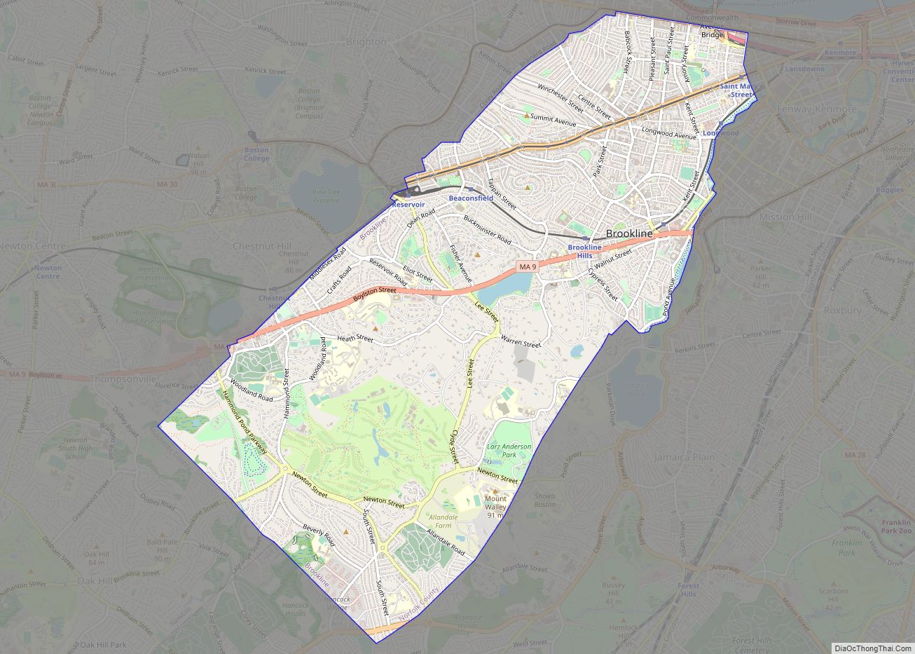
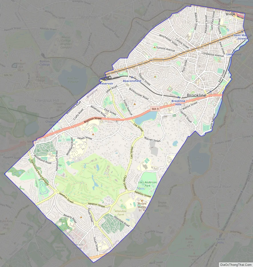
Brookline Road Map
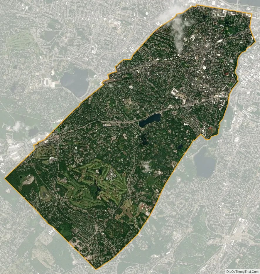
Brookline city Satellite Map
Geography
According to the United States Census Bureau, Brookline has a total area of 6.8 sq mi (17.7 km), all but 0.039 sq mi (0.1 km) (0.44%) of which is land.
The northern part of Brookline, roughly north of the D-line tracks, is urban in character, as highly walkable and transit rich. The population density of this northern part of town is nearly 20,000 inhabitants per square mile (8,000/km), similar to the densest neighborhoods in nearby Cambridge, Somerville and Chelsea, Massachusetts (the densest cities in New England), and slightly lower than that of central Boston’s residential districts (Back Bay, South End, Fenway, etc.). The overall density of Brookline, which also includes suburban districts and grand estates south of the D-line, is still higher than that of many of the largest cities in the United States, especially in the South and West. Brookline borders Newton (part of Middlesex County) to the west and Boston (part of Suffolk County) in all other directions; it is therefore non-contiguous with any other part of Norfolk County. Brookline became an exclave of Norfolk County in 1873, when the neighboring town of West Roxbury was annexed by Boston (and left Norfolk County to join Suffolk County). Brookline refused to be annexed by Boston after the Boston–Brookline annexation debate of 1873.
Brookline separates the bulk of the city of Boston (except for a narrow neck or corridor near the Charles River) from its westernmost neighborhoods of Allston–Brighton, which had been the separate town of Brighton until annexed by Boston in 1873.
Neighborhoods
There are many neighborhood associations, some of which overlap.
Neighborhoods, squares, and notable areas of Brookline include:
- Aspinwall Hill
- Beaconsfield
- Brookline Hills
- Brookline Village
- Buttonwood Village
- Brookline High School, Near Pierce District
- Chestnut Hill, which also extends into Newton and Boston
- Coolidge Corner
- Corey Farm
- Corey Hill
- Cottage Farm
- Fisher Hill
- Griggs Park
- JFK Crossing
- Longwood
- North Brookline
- Pill Hill (also known as “High Street Hill”)
- The Point (originally “Whiskey Point”)
- The Runkle District
- South Brookline (“Sobro”)
- The Heights (just west of Washington Square)
- Washington Square
- Woodland Heath
Climate
The climate of Brookline is humid continental Dfa.
Brookline falls under the USDA 6b Plant Hardiness zone.
See also
Map of Massachusetts State and its subdivision: Map of other states:- Alabama
- Alaska
- Arizona
- Arkansas
- California
- Colorado
- Connecticut
- Delaware
- District of Columbia
- Florida
- Georgia
- Hawaii
- Idaho
- Illinois
- Indiana
- Iowa
- Kansas
- Kentucky
- Louisiana
- Maine
- Maryland
- Massachusetts
- Michigan
- Minnesota
- Mississippi
- Missouri
- Montana
- Nebraska
- Nevada
- New Hampshire
- New Jersey
- New Mexico
- New York
- North Carolina
- North Dakota
- Ohio
- Oklahoma
- Oregon
- Pennsylvania
- Rhode Island
- South Carolina
- South Dakota
- Tennessee
- Texas
- Utah
- Vermont
- Virginia
- Washington
- West Virginia
- Wisconsin
- Wyoming