Accident is a town in Garrett County, Maryland, United States. The population was 338 at the 2020 United States census. Accident has been noted for its unusual place name. A person from Accident is called an “Accidental”.
| Name: | Accident town |
|---|---|
| LSAD Code: | 43 |
| LSAD Description: | town (suffix) |
| State: | Maryland |
| County: | Garrett County |
| Incorporated: | 1916 |
| Elevation: | 2,385 ft (727 m) |
| Total Area: | 0.49 sq mi (1.28 km²) |
| Land Area: | 0.49 sq mi (1.28 km²) |
| Water Area: | 0.00 sq mi (0.00 km²) |
| Total Population: | 338 |
| Population Density: | 684.21/sq mi (263.97/km²) |
| ZIP code: | 21520 |
| FIPS code: | 2400225 |
| GNISfeature ID: | 0582858 |
| Website: | www.accidentmd.org |
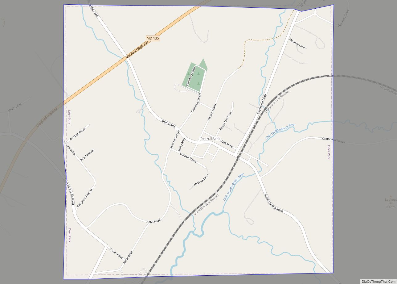
Online Interactive Map
Click on ![]() to view map in "full screen" mode.
to view map in "full screen" mode.
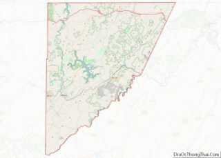
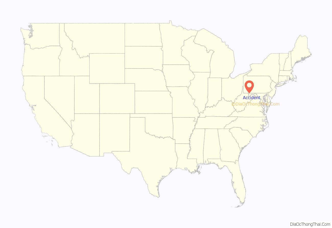
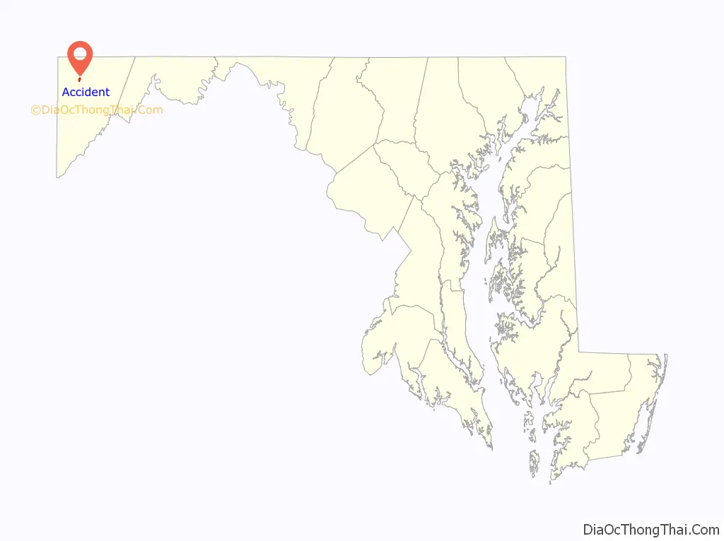
Accident location map. Where is Accident town?
History
Accident was one of the early settlements in the far west of Maryland. The name originates about the time of the 1786 land survey. Though the origin or meaning of the name is unknown, one popular story says that Brooke Beall and William Deakins, Jr., friends from Prince George’s County, were conducting separate surveys in the area at the time and “by accident” Deakins claimed land already surveyed by Beall.
When Lord Baltimore opened up the area, which he called Monocacy Manor, for settlement, in the early 1770s, Brooke Beall secured permission to survey 778 acres (315 hectares; 1.216 square miles). It will never be known for certain how Beall came to choose this particular spot, but the surveyor was given clear instructions where to start. He was to begin “in the center between two bounded white oak trees, standing on the North Side of the South fork of Bear Creek in or near a glade about one Hundred yards from said Run, about one or two Miles above a Lick known by the name of the “Cole Mine Lick”, about four miles (6.4 km) above the mouth of Broad Creek and about one mile (1.6 km) East of a Ridge of the Negro Mountain.” John Hanson, Jr., later a delegate to the Continental Congress, and President of the United States in Congress Assembled, on April 14, 1774, surveyed the land, finding that it only contained 682 acres (276 hectares). For the next twelve years, nothing was done with the survey. The American Revolutionary War intervened, and it was not until February 15, 1786, that the land was granted by means of a patent to William Deakins. The following year the surrounding countryside was surveyed into military lots by Francis Deakins, lots that were meant as compensation for the soldiers who served from Maryland during the Revolution. Each soldier who served for two years received one lot of 50 acres (20 hectares), officers received four lots of 50 acres (20 hectares) each.
Kaese Mill was listed on the National Register of Historic Places in 1984. The James Drane House was listed in 1985.
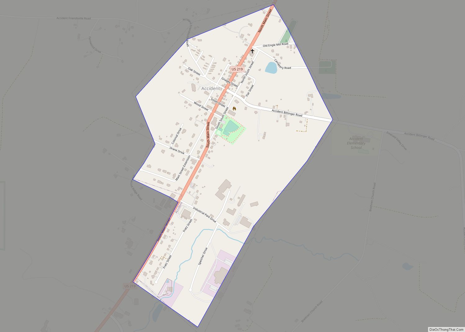
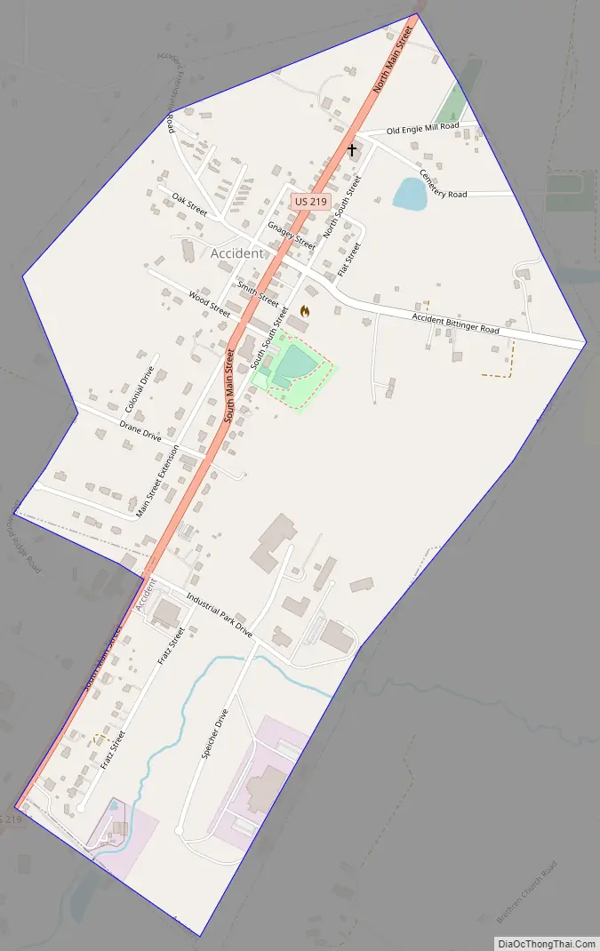
Accident Road Map
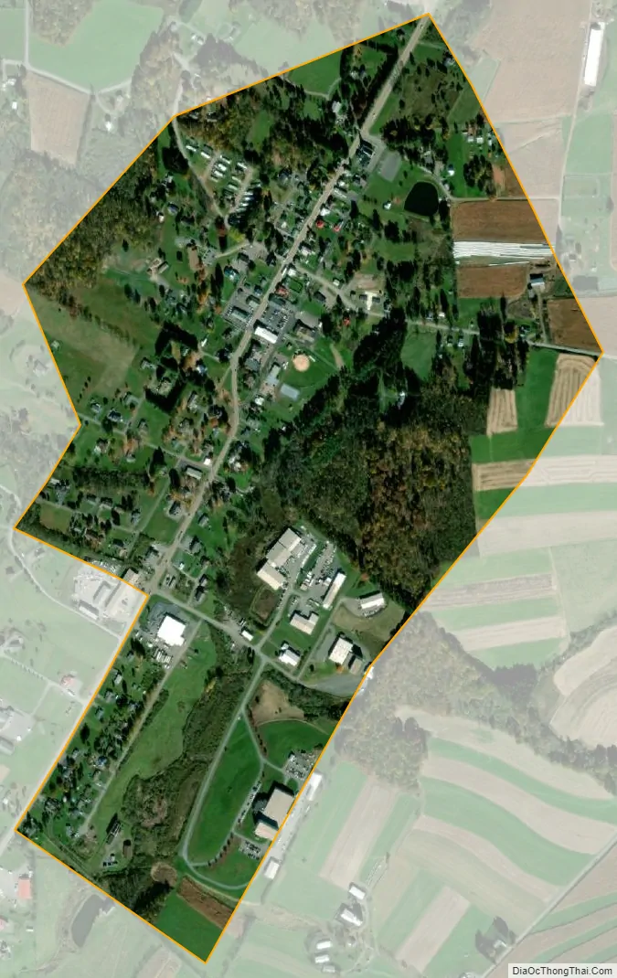
Accident city Satellite Map
Geography
Accident is located at 39°37′41″N 79°19′12″W / 39.62806°N 79.32000°W / 39.62806; -79.32000 (39.628074, -79.319996).
According to the United States Census Bureau, the town has a total area of 0.49 square miles (1.27 km), all land.
Accident is located in the plateau region of the Appalachian Mountains.
See also
Map of Maryland State and its subdivision: Map of other states:- Alabama
- Alaska
- Arizona
- Arkansas
- California
- Colorado
- Connecticut
- Delaware
- District of Columbia
- Florida
- Georgia
- Hawaii
- Idaho
- Illinois
- Indiana
- Iowa
- Kansas
- Kentucky
- Louisiana
- Maine
- Maryland
- Massachusetts
- Michigan
- Minnesota
- Mississippi
- Missouri
- Montana
- Nebraska
- Nevada
- New Hampshire
- New Jersey
- New Mexico
- New York
- North Carolina
- North Dakota
- Ohio
- Oklahoma
- Oregon
- Pennsylvania
- Rhode Island
- South Carolina
- South Dakota
- Tennessee
- Texas
- Utah
- Vermont
- Virginia
- Washington
- West Virginia
- Wisconsin
- Wyoming