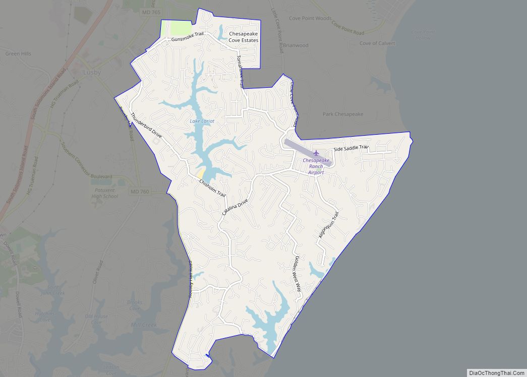
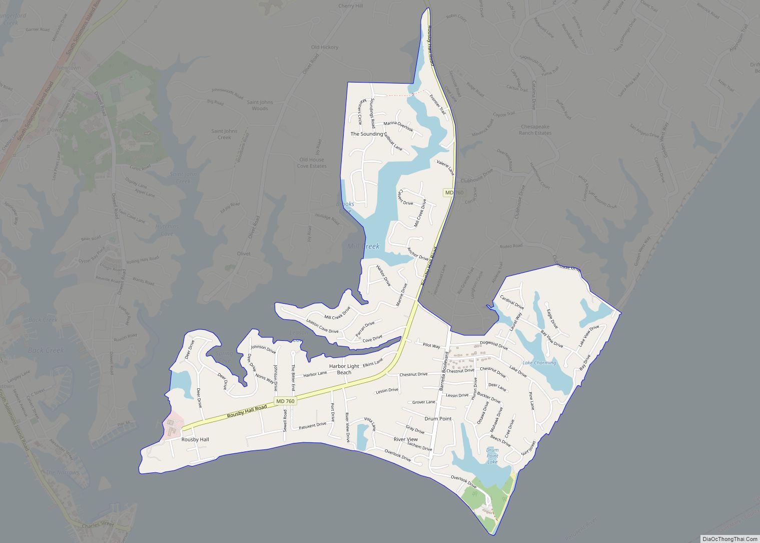
The Chesapeake Ranch Estates (CRE), also known locally as the Ranch Club, is located in Lusby, Maryland, United States, in southern Calvert County. CRE was founded in 1958 and is governed by a homeowners’ association, which is officially called the “Property Owner’s Association of the Chesapeake Ranch Estates” (POACRE). Today, CRE is composed of over 4,000 homes. The community is counted as a census-designated place for population statistics, with a residential population of 10,519 as of the 2010 census. At the 2000 census, the area was part of the Chesapeake Ranch Estates-Drum Point CDP.
| Name: | Chesapeake Ranch Estates CDP |
|---|---|
| LSAD Code: | 57 |
| LSAD Description: | CDP (suffix) |
| State: | Maryland |
| County: | Calvert County |
| Elevation: | 108 ft (33 m) |
| Total Area: | 4.51 sq mi (11.69 km²) |
| Land Area: | 4.32 sq mi (11.19 km²) |
| Water Area: | 0.19 sq mi (0.50 km²) |
| Total Population: | 10,308 |
| Population Density: | 2,386.66/sq mi (921.49/km²) |
| ZIP code: | 20657 |
| Area code: | 410, 443, and 667 |
| FIPS code: | 2416050 |
| GNISfeature ID: | 1676560 |
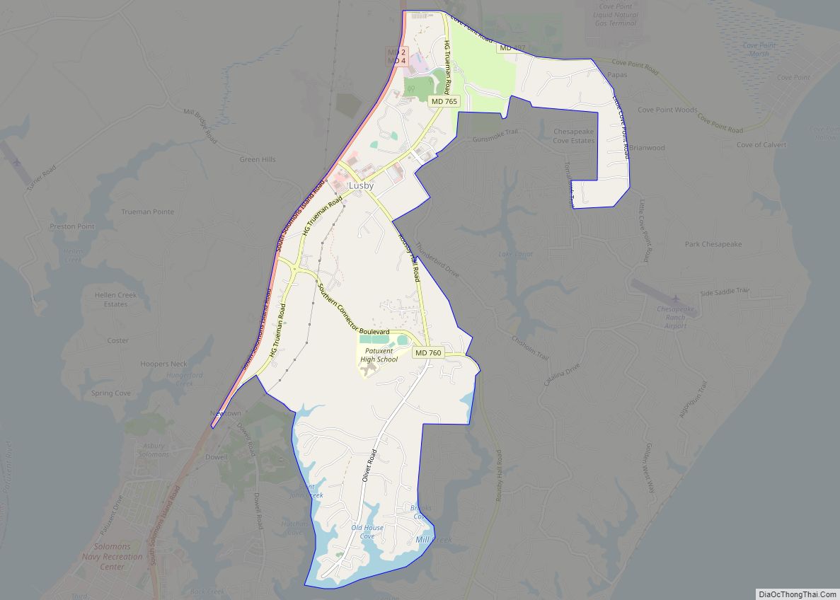
Online Interactive Map
Click on ![]() to view map in "full screen" mode.
to view map in "full screen" mode.
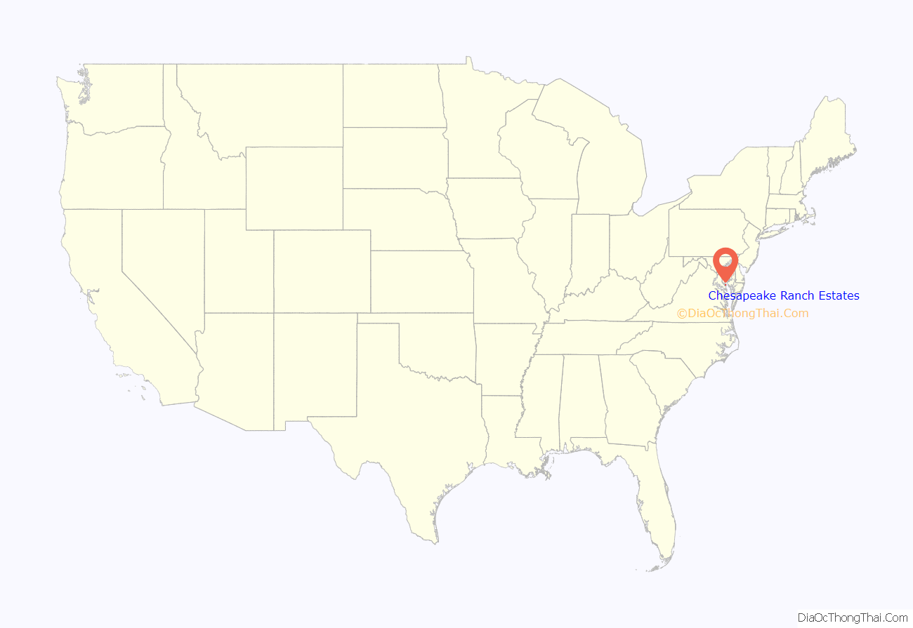
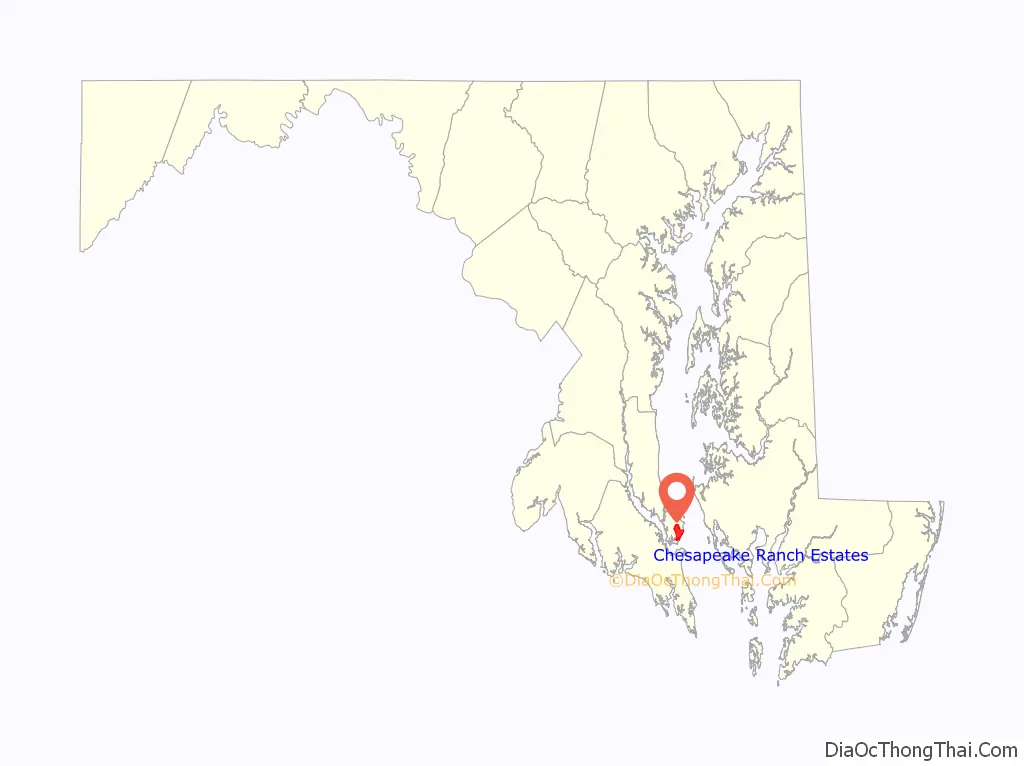
Chesapeake Ranch Estates location map. Where is Chesapeake Ranch Estates CDP?
Chesapeake Ranch Estates Road Map
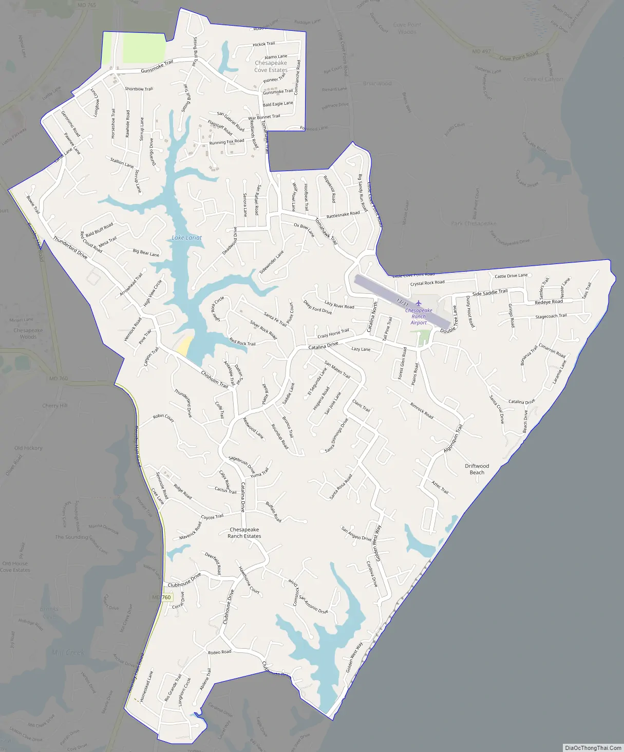
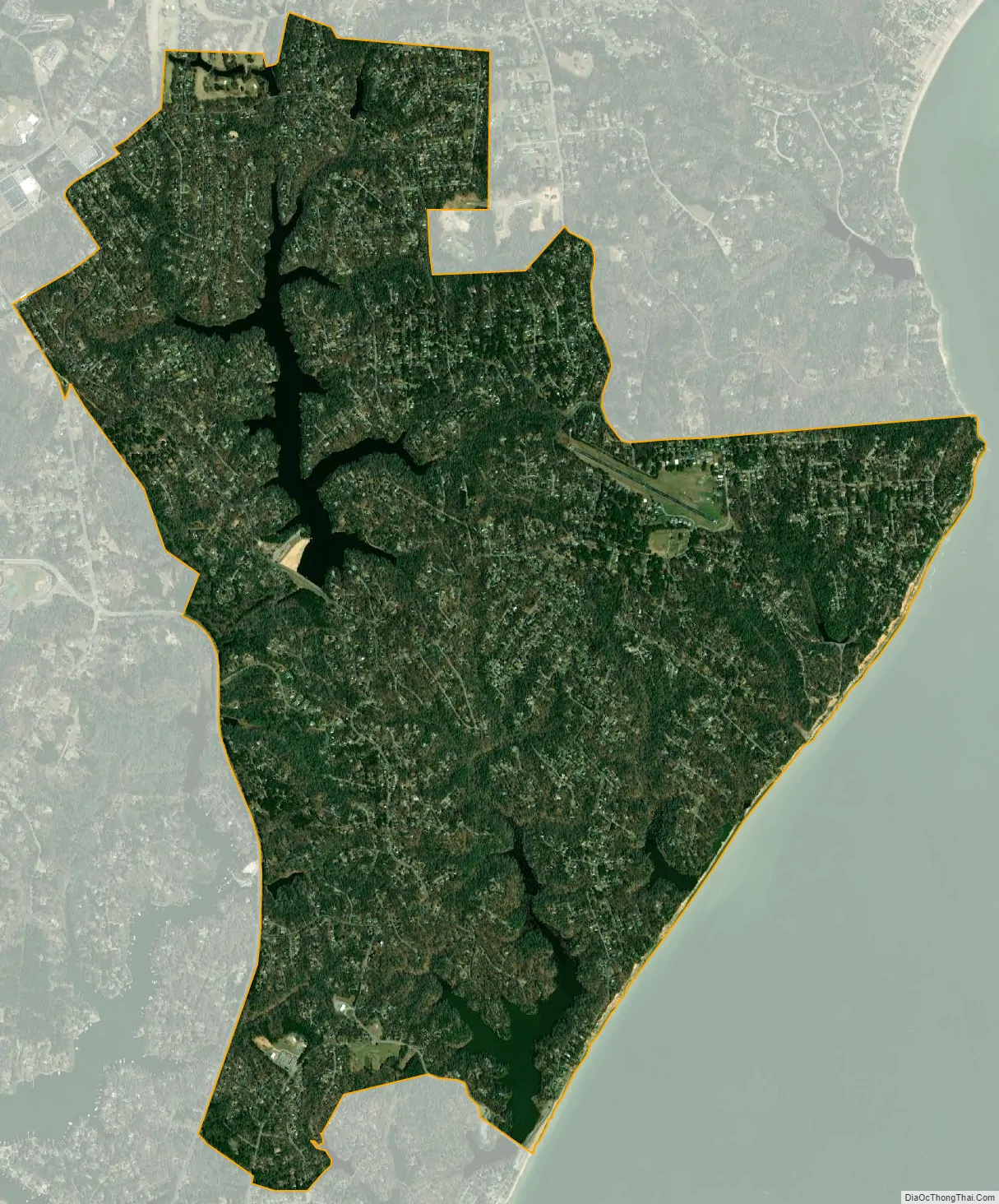
Chesapeake Ranch Estates city Satellite Map
See also
Map of Maryland State and its subdivision: Map of other states:- Alabama
- Alaska
- Arizona
- Arkansas
- California
- Colorado
- Connecticut
- Delaware
- District of Columbia
- Florida
- Georgia
- Hawaii
- Idaho
- Illinois
- Indiana
- Iowa
- Kansas
- Kentucky
- Louisiana
- Maine
- Maryland
- Massachusetts
- Michigan
- Minnesota
- Mississippi
- Missouri
- Montana
- Nebraska
- Nevada
- New Hampshire
- New Jersey
- New Mexico
- New York
- North Carolina
- North Dakota
- Ohio
- Oklahoma
- Oregon
- Pennsylvania
- Rhode Island
- South Carolina
- South Dakota
- Tennessee
- Texas
- Utah
- Vermont
- Virginia
- Washington
- West Virginia
- Wisconsin
- Wyoming