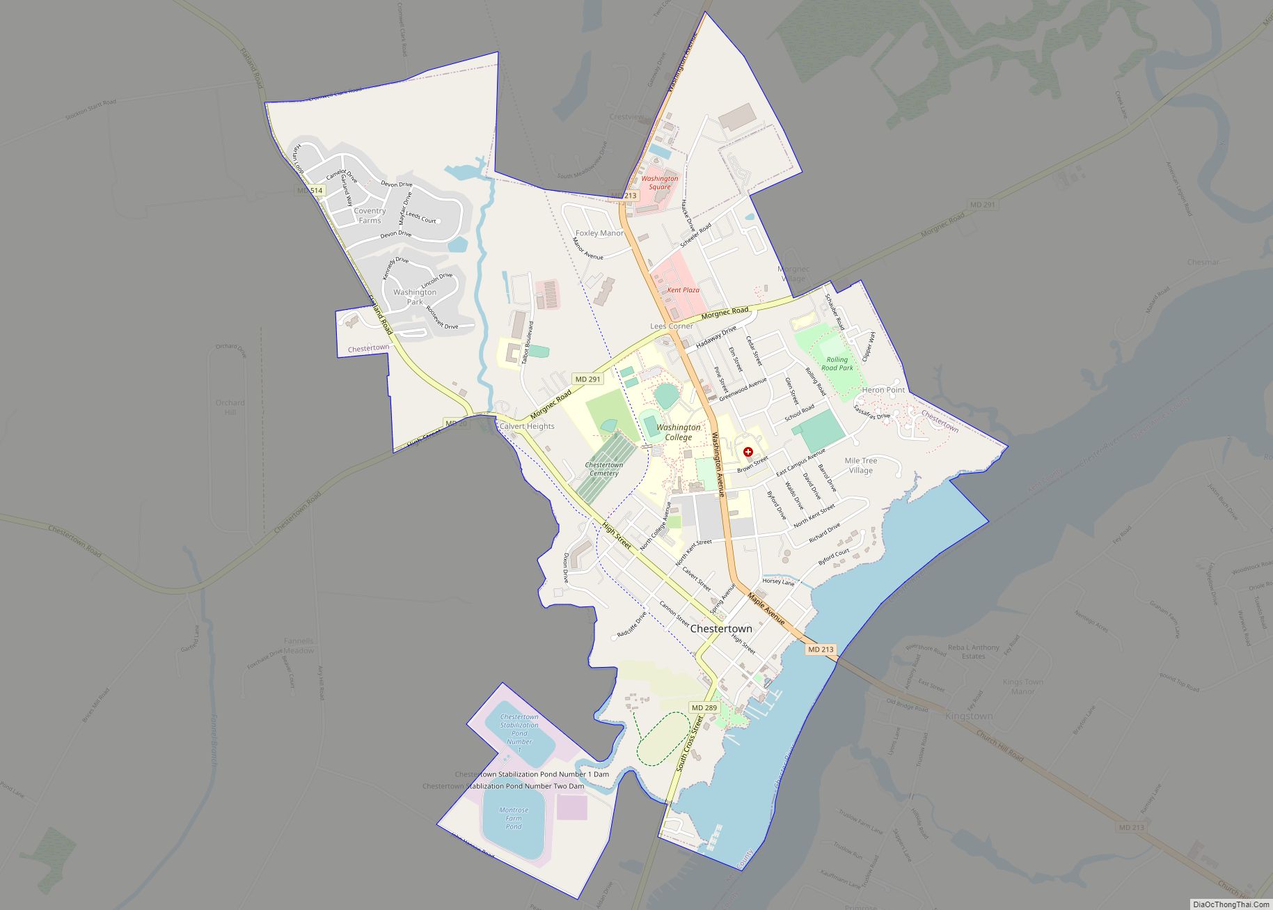
Chestertown is a town in Kent County, Maryland. The population was 5,252 as of the 2010 census. It is the county seat of Kent County.
| Name: | Chestertown town |
|---|---|
| LSAD Code: | 43 |
| LSAD Description: | town (suffix) |
| State: | Maryland |
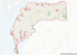
| County: | Kent County |
| Incorporated: | 1805 |
| Elevation: | 20 ft (6 m) |
| Total Area: | 3.29 sq mi (8.51 km²) |
| Land Area: | 2.92 sq mi (7.56 km²) |
| Water Area: | 0.37 sq mi (0.95 km²) |
| Total Population: | 5,532 |
| Population Density: | 1,895.82/sq mi (731.98/km²) |
| ZIP code: | 21620, 21690 |
| Area code: | 410 and 443 |
| FIPS code: | 2416225 |
| GNISfeature ID: | 0589954 |
Online Interactive Map
Click on ![]() to view map in "full screen" mode.
to view map in "full screen" mode.
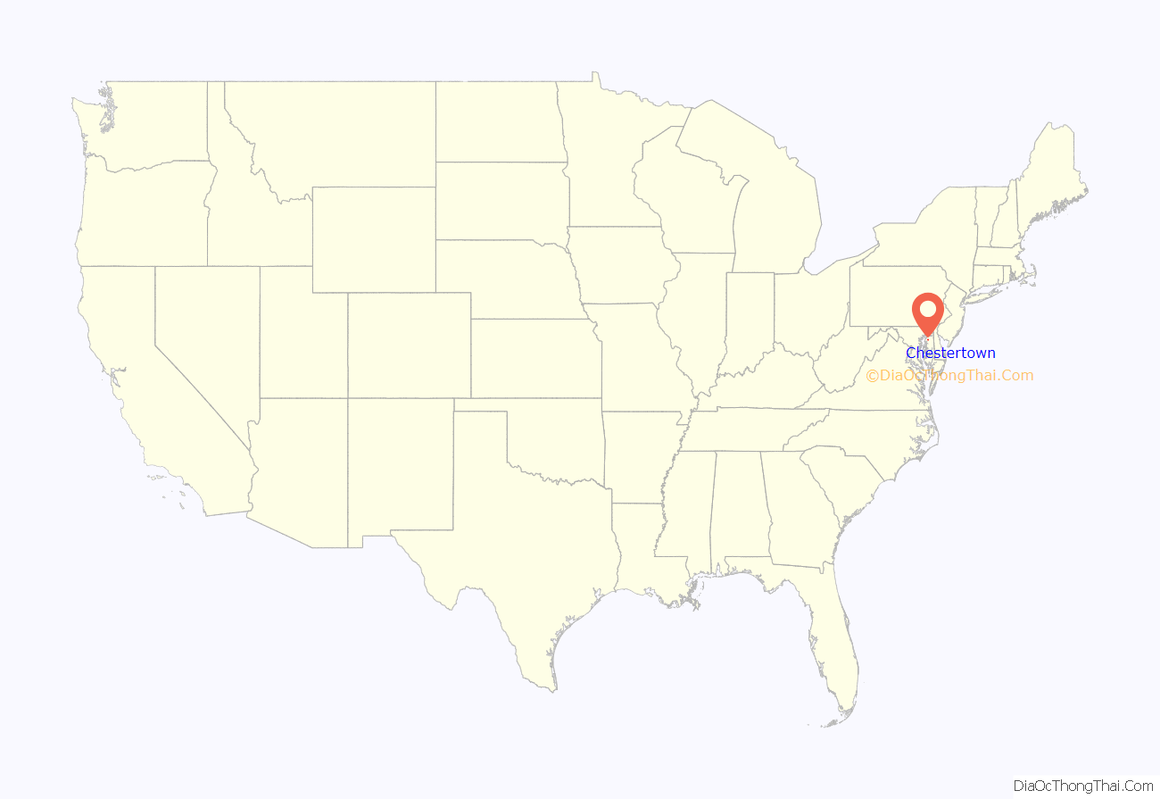
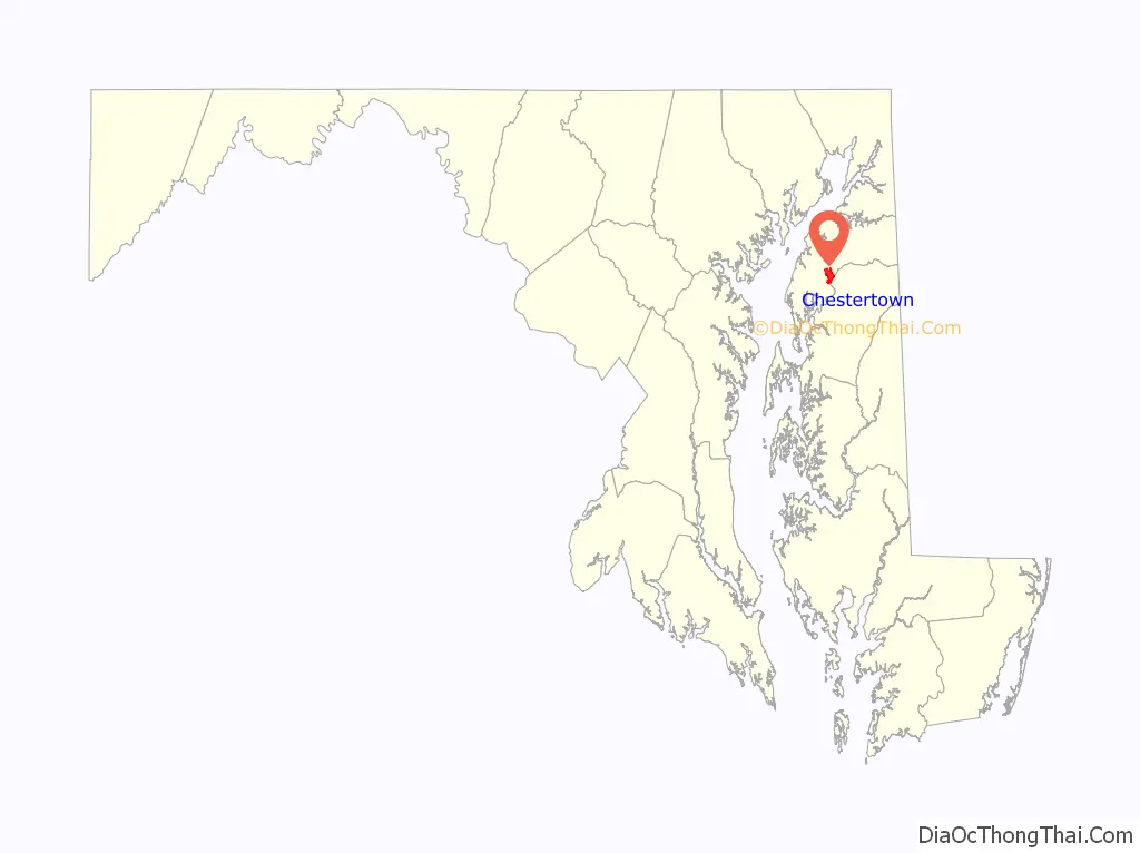
Chestertown location map. Where is Chestertown town?
History
Founded in 1706, Chestertown rose in stature when it was named one of the English colony of Maryland’s six Royal Ports of Entry. The shipping boom that followed this designation made the town at the navigable head of the Chester River wealthy. In the mid-eighteenth century, Chestertown trailed only Annapolis and was considered Maryland’s second leading port.
A burgeoning merchant class infused riches into the town, reflected in the many brick mansions and townhouses that sprang up along the waterfront. Another area in which Chestertown is second only to Annapolis is in its number of existing eighteenth century homes.
As of the 1790 census, Chestertown was the geographical center of population of the United States.
Chestertown was incorporated in 1805, and was named for the Chester River.
Airy Hill, the Bernice J., Brampton, Carvill Hall, Chester Hall, the Chestertown Armory, the Chestertown Historic District, Chestertown Railroad Station, Denton House, Gobbler Hill, Godlington Manor, the Island Image, Lauretum, Radcliffe Mill, Reward-Tilden’s Farm, Rose Hill, the Silver Heel, the Charles Sumner Post No. 25, Grand Army of the Republic, Thornton, Washington College: Middle, East and West Halls, and White House Farm (Chestertown, Maryland) are listed on the National Register of Historic Places.
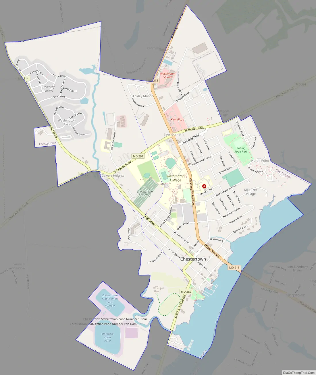
Chestertown Road Map
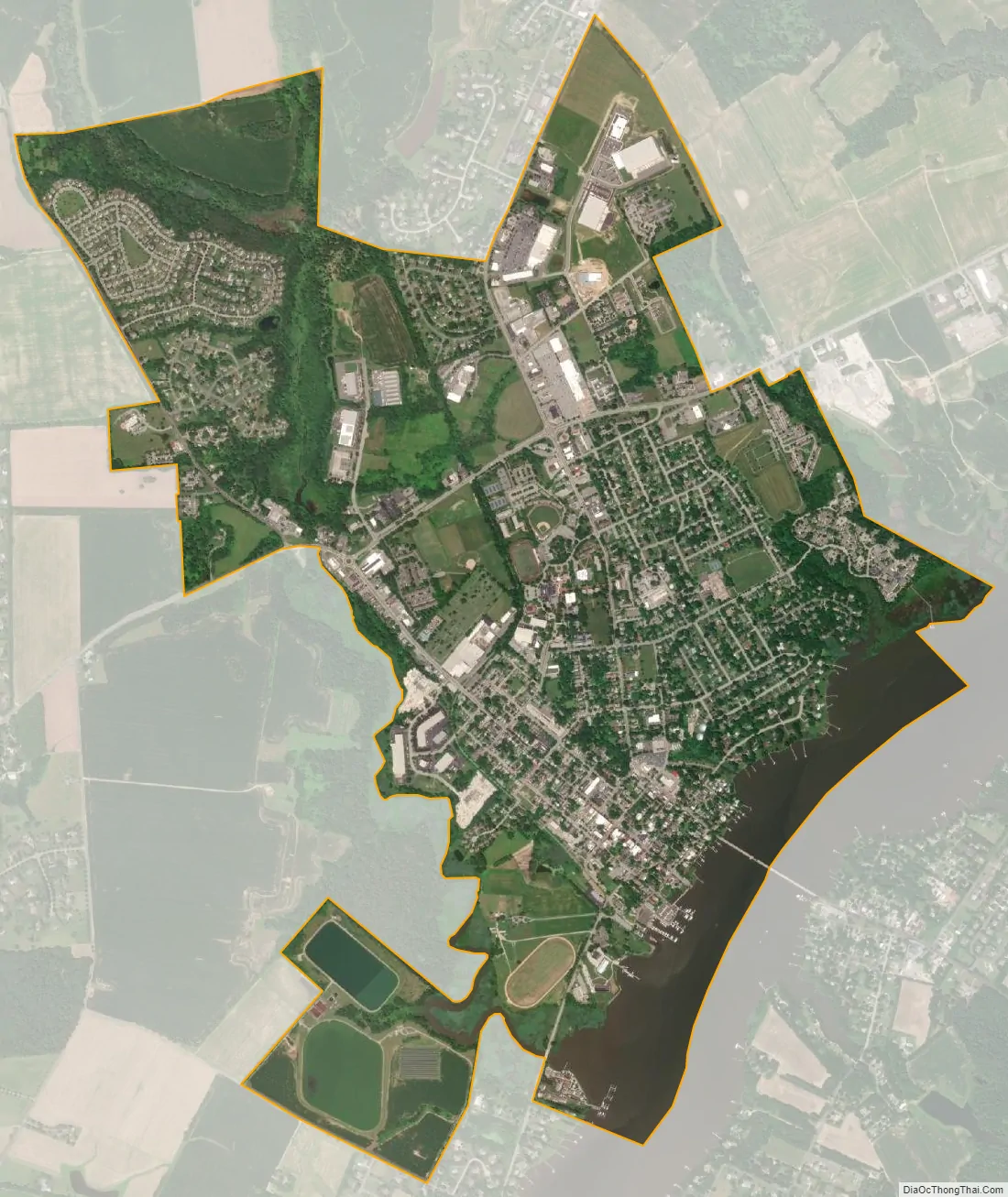
Chestertown city Satellite Map
Geography
Chestertown is at 39°13′10″N 76°4′6″W / 39.21944°N 76.06833°W / 39.21944; -76.06833 (39.219328, -76.068424).
According to the U.S. Census Bureau, the town has a total area of 2.91 square miles (7.54 km), of which 2.60 square miles (6.73 km) is land and 0.31 square miles (0.80 km) is water. As of the first US Census in 1790, Chestertown was the geographical center of the nation’s population.
Climate
The climate in this area is characterized by hot, humid summers and cool, wet winters. According to the Köppen Climate Classification system, Chestertown has a humid subtropical climate, abbreviated “Cfa” on climate maps.
See also
Map of Maryland State and its subdivision: Map of other states:- Alabama
- Alaska
- Arizona
- Arkansas
- California
- Colorado
- Connecticut
- Delaware
- District of Columbia
- Florida
- Georgia
- Hawaii
- Idaho
- Illinois
- Indiana
- Iowa
- Kansas
- Kentucky
- Louisiana
- Maine
- Maryland
- Massachusetts
- Michigan
- Minnesota
- Mississippi
- Missouri
- Montana
- Nebraska
- Nevada
- New Hampshire
- New Jersey
- New Mexico
- New York
- North Carolina
- North Dakota
- Ohio
- Oklahoma
- Oregon
- Pennsylvania
- Rhode Island
- South Carolina
- South Dakota
- Tennessee
- Texas
- Utah
- Vermont
- Virginia
- Washington
- West Virginia
- Wisconsin
- Wyoming