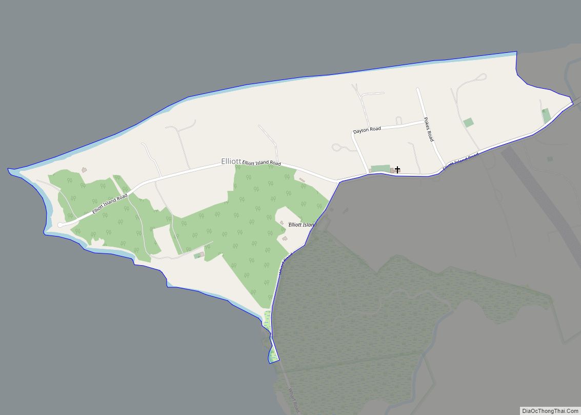
Elliott is an unincorporated community and census-designated place (CDP) in Dorchester County, Maryland, United States. The population was 52 at the 2010 census.
| Name: | Elliott CDP |
|---|---|
| LSAD Code: | 57 |
| LSAD Description: | CDP (suffix) |
| State: | Maryland |
| County: | Dorchester County |
| Elevation: | 4 ft (1 m) |
| Total Area: | 0.35 sq mi (0.92 km²) |
| Land Area: | 0.35 sq mi (0.91 km²) |
| Water Area: | 0.00 sq mi (0.01 km²) |
| Total Population: | 43 |
| Population Density: | 122.51/sq mi (47.31/km²) |
| ZIP code: | 21869 |
| Area code: | 410, 443, and 667 |
| FIPS code: | 2426025 |
| GNISfeature ID: | 590196 |
Online Interactive Map
Click on ![]() to view map in "full screen" mode.
to view map in "full screen" mode.
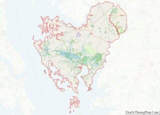
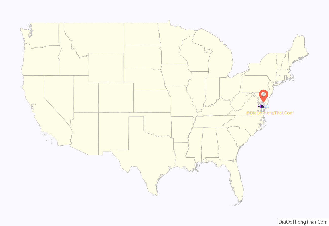
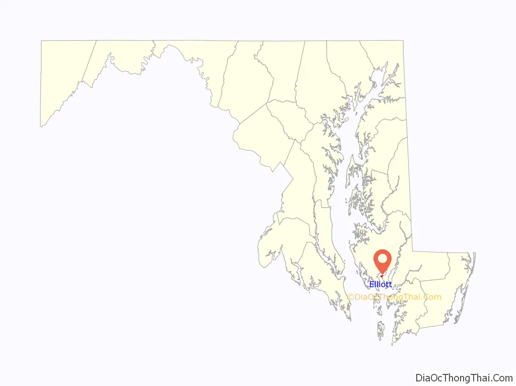
Elliott location map. Where is Elliott CDP?
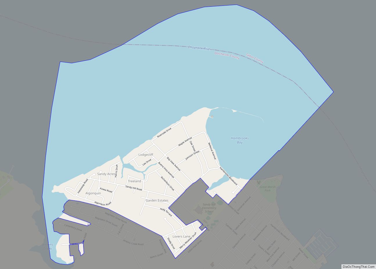
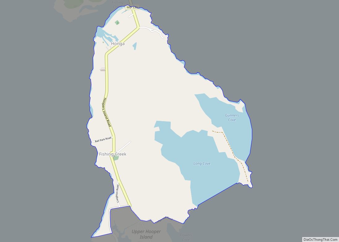
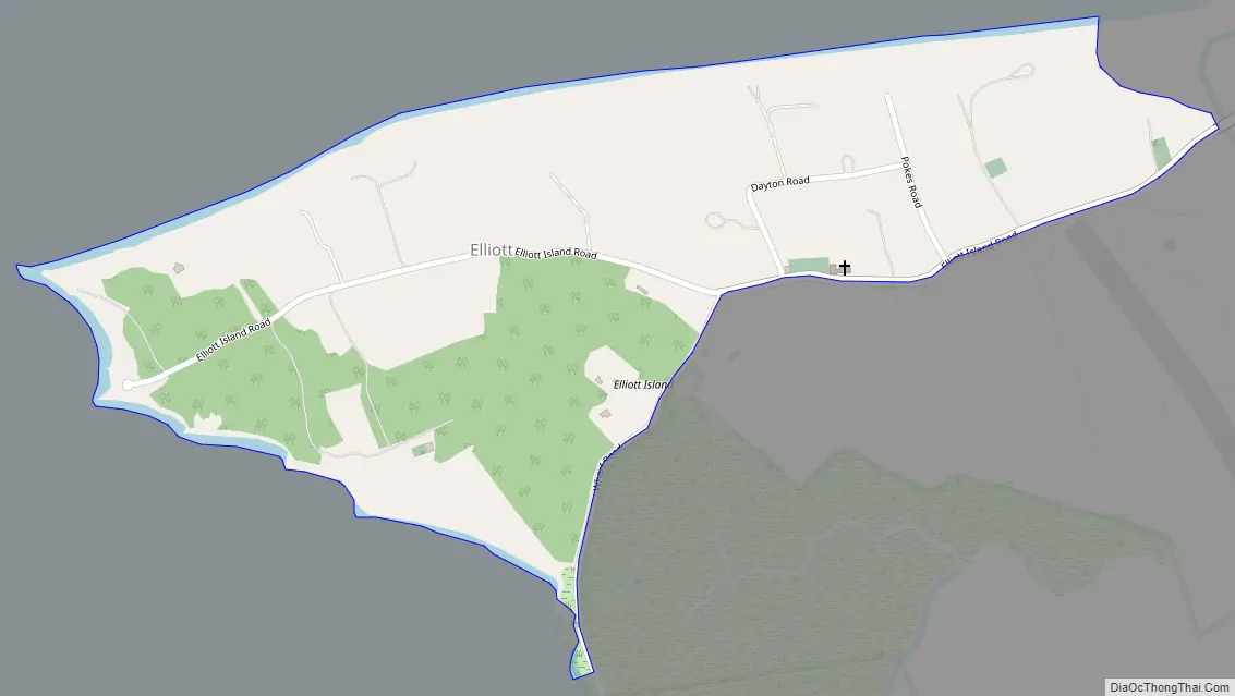
Elliott Road Map
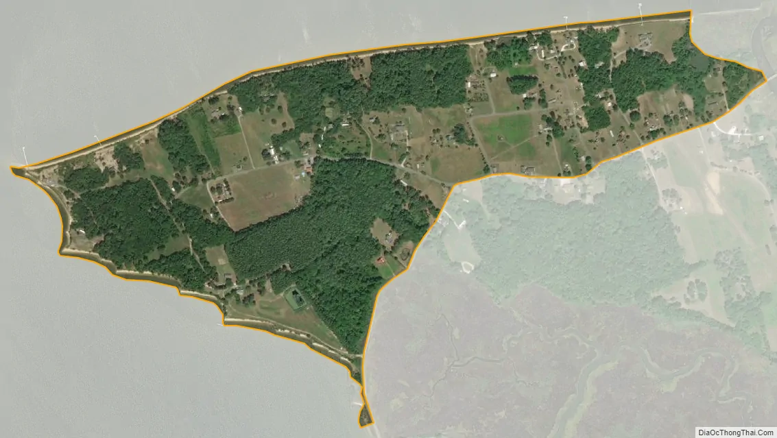
Elliott city Satellite Map
Geography
Elliott is located in southern Dorchester County on Elliott Island, on the east side of Fishing Bay. Elliott Island Road is the only road access to the town, leading 19 miles (31 km) northeast to U.S. Route 50 at Vienna.
According to the United States Census Bureau, the Elliott CDP has a total area of 0.36 square miles (0.92 km), of which 73,250 square feet (6,805 m), or 0.74%, is water.
See also
Map of Maryland State and its subdivision: Map of other states:- Alabama
- Alaska
- Arizona
- Arkansas
- California
- Colorado
- Connecticut
- Delaware
- District of Columbia
- Florida
- Georgia
- Hawaii
- Idaho
- Illinois
- Indiana
- Iowa
- Kansas
- Kentucky
- Louisiana
- Maine
- Maryland
- Massachusetts
- Michigan
- Minnesota
- Mississippi
- Missouri
- Montana
- Nebraska
- Nevada
- New Hampshire
- New Jersey
- New Mexico
- New York
- North Carolina
- North Dakota
- Ohio
- Oklahoma
- Oregon
- Pennsylvania
- Rhode Island
- South Carolina
- South Dakota
- Tennessee
- Texas
- Utah
- Vermont
- Virginia
- Washington
- West Virginia
- Wisconsin
- Wyoming