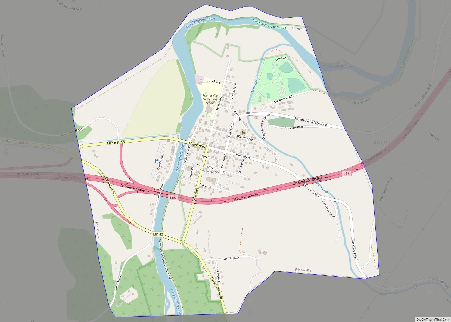
Friendsville is a town in Garrett County, Maryland, United States. The population was 491 at the 2010 census.
| Name: | Friendsville town |
|---|---|
| LSAD Code: | 43 |
| LSAD Description: | town (suffix) |
| State: | Maryland |
| County: | Garrett County |
| Incorporated: | 1902 |
| Elevation: | 1,499 ft (457 m) |
| Total Area: | 1.00 sq mi (2.59 km²) |
| Land Area: | 1.00 sq mi (2.59 km²) |
| Water Area: | 0.00 sq mi (0.00 km²) |
| Total Population: | 438 |
| Population Density: | 438.00/sq mi (169.18/km²) |
| ZIP code: | 21531 |
| FIPS code: | 2430850 |
| GNISfeature ID: | 0584517 |
| Website: | www.friendsville.org |
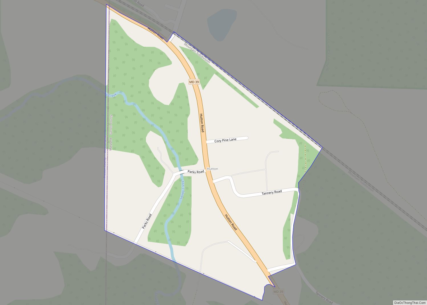
Online Interactive Map
Click on ![]() to view map in "full screen" mode.
to view map in "full screen" mode.
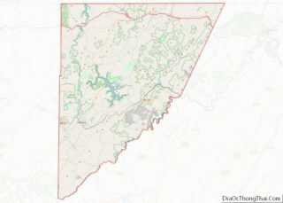
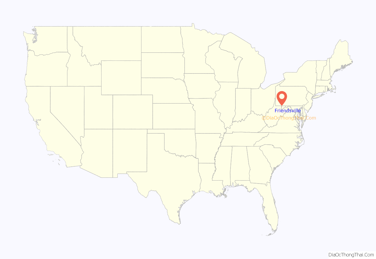
Friendsville location map. Where is Friendsville town?
History
Friendsville is named after its first European settler, John Friend, who came to what is now Garrett County before the American Revolution. Many of Friend’s descendants live in Garrett County today, and the headquarters and library of the Friend Family Association are in Friendsville because of this connection.
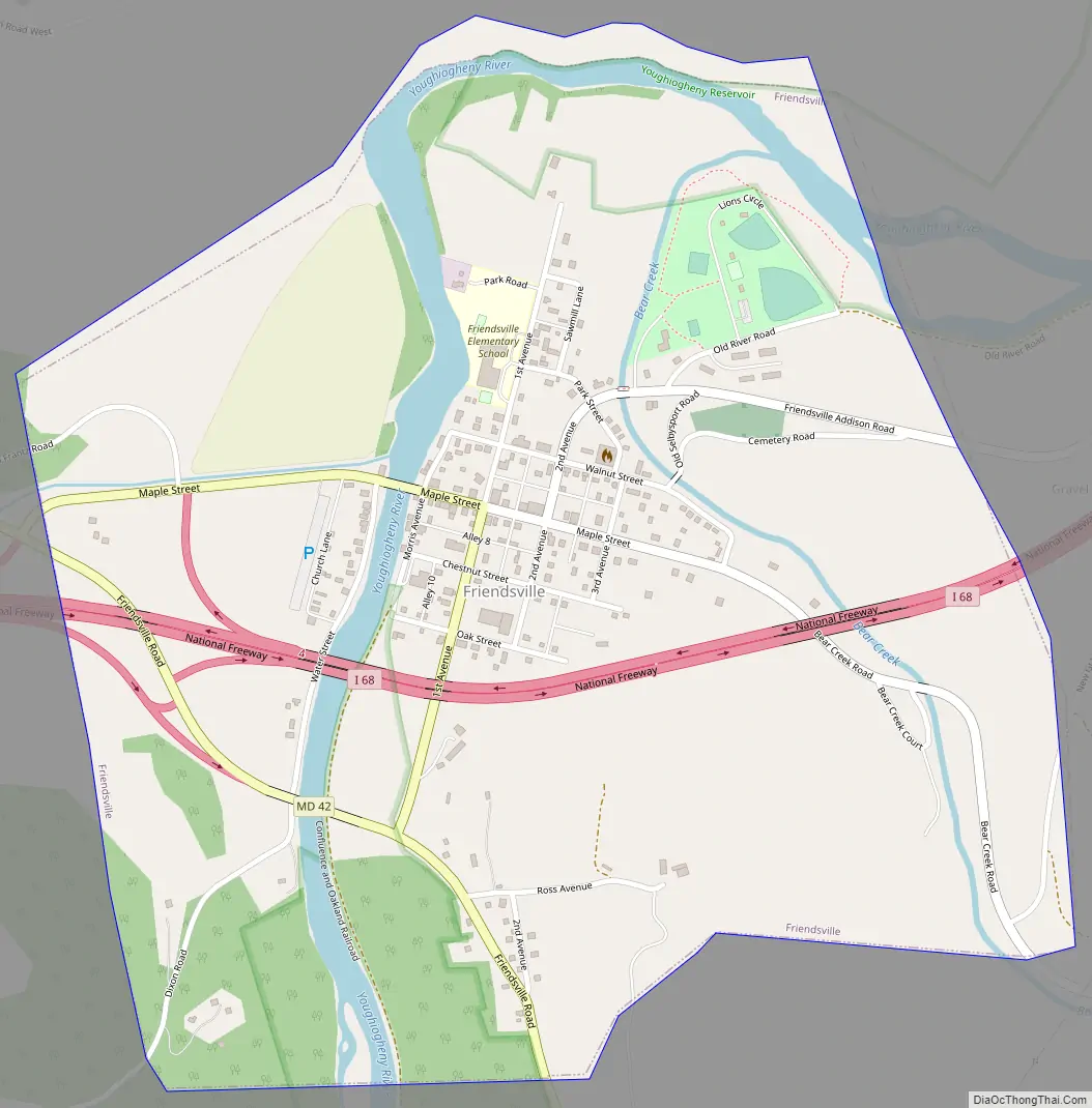
Friendsville Road Map
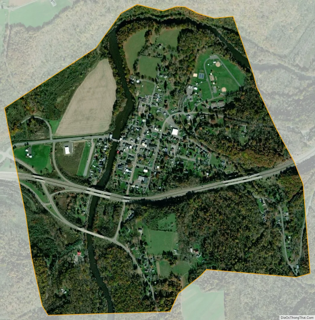
Friendsville city Satellite Map
Geography
Friendsville is located at 39°39′44″N 79°24′19″W / 39.66222°N 79.40528°W / 39.66222; -79.40528 (39.662127, -79.405251).
According to the United States Census Bureau, the town has a total area of 0.91 square miles (2.36 km), all land. The Youghiogheny River flows through the town and is renowned by the whitewater kayaking/rafting community as the take-out for the famous Upper Yough run.
See also
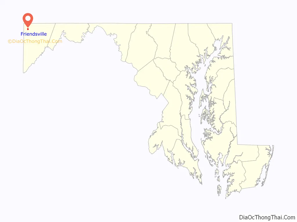
Map of Maryland State and its subdivision: Map of other states:- Alabama
- Alaska
- Arizona
- Arkansas
- California
- Colorado
- Connecticut
- Delaware
- District of Columbia
- Florida
- Georgia
- Hawaii
- Idaho
- Illinois
- Indiana
- Iowa
- Kansas
- Kentucky
- Louisiana
- Maine
- Maryland
- Massachusetts
- Michigan
- Minnesota
- Mississippi
- Missouri
- Montana
- Nebraska
- Nevada
- New Hampshire
- New Jersey
- New Mexico
- New York
- North Carolina
- North Dakota
- Ohio
- Oklahoma
- Oregon
- Pennsylvania
- Rhode Island
- South Carolina
- South Dakota
- Tennessee
- Texas
- Utah
- Vermont
- Virginia
- Washington
- West Virginia
- Wisconsin
- Wyoming