Funkstown is a town in Washington County, Maryland, United States. The population was 904 at the 2010 census.
| Name: | Funkstown town |
|---|---|
| LSAD Code: | 43 |
| LSAD Description: | town (suffix) |
| State: | Maryland |
| County: | Washington County |
| Incorporated: | 1840 |
| Elevation: | 495 ft (151 m) |
| Total Area: | 0.55 sq mi (1.43 km²) |
| Land Area: | 0.55 sq mi (1.43 km²) |
| Water Area: | 0.00 sq mi (0.00 km²) |
| Total Population: | 852 |
| Population Density: | 1,546.28/sq mi (597.12/km²) |
| ZIP code: | 21734 |
| Area code: | 301, 240 |
| FIPS code: | 2431100 |
| GNISfeature ID: | 0590264 |
| Website: | www.funkstown.com |
Online Interactive Map
Click on ![]() to view map in "full screen" mode.
to view map in "full screen" mode.
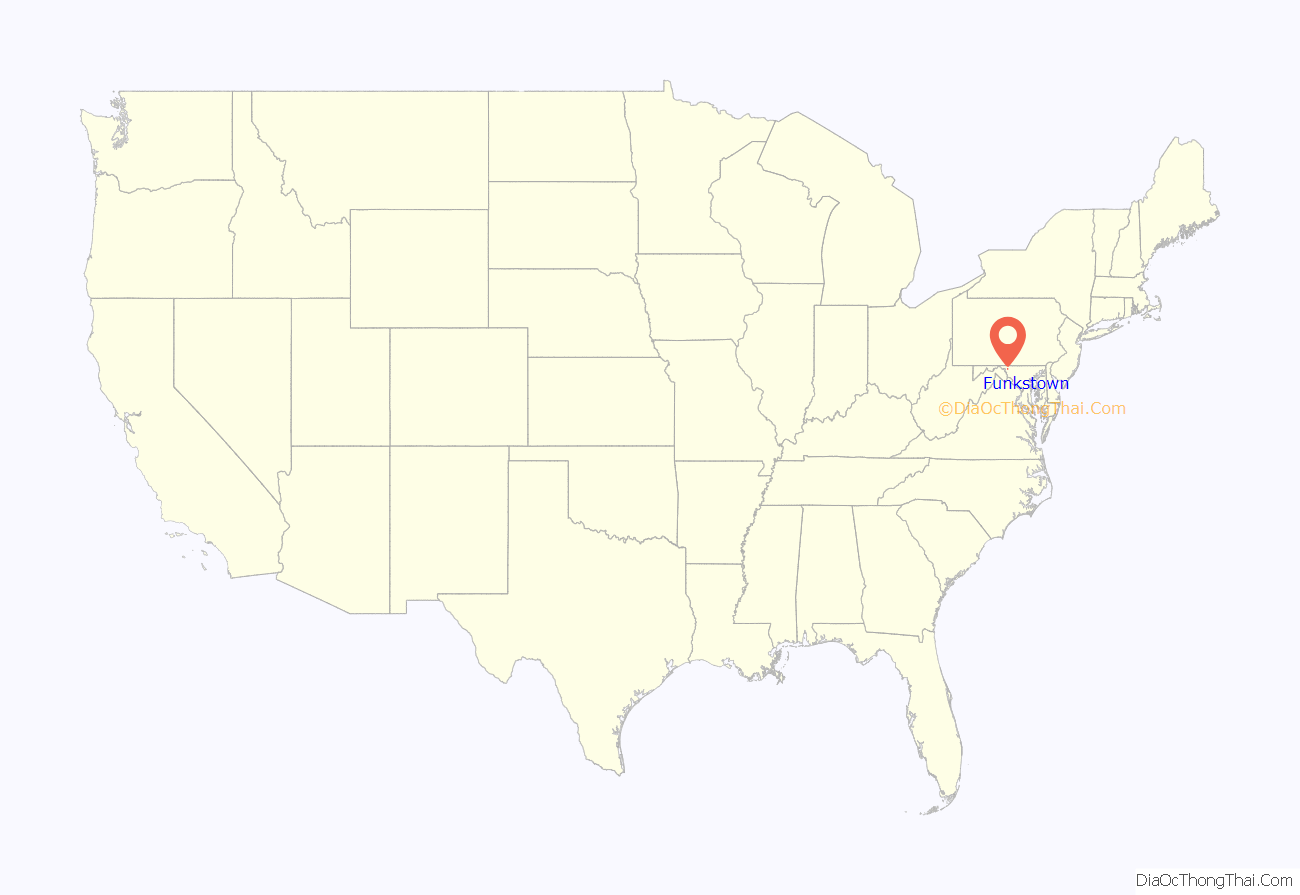
Funkstown location map. Where is Funkstown town?

History
Originally 88 acres (360,000 m) were sold to Henry Funk by Frederick Calvert, 6th Baron Baltimore in 1754 and settled as Jerusalem.
The Civil War Battle of Funkstown took place July 10, 1863, during the Gettysburg Campaign as Robert E. Lee’s Army of Northern Virginia retreated toward Virginia in the week following the Battle of Gettysburg. Union forces of the Army of the Potomac attacked the rear guard of the Confederate Army of Northern Virginia during its retreat from Pennsylvania following the Battle of Gettysburg.
A strong Confederate presence at Funkstown threatened any Union advance against Gen. Robert E. Lee’s position near Williamsport and the Potomac River as he retreated to Virginia after the Battle of Gettysburg. Maj. Gen. J.E.B. Stuart’s cavalry, posted at Funkstown, posed a serious risk to the Federal right and rear if the Union army lunged west from Boonsboro. Stuart, meanwhile, determined to wage a spirited defense to ensure Lee time to complete fortifications protecting his army and his avenue of retreat.
As Brig. Gen. John Buford’s Federal cavalry division cautiously approached Funkstown via the National Road on Friday morning July 10, 1863, it encountered Stuart’s crescent-shaped, three-mile-long battle line. It was Stuart’s first defensive battle since reentering Maryland. The high ground constituted Stuart’s extreme right, held by Preston Chew’s horse artillery. A nearby stone barn and barnyard wall proved a superb defensive position for the 34th Virginia Battalion’s dismounted cavalry. Col. Thomas C. Devin’s dismounted Union cavalry brigade attacked about 8:00 a.m. By mid-afternoon, with Buford’s cavalrymen running low on ammunition and gaining little ground, Col. Lewis A. Grant’s First Vermont Brigade of infantry arrived and jabbed at the Confederate center less than one mile away. Unbeknownst to the Vermonters, Gen. George T. Anderson’s Confederate brigade now faced them, the first time opposing infantry had clashed since the Battle of Gettysburg.
By early evening, the Union Army began withdrawing south towards Beaver Creek. Stuart had kept the Federals at bay for yet another day. The day-long battle east of the road resulted in 479 casualties. The Chaney house served as a hospital. At the Keller home, Confederate Major Henry D. McDaniel, later the governor of Georgia, survived his wounds.
The house at 16 W. Cemetery St. remained a church until it burned down a second time, finally being rebuilt into the existing house in 1913.
The Funkstown Historic District was listed on the National Register of Historic Places in 2000.
As of 2017 the town park is listed as 77.04 acres and the town area, less the park, is 208.77 acres for a grand total of 285.81 acres.
Funkstown Road Map
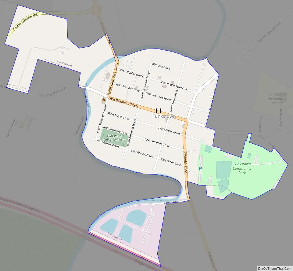
Funkstown city Satellite Map

Geography
Funkstown is located at 39°36′33″N 77°42′27″W / 39.60917°N 77.70750°W / 39.60917; -77.70750 (39.609096, -77.707527), on Antietam Creek, south of Hagerstown.
According to the United States Census Bureau, the town has a total area of 0.36 square miles (0.93 km), all land. Antietam Creek flows to the south within the city limits.
Climate
The climate in this area is characterized by hot, humid summers and generally mild to cool winters. According to the Köppen Climate Classification system, Funkstown has a humid subtropical climate, abbreviated “Cfa” on climate maps.
See also
Map of Maryland State and its subdivision: Map of other states:- Alabama
- Alaska
- Arizona
- Arkansas
- California
- Colorado
- Connecticut
- Delaware
- District of Columbia
- Florida
- Georgia
- Hawaii
- Idaho
- Illinois
- Indiana
- Iowa
- Kansas
- Kentucky
- Louisiana
- Maine
- Maryland
- Massachusetts
- Michigan
- Minnesota
- Mississippi
- Missouri
- Montana
- Nebraska
- Nevada
- New Hampshire
- New Jersey
- New Mexico
- New York
- North Carolina
- North Dakota
- Ohio
- Oklahoma
- Oregon
- Pennsylvania
- Rhode Island
- South Carolina
- South Dakota
- Tennessee
- Texas
- Utah
- Vermont
- Virginia
- Washington
- West Virginia
- Wisconsin
- Wyoming


