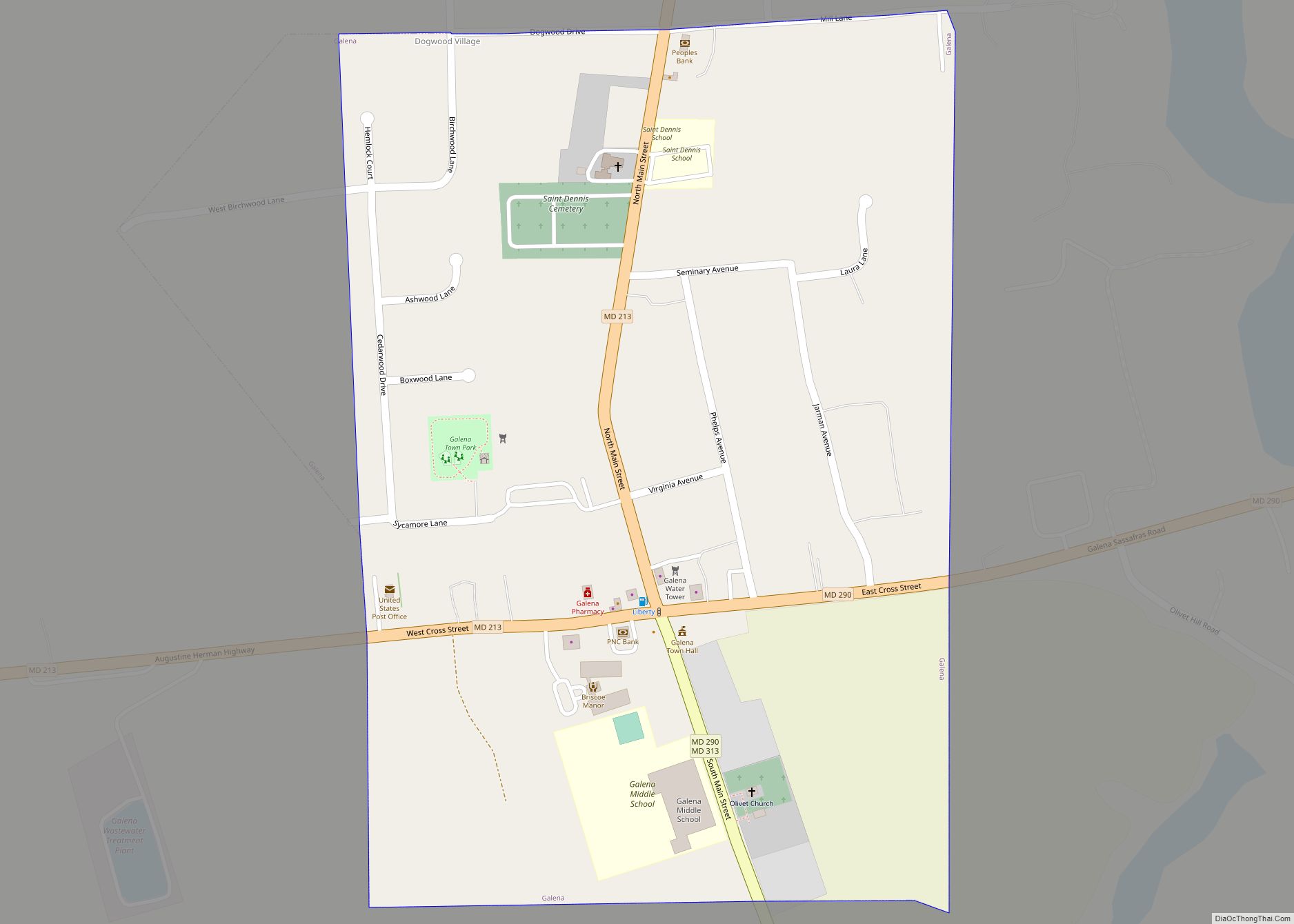
Galena is a town in Kent County, Maryland, United States. The population was 612 at the 2010 census.
| Name: | Galena town |
|---|---|
| LSAD Code: | 43 |
| LSAD Description: | town (suffix) |
| State: | Maryland |
| County: | Kent County |
| Incorporated: | 1858 |
| Elevation: | 69 ft (21 m) |
| Total Area: | 0.36 sq mi (0.93 km²) |
| Land Area: | 0.36 sq mi (0.93 km²) |
| Water Area: | 0.00 sq mi (0.00 km²) |
| Total Population: | 539 |
| Population Density: | 1,493.07/sq mi (577.04/km²) |
| ZIP code: | 21635 |
| Area code: | 410 |
| FIPS code: | 2431225 |
| GNISfeature ID: | 0590270 |
| Website: | www.townofgalena.com |
Online Interactive Map
Click on ![]() to view map in "full screen" mode.
to view map in "full screen" mode.
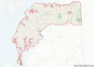
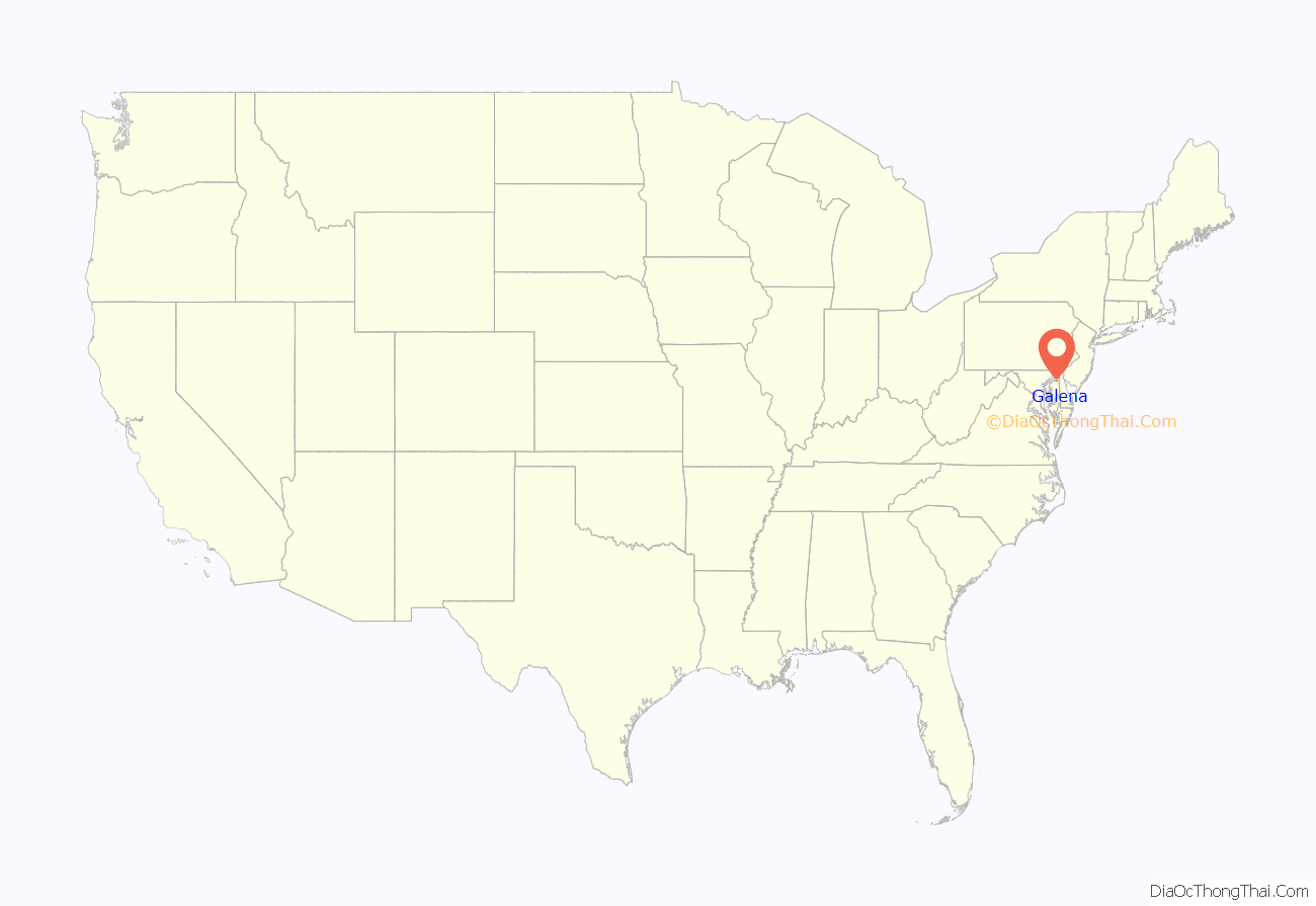
Galena location map. Where is Galena town?
History
Galena was founded in 1763 under the name Down’s Cross Roads, after William Downs, a local tavern owner. The name was later changed to Georgetown Cross Roads sometime before 1813, and finally to Galena in 1858. The name comes from a supposed silver mine in the vicinity of the town, which extracted the metal from the lead ore known as galena. There is, however, no geological evidence for galena deposits on Maryland’s Eastern Shore, and the story is likely apocryphal.
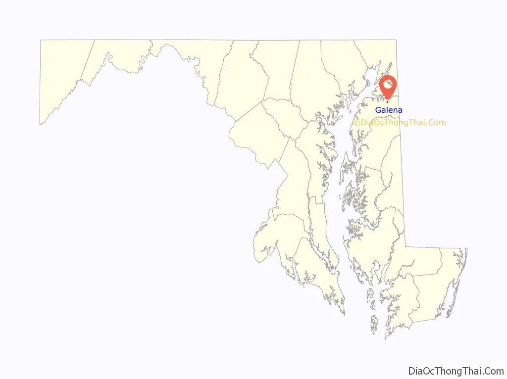
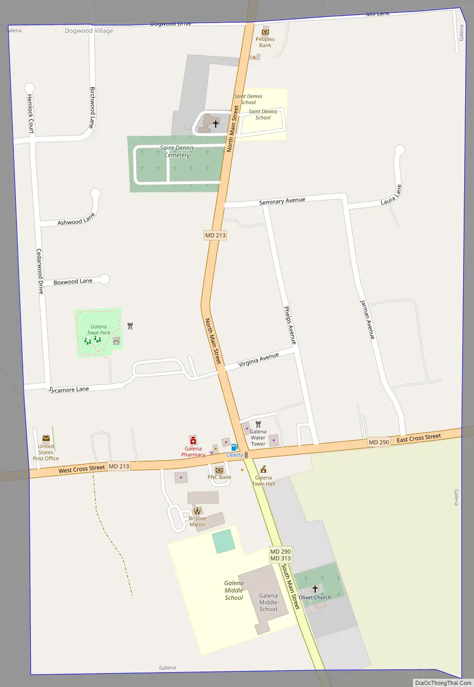
Galena Road Map
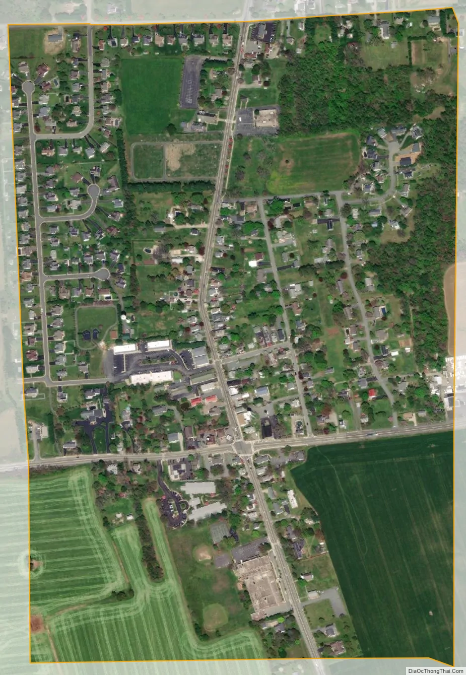
Galena city Satellite Map
Geography
Galena is located at 39°20′30″N 75°52′42″W / 39.34167°N 75.87833°W / 39.34167; -75.87833 (39.341680, -75.878444).
According to the United States Census Bureau, the town has a total area of 0.36 square miles (0.93 km), all land.
See also
Map of Maryland State and its subdivision: Map of other states:- Alabama
- Alaska
- Arizona
- Arkansas
- California
- Colorado
- Connecticut
- Delaware
- District of Columbia
- Florida
- Georgia
- Hawaii
- Idaho
- Illinois
- Indiana
- Iowa
- Kansas
- Kentucky
- Louisiana
- Maine
- Maryland
- Massachusetts
- Michigan
- Minnesota
- Mississippi
- Missouri
- Montana
- Nebraska
- Nevada
- New Hampshire
- New Jersey
- New Mexico
- New York
- North Carolina
- North Dakota
- Ohio
- Oklahoma
- Oregon
- Pennsylvania
- Rhode Island
- South Carolina
- South Dakota
- Tennessee
- Texas
- Utah
- Vermont
- Virginia
- Washington
- West Virginia
- Wisconsin
- Wyoming