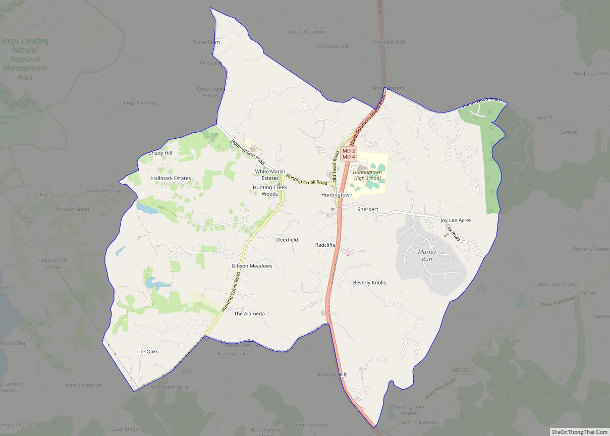
Huntingtown, established 1683, is a census-designated place (CDP) in Calvert County, Maryland, United States. The population was 3,311 at the 2010 census, up from 2,436 in 2000. Many large estate homes have recently been built in small developments off routes 2/4. It has a public high school called Huntingtown High. The Calverton School is located just south of the town center. State-operated commuter buses and private vanpools carry residents to Washington.
| Name: | Huntingtown CDP |
|---|---|
| LSAD Code: | 57 |
| LSAD Description: | CDP (suffix) |
| State: | Maryland |
| County: | Calvert County |
| Elevation: | 174 ft (53 m) |
| Total Area: | 8.10 sq mi (20.97 km²) |
| Land Area: | 8.07 sq mi (20.90 km²) |
| Water Area: | 0.03 sq mi (0.06 km²) |
| Total Population: | 3,545 |
| Population Density: | 439.23/sq mi (169.58/km²) |
| ZIP code: | 20639 |
| Area code: | 410 |
| FIPS code: | 2441025 |
| GNISfeature ID: | 1852593 |
Online Interactive Map
Click on ![]() to view map in "full screen" mode.
to view map in "full screen" mode.
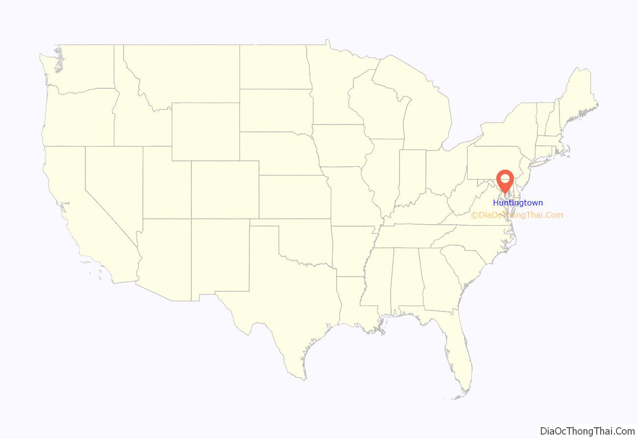
Huntingtown location map. Where is Huntingtown CDP?

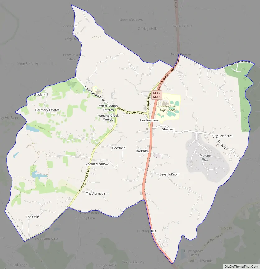
Huntingtown Road Map
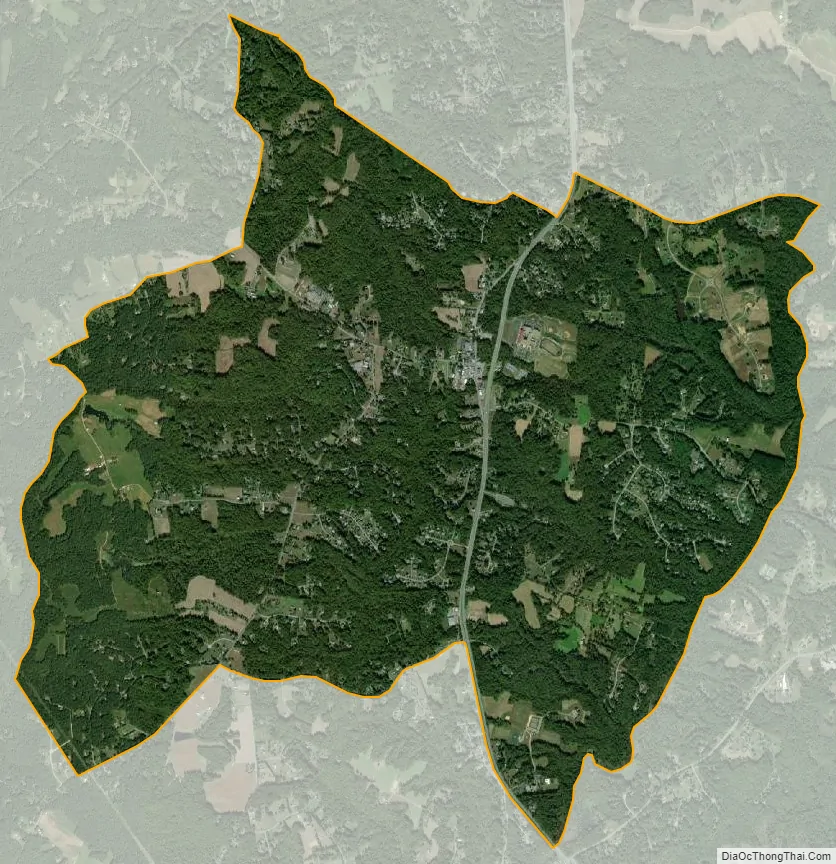
Huntingtown city Satellite Map
See also
Map of Maryland State and its subdivision: Map of other states:- Alabama
- Alaska
- Arizona
- Arkansas
- California
- Colorado
- Connecticut
- Delaware
- District of Columbia
- Florida
- Georgia
- Hawaii
- Idaho
- Illinois
- Indiana
- Iowa
- Kansas
- Kentucky
- Louisiana
- Maine
- Maryland
- Massachusetts
- Michigan
- Minnesota
- Mississippi
- Missouri
- Montana
- Nebraska
- Nevada
- New Hampshire
- New Jersey
- New Mexico
- New York
- North Carolina
- North Dakota
- Ohio
- Oklahoma
- Oregon
- Pennsylvania
- Rhode Island
- South Carolina
- South Dakota
- Tennessee
- Texas
- Utah
- Vermont
- Virginia
- Washington
- West Virginia
- Wisconsin
- Wyoming