Mays Chapel is an unincorporated community and census-designated place in Baltimore County, Maryland, United States. The population was 11,420 at the 2010 census.
| Name: | Mays Chapel CDP |
|---|---|
| LSAD Code: | 57 |
| LSAD Description: | CDP (suffix) |
| State: | Maryland |
| County: | Baltimore County |
| Elevation: | 459 ft (140 m) |
| Total Area: | 3.71 sq mi (9.62 km²) |
| Land Area: | 3.71 sq mi (9.61 km²) |
| Water Area: | 0.00 sq mi (0.01 km²) |
| Total Population: | 12,224 |
| Population Density: | 3,295.77/sq mi (1,272.36/km²) |
| ZIP code: | 21093 |
| Area code: | 410 and 443 and 667 |
| FIPS code: | 2451587 |
| GNISfeature ID: | 1867295 |
Online Interactive Map
Click on ![]() to view map in "full screen" mode.
to view map in "full screen" mode.
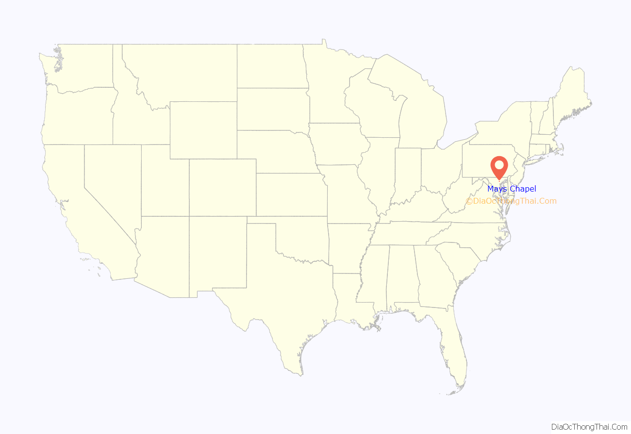
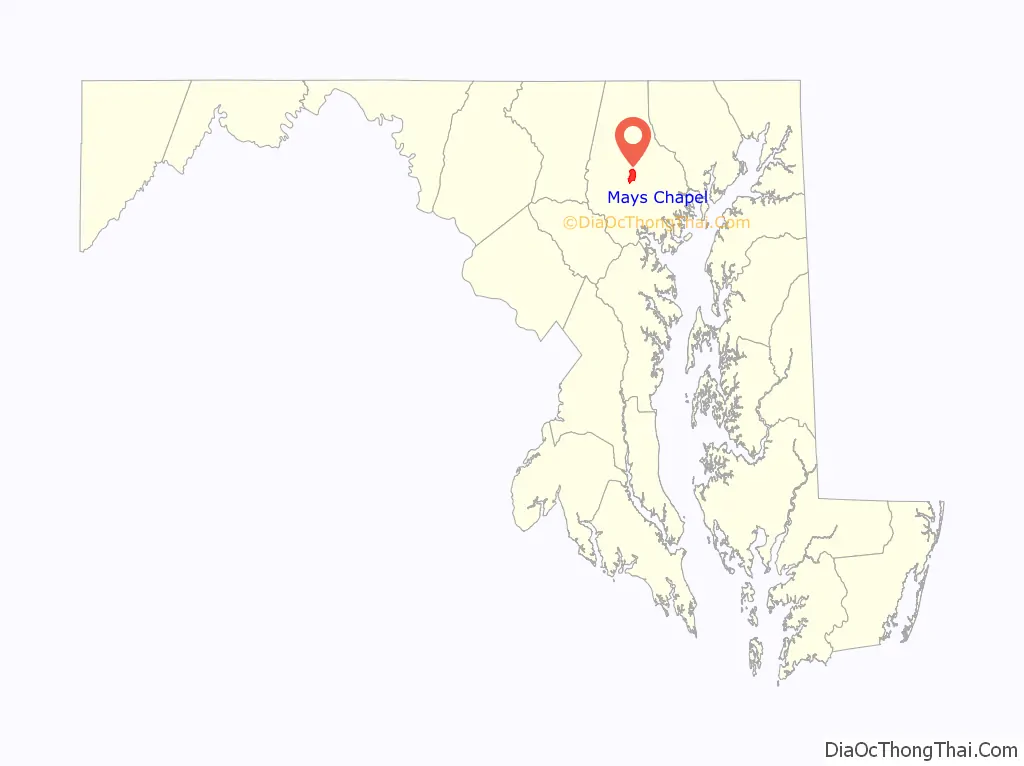
Mays Chapel location map. Where is Mays Chapel CDP?
History
Mays Chapel Village was developed in the 1970s. The property was originally a large farm known as Mayfair, whose 1812 stone house remains overlooking Greenpoint Road near its intersection with Avebury Road. The land originally belonged to Thomas Cockey Deye, and it was the home of Frederick Price and Penelope Deye Owings Price. Penelope Price was later remarried, taking the surname Goodwin. The 1850 Baltimore County Atlas confirms Mrs. Goodwin’s residency in the dwelling. Upon her death in 1875, the property passed to her heirs, first to Eliza Goodwin and then Charles E.R. Goodwin. In 1904, the property finally passed out of the family upon its conveyance to Fairfax S. Landstreet from then-owner Edward G. Cherbonnier. The original road leading from York Road was called Landstreet Road, and while this is now cut off by Interstate 83, the lot on which the 1812 house stands is still listed as being on Landstreet Road. The farmland was sold for development in the 1970s, and Mays Chapel Village was named for a nearby mid-19th century church.
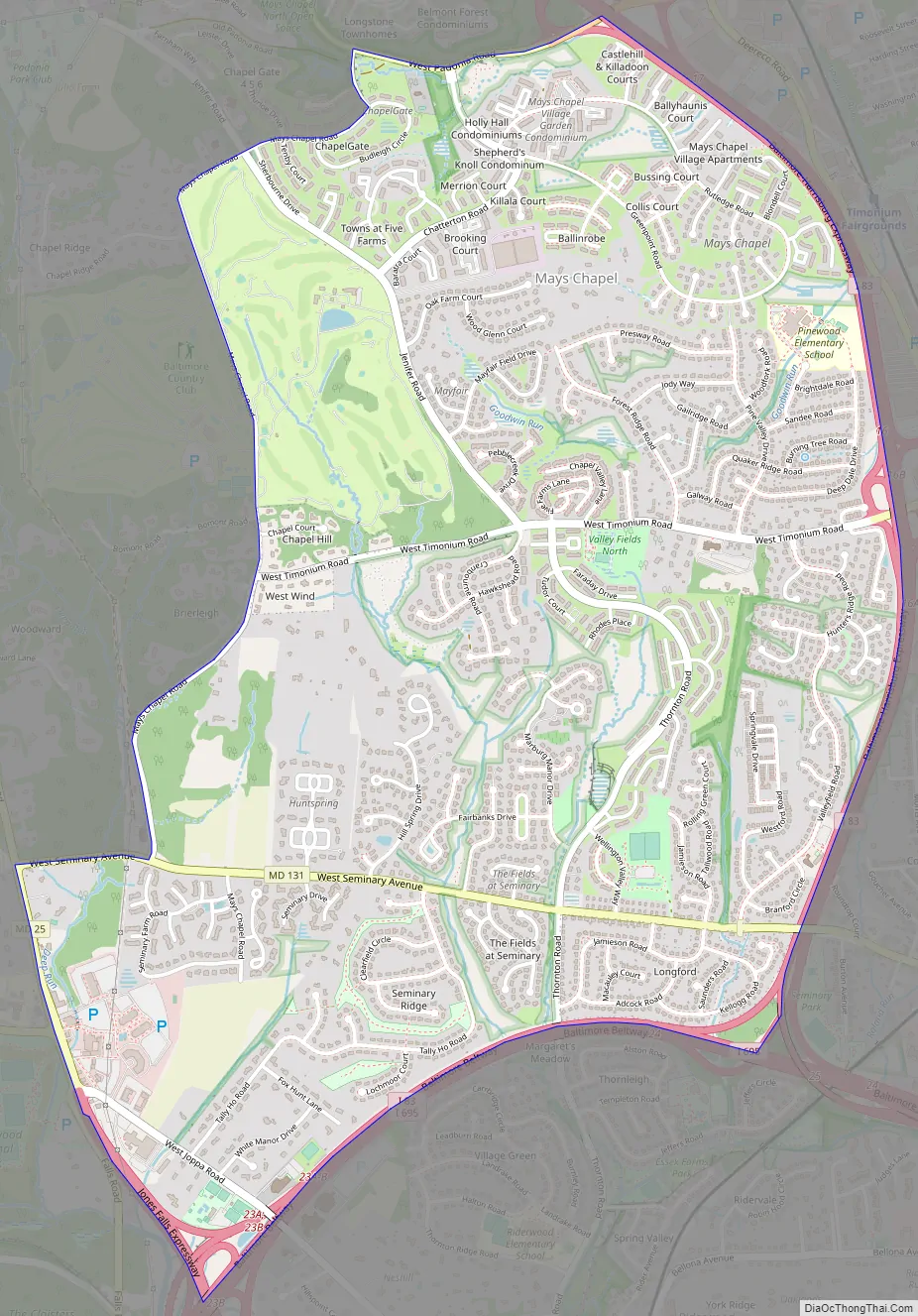
Mays Chapel Road Map
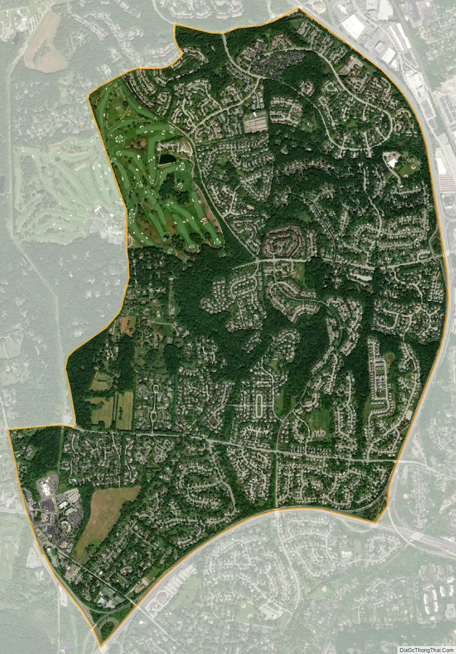
Mays Chapel city Satellite Map
Geography
Mays Chapel is located at 39°26′1″N 76°38′59″W / 39.43361°N 76.64972°W / 39.43361; -76.64972 (39.433708, −76.649694), to the west of Timonium across Interstate 83.
According to the United States Census Bureau, the CDP has a total area of 3.8 square miles (9.8 km), all land.
See also
Map of Maryland State and its subdivision: Map of other states:- Alabama
- Alaska
- Arizona
- Arkansas
- California
- Colorado
- Connecticut
- Delaware
- District of Columbia
- Florida
- Georgia
- Hawaii
- Idaho
- Illinois
- Indiana
- Iowa
- Kansas
- Kentucky
- Louisiana
- Maine
- Maryland
- Massachusetts
- Michigan
- Minnesota
- Mississippi
- Missouri
- Montana
- Nebraska
- Nevada
- New Hampshire
- New Jersey
- New Mexico
- New York
- North Carolina
- North Dakota
- Ohio
- Oklahoma
- Oregon
- Pennsylvania
- Rhode Island
- South Carolina
- South Dakota
- Tennessee
- Texas
- Utah
- Vermont
- Virginia
- Washington
- West Virginia
- Wisconsin
- Wyoming


