Middle River is an unincorporated community and census-designated place in Baltimore County, Maryland, United States. The population was 33,203 at the 2020 census. A Middle River Train Station first appeared on the 1877 G.M. Hopkins & Co Baltimore County Map and by 1898 had a designated Post Office and modest street grid. The town expanded during the 1930s and 1940s and established the “Aero Acres” housing community which borders the railroad tracks and Martin Blvd. to serve as housing for people working at the Martin Aerospace Company. For this development, the architecture firm of Skidmore, Owings & Merrill designed gable-roofed Cape Cod houses with dimensions of 24 feet (7.3 m) by 28 feet (8.5 m), featuring large commercial-style windows in their principal rooms. In 1941 a total of 600 homes were built at Aero Acres using this design from Cemento (a cement/asbestos material).[2]
| Name: | Middle River CDP |
|---|---|
| LSAD Code: | 57 |
| LSAD Description: | CDP (suffix) |
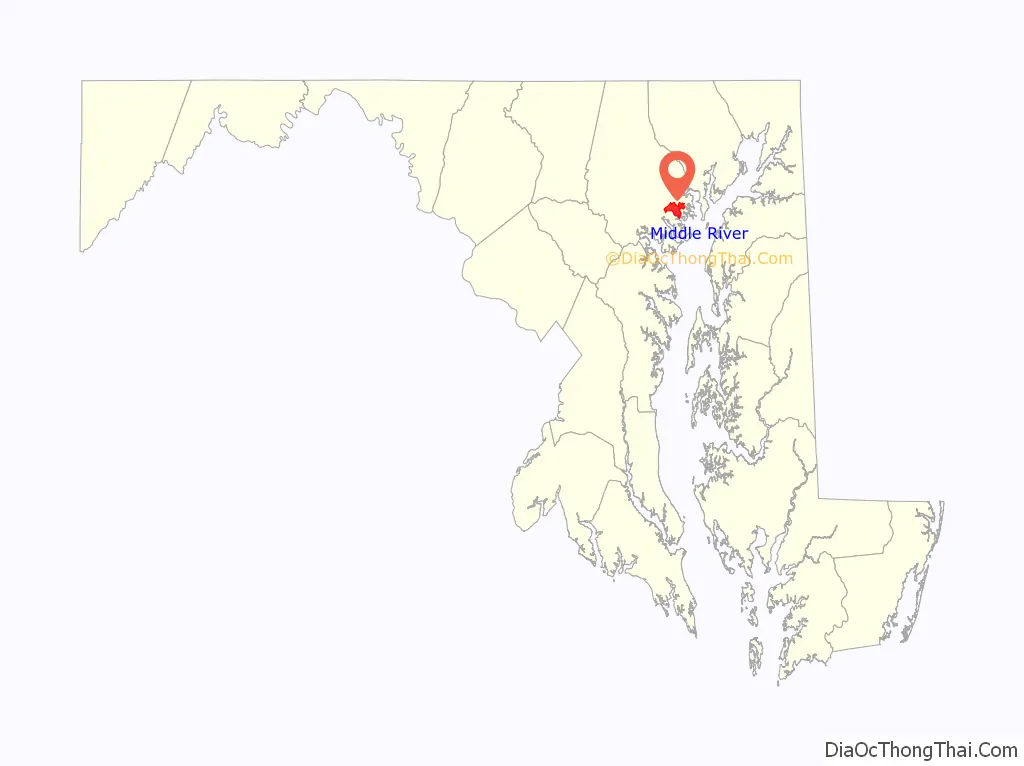
| State: | Maryland |
| County: | Baltimore County |
| Elevation: | 26 ft (8 m) |
| Total Area: | 13.64 sq mi (35.34 km²) |
| Land Area: | 12.76 sq mi (33.04 km²) |
| Water Area: | 0.89 sq mi (2.30 km²) |
| Total Population: | 33,203 |
| Population Density: | 2,602.52/sq mi (1,004.86/km²) |
| ZIP code: | 21220 |
| Area code: | 410 and 443 |
| FIPS code: | 2452300 |
| GNISfeature ID: | 0590793 |
Online Interactive Map
Click on ![]() to view map in "full screen" mode.
to view map in "full screen" mode.
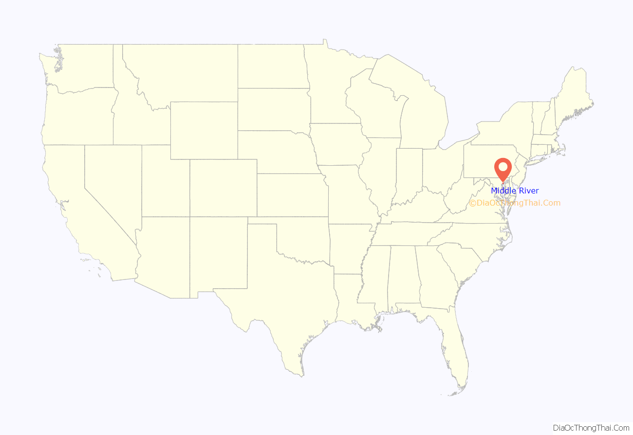
Middle River location map. Where is Middle River CDP?
History
Middle River was once known as a “Little Appalachia”. Before, during, and after World War II many Appalachian migrants settled in the Baltimore area, including Middle River. Appalachian people who migrated to Middle River were largely economic migrants who came looking for work.
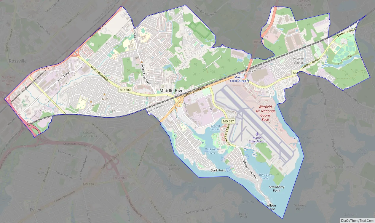
Middle River Road Map
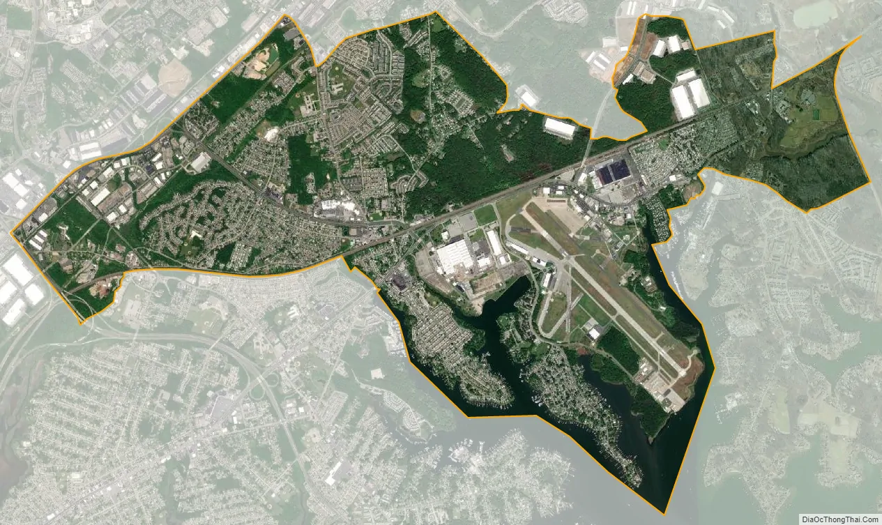
Middle River city Satellite Map
Geography
Middle River is located at 39°20′2″N 76°26′26″W / 39.33389°N 76.44056°W / 39.33389; -76.44056 (39.333957, −76.440502).
According to the United States Census Bureau, the Census Designated Place (CDP) has a total area of 8.5 square miles (22 km), of which 7.7 square miles (20 km) is land and 0.7 square miles (1.8 km), or 8.63%, is water.
See also
Map of Maryland State and its subdivision: Map of other states:- Alabama
- Alaska
- Arizona
- Arkansas
- California
- Colorado
- Connecticut
- Delaware
- District of Columbia
- Florida
- Georgia
- Hawaii
- Idaho
- Illinois
- Indiana
- Iowa
- Kansas
- Kentucky
- Louisiana
- Maine
- Maryland
- Massachusetts
- Michigan
- Minnesota
- Mississippi
- Missouri
- Montana
- Nebraska
- Nevada
- New Hampshire
- New Jersey
- New Mexico
- New York
- North Carolina
- North Dakota
- Ohio
- Oklahoma
- Oregon
- Pennsylvania
- Rhode Island
- South Carolina
- South Dakota
- Tennessee
- Texas
- Utah
- Vermont
- Virginia
- Washington
- West Virginia
- Wisconsin
- Wyoming


