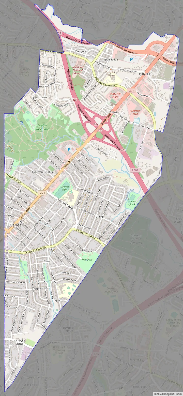
Overlea /ˈoʊvərˌliː/ is an unincorporated community and census-designated place in Baltimore County, Maryland, United States. The population was 12,275 at the 2010 census. Students attend Overlea High School. Area roads include Belair Road (U.S. Route 1) and Kenwood Avenue (Maryland Route 588).
Overlea includes the neighborhood of Fullerton.
| Name: | Overlea CDP |
|---|---|
| LSAD Code: | 57 |
| LSAD Description: | CDP (suffix) |
| State: | Maryland |
| County: | Baltimore County |
| Elevation: | 226 ft (69 m) |
| Total Area: | 3.02 sq mi (7.81 km²) |
| Land Area: | 3.02 sq mi (7.81 km²) |
| Water Area: | 0.00 sq mi (0.00 km²) |
| Total Population: | 12,832 |
| Population Density: | 4,254.64/sq mi (1,642.93/km²) |
| FIPS code: | 2459325 |
| GNISfeature ID: | 0590957 |
Online Interactive Map
Click on ![]() to view map in "full screen" mode.
to view map in "full screen" mode.
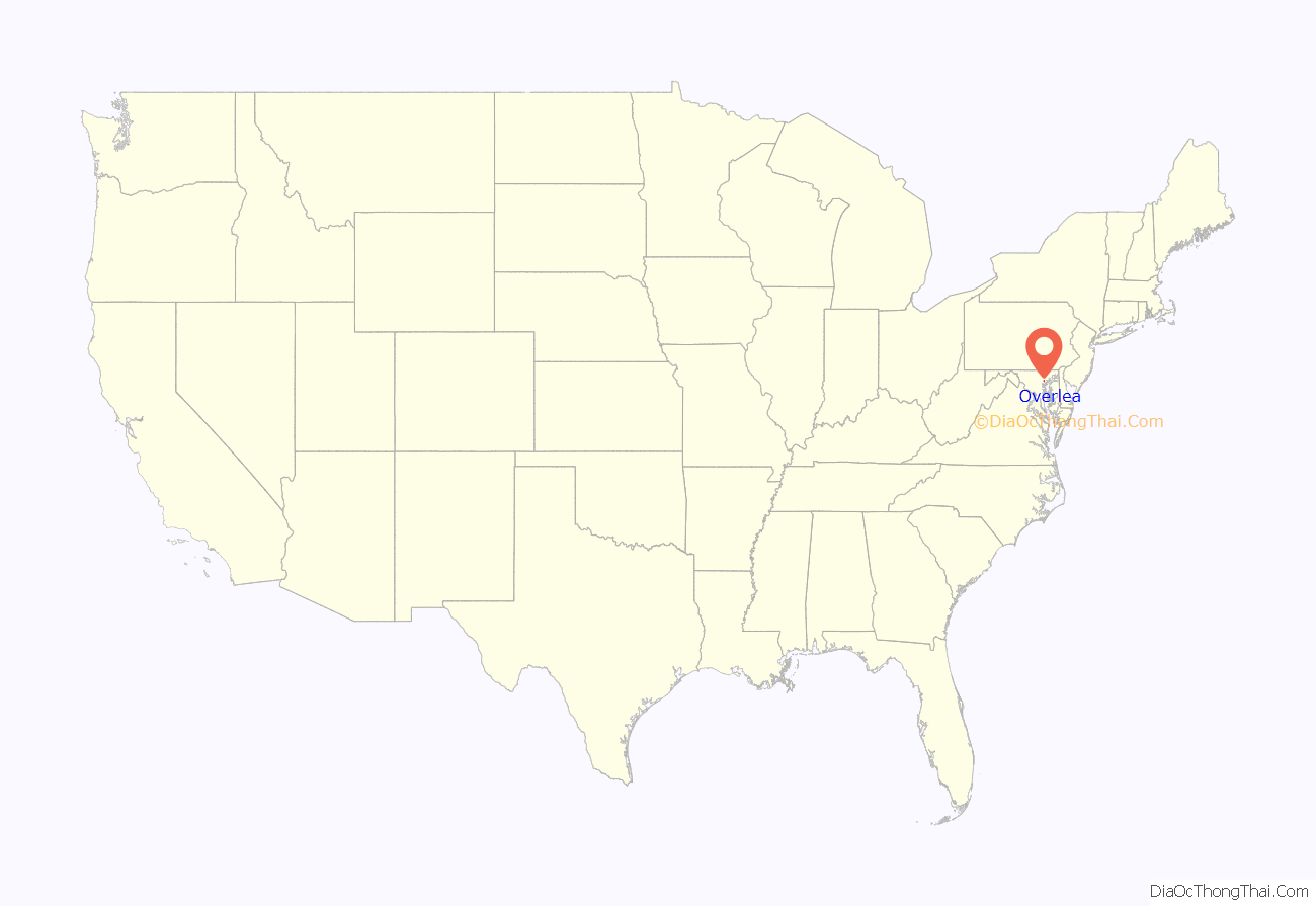
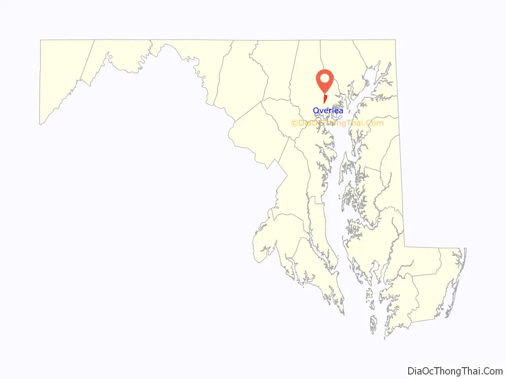
Overlea location map. Where is Overlea CDP?
History
Overlea first started out as a 43-acre tract, owned by Margaret Fuller (Fullerton, Maryland, is named for her most likely). This tract started in 1858, just three years before the start of the American Civil War. She was a widow and brought her six children with her. Margaret Fuller originally hailed from Ohio. The 43-acre tract was referred to as “Sophie’s Garden Regulated”. This original tract is located around the intersection of Belair Road and Taylor Avenue, along with the original house still standing there today. In 1885, the first Post office and general store were established. Later in 1886, Fullerton School was established as a one roomed log house, and was rebuilt as a frame house. Overlea began to truly develop in 1895 when the Kennard Land Company bought Lange’s Farm (either Fuller’s original tract, or a different tract, or possibly both). Kennard Land company mapped out the streets as: Spruce, Ash, Cedar, Maple, Hickory, Chestnut, Walnut, Willow, Beech, Poplar, Elm and Linden. Streets were named after trees. In 1910, a “town hall” was built on the Corner of Overlea Avenue and Belair Road, and still stands there today as the Natural History Society of Maryland. The town hall served as a grocery store as well. On February 23, 1913, a group of suffragists called “The Army of the Hudson” stopped at the town hall on their way from New York City to the march organized in Washington, D.C., by the National American Woman Suffrage Association. They held a meeting in the town hall, and although many were not sympathetic, a few showed support. In the same year, St. Michael’s Roman Catholic Church held its first mass in the town hall. In 1919, The City of Baltimore annexed a portion of Overlea to what is now Overlea, Baltimore.
Overlea Road Map
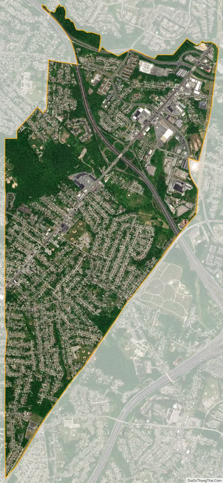
Overlea city Satellite Map
Geography
Overlea is located at 39°21′40″N 76°31′10″W / 39.36111°N 76.51944°W / 39.36111; -76.51944 (39.361107, −76.519535).
According to the United States Census Bureau, the CDP has a total area of 3.1 square miles (8.0 km), all land.
See also
Map of Maryland State and its subdivision: Map of other states:- Alabama
- Alaska
- Arizona
- Arkansas
- California
- Colorado
- Connecticut
- Delaware
- District of Columbia
- Florida
- Georgia
- Hawaii
- Idaho
- Illinois
- Indiana
- Iowa
- Kansas
- Kentucky
- Louisiana
- Maine
- Maryland
- Massachusetts
- Michigan
- Minnesota
- Mississippi
- Missouri
- Montana
- Nebraska
- Nevada
- New Hampshire
- New Jersey
- New Mexico
- New York
- North Carolina
- North Dakota
- Ohio
- Oklahoma
- Oregon
- Pennsylvania
- Rhode Island
- South Carolina
- South Dakota
- Tennessee
- Texas
- Utah
- Vermont
- Virginia
- Washington
- West Virginia
- Wisconsin
- Wyoming


