Queenstown is a town in Queen Anne’s County, Maryland, United States. The population was 664 at the 2010 census.
| Name: | Queenstown town |
|---|---|
| LSAD Code: | 43 |
| LSAD Description: | town (suffix) |
| State: | Maryland |
| County: | Queen Anne’s County |
| Incorporated: | 1892 |
| Elevation: | 20 ft (6 m) |
| Total Area: | 2.01 sq mi (5.20 km²) |
| Land Area: | 2.01 sq mi (5.20 km²) |
| Water Area: | 0.00 sq mi (0.00 km²) |
| Total Population: | 705 |
| Population Density: | 350.92/sq mi (135.50/km²) |
| ZIP code: | 21658 |
| Area code: | 410 |
| FIPS code: | 2464600 |
| GNISfeature ID: | 0597939 |
| Website: | www.queenstown-md.com |
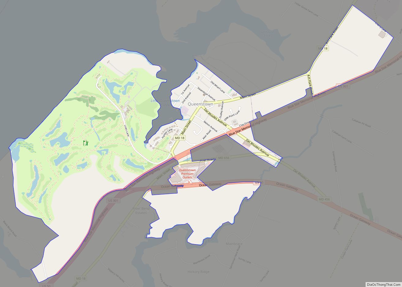
Online Interactive Map
Click on ![]() to view map in "full screen" mode.
to view map in "full screen" mode.
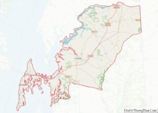
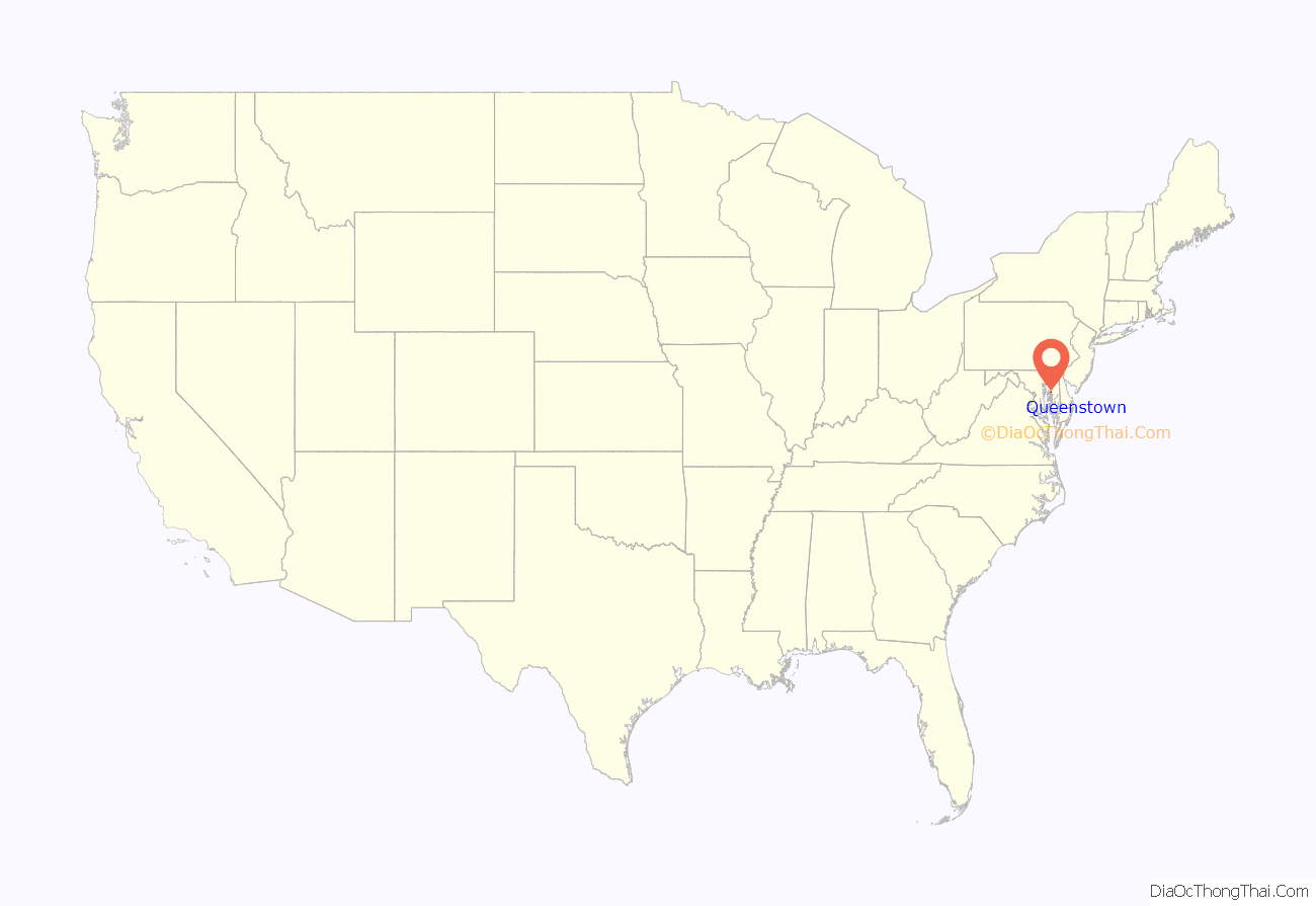
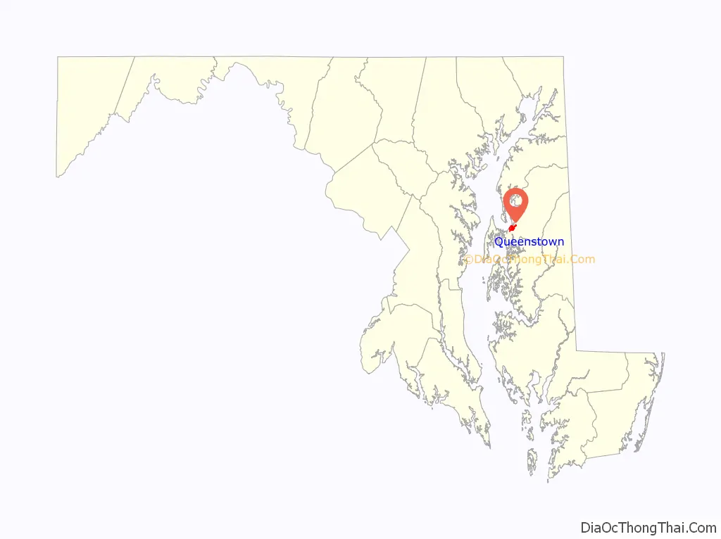
Queenstown location map. Where is Queenstown town?
History
Queenstown was the original seat of Queen Anne’s County, before the location changed to Centreville, Maryland. Its location was important during the 18th century, because it is near a creek that, during that time, could be navigated by tradesmen. A hub for shipping and receiving, Queenstown was attacked by English troops in the War of 1812 on August 13, 1813.
Bloomingdale, Bowlingly, and St. Peter’s Church are listed on the National Register of Historic Places.
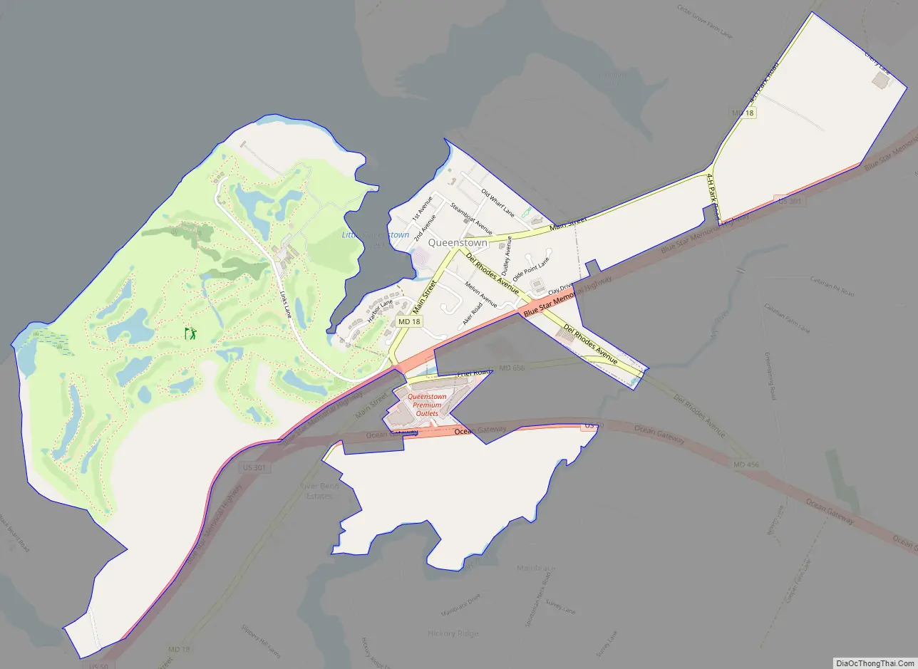
Queenstown Road Map
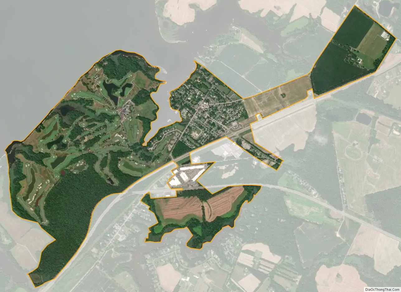
Queenstown city Satellite Map
Geography
Queenstown is located at 38°59′21″N 76°9′24″W / 38.98917°N 76.15667°W / 38.98917; -76.15667 (38.989086, -76.156645).
According to the United States Census Bureau, the town has a total area of 1.45 square miles (3.76 km), all land.
See also
Map of Maryland State and its subdivision: Map of other states:- Alabama
- Alaska
- Arizona
- Arkansas
- California
- Colorado
- Connecticut
- Delaware
- District of Columbia
- Florida
- Georgia
- Hawaii
- Idaho
- Illinois
- Indiana
- Iowa
- Kansas
- Kentucky
- Louisiana
- Maine
- Maryland
- Massachusetts
- Michigan
- Minnesota
- Mississippi
- Missouri
- Montana
- Nebraska
- Nevada
- New Hampshire
- New Jersey
- New Mexico
- New York
- North Carolina
- North Dakota
- Ohio
- Oklahoma
- Oregon
- Pennsylvania
- Rhode Island
- South Carolina
- South Dakota
- Tennessee
- Texas
- Utah
- Vermont
- Virginia
- Washington
- West Virginia
- Wisconsin
- Wyoming