Taylors Island is an unincorporated community and census-designated place in Dorchester County, Maryland, United States, in the state’s Eastern Shore region. The population was 173 at the 2010 census. It is known for hunting, crabbing and fishing. Ridgeton Farm was listed on the National Register of Historic Places in 1977. Bethlehem Methodist Episcopal Church and Grace Episcopal Church Complex were listed in 1979.
| Name: | Taylors Island CDP |
|---|---|
| LSAD Code: | 57 |
| LSAD Description: | CDP (suffix) |
| State: | Maryland |
| County: | Dorchester County |
| Elevation: | 3.0 ft (0.9 m) |
| Total Area: | 4.16 sq mi (10.78 km²) |
| Land Area: | 4.14 sq mi (10.73 km²) |
| Water Area: | 0.02 sq mi (0.05 km²) |
| Total Population: | 125 |
| Population Density: | 30.17/sq mi (11.65/km²) |
| ZIP code: | 21669 |
| Area code: | 410, 443, and 667 |
| FIPS code: | 2476925 |
| GNISfeature ID: | 591395 |
Online Interactive Map
Click on ![]() to view map in "full screen" mode.
to view map in "full screen" mode.
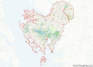
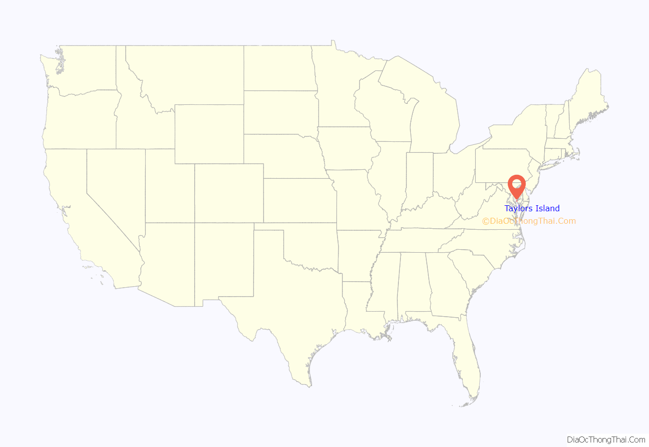
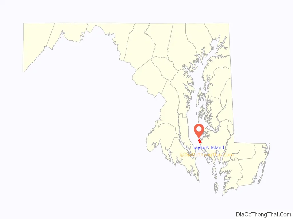
Taylors Island location map. Where is Taylors Island CDP?
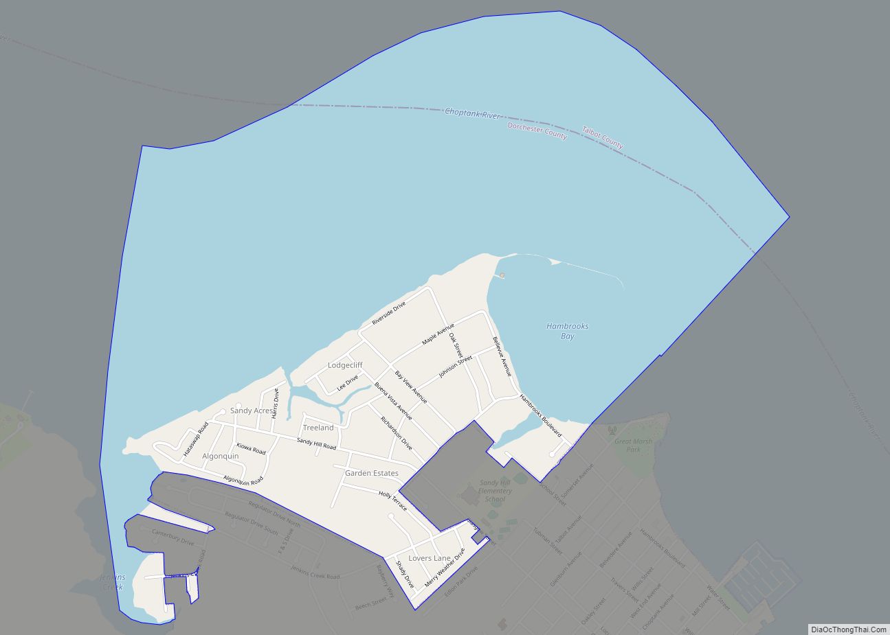
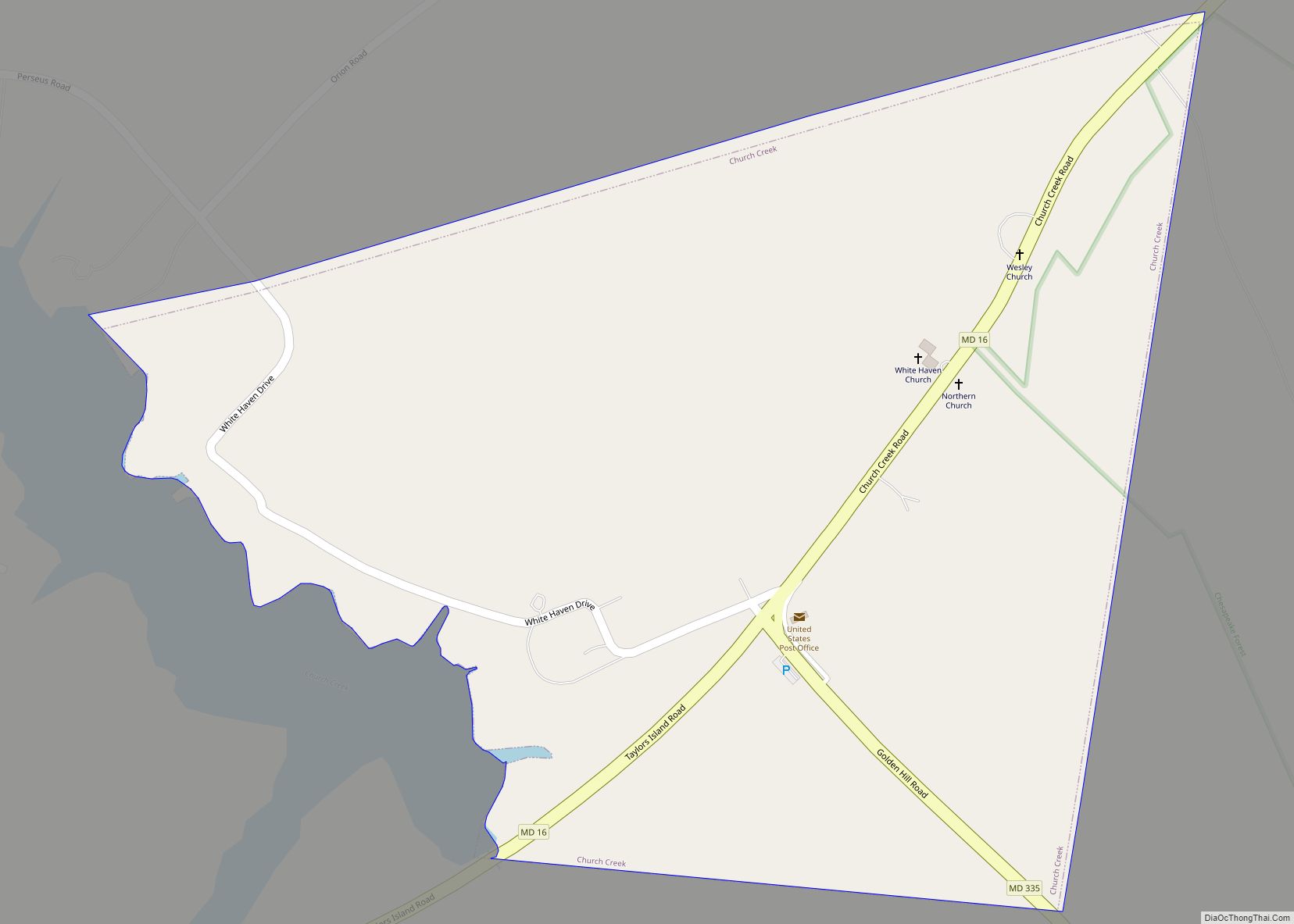
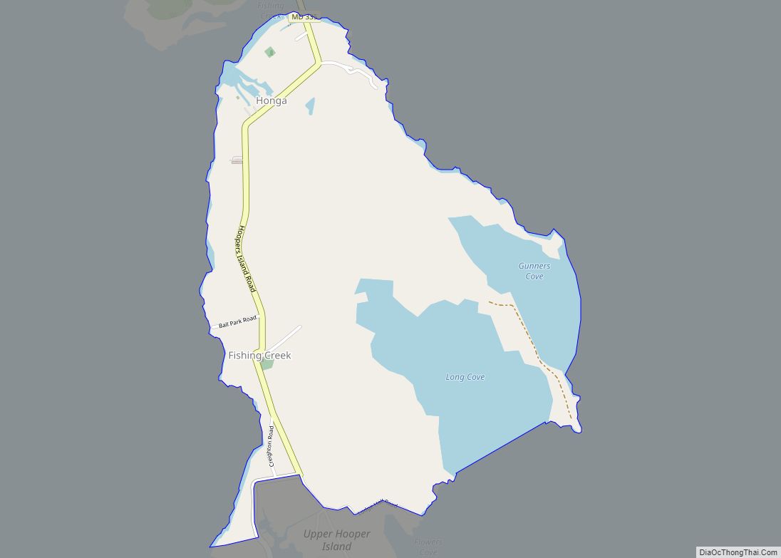
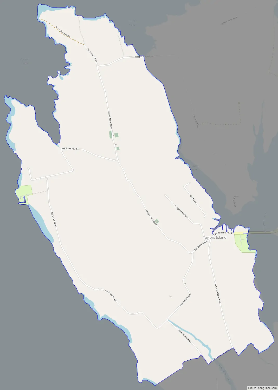
Taylors Island Road Map
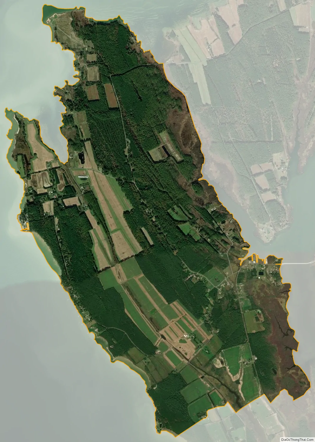
Taylors Island city Satellite Map
Geography
Taylors Island is in western Dorchester County on the eastern shore of Chesapeake Bay. It is separated from the mainland on the east by Slaughter Creek. Maryland Route 16 leads northeast from Taylors Island 16 miles (26 km) to Cambridge, the Dorchester County seat.
According to the United States Census Bureau, the Taylors Island CDP occupies the central, northern, and western parts of the island. The CDP has a total area of 4.2 square miles (10.8 km), of which 0.02 square miles (0.05 km), or 0.47%, is water.
See also
Map of Maryland State and its subdivision: Map of other states:- Alabama
- Alaska
- Arizona
- Arkansas
- California
- Colorado
- Connecticut
- Delaware
- District of Columbia
- Florida
- Georgia
- Hawaii
- Idaho
- Illinois
- Indiana
- Iowa
- Kansas
- Kentucky
- Louisiana
- Maine
- Maryland
- Massachusetts
- Michigan
- Minnesota
- Mississippi
- Missouri
- Montana
- Nebraska
- Nevada
- New Hampshire
- New Jersey
- New Mexico
- New York
- North Carolina
- North Dakota
- Ohio
- Oklahoma
- Oregon
- Pennsylvania
- Rhode Island
- South Carolina
- South Dakota
- Tennessee
- Texas
- Utah
- Vermont
- Virginia
- Washington
- West Virginia
- Wisconsin
- Wyoming