Fanwood is a borough in Union County, in the U.S. state of New Jersey. As of the 2020 United States census, the borough’s population was 7,774, an increase of 456 (+6.2%) from the 2010 census count of 7,318, which in turn reflected an increase of 144 (+2.0%) from the 7,174 counted in the 2000 census.
Fanwood was incorporated as a borough by an act of the New Jersey Legislature on October 2, 1895, from portions of Fanwood Township (now known as Scotch Plains), based on the results of a referendum held the previous day. The borough was named for Fannie Wood, an author.
| Name: | Fanwood borough |
|---|---|
| LSAD Code: | 21 |
| LSAD Description: | borough (suffix) |
| State: | New Jersey |
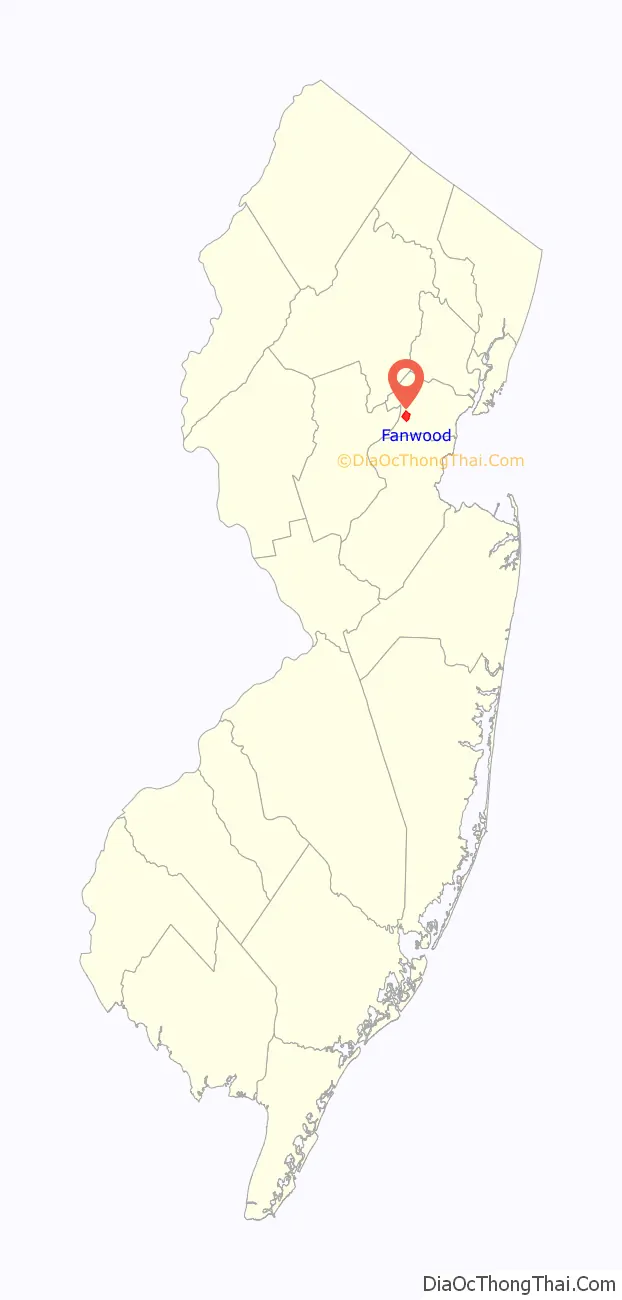
| County: | Union County |
| Incorporated: | October 2, 1895 |
| Elevation: | 157 ft (48 m) |
| Total Area: | 1.34 sq mi (3.47 km²) |
| Land Area: | 1.34 sq mi (3.47 km²) |
| Water Area: | 0.00 sq mi (0.00 km²) 0.00% |
| Total Population: | 7,774 |
| Population Density: | 5,801.5/sq mi (2,240.0/km²) |
| ZIP code: | 07023 |
| Area code: | 908 exchanges: 322, 490, 889 |
| FIPS code: | 3422860 |
| GNISfeature ID: | 0885216 |
| Website: | www.fanwoodnj.org |
Online Interactive Map
Click on ![]() to view map in "full screen" mode.
to view map in "full screen" mode.
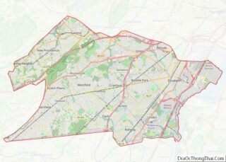
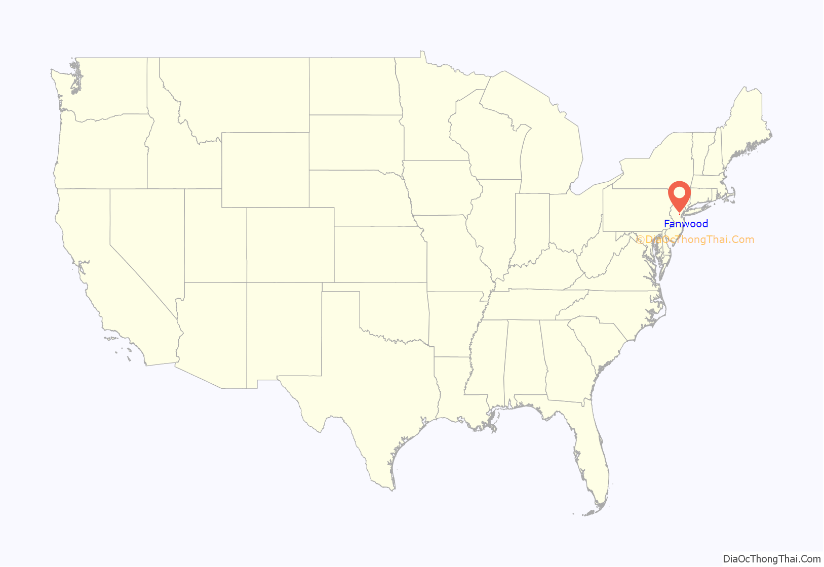
Fanwood location map. Where is Fanwood borough?
History
In 1831, the Elizabethtown and Somerville Railroad received a legislative charter to construct a railroad through the area. The line reached here in 1837 and a station, known as the Scotch Plains station, was built in 1839. The company became the Central Railroad of New Jersey in 1849. The line was later moved to reduce the grade and a new station, known as the Fanwood station, was built in 1874. At the same time, the Central New Jersey Land Improvement Company began development of Fanwood Park, a residential community around the station. The development featured curvilinear streets. John Taylor Johnston, then president of CNJ, named the community after his wife, Frances, also known as Fanny, according to his daughter, Emily. In 1878, Fanwood Township was created from Plainfield and Westfield Townships.
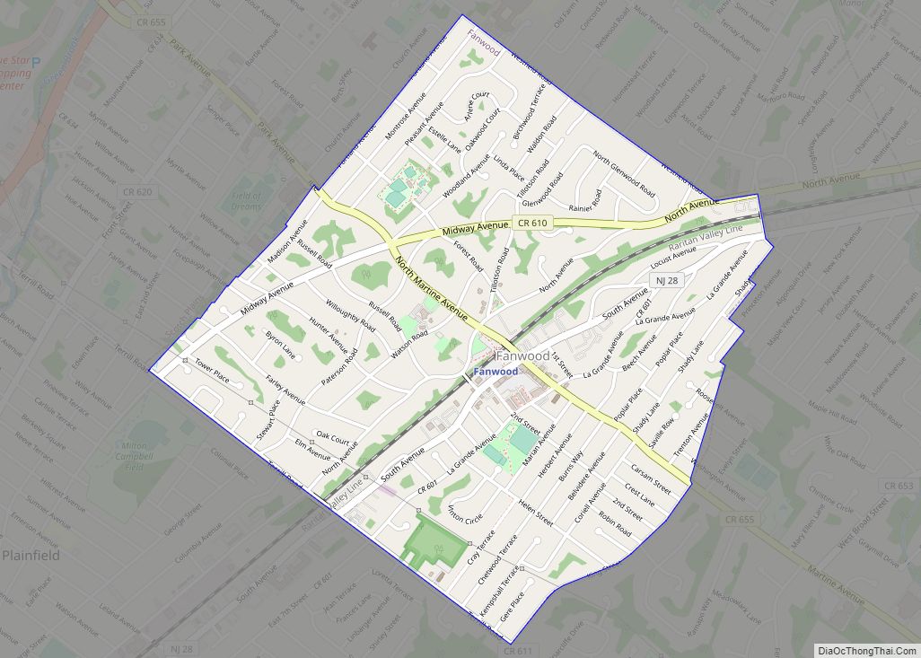
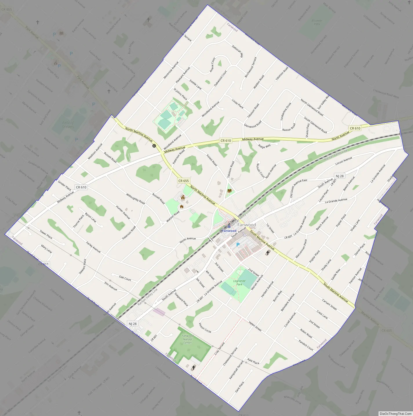
Fanwood Road Map
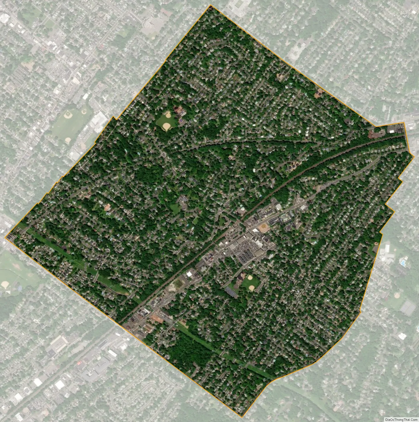
Fanwood city Satellite Map
Geography
According to the United States Census Bureau, the borough had a total area of 1.34 square miles (3.47 km), all of which was land.
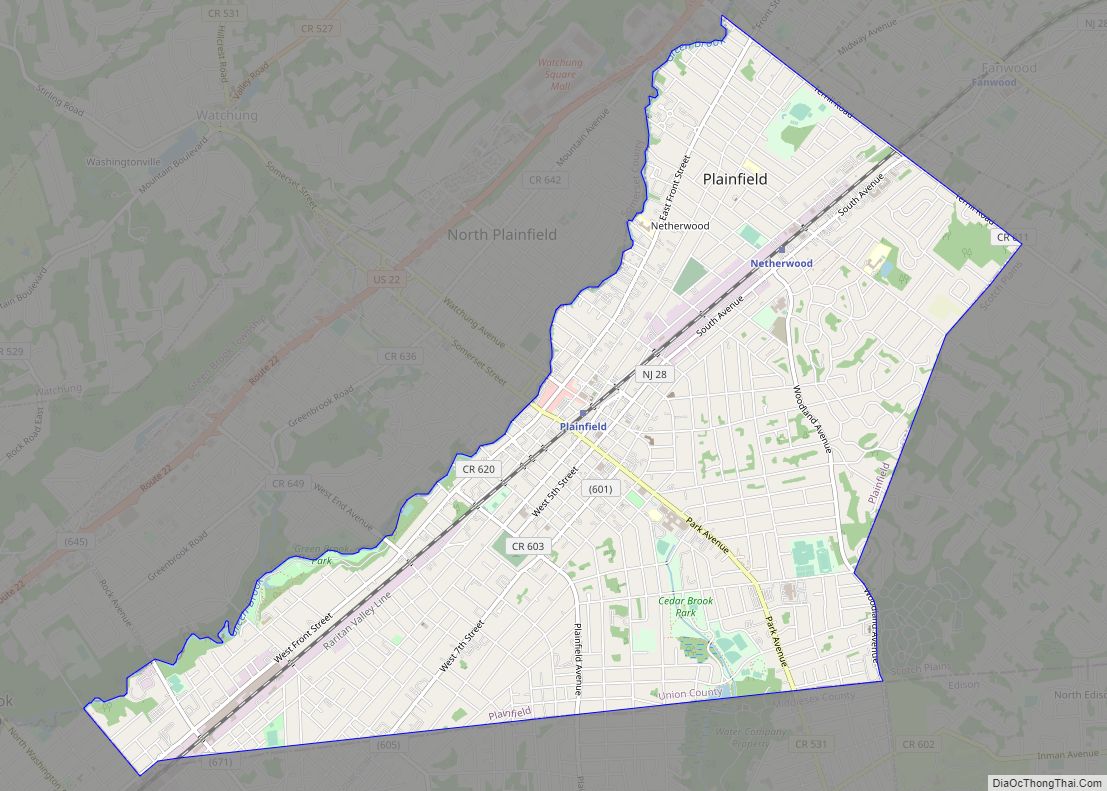
The borough is bordered by Plainfield in the southwest and by Scotch Plains in all other directions.
The Robinsons Branch of the Rahway River additionally flows through Fanwood en route to the Robinson’s Branch Reservoir.
See also
Map of New Jersey State and its subdivision: Map of other states:- Alabama
- Alaska
- Arizona
- Arkansas
- California
- Colorado
- Connecticut
- Delaware
- District of Columbia
- Florida
- Georgia
- Hawaii
- Idaho
- Illinois
- Indiana
- Iowa
- Kansas
- Kentucky
- Louisiana
- Maine
- Maryland
- Massachusetts
- Michigan
- Minnesota
- Mississippi
- Missouri
- Montana
- Nebraska
- Nevada
- New Hampshire
- New Jersey
- New Mexico
- New York
- North Carolina
- North Dakota
- Ohio
- Oklahoma
- Oregon
- Pennsylvania
- Rhode Island
- South Carolina
- South Dakota
- Tennessee
- Texas
- Utah
- Vermont
- Virginia
- Washington
- West Virginia
- Wisconsin
- Wyoming