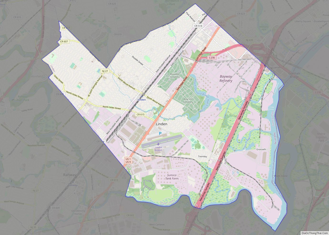
Linden is a city in southeastern Union County, in the U.S. state of New Jersey. It is part of the New York Metropolitan Area, located about 13 miles (21 km) southwest of Manhattan and bordering Staten Island, a borough of New York City, across the Arthur Kill. As of the 2020 United States census, the city’s population was 43,738, an increase of 3,239 (+8.0%) from the 2010 census count of 40,499, which in turn reflected an increase of 1,105 (+2.8%) from the 39,394 counted in the 2000 census.
Linden was originally formed as a township on March 4, 1861 from portions of Elizabeth, Rahway and Union Township. Portions of the township were taken to form Cranford (March 14, 1871), Linden Borough (March 30, 1882) and Roselle (December 20, 1894). Linden was incorporated as a city by an act of the New Jersey Legislature on January 1, 1925, replacing both Linden Township and Linden Borough, based on the results of a referendum held on November 8, 1923. The city’s name derives from linden trees brought from Germany.
| Name: | Linden city |
|---|---|
| LSAD Code: | 25 |
| LSAD Description: | city (suffix) |
| State: | New Jersey |
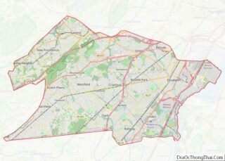
| County: | Union County |
| Incorporated: | January 1, 1925 |
| Elevation: | 7 ft (2 m) |
| Total Area: | 11.35 sq mi (29.39 km²) |
| Land Area: | 10.69 sq mi (27.68 km²) |
| Water Area: | 0.66 sq mi (1.71 km²) 6.37% |
| Total Population: | 43,738 |
| Population Density: | 4,092.3/sq mi (1,580.0/km²) |
| ZIP code: | 07036 |
| Area code: | 908 |
| FIPS code: | 3440350 |
| GNISfeature ID: | 0885278 |
| Website: | linden-nj.gov |
Online Interactive Map
Click on ![]() to view map in "full screen" mode.
to view map in "full screen" mode.
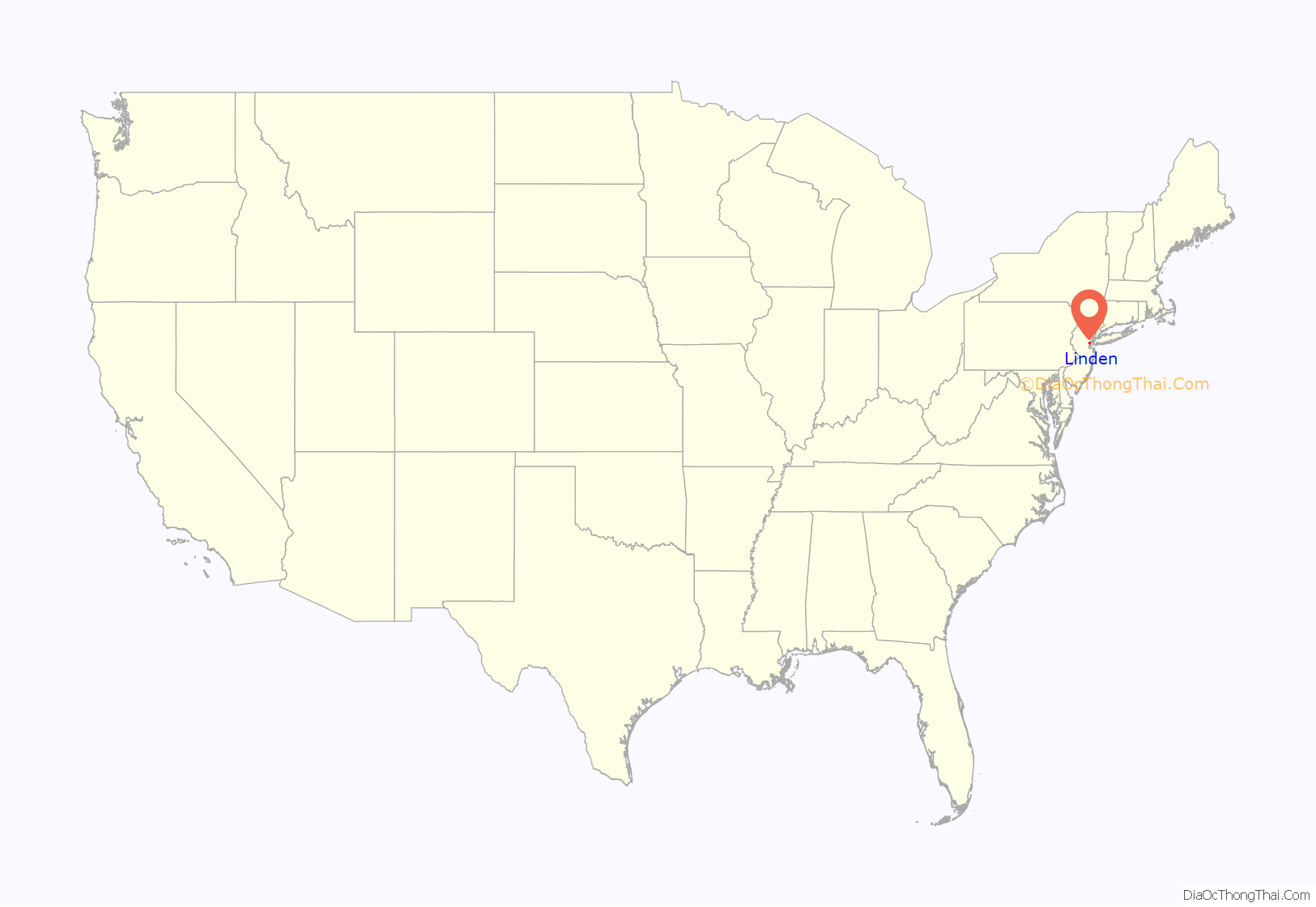
Linden location map. Where is Linden city?

Linden Road Map
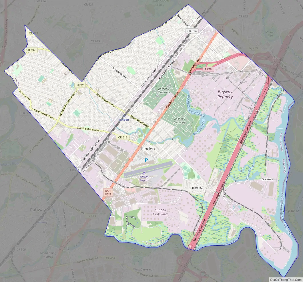
Linden city Satellite Map

Geography
According to the United States Census Bureau, the city had a total area of 11.42 square miles (29.56 km), including 10.69 square miles (27.68 km) of land and 0.73 square miles (1.88 km) of water (6.37%).
Unincorporated communities, localities and place names located partially or completely within the city include Bayway, Grasselli, Morses Mill, Tremley, Sunnyside, Vreeland Mills, Warners and Wheatsheaf.
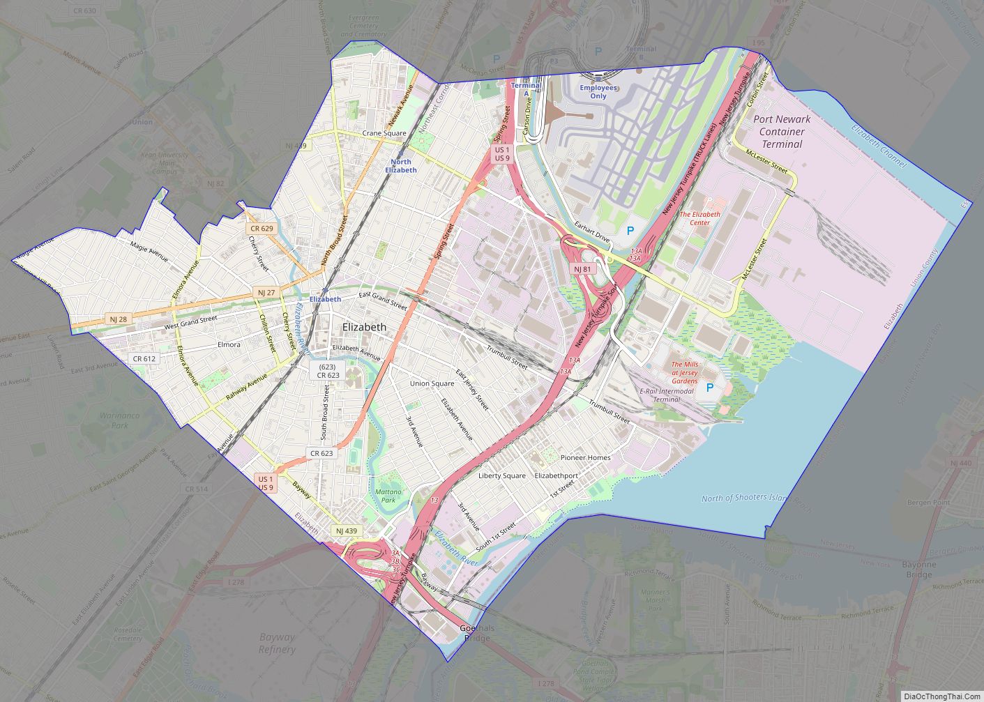
The city borders the municipalities of Clark, Cranford Township, Elizabeth, Rahway, Roselle and Winfield Township in Union County; Carteret and Woodbridge Township in Middlesex County; and Staten Island in New York City across the Arthur Kill tidal strait.
See also
Map of New Jersey State and its subdivision: Map of other states:- Alabama
- Alaska
- Arizona
- Arkansas
- California
- Colorado
- Connecticut
- Delaware
- District of Columbia
- Florida
- Georgia
- Hawaii
- Idaho
- Illinois
- Indiana
- Iowa
- Kansas
- Kentucky
- Louisiana
- Maine
- Maryland
- Massachusetts
- Michigan
- Minnesota
- Mississippi
- Missouri
- Montana
- Nebraska
- Nevada
- New Hampshire
- New Jersey
- New Mexico
- New York
- North Carolina
- North Dakota
- Ohio
- Oklahoma
- Oregon
- Pennsylvania
- Rhode Island
- South Carolina
- South Dakota
- Tennessee
- Texas
- Utah
- Vermont
- Virginia
- Washington
- West Virginia
- Wisconsin
- Wyoming