New Providence is a borough on the northwestern edge of Union County, in the U.S. state of New Jersey. It is located on the Passaic River, which forms the county boundary with Morris County bordering Chatham Township. As of the 2020 United States census, the borough’s population was 13,650, an increase of 1,479 (+12.2%) from the 2010 census count of 12,171, which in turn reflected increase of 264 (+2.2%) from the 11,907 counted in the 2000 census.
The borough is home to much of the Murray Hill neighborhood with the remainder lying in neighboring Berkeley Heights. Service on the NJ Transit is available at the New Providence and Murray Hill stations. More than 9% of New Providence’s land is publicly-owned and protected parkland.
| Name: | New Providence borough |
|---|---|
| LSAD Code: | 21 |
| LSAD Description: | borough (suffix) |
| State: | New Jersey |
| County: | Union County |
| Incorporated: | March 14, 1899 |
| Elevation: | 217 ft (66 m) |
| Total Area: | 3.71 sq mi (9.61 km²) |
| Land Area: | 3.69 sq mi (9.55 km²) |
| Water Area: | 0.02 sq mi (0.05 km²) 0.57% |
| Total Population: | 13,650 |
| Population Density: | 3,701.2/sq mi (1,429.0/km²) |
| ZIP code: | 07974 |
| Area code: | 908 and 973 |
| FIPS code: | 3451810 |
| GNISfeature ID: | 0885321 |
| Website: | www.newprov.org |
Online Interactive Map
Click on ![]() to view map in "full screen" mode.
to view map in "full screen" mode.
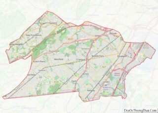
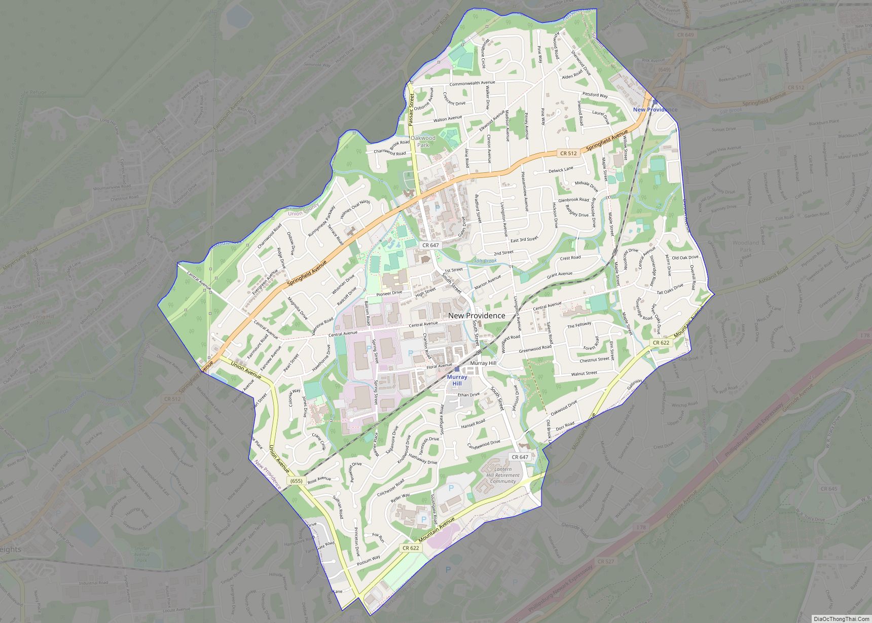
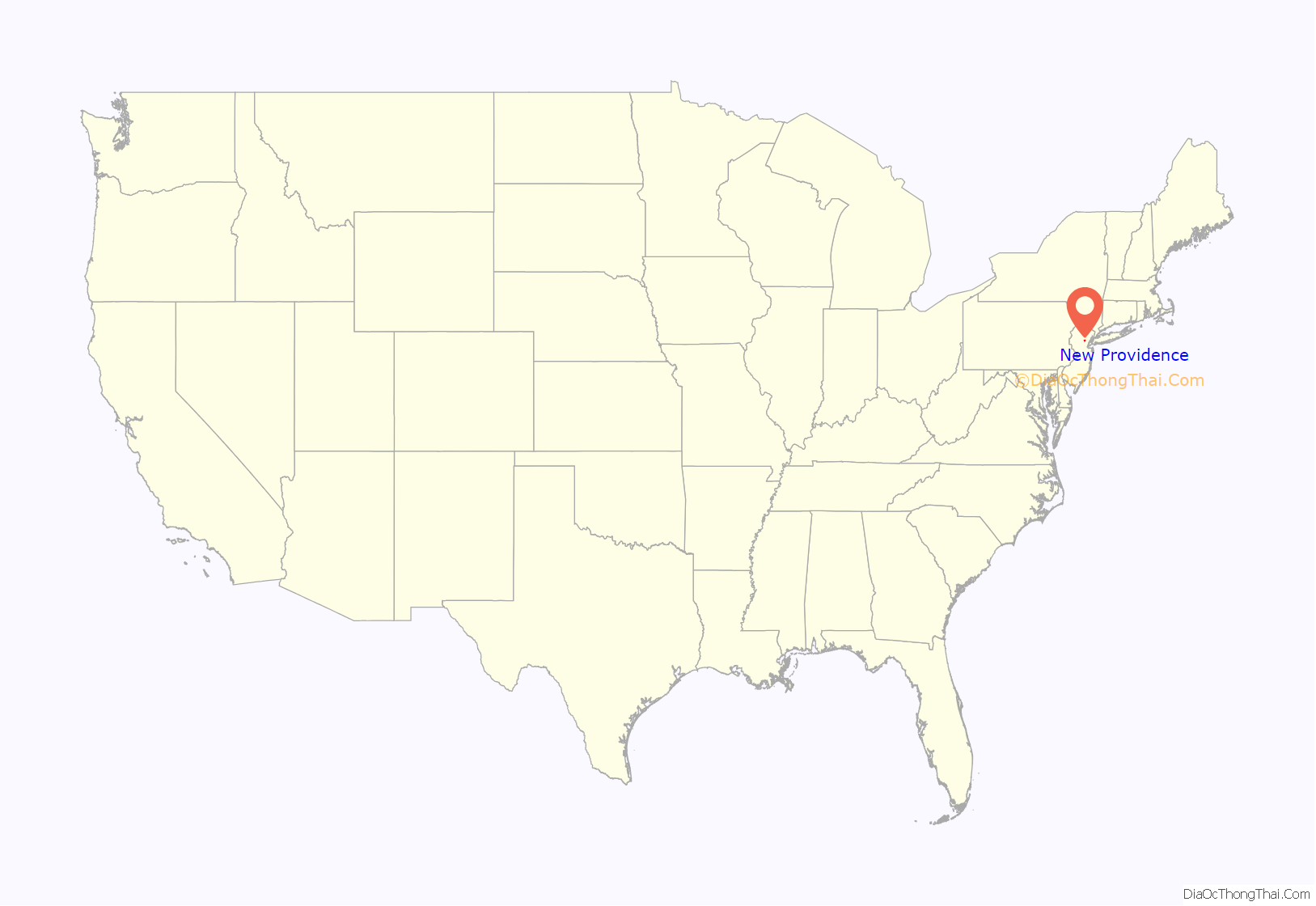
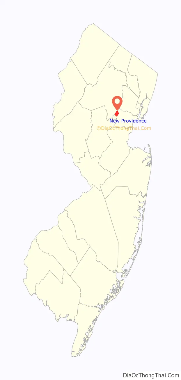
New Providence location map. Where is New Providence borough?
History
The written history of New Providence begins in 1664 when James, Duke of York and brother to King Charles II, purchased the land that became known as the Elizabethtown Tract from the Lenape Native Americans. Its first European settlers were members of a Puritan colony established in 1720, which was the first permanent settlement of its type. The settlement was originally called “Turkey” or “Turkey Town”, due to the presence of wild turkeys in the area.
The Presbyterian Church established in 1737 was a focal point for the community, and the lack of serious injuries when the church’s balcony collapsed in 1759 was deemed to be an example of divine intervention, leading residents to change the area’s name to New Providence.
According to local tradition, George Washington spent the night in a local home, which still stands to this day. Supposedly, the local stream, Salt Brook, is named for an incident when the salt supply of the colonial village was dumped into the brook to prevent passing British soldiers from taking it. Ironically, the British Army never crossed the Watchung Mountains into this region. Salt Brook winds through town, starting near the eponymous Salt Brook Elementary School.
On April 14, 1794, Springfield Township was formed, which included the present-day township, along with the towns of Summit, New Providence, and Berkeley Heights. Growth continued in the area, and on November 8, 1809, New Providence Township was formed from within Springfield Township. It included what is now Summit, New Providence, and Berkeley Heights. On March 23, 1869, Summit withdrew from the New Providence Township and reincorporated as a township without any other town.
On March 14, 1899, New Providence also withdrew from New Providence Township and was reincorporated as a borough. With Boroughitis sweeping across the state, many communities within townships were reverting to small, locally governed communities (mostly reincorporating as boroughs) due to acts of the New Jersey Legislature that made it economically advantageous for communities so do so. New Providence Township was renamed to Berkeley Heights as of November 6, 1951.
The cultivation of roses played an important role in the local economy in the 1900s.
New Providence had long been a semi-dry town, under which there were no bars and no restaurants permitted to sell alcoholic beverages. Retail liquor sales were legal and restaurant-goers may bring their own alcoholic beverages. In 2011, the borough announced that it was considering issuing on-premises liquor licenses, which could bring in as much as $500,000 for each bar granted a license, with plans to use the money raised to pay for improvements to recreation areas. Liquor licenses were granted in 2015 to a pair of restaurants, ending a 100-year period in which the borough had no on-premises liquor licenses.
The 2011 film Win Win is set at New Providence High School, having been written by Tom McCarthy and Joe Tiboni, two former students at the school.
Landmarks
- Nokia Bell Labs, formerly known as Bell Telephone Laboratories, is located in the New Providence neighborhood of Murray Hill. Researchers at this facility were credited with the development of radio astronomy, the transistor, the laser, the photovoltaic cell and other advances in technology. Nine Nobel Prizes have been awarded for work completed at this facility.
- The Presbyterian Church is a large, white, historic church in the center of town.
- The Village Shopping Center is a shopping center that takes up the majority of downtown New Providence.
- New Providence School District currently links together the computer networks of its buildings by using a wireless LAN which includes Yagi antennas at two towers by the large copper pyramid-shaped roof.
- Our Lady of Peace is a Roman Catholic church and school located on South Street. The parking lot at OLP becomes the home of the town’s OLP fair, held for three days each spring, complete with rides, games, food, and an indoor auction/junk fest.
- The Salt Box Museum, located at 1350 Springfield Avenue, is an 18th-century farmhouse owned by the New Providence Historical Society.
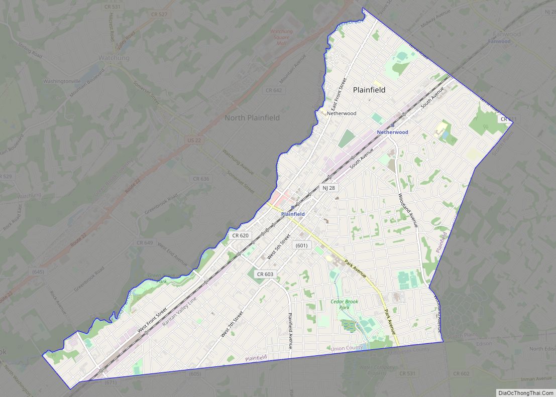
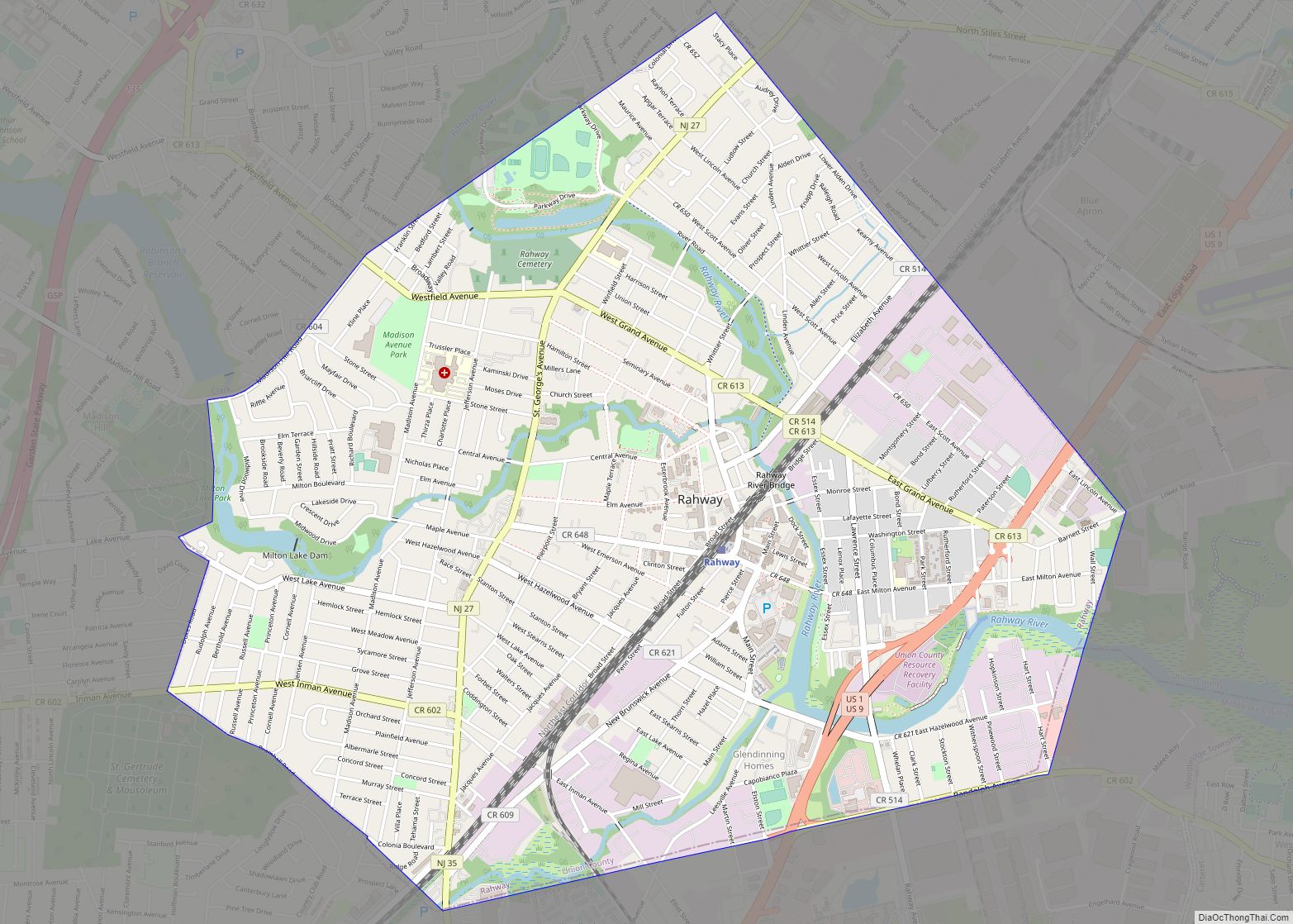
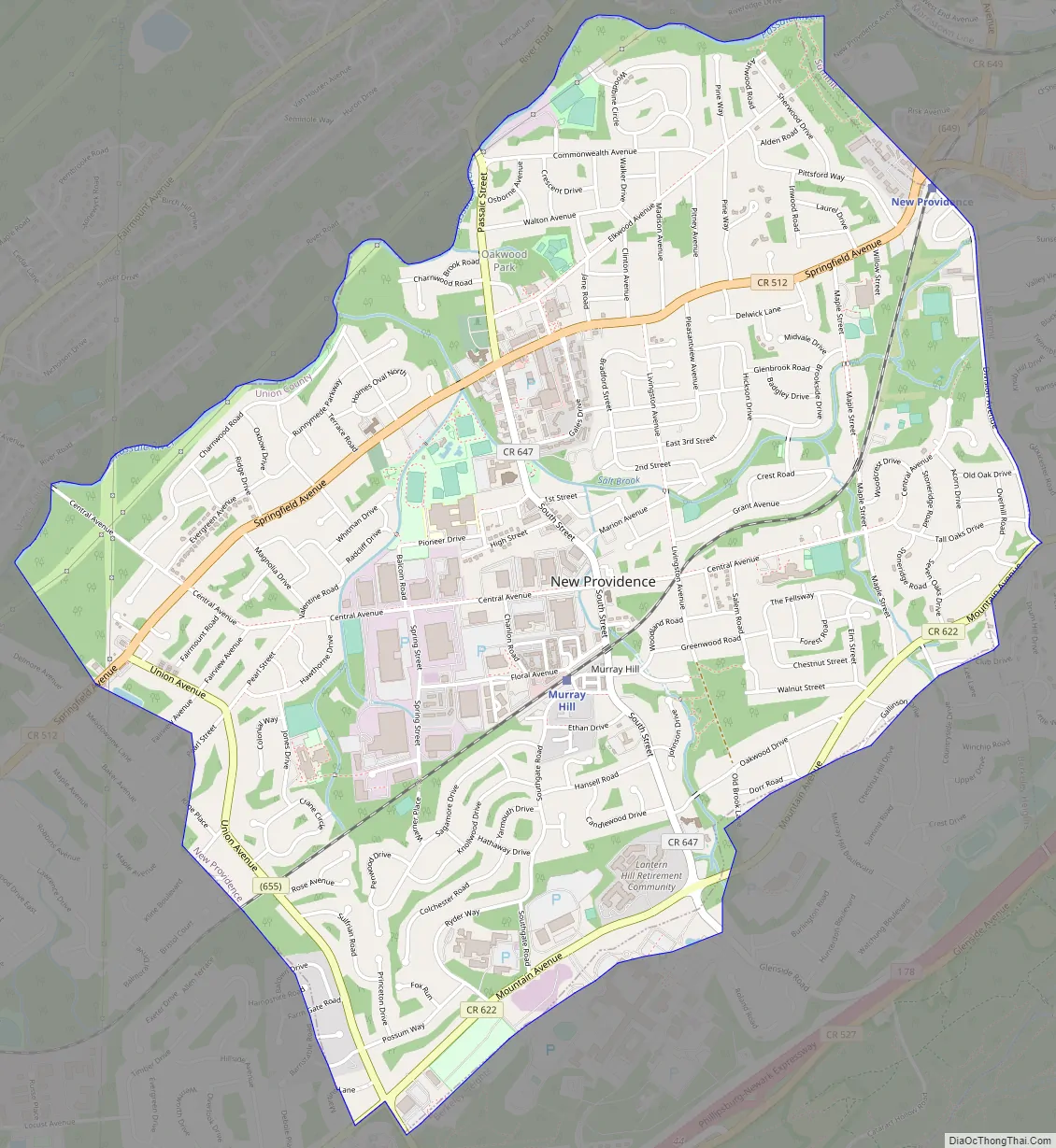
New Providence Road Map
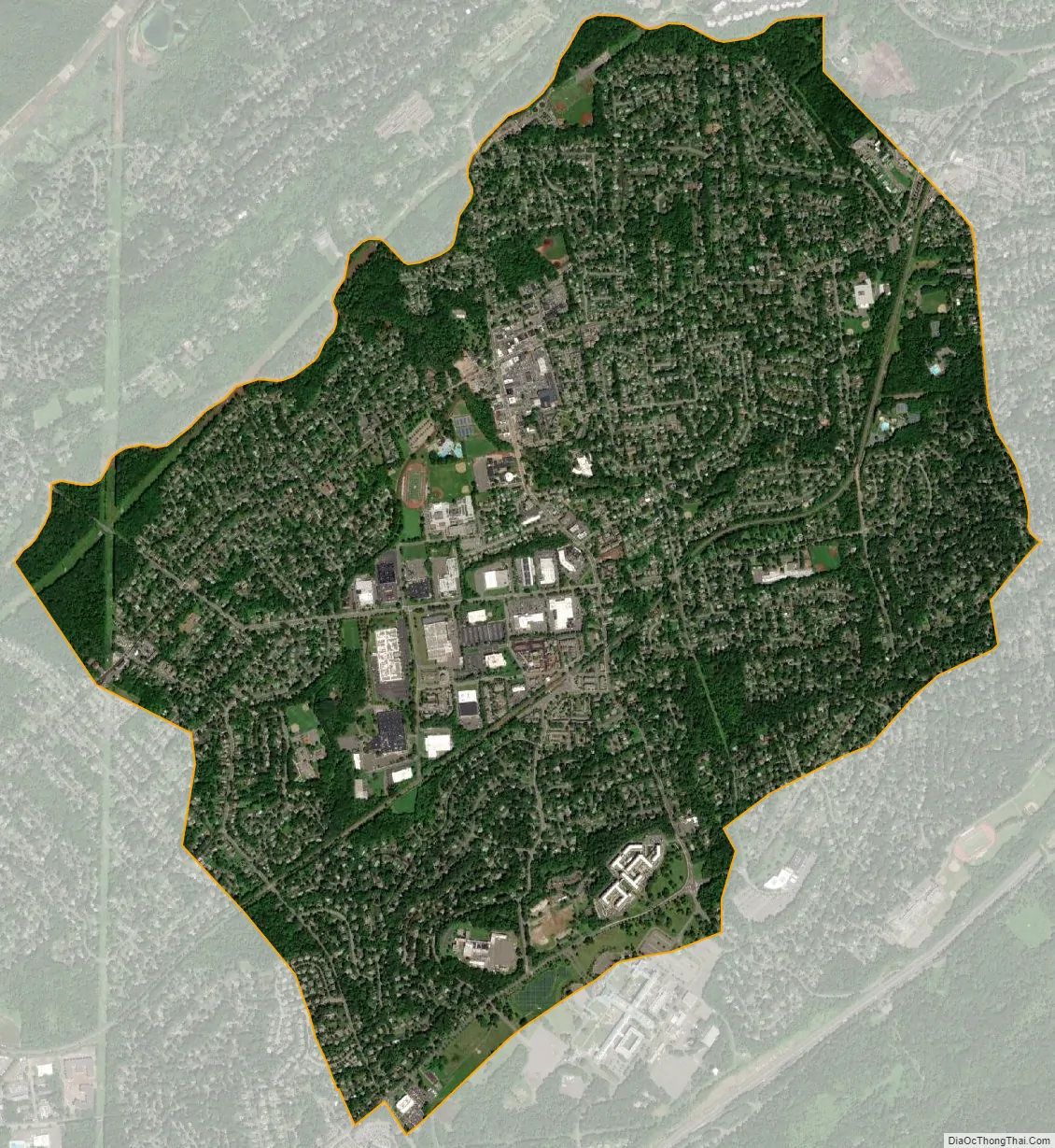
New Providence city Satellite Map
Geography
According to the United States Census Bureau, New Providence borough had a total area of 3.71 square miles (9.61 km), including 3.69 square miles (9.55 km) of land and 0.02 square miles (0.05 km) of water (0.57%).
New Providence is bordered by Berkeley Heights to the southwest and south, and by Summit to the east in Union County; and to the north by Chatham Township, across the Passaic River, in Morris County.
Much of the Murray Hill neighborhood lies in New Providence, with the remainder in Berkeley Heights; Other unincorporated communities, localities and place names within the borough include Tall Oaks, Johnsons Bridge, and West Summit.
The borough lies on the western slope of Second Watchung Mountain. There are several creek beds carved into the landscape, most of which are forks and branches of Salt Brook. These creeks join together near the center of town then flow into the Passaic River, along the banks of which Passaic River Parkway is found. Over nine percent of New Providence’s land area is permanently protected, publicly owned parkland. Most of this land is wooded floodplain adjacent to the Passaic. Union County owns much of the riverfront parkland and New Providence owns the remainder. There are several borough-owned parks that bracket Salt Brook, including Veterans Memorial Park on South Street, Lions Park on Livingston Avenue, and Clearwater Park near the end of Central Avenue.
See also
Map of New Jersey State and its subdivision: Map of other states:- Alabama
- Alaska
- Arizona
- Arkansas
- California
- Colorado
- Connecticut
- Delaware
- District of Columbia
- Florida
- Georgia
- Hawaii
- Idaho
- Illinois
- Indiana
- Iowa
- Kansas
- Kentucky
- Louisiana
- Maine
- Maryland
- Massachusetts
- Michigan
- Minnesota
- Mississippi
- Missouri
- Montana
- Nebraska
- Nevada
- New Hampshire
- New Jersey
- New Mexico
- New York
- North Carolina
- North Dakota
- Ohio
- Oklahoma
- Oregon
- Pennsylvania
- Rhode Island
- South Carolina
- South Dakota
- Tennessee
- Texas
- Utah
- Vermont
- Virginia
- Washington
- West Virginia
- Wisconsin
- Wyoming