Westfield is a town in Union County, in the U.S. state of New Jersey, located 16 miles (26 km) southwest of Manhattan. As of the 2020 United States census, the town’s population was 31,032, an increase of 716 (+2.4%) from the 2010 census count of 30,316, which in turn reflected an increase of 672 (+2.3%) from the 29,644 counted in the 2000 census.
In March 2018, Bloomberg ranked Westfield as the 99th highest-income place in the United States, and the 18th highest-income location in New Jersey. According to a 2014 nationwide survey, Westfield was ranked as the 30th-safest city to live in the United States.
The town has been one of the state’s highest-income communities. Based on data from the American Community Survey for 2013–2017, Westfield residents had a median household income of $159,923, ranked 8th in the state among municipalities with more than 10,000 residents, more than double the statewide median of $76,475.
| Name: | Westfield town |
|---|---|
| LSAD Code: | 43 |
| LSAD Description: | town (suffix) |
| State: | New Jersey |
| County: | Union County |
| Incorporated: | February 21, 1798 (as township) |
| Elevation: | 118 ft (36 m) |
| Total Area: | 6.74 sq mi (17.46 km²) |
| Land Area: | 6.72 sq mi (17.42 km²) |
| Water Area: | 0.02 sq mi (0.05 km²) 0.28% |
| Total Population: | 31,032 |
| Population Density: | 4,615.1/sq mi (1,781.9/km²) |
| Area code: | 908 |
| FIPS code: | 3479040 |
| GNISfeature ID: | 0885436 |
| Website: | www.westfieldnj.gov |
Online Interactive Map
Click on ![]() to view map in "full screen" mode.
to view map in "full screen" mode.
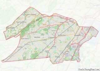
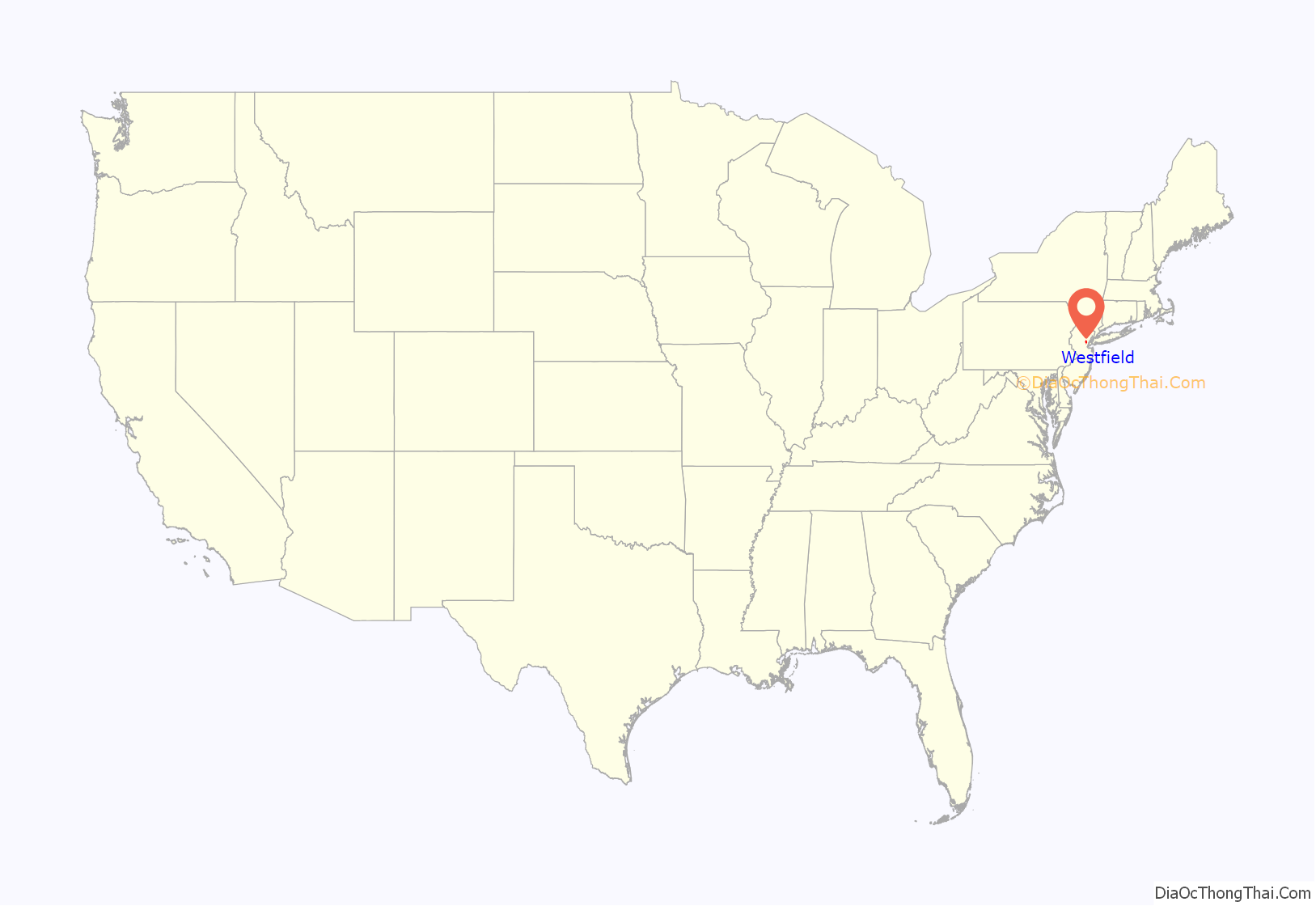
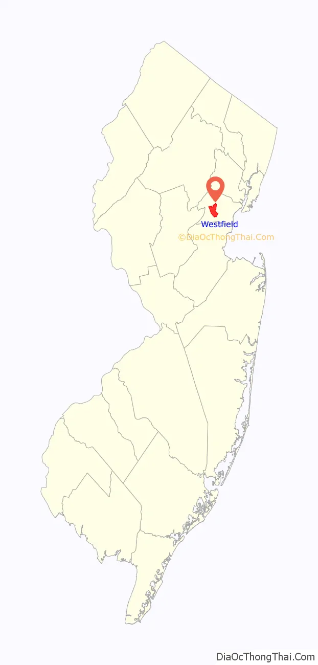
Westfield location map. Where is Westfield town?
History
History says that Westfield took its name from the rich “fields west of Elizabeth Town, and hence for over one hundred years went by the name of West Fields.” Town records say that “the settlement of Westfield dates back to the last year (1699) of the seventeenth century. It was the result of the ‘Clinker Lot Division.’ Almost immediately after the division emigration from the older parts of the town of Elizabeth began to set towards the interior,—especially to the territory lying between the Rahway river, on the east, and the mountains, on the west. It was not, however, until 1720 that the settlers became numerous enough to constitute a distinct community.” The old village area, now the downtown district, was settled in 1720 as part of the Elizabethtown Tract.
Westfield was originally formed as a township on January 27, 1794, from portions of Elizabeth Township, while the area was still part of Essex County, and was incorporated on February 21, 1798, as one of New Jersey’s initial group of 104 townships by an act of the New Jersey Legislature. It became part of the newly formed Union County on March 19, 1857. Portions of the township have been taken to form Rahway Township (February 27, 1804), Plainfield Township (April 5, 1847), Cranford Township (March 14, 1871), Fanwood Township (March 6, 1878; now known as Scotch Plains) and Mountainside (September 25, 1895). The Town of Westfield was incorporated on March 4, 1903, replacing Westfield Township. The name of the town is derived from its location in the western, undeveloped fields of the Elizabethtown tract.
As recently as 2017, the Broaddus family living in Westfield received threatening letters from a supposed stalker who referred to himself as “The Watcher,” causing a national sensation. The Broaddus family’s experience, along with the 1971 John List family murders that also occurred in Westfield, were later adapted into the 2022 Netflix series The Watcher.
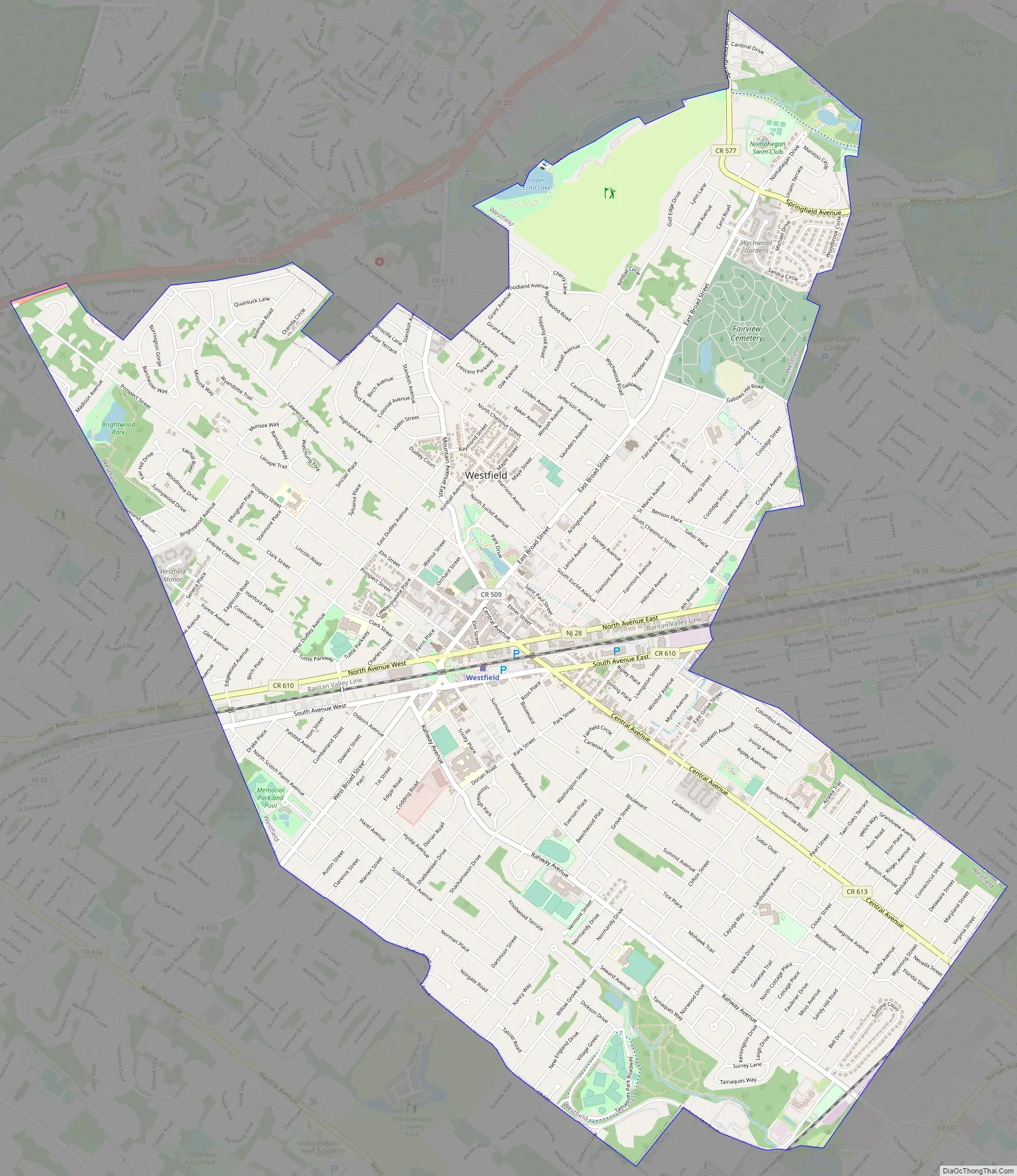
Westfield Road Map
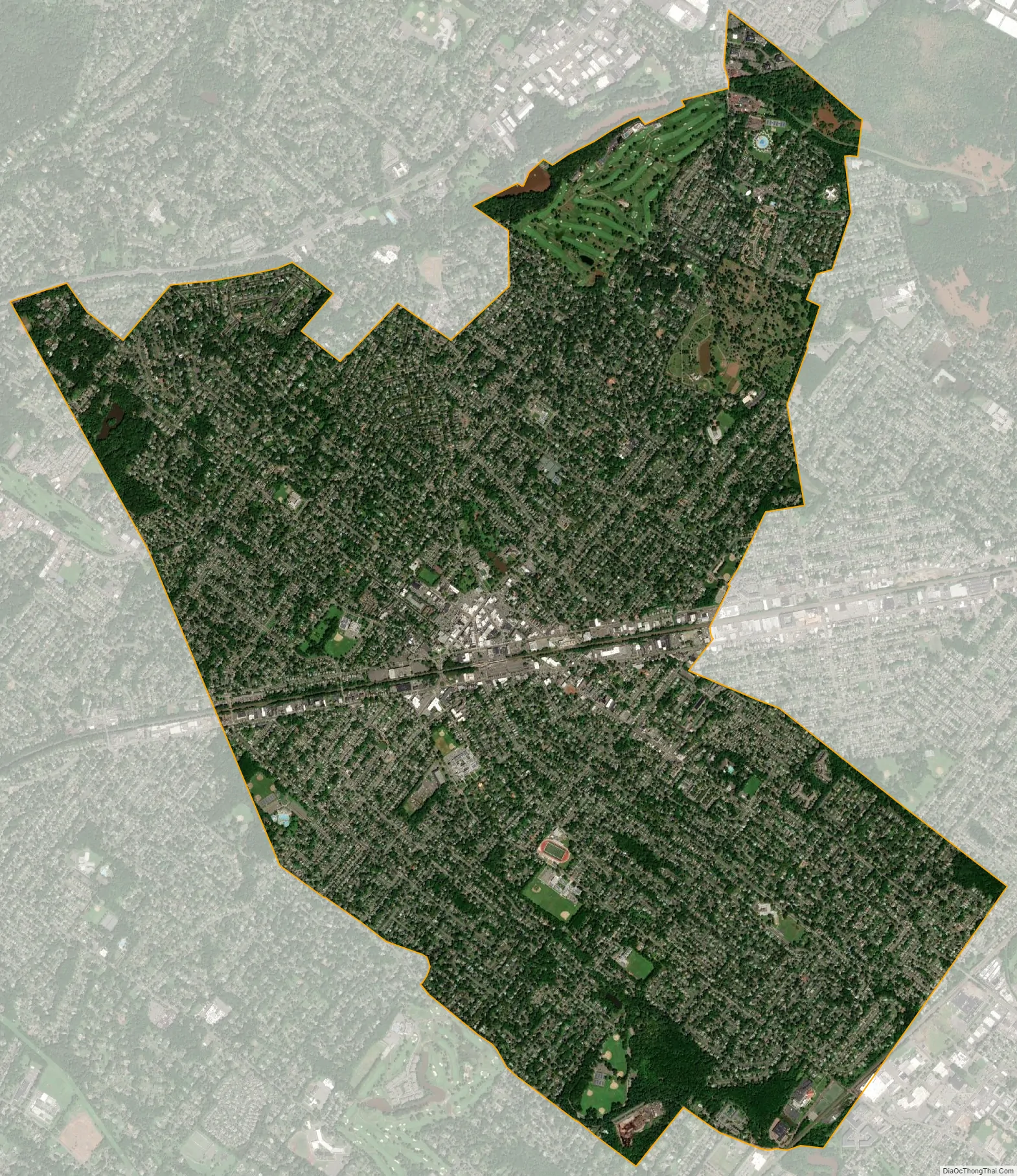
Westfield city Satellite Map
Geography
According to the United States Census Bureau, the town had a total area of 6.74 square miles (17.46 km), including 6.72 square miles (17.42 km) of land and 0.02 square miles (0.05 km) of water (0.28%).
Unincorporated communities, localities and place names located partially or completely within the township include Germantown and Tamaques Reservation Mill.
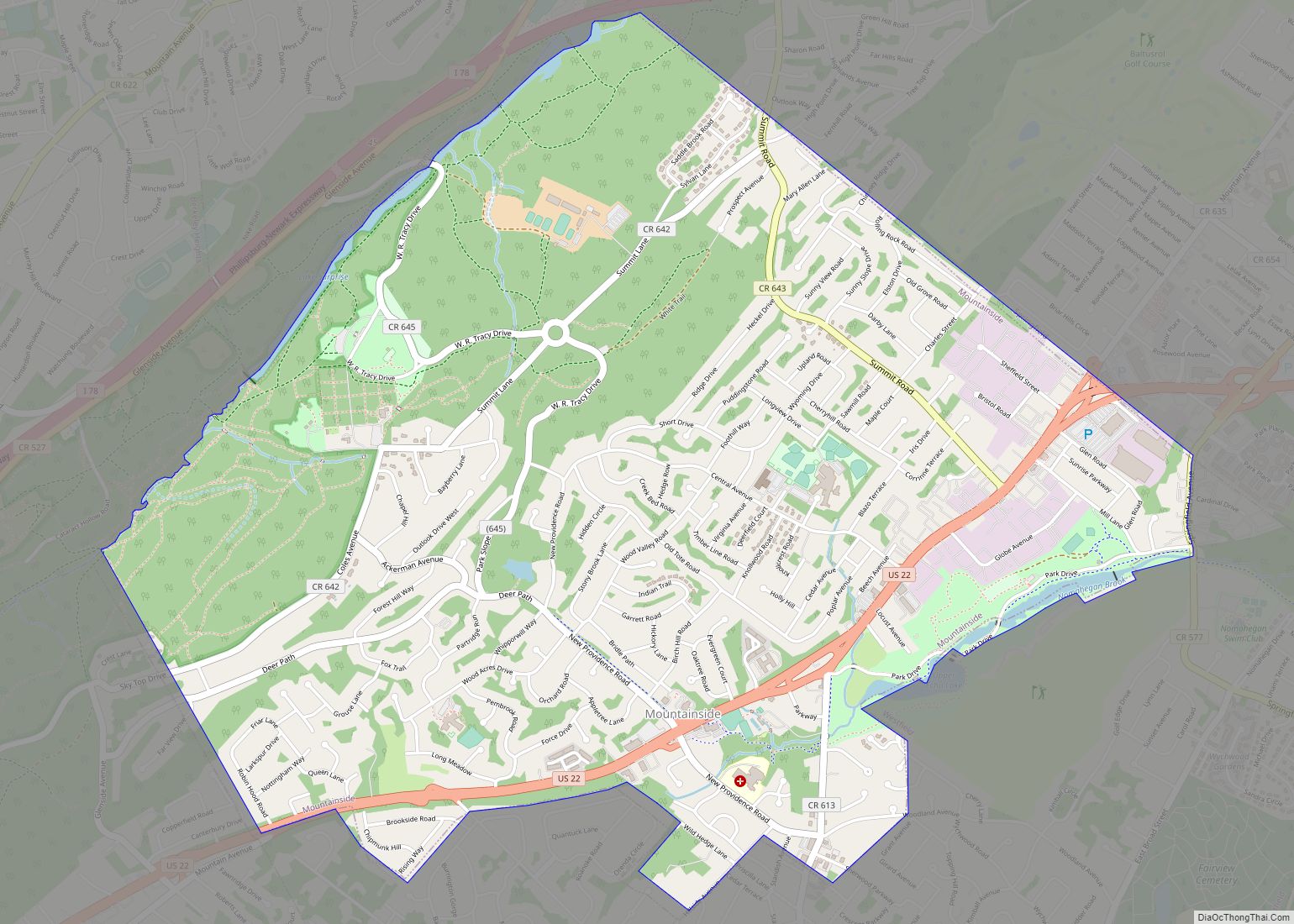
Six municipalities border the town of Westfield: Mountainside to the north, Springfield Township to the northeast, Garwood and Cranford to the east, Clark to the southeast, and Scotch Plains to the west and southwest.
The upper reaches of the Rahway River Parkway run through the township along tributaries of the Rahway River.
The Robinson’s Branch of the Rahway River additionally flows through the southern portion of Westfield en route to the Robinson’s Branch Reservoir, also known as the Clark Reservoir.
It is located about one hour from Manhattan.
See also
Map of New Jersey State and its subdivision: Map of other states:- Alabama
- Alaska
- Arizona
- Arkansas
- California
- Colorado
- Connecticut
- Delaware
- District of Columbia
- Florida
- Georgia
- Hawaii
- Idaho
- Illinois
- Indiana
- Iowa
- Kansas
- Kentucky
- Louisiana
- Maine
- Maryland
- Massachusetts
- Michigan
- Minnesota
- Mississippi
- Missouri
- Montana
- Nebraska
- Nevada
- New Hampshire
- New Jersey
- New Mexico
- New York
- North Carolina
- North Dakota
- Ohio
- Oklahoma
- Oregon
- Pennsylvania
- Rhode Island
- South Carolina
- South Dakota
- Tennessee
- Texas
- Utah
- Vermont
- Virginia
- Washington
- West Virginia
- Wisconsin
- Wyoming