Woodlynne is a borough in Camden County, in the U.S. state of New Jersey. As of the 2020 United States census, the borough’s population was 2,902, a decrease of 76 (−2.6%) from the 2010 census count of 2,978, which in turn reflected an increase of 182 (+6.5%) from the 2,796 counted in the 2000 census. The borough is the state’s eighth-smallest municipality. Established on the site of a defunct amusement park, Woodlynne is less than one-third the size of Six Flags Great Adventure and Safari.
Woodlynne was incorporated as a borough by an act of the New Jersey Legislature on March 19, 1901, from portions of Haddon Township. In 1906, the City of Camden made an unsuccessful attempt to annex Woodlynne.
Woodlynne had the highest property tax rate in New Jersey, with an equalized rate of 7.384% in 2020, compared to a statewide average of 2.279% and 3.470% in Camden County.
| Name: | Woodlynne borough |
|---|---|
| LSAD Code: | 21 |
| LSAD Description: | borough (suffix) |
| State: | New Jersey |
| County: | Camden County |
| Incorporated: | March 19, 1901 |
| Elevation: | 20 ft (6 m) |
| Total Area: | 0.23 sq mi (0.58 km²) |
| Land Area: | 0.22 sq mi (0.56 km²) |
| Water Area: | 0.01 sq mi (0.02 km²) 3.04% |
| Total Population: | 2,902 |
| Population Density: | 13,338.4/sq mi (5,150.0/km²) |
| ZIP code: | 08107 |
| Area code: | 856 |
| FIPS code: | 3482450 |
| GNISfeature ID: | 0885450 |
| Website: | www.woodlynnenj.org |
Online Interactive Map
Click on ![]() to view map in "full screen" mode.
to view map in "full screen" mode.
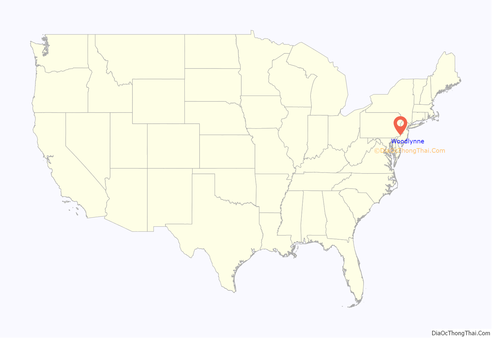
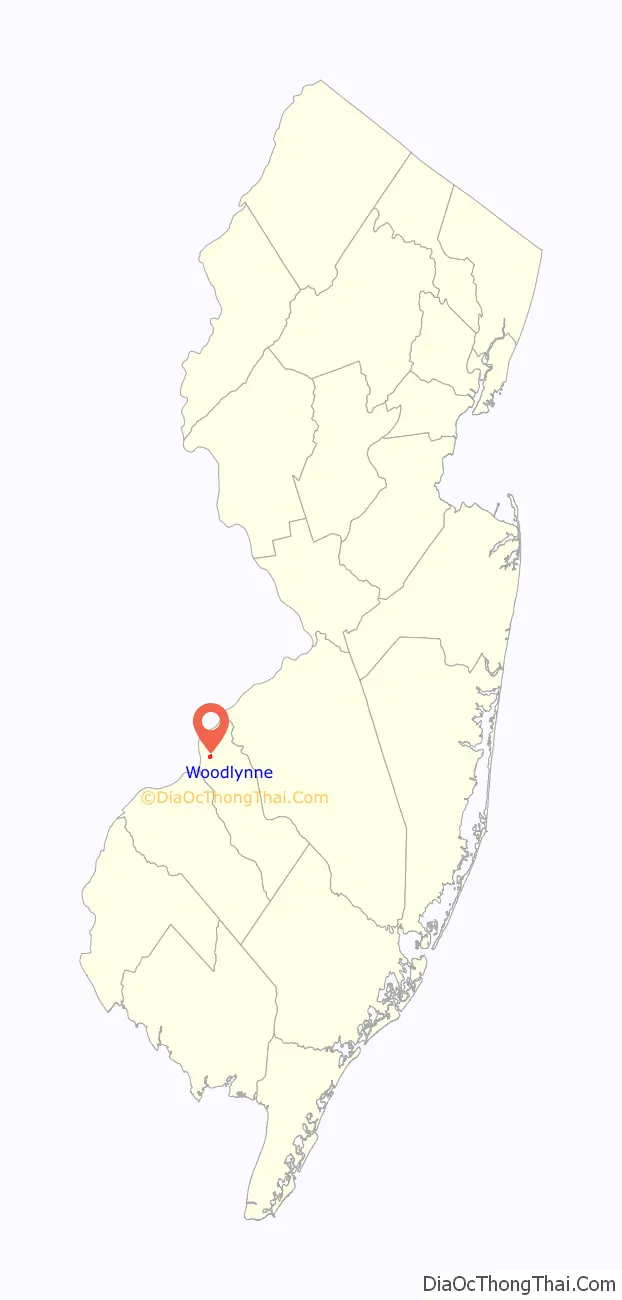
Woodlynne location map. Where is Woodlynne borough?
History
First settled by Europeans in 1681, a property owned by Mark Newbie was called Lynnewood, named for the linden trees in the area. The name was changed from Lynnewood to Woodlynne in 1892, due to conflicts with the name of another municipality.
Woodlynne Amusement Park, which encompassed Woodlynne Lake (no longer in existence), operated between the years 1895 and 1914 in the area that now comprises the town of Woodlynne. The New Camden Land Improvement Company commissioned the creation of Woodlynne Amusement Park on the estate of Charles M. Cooper in 1892. Homes built over the old lake tend to flood in the basements during heavy rainstorms.
The Camden and Suburban Railway Company, formed in 1896, established a housing development in a section of Woodlynne Amusement Park, which contributed to its incorporation as Woodlynne Borough in 1901.
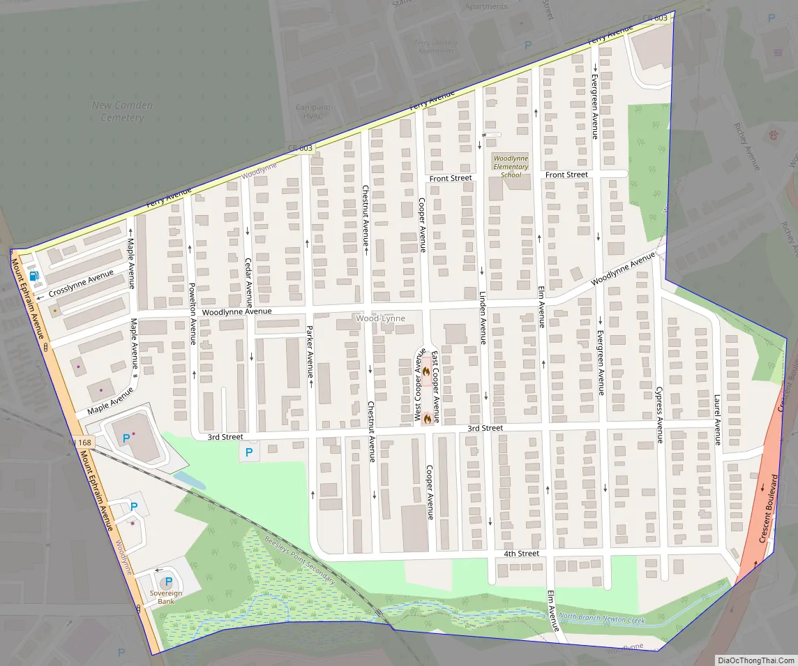
Woodlynne Road Map
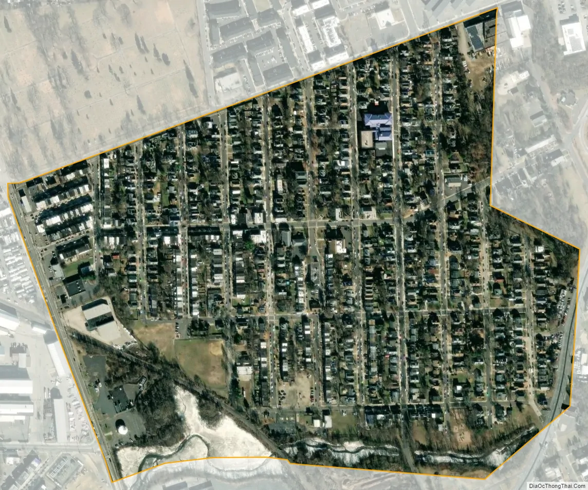
Woodlynne city Satellite Map
Geography
According to the United States Census Bureau, the borough had a total area of 0.23 square miles (0.58 km), including 0.22 square miles (0.56 km) of land and 0.01 square miles (0.02 km) of water (3.04%).
Woodlynne borders the Borough of Collingswood and the City of Camden.
Climate
The climate in this area is characterized by hot, humid summers and generally mild to cool winters. According to the Köppen Climate Classification system, Woodlynne has a humid subtropical climate, abbreviated “Cfa” on climate maps.
See also
Map of New Jersey State and its subdivision: Map of other states:- Alabama
- Alaska
- Arizona
- Arkansas
- California
- Colorado
- Connecticut
- Delaware
- District of Columbia
- Florida
- Georgia
- Hawaii
- Idaho
- Illinois
- Indiana
- Iowa
- Kansas
- Kentucky
- Louisiana
- Maine
- Maryland
- Massachusetts
- Michigan
- Minnesota
- Mississippi
- Missouri
- Montana
- Nebraska
- Nevada
- New Hampshire
- New Jersey
- New Mexico
- New York
- North Carolina
- North Dakota
- Ohio
- Oklahoma
- Oregon
- Pennsylvania
- Rhode Island
- South Carolina
- South Dakota
- Tennessee
- Texas
- Utah
- Vermont
- Virginia
- Washington
- West Virginia
- Wisconsin
- Wyoming


Peace, Love and Harmony