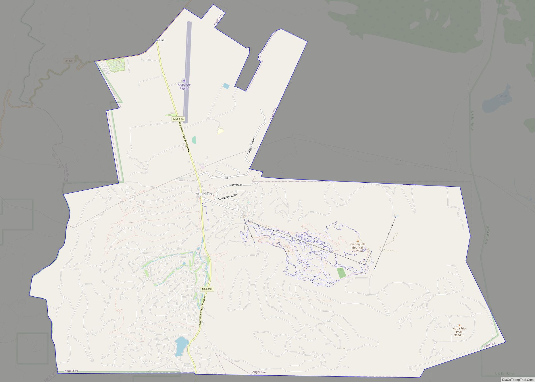
Angel Fire is a village in Colfax County, New Mexico, United States. The population was 1,216 at the 2010 census. It is a popular ski resort destination, with over 500 acres (2.0 km) of slopes. Angel Fire and nearby communities experience cold winter temperatures and mild temperatures in the summer.
To the north, off U.S. Route 64, is Vietnam Veterans Memorial State Park. Angel Fire is on the Enchanted Circle Scenic Byway.
| Name: | Angel Fire village |
|---|---|
| LSAD Code: | 47 |
| LSAD Description: | village (suffix) |
| State: | New Mexico |
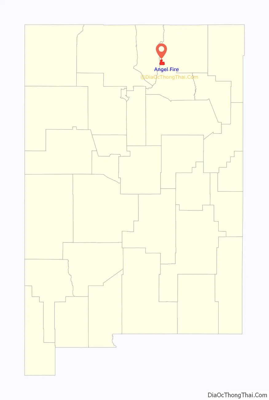
| County: | Colfax County |
| Incorporated: | 1986 |
| Elevation: | 8,406 ft (2,562 m) |
| Total Area: | 28.84 sq mi (74.71 km²) |
| Land Area: | 28.80 sq mi (74.61 km²) |
| Water Area: | 0.04 sq mi (0.10 km²) |
| Total Population: | 1,192 |
| Population Density: | 41.38/sq mi (15.98/km²) |
| ZIP code: | 87710 |
| Area code: | 575 |
| FIPS code: | 3503400 |
| GNISfeature ID: | 0901719 |
| Website: | www.afgov.com |
Online Interactive Map
Click on ![]() to view map in "full screen" mode.
to view map in "full screen" mode.
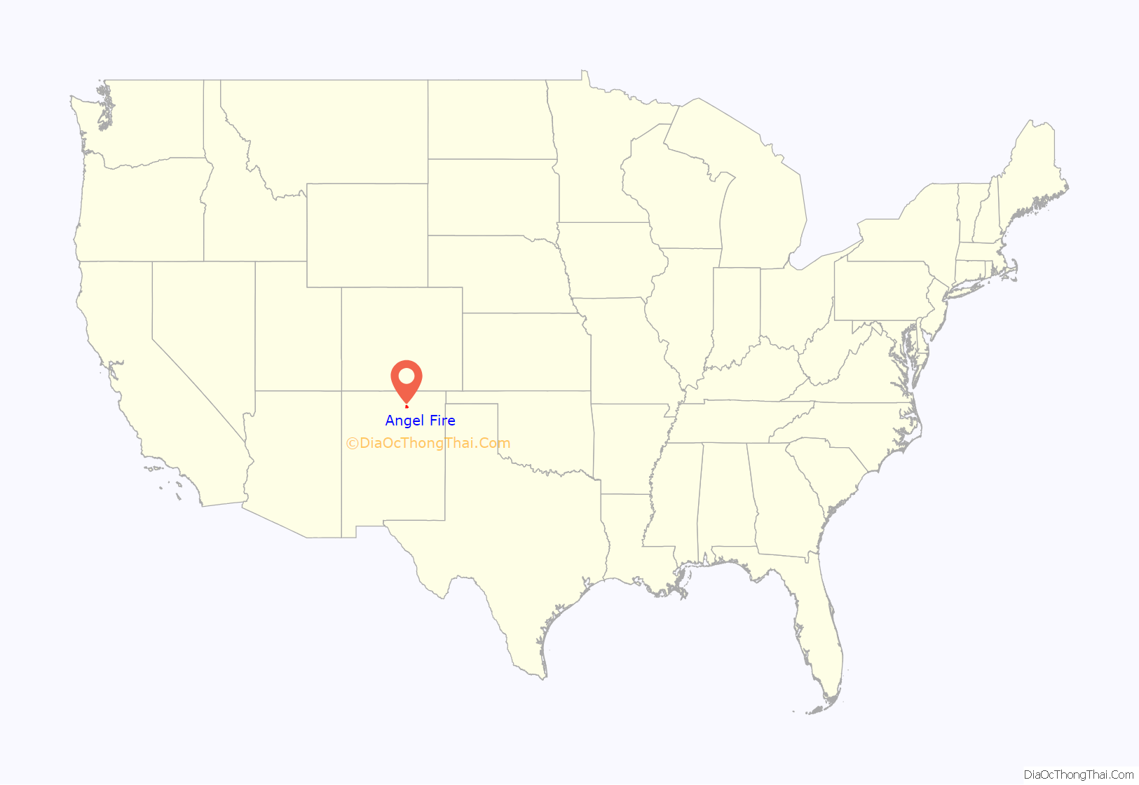
Angel Fire location map. Where is Angel Fire village?
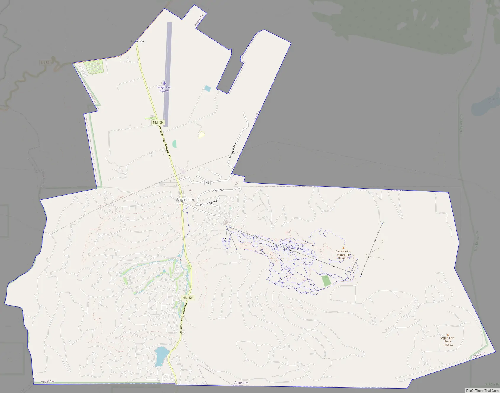
Angel Fire Road Map
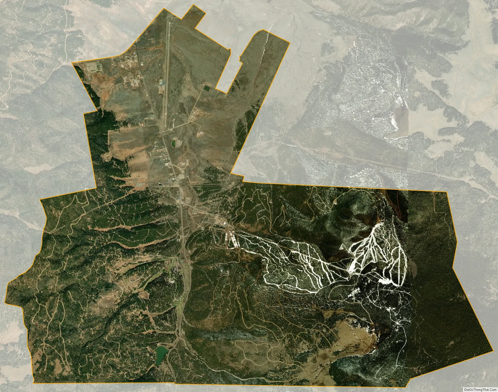
Angel Fire city Satellite Map
Geography
Angel Fire is located in southwestern Colfax County at 36°22′44″N 105°17′8″W / 36.37889°N 105.28556°W / 36.37889; -105.28556 (36.378808, -105.285658). The village center is in the valley of Cieneguilla Creek, with housing developments climbing mountain slopes to the east and west. Angel Fire Resort, entirely within the village limits, is on the east side of the valley, with a base elevation of 8,600 feet (2,600 m) and a summit elevation of 10,677 feet (3,254 m). Agua Fria Peak, with a summit elevation of 11,078 feet (3,377 m), rises to the southeast of the ski area; the summit is near the southeast corner of the village limits.
The village limits extend north as far as U.S. Route 64 at a point 10 miles (16 km) south of Eagle Nest. To the west, US 64 climbs over Palo Flechado Pass in the Sangre de Cristo Mountains and leads 21 miles (34 km) to Taos. New Mexico State Road 434 connects the center of Angel Fire with US 64 to the north and leads south 34 miles (55 km) from the village center to Mora.
According to the United States Census Bureau, the village of Angel Fire has a total area of 29.0 square miles (75.0 km), of which 28.9 square miles (74.9 km) is land and 0.04 square miles (0.1 km), or 0.14%, is water.
See also
Map of New Mexico State and its subdivision: Map of other states:- Alabama
- Alaska
- Arizona
- Arkansas
- California
- Colorado
- Connecticut
- Delaware
- District of Columbia
- Florida
- Georgia
- Hawaii
- Idaho
- Illinois
- Indiana
- Iowa
- Kansas
- Kentucky
- Louisiana
- Maine
- Maryland
- Massachusetts
- Michigan
- Minnesota
- Mississippi
- Missouri
- Montana
- Nebraska
- Nevada
- New Hampshire
- New Jersey
- New Mexico
- New York
- North Carolina
- North Dakota
- Ohio
- Oklahoma
- Oregon
- Pennsylvania
- Rhode Island
- South Carolina
- South Dakota
- Tennessee
- Texas
- Utah
- Vermont
- Virginia
- Washington
- West Virginia
- Wisconsin
- Wyoming