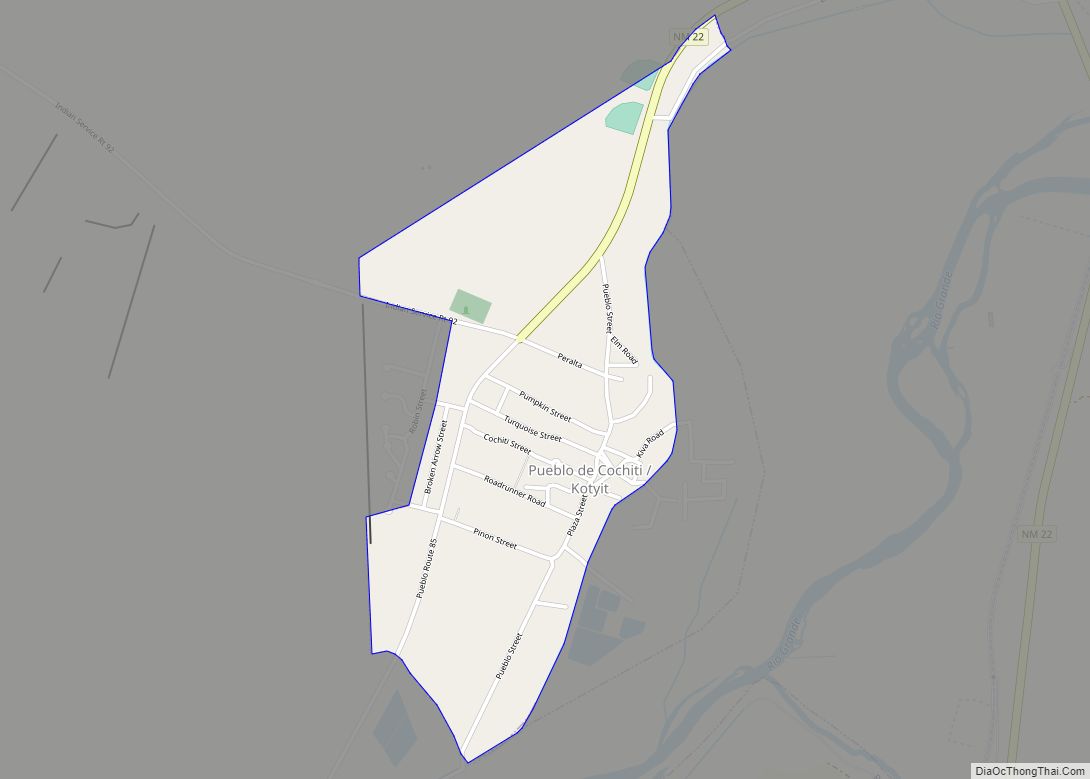
Cochiti (/ˈkoʊtʃəti/; Eastern Keresan: Kotyit [kʰocʰi̥tʰ]; Western Keresan K’úutìim’é [kʼúːtʰìːm̰é], Navajo: Tǫ́ʼgaaʼ /tʰṍʔkɑ̀ːʔ/) is a census-designated place (CDP) in Sandoval County, New Mexico, United States. A historic pueblo of the Cochiti people, one of the Keresan Nations, it is part of the Albuquerque Metropolitan Statistical Area. The population was 528 at the 2010 census. Located 22 miles (35 km) southwest of Santa Fe, the community is listed as a historic district on the National Register of Historic Places.
| Name: | Cochiti CDP |
|---|---|
| LSAD Code: | 57 |
| LSAD Description: | CDP (suffix) |
| State: | New Mexico |
| County: | Sandoval County |
| Elevation: | 5,276 ft (1,608 m) |
| Total Area: | 0.78 sq mi (2.02 km²) |
| Land Area: | 0.78 sq mi (2.02 km²) |
| Water Area: | 0.00 sq mi (0.00 km²) |
| Total Population: | 479 |
| Population Density: | 614.89/sq mi (237.41/km²) |
| ZIP code: | 87072 |
| Area code: | 505 |
| FIPS code: | 3516560 |
| GNISfeature ID: | 1867383 |
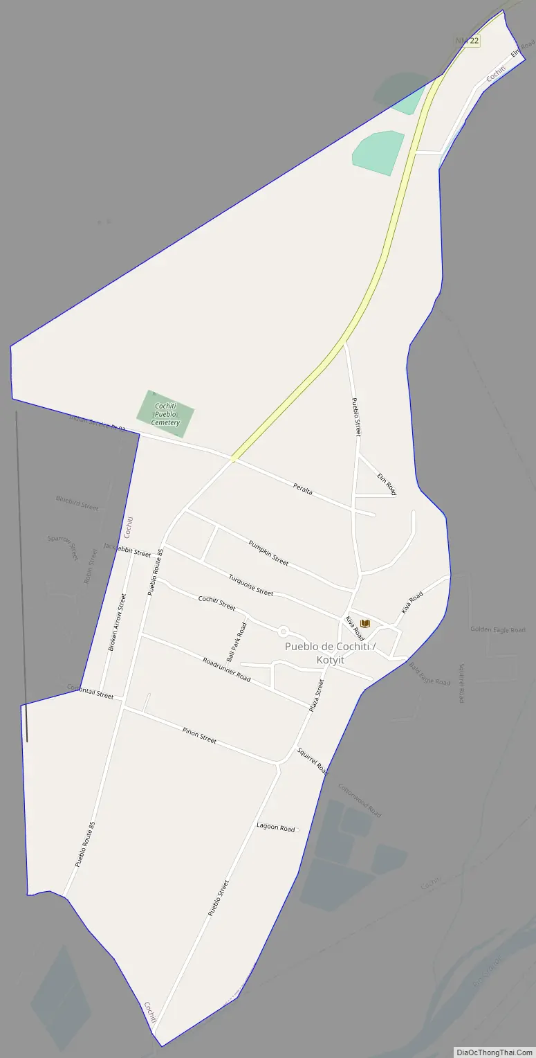
Online Interactive Map
Click on ![]() to view map in "full screen" mode.
to view map in "full screen" mode.
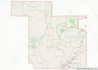
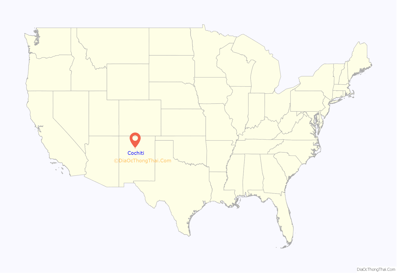
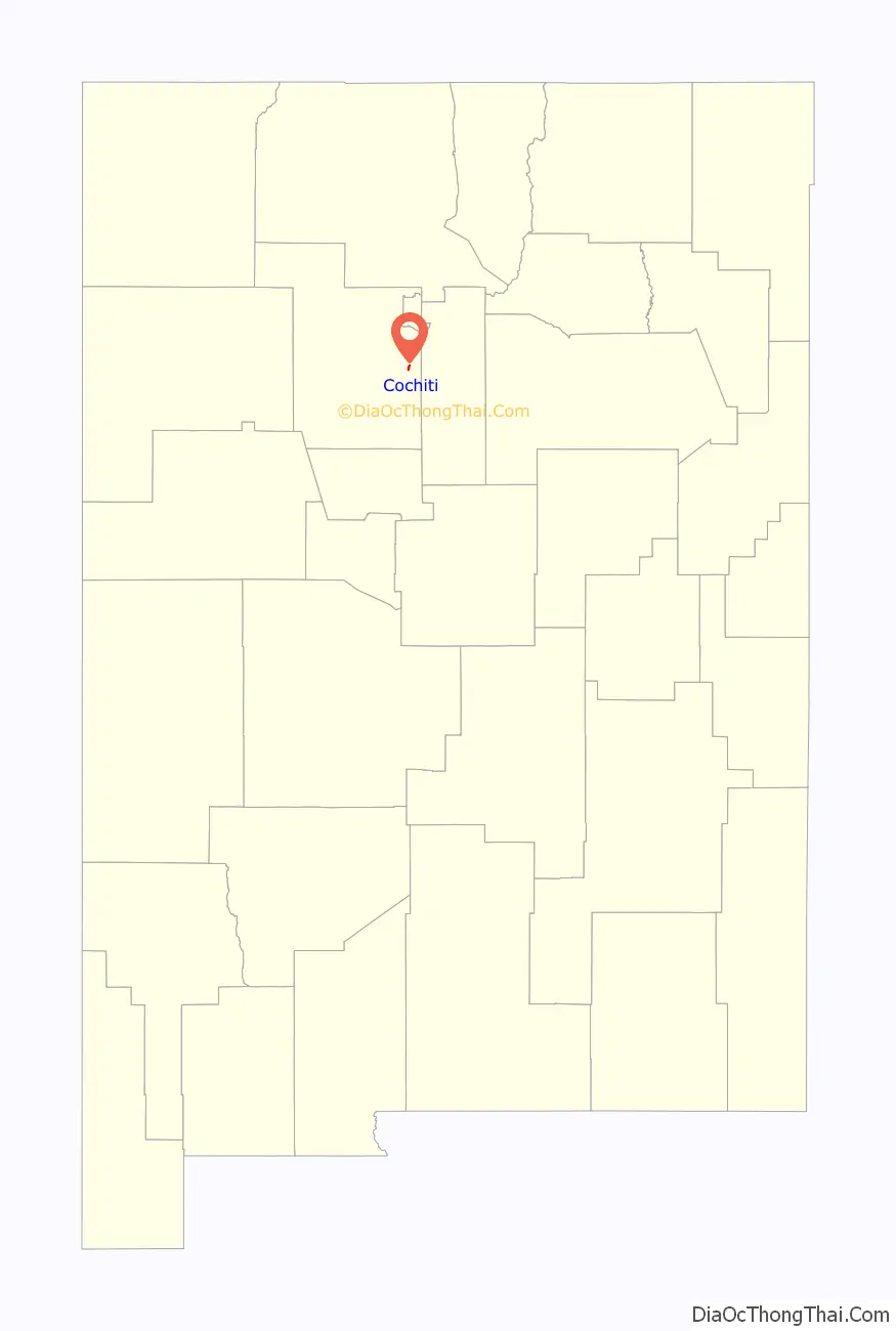
Cochiti location map. Where is Cochiti CDP?
History
The Cochiti people are thought to be descended from the Ancestral Puebloans (formerly known as the Anasazi). The ancestors of the Cochiti people, living in cliff dwellings at Rito de los Frijoles in present-day Bandelier National Monument, divided into two groups. One was located in the pueblo of Katishtya (later called San Felipe pueblo) in the south and the other was located in Potrero Viejo, one of the finger mesas of the Pajarito Plateau in northern central New Mexico. Approximately 12 miles northwest of the present-day Cochiti Pueblo, a temporary pueblo known as Hanut Cochiti had been established.
In 1598, Spanish conquistador, Juan de Oñate came to Cochiti Pueblo. At first, the Spaniards admired and respected the Pueblo Peoples for their Spanish-like farming techniques and villages, viewing them as equals, and opening trade. As time went on, the Spaniards attempted to assimilate Cochiti people (and other tribes) into New Spanish society. They were forced to pay taxes in crops, cotton, and work. The Spanish Catholic missionaries attacked their religion and renamed the Pueblos with Catholic saints’ names and began a program of church construction, such as the San Buenaventura Mission at Cochiti, routinely torturing the tribes for practicing their traditional religion, and forcing the them into labor and/or slavery.
The Cochiti pueblo people took part in the Pueblo Revolt of 1680, an uprising of the Native Americans against the Spaniards. When Spanish Governor Antonio de Otermin reconquered New Mexico, the tribe retreated with the other Keresan tribes of San Felipe and Santo Domingo (now called Kewa) to the Potrero Viejo. The Cochiti people remained at Potrero Viejo until 1693 when they were forced to flee Spanish Governor Don Diego de Vargas and his troops.
Cochiti Road Map
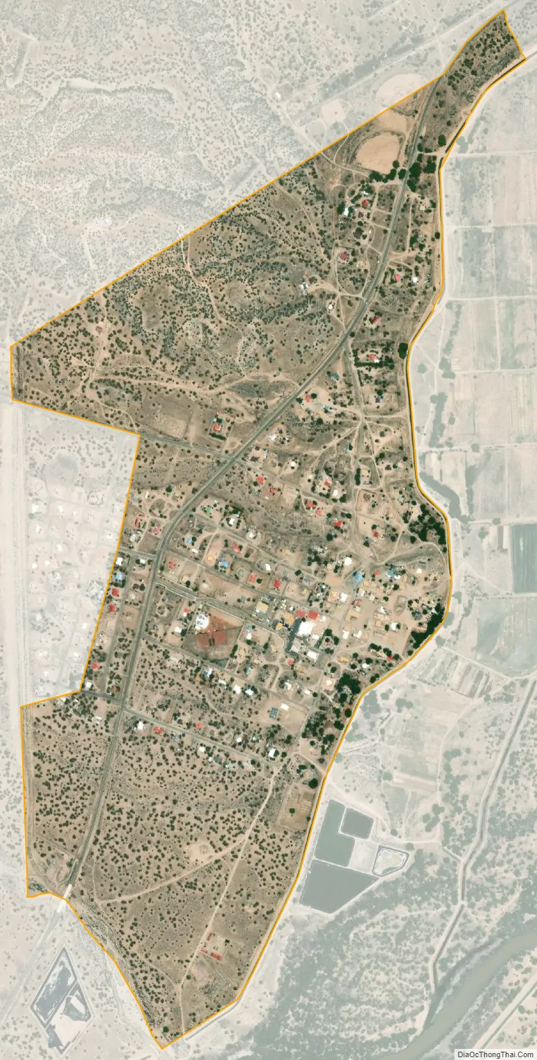
Cochiti city Satellite Map
Geography
According to the United States Census Bureau, the CDP has a total area of 1.2 square miles (3.1 km), all land.
See also
Map of New Mexico State and its subdivision: Map of other states:- Alabama
- Alaska
- Arizona
- Arkansas
- California
- Colorado
- Connecticut
- Delaware
- District of Columbia
- Florida
- Georgia
- Hawaii
- Idaho
- Illinois
- Indiana
- Iowa
- Kansas
- Kentucky
- Louisiana
- Maine
- Maryland
- Massachusetts
- Michigan
- Minnesota
- Mississippi
- Missouri
- Montana
- Nebraska
- Nevada
- New Hampshire
- New Jersey
- New Mexico
- New York
- North Carolina
- North Dakota
- Ohio
- Oklahoma
- Oregon
- Pennsylvania
- Rhode Island
- South Carolina
- South Dakota
- Tennessee
- Texas
- Utah
- Vermont
- Virginia
- Washington
- West Virginia
- Wisconsin
- Wyoming