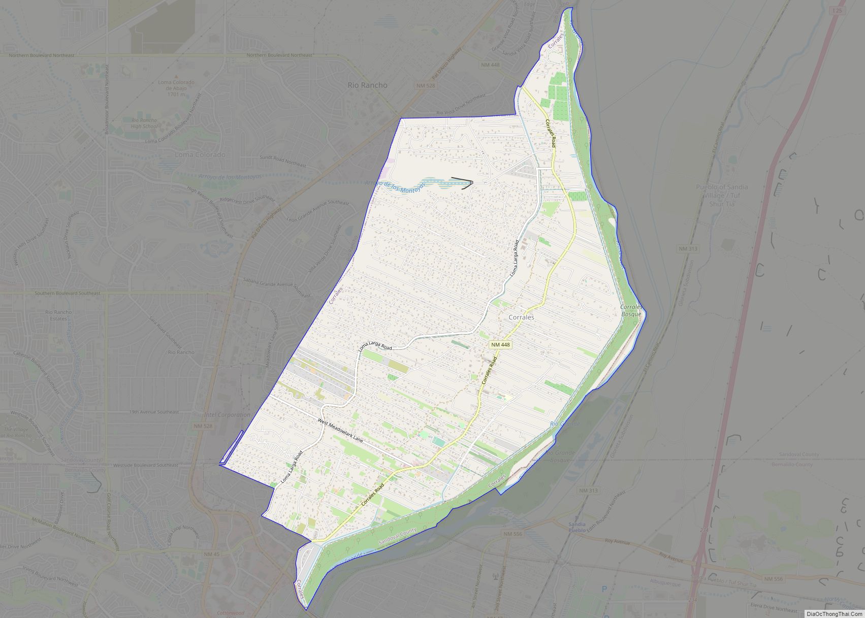
Corrales is a village in southern Sandoval County, New Mexico, United States. First farmed by Tiquex Pueblo people, chosen due to its proximity to the Rio Grande, as documented by Hispano farmers of Nuevo México in the late 1500s. Despite being a part of the Albuquerque metropolitan area, the village maintains its rural character, while also being surrounded by the cities of Albuquerque and Rio Rancho. The population of Corrales was 8,329 at the 2010 Census.
The Rio Grande Bosque on the eastern edge of the village provides refuge for native animals and plants, and ancient Pueblo and Hispano acequias continue to be maintained by the United States Department of Agriculture’s Natural Resources Conservation Service and the Middle Rio Grande Conservancy District.
| Name: | Corrales village |
|---|---|
| LSAD Code: | 47 |
| LSAD Description: | village (suffix) |
| State: | New Mexico |
| County: | Sandoval County |
| Elevation: | 5,036 ft (1,535 m) |
| Total Area: | 10.95 sq mi (28.37 km²) |
| Land Area: | 10.79 sq mi (27.94 km²) |
| Water Area: | 0.16 sq mi (0.43 km²) |
| Total Population: | 8,493 |
| Population Density: | 787.19/sq mi (303.93/km²) |
| ZIP code: | 87048 |
| Area code: | 505 |
| FIPS code: | 3517960 |
| GNISfeature ID: | 2413544 |
| Website: | corrales-nm.org |
Online Interactive Map
Click on ![]() to view map in "full screen" mode.
to view map in "full screen" mode.
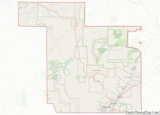
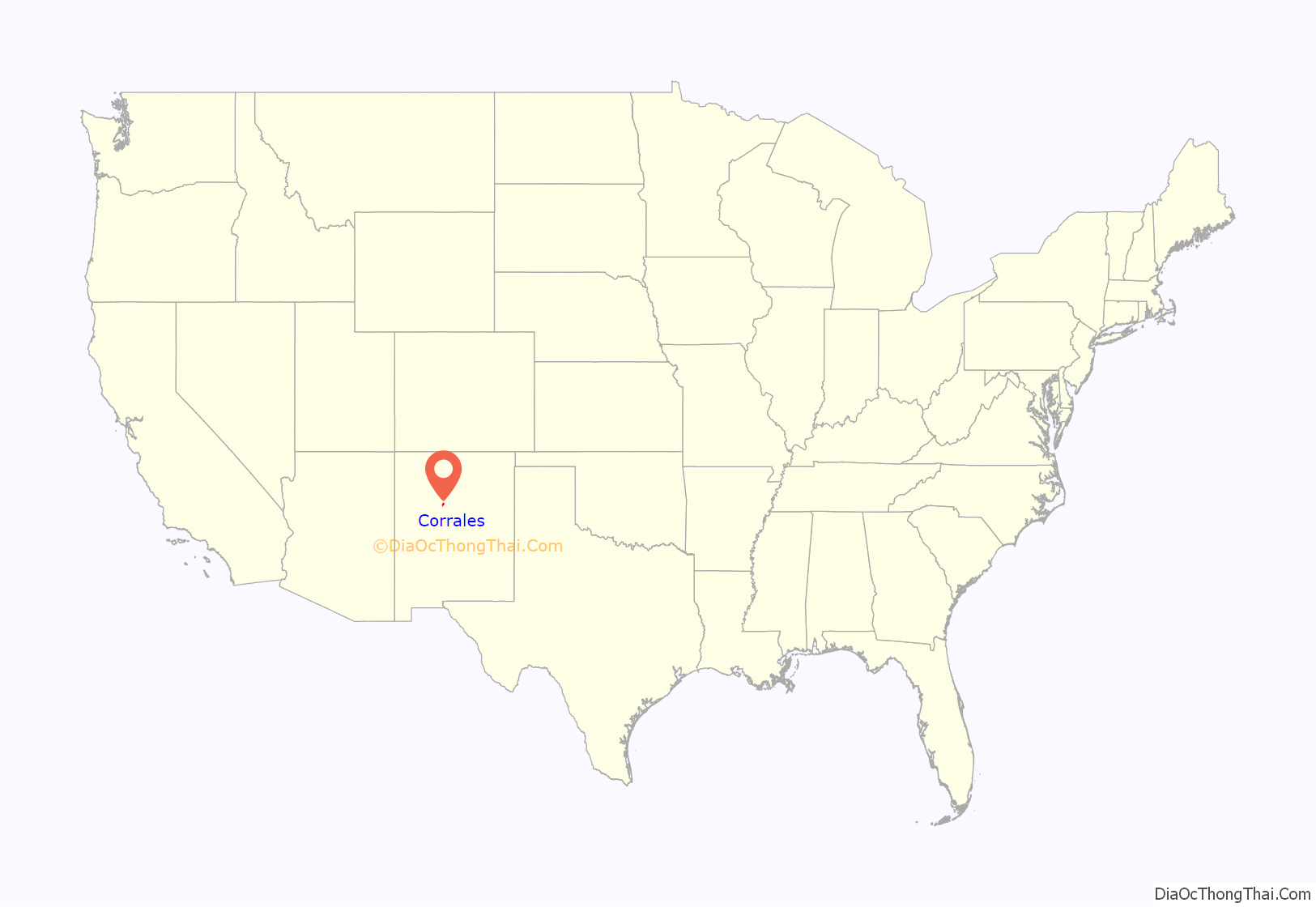
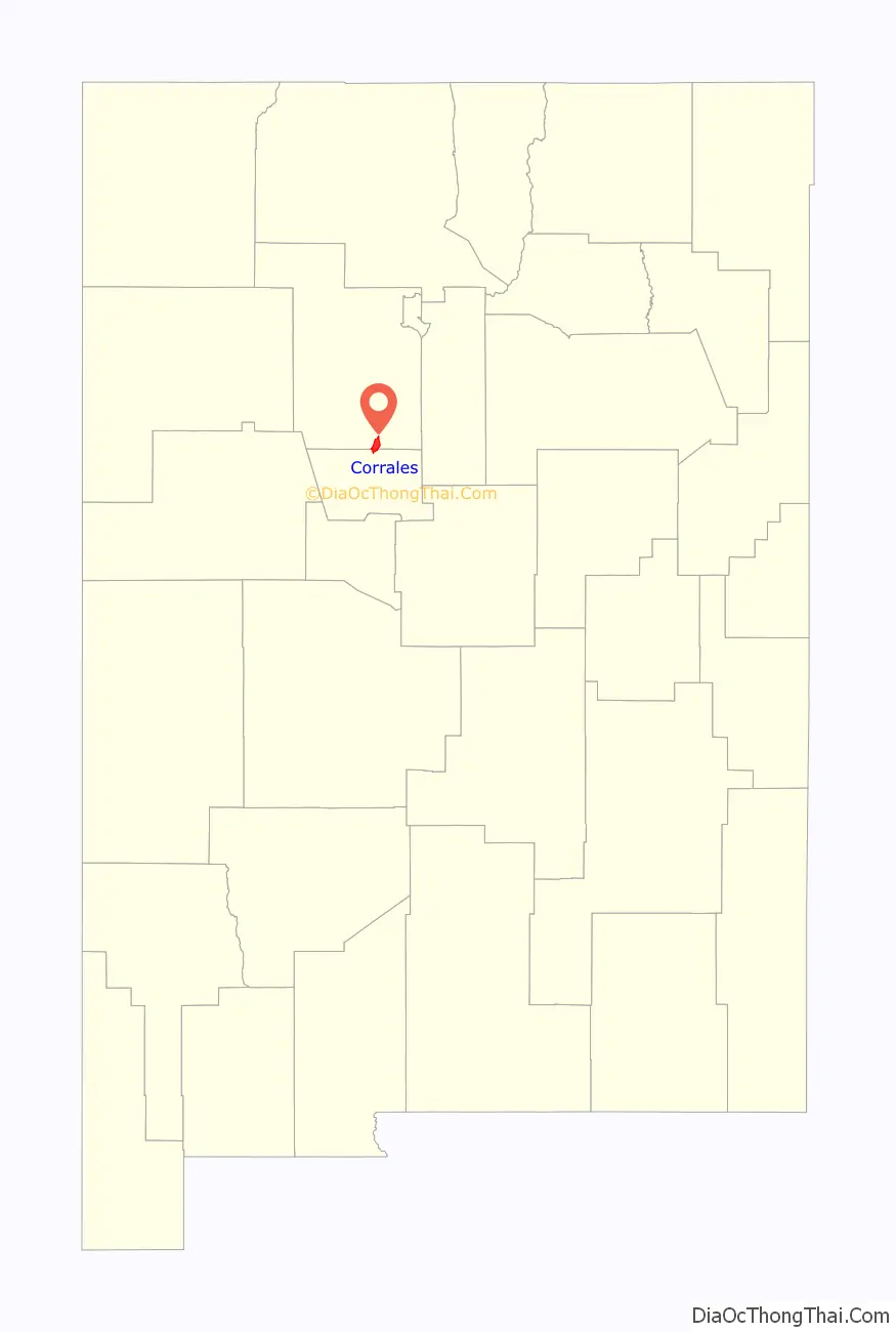
Corrales location map. Where is Corrales village?
History
The village of Corrales (Spanish for “corrals”) is located along the Rio Grande and is built on the site of two Indian Pueblos settled before AD 500 by the Tiguex Indians, and which were later occupied by Spanish Colonists and explorers who colonized the region around 1540. The Spanish Colonists subsequently built an adobe church on the site called the Church of San Ysidro in 1868, named after the annual fiesta de San Ysidro in May.
In 1710, a grant of the Alameda lands (including Corrales) was given to Corporal Francisco Montes Vigil, A soldier in the Spanish army. Vigil sold it in 1712 to Captain Juan Gonzáles Bas who was then living in Bernalillo. Gonzáles subsequently sold the land comprising the Village of Corrales in 1718 to Salvador Martinez. Over time, the land comprising the Village of Corrales was parceled off and sold for agricultural development and livestock ranching. The current Village of Corrales government was incorporated and chartered in 1971.
The village was selected as #19 in CNN Money’s list of the 100 best places to live in 2007.
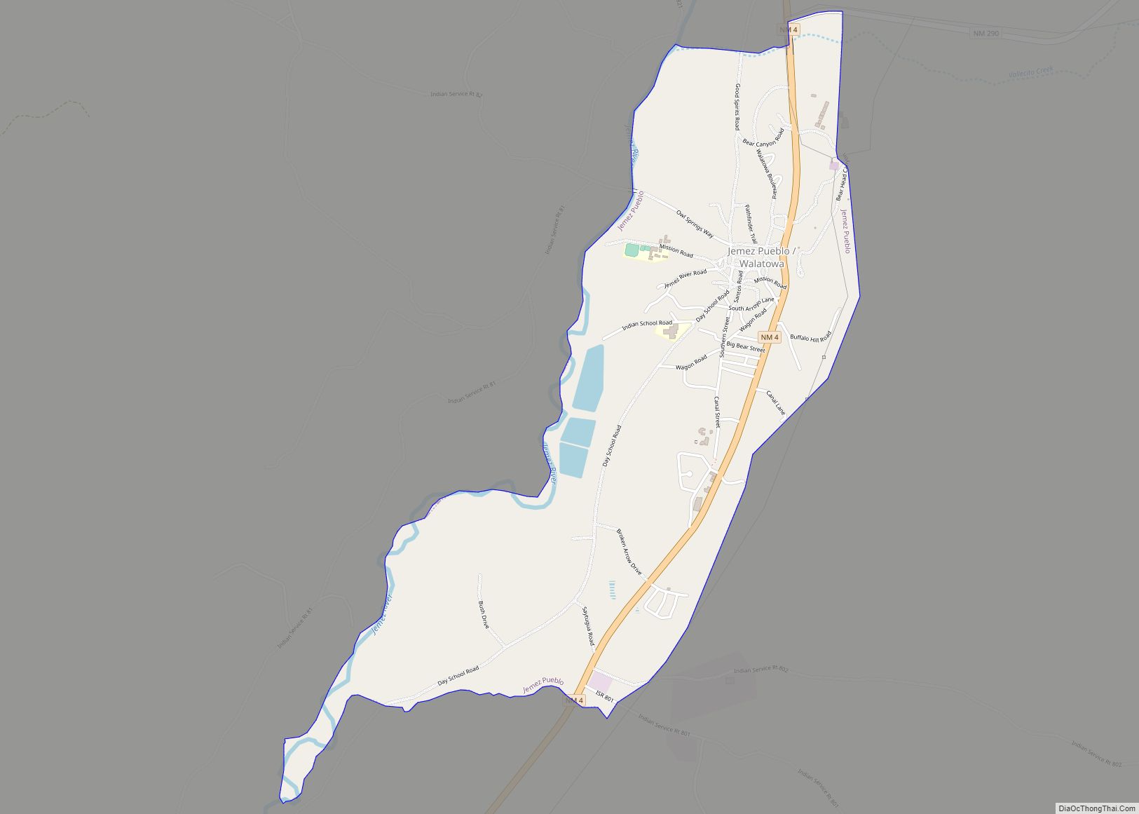
Corrales Road Map
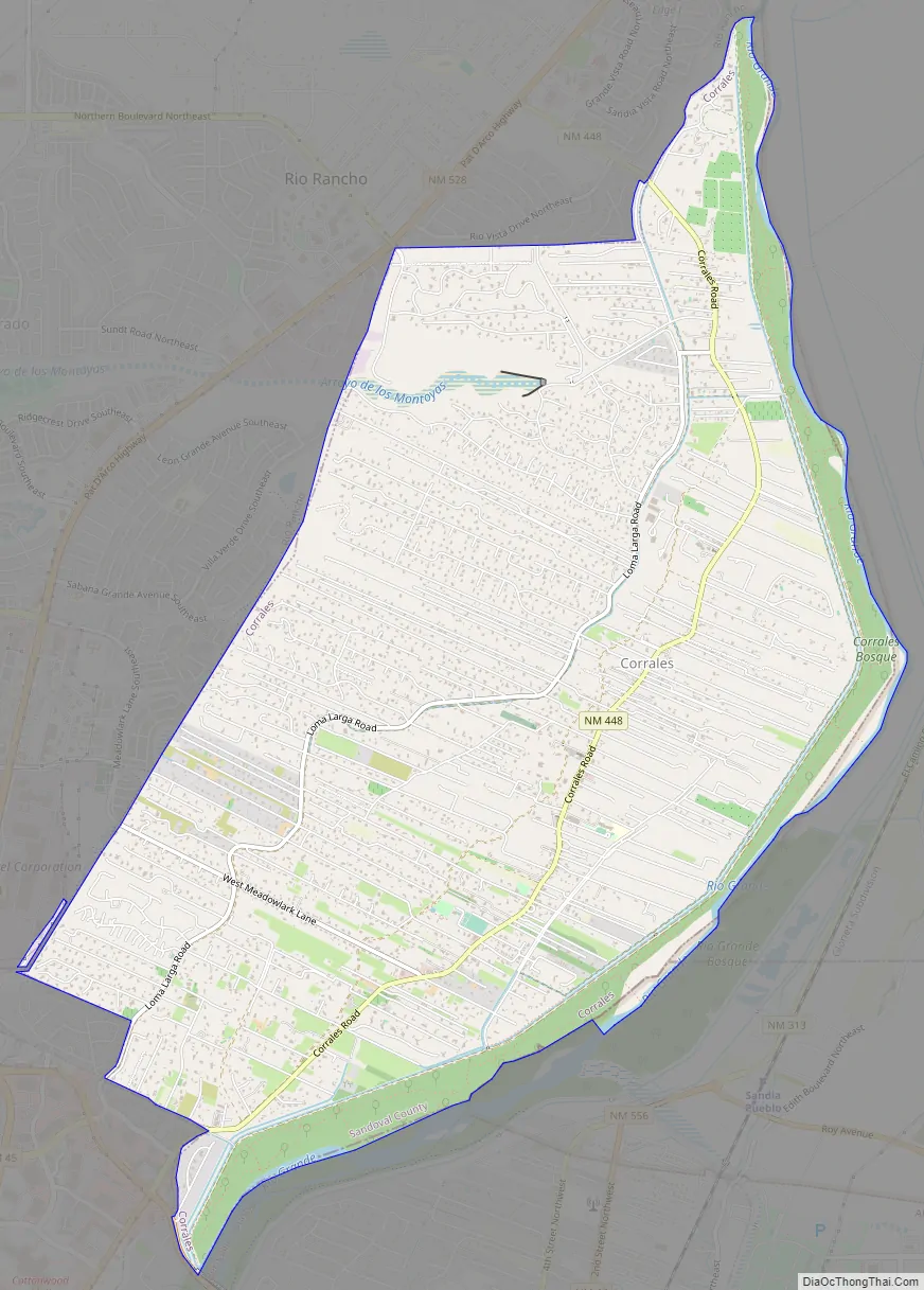
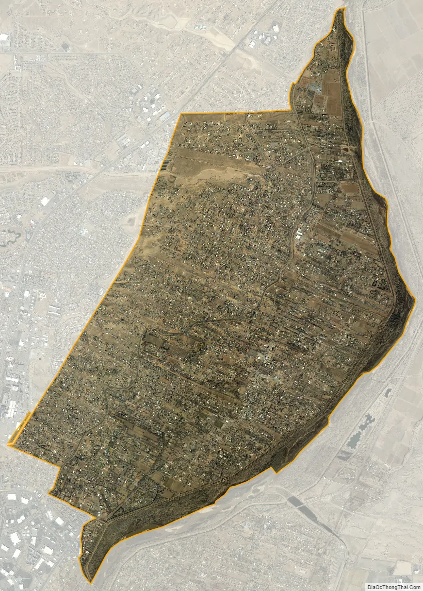
Corrales city Satellite Map
Geography
Corrales is located at 35°14′5″N 106°37′5″W / 35.23472°N 106.61806°W / 35.23472; -106.61806 (35.234838, −106.618183).
According to the United States Census Bureau, the village has a total area of 11.2 square miles (29 km), of which 10.7 square miles (28 km) is land and 0.5 square miles (1.3 km) (4.71%) is water.
Until 2005, portions of the Village of Corrales were located in both Bernalillo and Sandoval counties. In 2005, a special election annexed the portion of Corrales located in Bernalillo County to Sandoval County, so that now the entire village is located in Sandoval County.
Climate
See also
Map of New Mexico State and its subdivision: Map of other states:- Alabama
- Alaska
- Arizona
- Arkansas
- California
- Colorado
- Connecticut
- Delaware
- District of Columbia
- Florida
- Georgia
- Hawaii
- Idaho
- Illinois
- Indiana
- Iowa
- Kansas
- Kentucky
- Louisiana
- Maine
- Maryland
- Massachusetts
- Michigan
- Minnesota
- Mississippi
- Missouri
- Montana
- Nebraska
- Nevada
- New Hampshire
- New Jersey
- New Mexico
- New York
- North Carolina
- North Dakota
- Ohio
- Oklahoma
- Oregon
- Pennsylvania
- Rhode Island
- South Carolina
- South Dakota
- Tennessee
- Texas
- Utah
- Vermont
- Virginia
- Washington
- West Virginia
- Wisconsin
- Wyoming