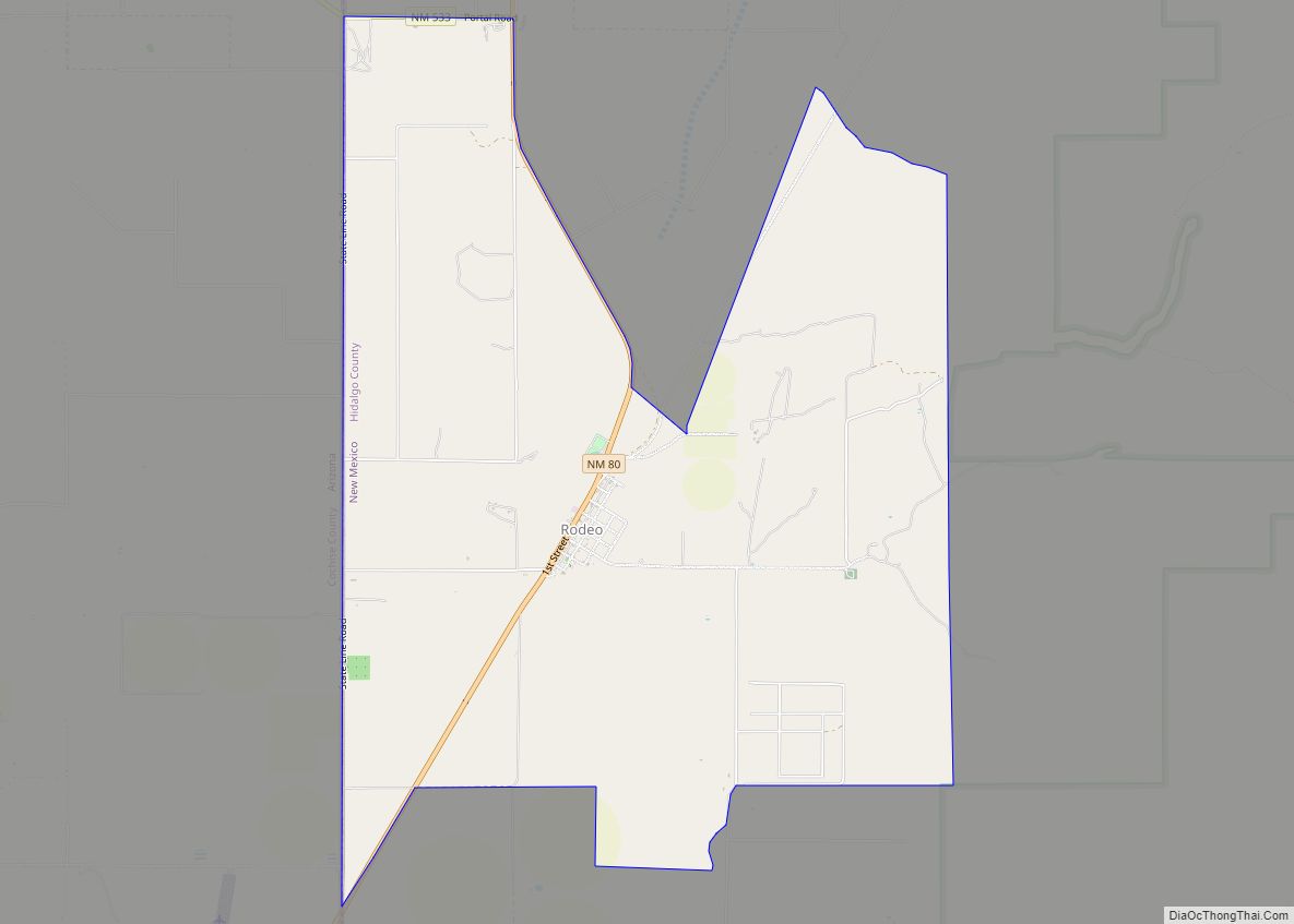
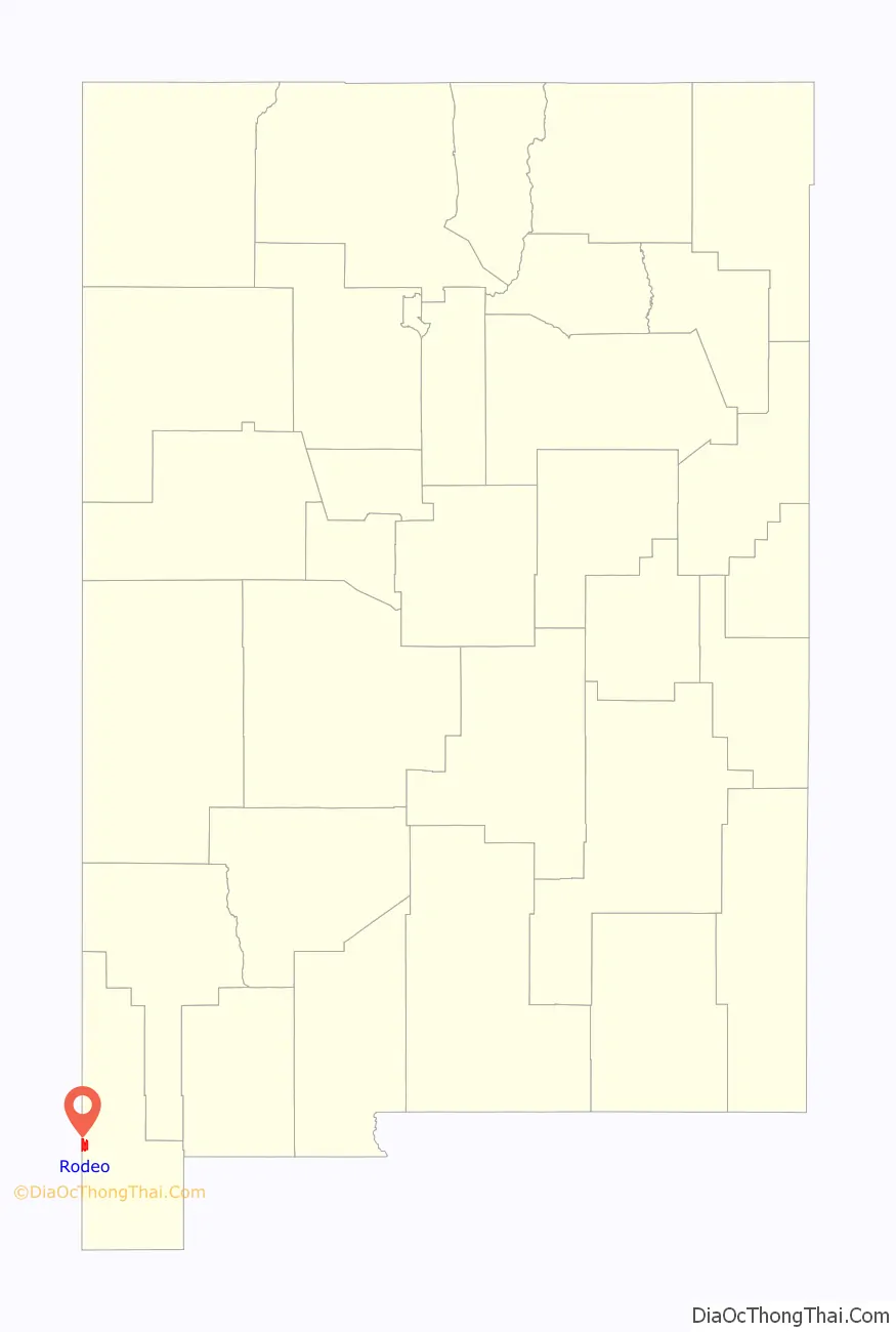
Rodeo is a census-designated place (CDP) in Hidalgo County, New Mexico, United States, at 31°50′13″N 109°01′54″W / 31.83694°N 109.03167°W / 31.83694; -109.03167. It lies less than one mile (1.6 km) from the border with Arizona on New Mexico State Road 80. As of the 2010 census, the population of Rodeo was 101.
| Name: | Rodeo CDP |
|---|---|
| LSAD Code: | 57 |
| LSAD Description: | CDP (suffix) |
| State: | New Mexico |
| County: | Hidalgo County |
| Elevation: | 4,124 ft (1,257 m) |
| Total Area: | 8.19 sq mi (21.22 km²) |
| Land Area: | 8.19 sq mi (21.22 km²) |
| Water Area: | 0.00 sq mi (0.00 km²) |
| Total Population: | 108 |
| Population Density: | 13.18/sq mi (5.09/km²) |
| ZIP code: | 88056 |
| Area code: | 575 |
| FIPS code: | 3564370 |
| GNISfeature ID: | 0894117 |
| Website: | www.hidalgocounty.org |
Online Interactive Map
Click on ![]() to view map in "full screen" mode.
to view map in "full screen" mode.
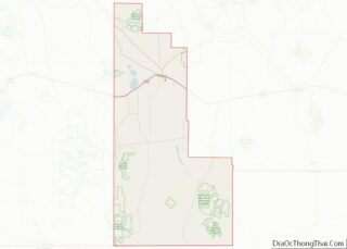
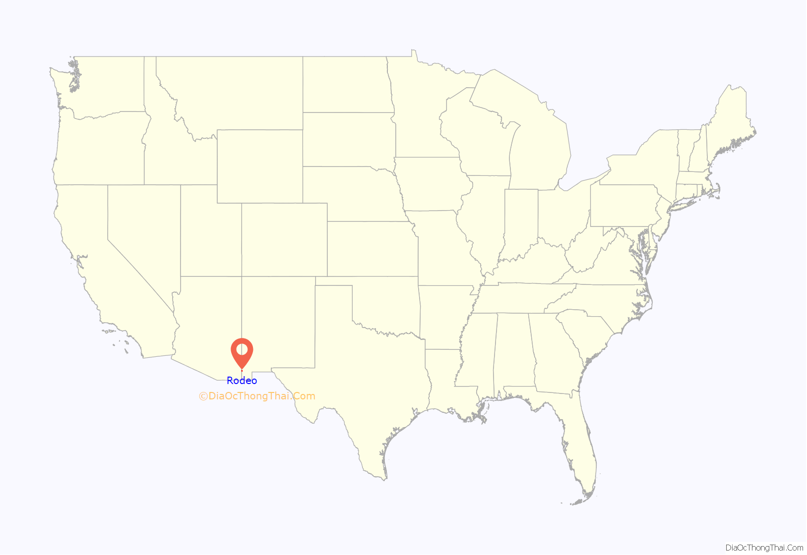
Rodeo location map. Where is Rodeo CDP?
History
Founded in 1902 as a rail stop on the El Paso and Southwestern Railroad line running from Bisbee, Arizona to El Paso, Texas, it became the center for cattle shipping in the San Simon Valley. Two views exist as to the source of Rodeo’s name. One suggests it derives from the Spanish word rodeo, meaning “roundup” or “enclosure”, in reference to cattle shipping. However, the noun rodeo is derived from the Spanish verb rodear meaning “to surround” or “to go around”. The El Paso and Southwestern railroad runs east across the southern part of the state and after passing through Antelope Pass turns south to Rodeo continuing to Douglas, Arizona, and then north to Bisbee, going around the Chiricahua Mountains.
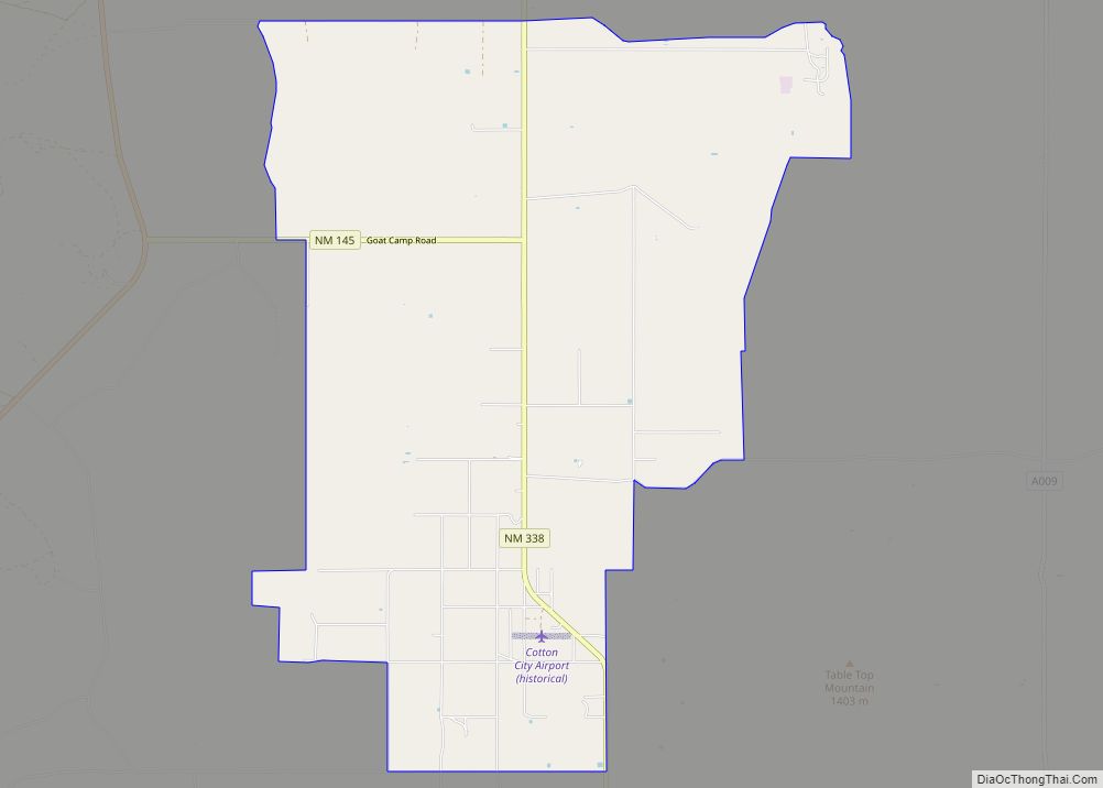
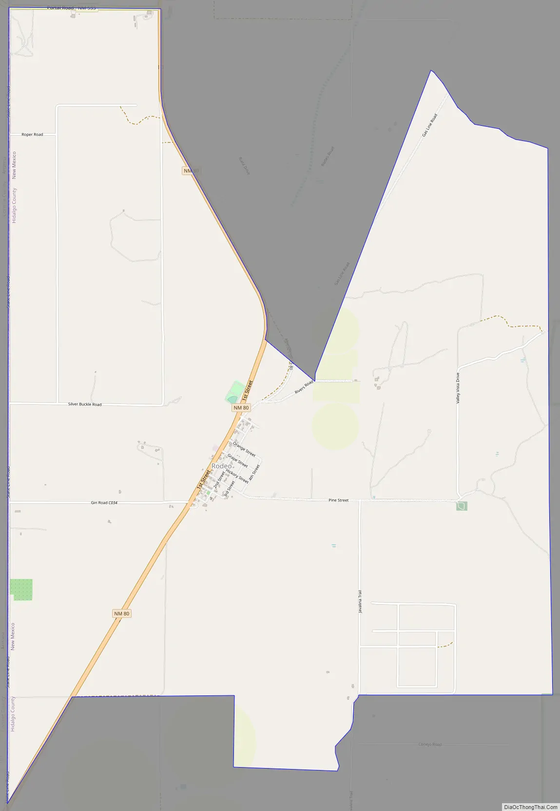
Rodeo Road Map
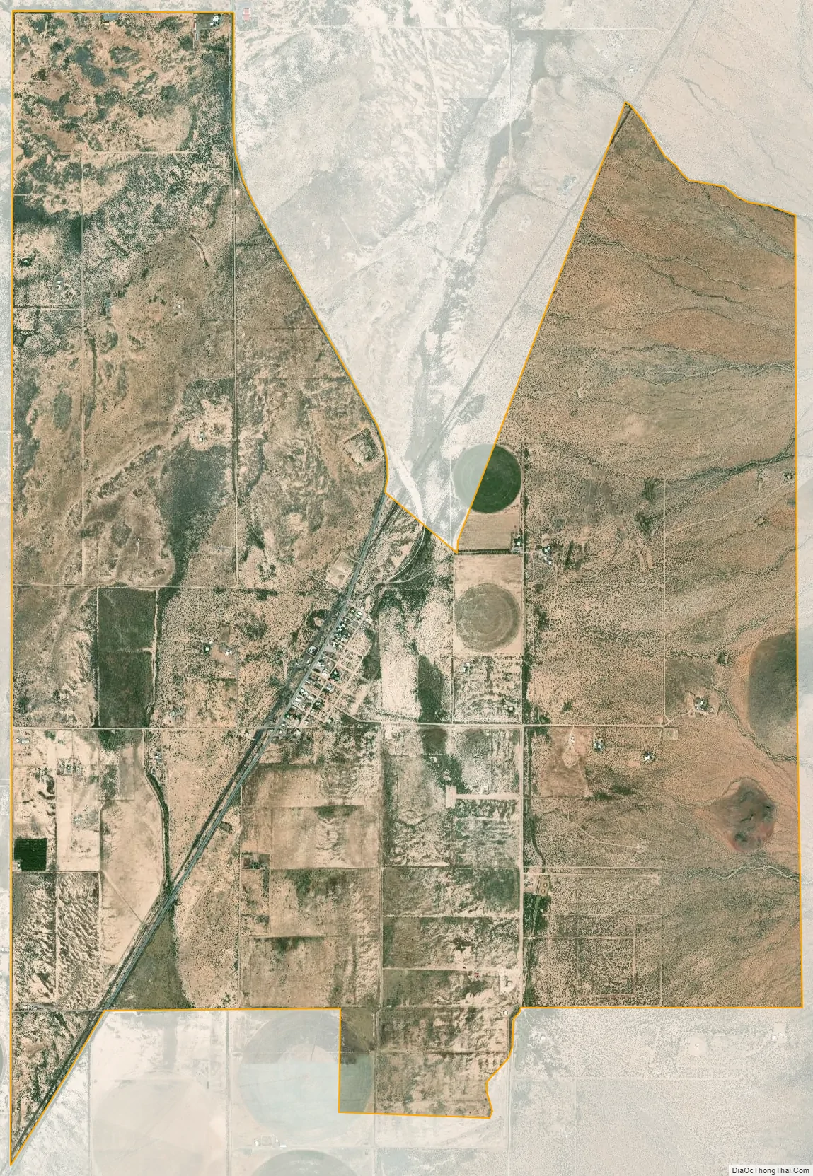
Rodeo city Satellite Map
Geography
Rodeo is in western Hidalgo County, bordering the state of Arizona. New Mexico Highway 80 leads north 30 miles (48 km) to Interstate 10 at Road Forks and southwest 2 miles (3 km) to the state line, continuing as Arizona State Route 80 southwest another 48 miles (77 km) to Douglas, Arizona. Lordsburg, the Hidalgo County seat, is 47 miles (76 km) to the northeast via Highway 80 and I-10.
According to the U.S. Census Bureau, the Rodeo CDP has an area of 8.2 square miles (21.2 km), all land.
See also
Map of New Mexico State and its subdivision: Map of other states:- Alabama
- Alaska
- Arizona
- Arkansas
- California
- Colorado
- Connecticut
- Delaware
- District of Columbia
- Florida
- Georgia
- Hawaii
- Idaho
- Illinois
- Indiana
- Iowa
- Kansas
- Kentucky
- Louisiana
- Maine
- Maryland
- Massachusetts
- Michigan
- Minnesota
- Mississippi
- Missouri
- Montana
- Nebraska
- Nevada
- New Hampshire
- New Jersey
- New Mexico
- New York
- North Carolina
- North Dakota
- Ohio
- Oklahoma
- Oregon
- Pennsylvania
- Rhode Island
- South Carolina
- South Dakota
- Tennessee
- Texas
- Utah
- Vermont
- Virginia
- Washington
- West Virginia
- Wisconsin
- Wyoming