Buffalo is a town and county seat of Harper County, Oklahoma, United States. The population was 1,299 at the 2010 census. It was named after the Buffalo Creek valley, in which it is located.
| Name: | Buffalo town |
|---|---|
| LSAD Code: | 43 |
| LSAD Description: | town (suffix) |
| State: | Oklahoma |
| County: | Harper County |
| Elevation: | 1,818 ft (554 m) |
| Total Area: | 1.11 sq mi (2.88 km²) |
| Land Area: | 1.11 sq mi (2.88 km²) |
| Water Area: | 0.00 sq mi (0.00 km²) |
| Total Population: | 1,039 |
| Population Density: | 933.51/sq mi (360.37/km²) |
| ZIP code: | 73834 |
| Area code: | 580 |
| FIPS code: | 4009850 |
| Website: | buffalooklahoma.org |
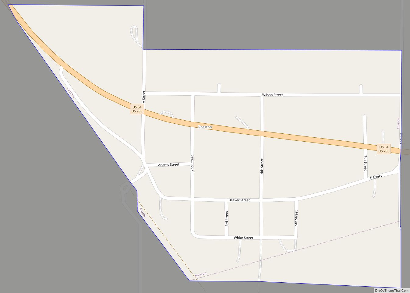
Online Interactive Map
Click on ![]() to view map in "full screen" mode.
to view map in "full screen" mode.
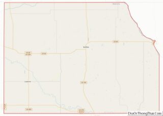
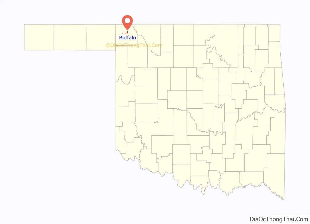
Buffalo location map. Where is Buffalo town?

History
In 1907, the town was “staked out” and a post office was established with the name Buffalo, which was derived from nearby Buffalo Creek. In 1908, a county seat election gave the seat to Buffalo and the town was incorporated in the same year. Buffalo’s founders issued instructions for all buildings to be built of stone, thereby many of those structures survived the test of time.
When citizens of Harper County decided to link their county seat with the railroads, they created the Buffalo and Northwestern Railroad, which arrived in Buffalo in May of 1920. However, that trackage was abandoned in 1982, and Buffalo currently has no rail service.
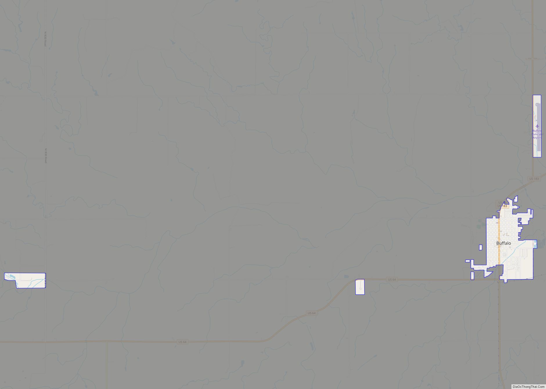
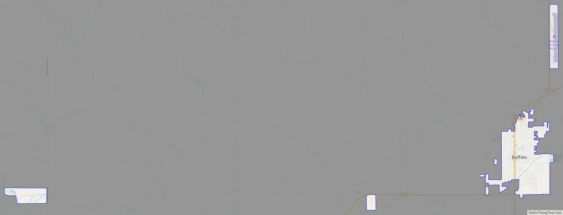
Buffalo Road Map
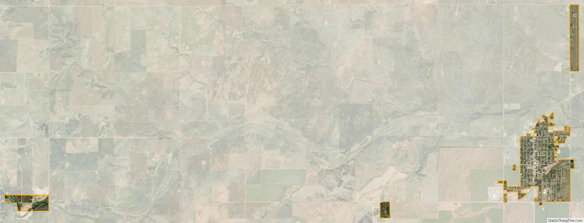
Buffalo city Satellite Map
Geography
According to the United States Census Bureau, Buffalo has a total area of 0.8 square miles (2.1 km), all land. The city lies in the northwestern corner of Oklahoma at the Panhandle’s eastern entrance, along U.S. routes 64/183, 12 miles (19 km) south of the Kansas state line. It is 30 miles (48 km) northeast of the Texas state line and 174 miles (280 km) northwest of Oklahoma City.
Doby Springs Park and Campgrounds, located about 11 miles west, includes a fishing lake, camping sites, a playground, and nature trails along rolling canyons. The complex also has a PGA-rated 9-hole golf course.
Climate
While not the snowiest location in Oklahoma ranked by highest annual average snowfall, Buffalo has the distinction of holding the State snowfall record over 24 hours, being 23” which fell February 21, 1971.
See also
Map of Oklahoma State and its subdivision:- Adair
- Alfalfa
- Atoka
- Beaver
- Beckham
- Blaine
- Bryan
- Caddo
- Canadian
- Carter
- Cherokee
- Choctaw
- Cimarron
- Cleveland
- Coal
- Comanche
- Cotton
- Craig
- Creek
- Custer
- Delaware
- Dewey
- Ellis
- Garfield
- Garvin
- Grady
- Grant
- Greer
- Harmon
- Harper
- Haskell
- Hughes
- Jackson
- Jefferson
- Johnston
- Kay
- Kingfisher
- Kiowa
- Latimer
- Le Flore
- Lincoln
- Logan
- Love
- Major
- Marshall
- Mayes
- McClain
- McCurtain
- McIntosh
- Murray
- Muskogee
- Noble
- Nowata
- Okfuskee
- Oklahoma
- Okmulgee
- Osage
- Ottawa
- Pawnee
- Payne
- Pittsburg
- Pontotoc
- Pottawatomie
- Pushmataha
- Roger Mills
- Rogers
- Seminole
- Sequoyah
- Stephens
- Texas
- Tillman
- Tulsa
- Wagoner
- Washington
- Washita
- Woods
- Woodward
- Alabama
- Alaska
- Arizona
- Arkansas
- California
- Colorado
- Connecticut
- Delaware
- District of Columbia
- Florida
- Georgia
- Hawaii
- Idaho
- Illinois
- Indiana
- Iowa
- Kansas
- Kentucky
- Louisiana
- Maine
- Maryland
- Massachusetts
- Michigan
- Minnesota
- Mississippi
- Missouri
- Montana
- Nebraska
- Nevada
- New Hampshire
- New Jersey
- New Mexico
- New York
- North Carolina
- North Dakota
- Ohio
- Oklahoma
- Oregon
- Pennsylvania
- Rhode Island
- South Carolina
- South Dakota
- Tennessee
- Texas
- Utah
- Vermont
- Virginia
- Washington
- West Virginia
- Wisconsin
- Wyoming