Chelsea is a town in Rogers County, Oklahoma, United States. The population was 1,964 at the 2010 census, a decline of 8.3 percent from the figure of 2,136 recorded in 2000. Chelsea was named after the area in London, England, by Charles Peach, a railroad official who was a native of London. The town was the site of the Chelsea-Alluwe Oil Field, which produced a significant amount of oil from circa 1910 until the early 1920s, before it played out.
| Name: | Chelsea town |
|---|---|
| LSAD Code: | 43 |
| LSAD Description: | town (suffix) |
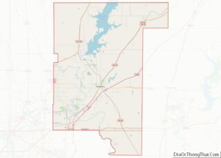
| State: | Oklahoma |
| County: | Rogers County |
| Elevation: | 722 ft (220 m) |
| Total Area: | 1.78 sq mi (4.60 km²) |
| Land Area: | 1.78 sq mi (4.60 km²) |
| Water Area: | 0.00 sq mi (0.00 km²) |
| Total Population: | 1,991 |
| Population Density: | 1,120.43/sq mi (432.52/km²) |
| ZIP code: | 74016 |
| Area code: | 539/918 |
| FIPS code: | 4013700 |
| GNISfeature ID: | 1091232 |
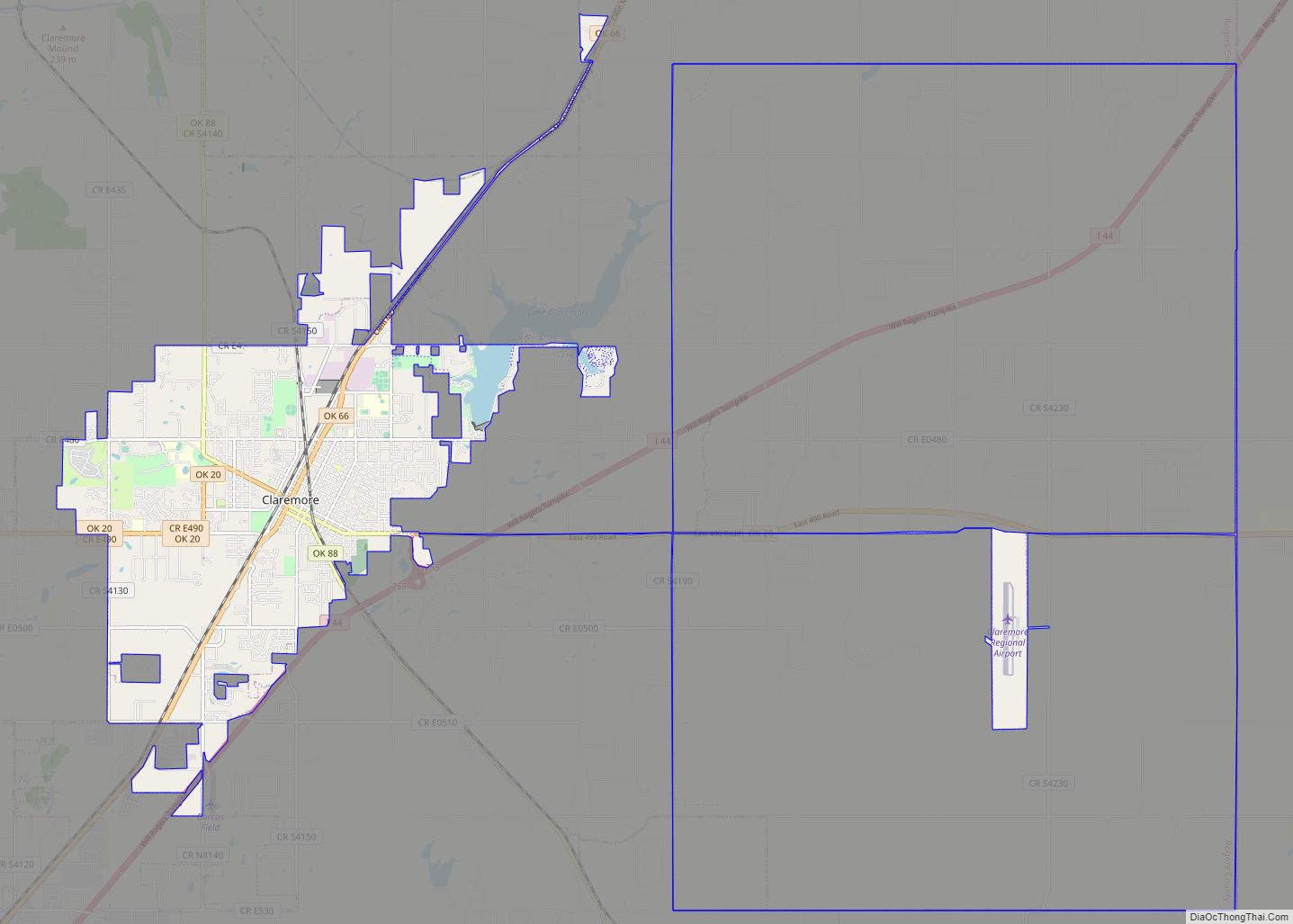
Online Interactive Map
Click on ![]() to view map in "full screen" mode.
to view map in "full screen" mode.
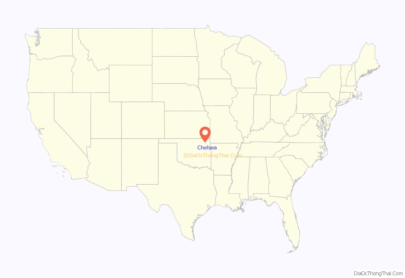
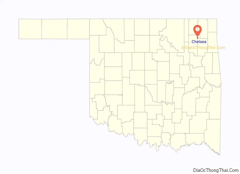
Chelsea location map. Where is Chelsea town?
History
In 1881, Chelsea began as a stop on the Atlantic and Pacific Railroad. A post office was established in November 1882. The community incorporated as a town in the Cherokee Nation, Indian Territory, in 1889. The town was surveyed and platted in 1902. The Bank of Chelsea, the first state bank in Indian Territory, began operation in March 1896.
The town economy has historically rested on farming, ranching and oil production. Important farm products were oats, corn, wheat and pecans. A flour mill built circa 1892 was one of Chelsea’s original industries. Chelsea became noted as a shipping point for cattle and hay before statehood in 1907. The Chelsea-Alluwe oil field was discovered southwest of Chelsea in 1889 by the United States Oil and Gas Company.
According to the American Oil & Gas Historical Society, Edward Byrd, whose wife was a Cherokee woman, discovered oil seeps in 1882 southwest Chelsea, which was then part of the Cherokee Nation in Indian Territory. He apparently took no action to exploit his discovery until 1887, when he and William B. Linn, a Pennsylvanian, and a group of investors from Kansas organized the United States Oil and Gas Company (USOGC). The company subsequently leased drilling rights from the Cherokee Nation on 100,000 acres (400 km) of land lying west of Chelsea between the St. Louis and San Francisco Railroad and the Verdigris River. USOGC completed its first well in 1890, on Spencer Creek. It was a rudimentary operation, compared to productive sites completed a few years later. The well began producing a half barrel of good-quality crude per day from a depth of only 36 feet (11 m). This was enough for USOGC enthusiasts to claim it was, “… the first oil well in Oklahoma.”
Chelsea’s claim to the first oil well proved to be untrue. Although USOGC drilled ten other wells on its lease in the next two years, the total production was said to be only 12 barrels, economically insignificant, after which the company ceased operating. The Cherokee Oil and Gas Company then took over the lease. By then, the Cherokee government had limited the size of each lease to 12,000 acres (49 km). It and other companies later drilled more productive wells which proved economically viable. The whole area became known as the Chelsea-Alluwe Oil Field. Significant production dropped after 1916 and the oil companies stopped work in this field shortly after.
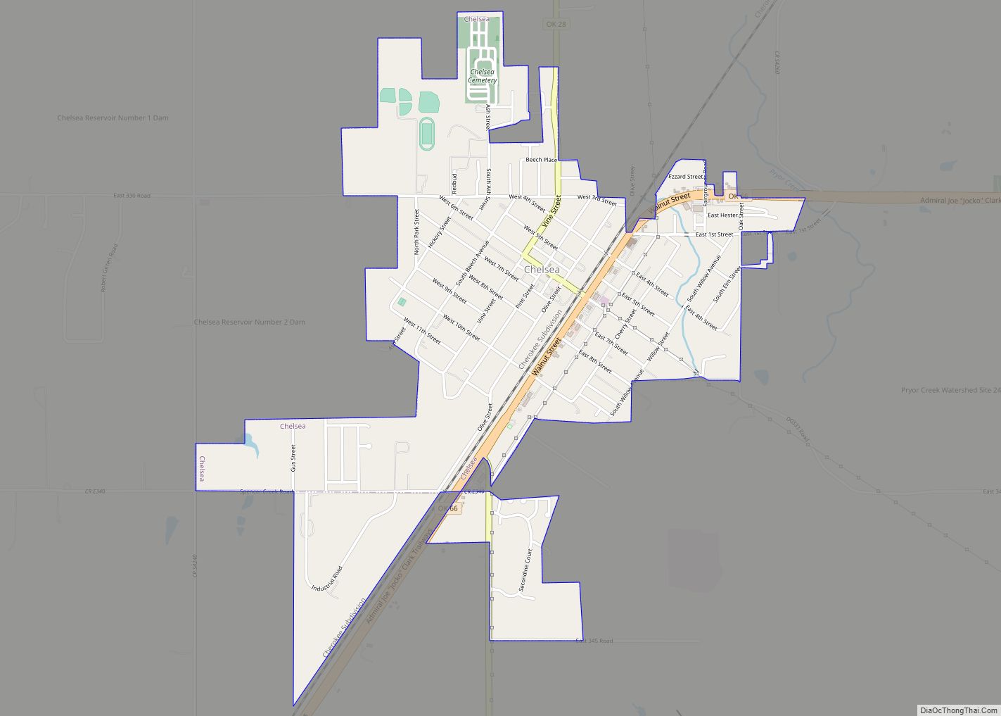
Chelsea Road Map
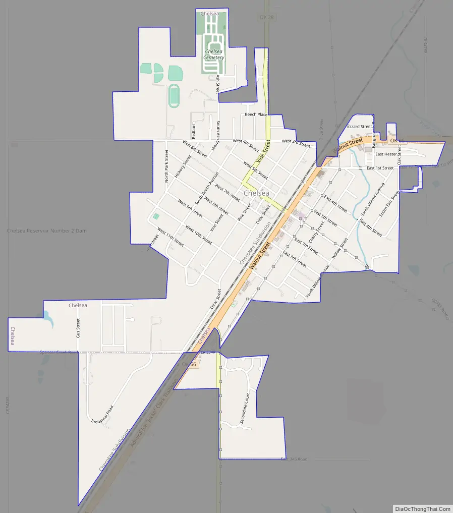
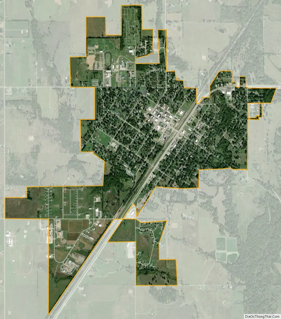
Chelsea city Satellite Map
Geography
Chelsea is located at 36°32′8″N 95°25′53″W / 36.53556°N 95.43139°W / 36.53556; -95.43139 (36.535544, -95.431466). It is 19 miles (31 km) northeast of Claremore and 47 miles (76 km) northeast of Tulsa. According to the United States Census Bureau, the city has a total area of 1.7 square miles (4.4 km), all land.
See also
Map of Oklahoma State and its subdivision:- Adair
- Alfalfa
- Atoka
- Beaver
- Beckham
- Blaine
- Bryan
- Caddo
- Canadian
- Carter
- Cherokee
- Choctaw
- Cimarron
- Cleveland
- Coal
- Comanche
- Cotton
- Craig
- Creek
- Custer
- Delaware
- Dewey
- Ellis
- Garfield
- Garvin
- Grady
- Grant
- Greer
- Harmon
- Harper
- Haskell
- Hughes
- Jackson
- Jefferson
- Johnston
- Kay
- Kingfisher
- Kiowa
- Latimer
- Le Flore
- Lincoln
- Logan
- Love
- Major
- Marshall
- Mayes
- McClain
- McCurtain
- McIntosh
- Murray
- Muskogee
- Noble
- Nowata
- Okfuskee
- Oklahoma
- Okmulgee
- Osage
- Ottawa
- Pawnee
- Payne
- Pittsburg
- Pontotoc
- Pottawatomie
- Pushmataha
- Roger Mills
- Rogers
- Seminole
- Sequoyah
- Stephens
- Texas
- Tillman
- Tulsa
- Wagoner
- Washington
- Washita
- Woods
- Woodward
- Alabama
- Alaska
- Arizona
- Arkansas
- California
- Colorado
- Connecticut
- Delaware
- District of Columbia
- Florida
- Georgia
- Hawaii
- Idaho
- Illinois
- Indiana
- Iowa
- Kansas
- Kentucky
- Louisiana
- Maine
- Maryland
- Massachusetts
- Michigan
- Minnesota
- Mississippi
- Missouri
- Montana
- Nebraska
- Nevada
- New Hampshire
- New Jersey
- New Mexico
- New York
- North Carolina
- North Dakota
- Ohio
- Oklahoma
- Oregon
- Pennsylvania
- Rhode Island
- South Carolina
- South Dakota
- Tennessee
- Texas
- Utah
- Vermont
- Virginia
- Washington
- West Virginia
- Wisconsin
- Wyoming