Claremore is a city and the county seat of Rogers County in Green Country or northeastern Oklahoma, United States. The population was 19,580 at the 2020 census, a 5.4 percent increase over the figure of 18,581 recorded in 2010. Located in the foothills of the Ozark Mountains, the town is part of the Tulsa Metropolitan Area and home to Rogers State University. It is best known as the home of early 20th-century entertainer Will Rogers.
This area was part of the territory of the Osage, but they were forced out under a treaty with the United States. During the Indian Removal period and until statehood, this area was a reserve of the Cherokee Nation, which had been removed from its territory in the Southeast United States. This was within what was known as the Cherokee Cooweescoowee District.
| Name: | Claremore city |
|---|---|
| LSAD Code: | 25 |
| LSAD Description: | city (suffix) |
| State: | Oklahoma |
| County: | Rogers County |
| Incorporated: | 1883 |
| Elevation: | 597 ft (182 m) |
| Land Area: | 15.01 sq mi (38.87 km²) |
| Water Area: | 0.25 sq mi (0.66 km²) |
| Population Density: | 1,304.64/sq mi (503.71/km²) |
| ZIP code: | 74017, 74018, 74019 |
| Area code: | 539/918 |
| FIPS code: | 4014700 |
| GNISfeature ID: | 1091382 |
| Website: | www.claremorecity.com |
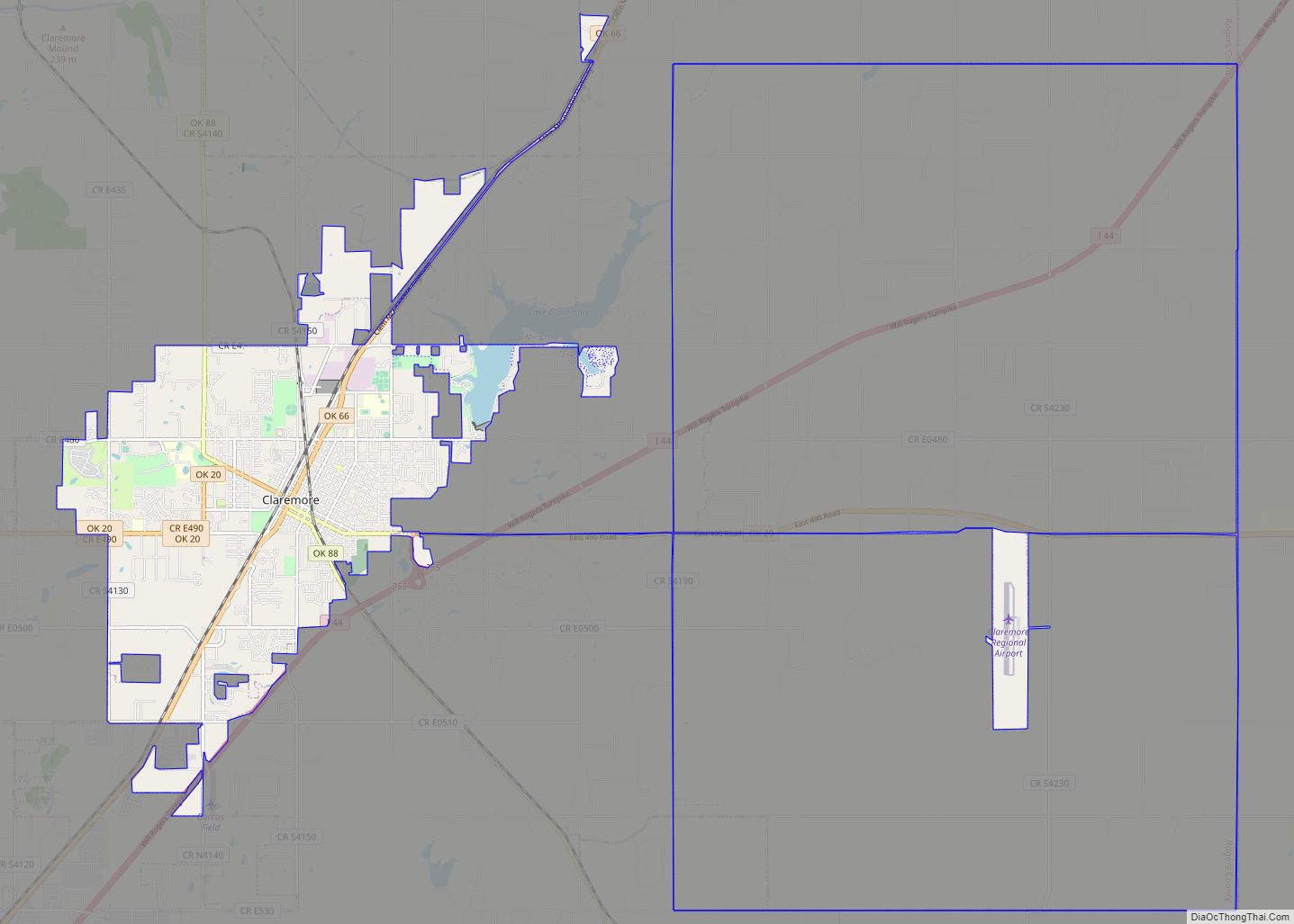
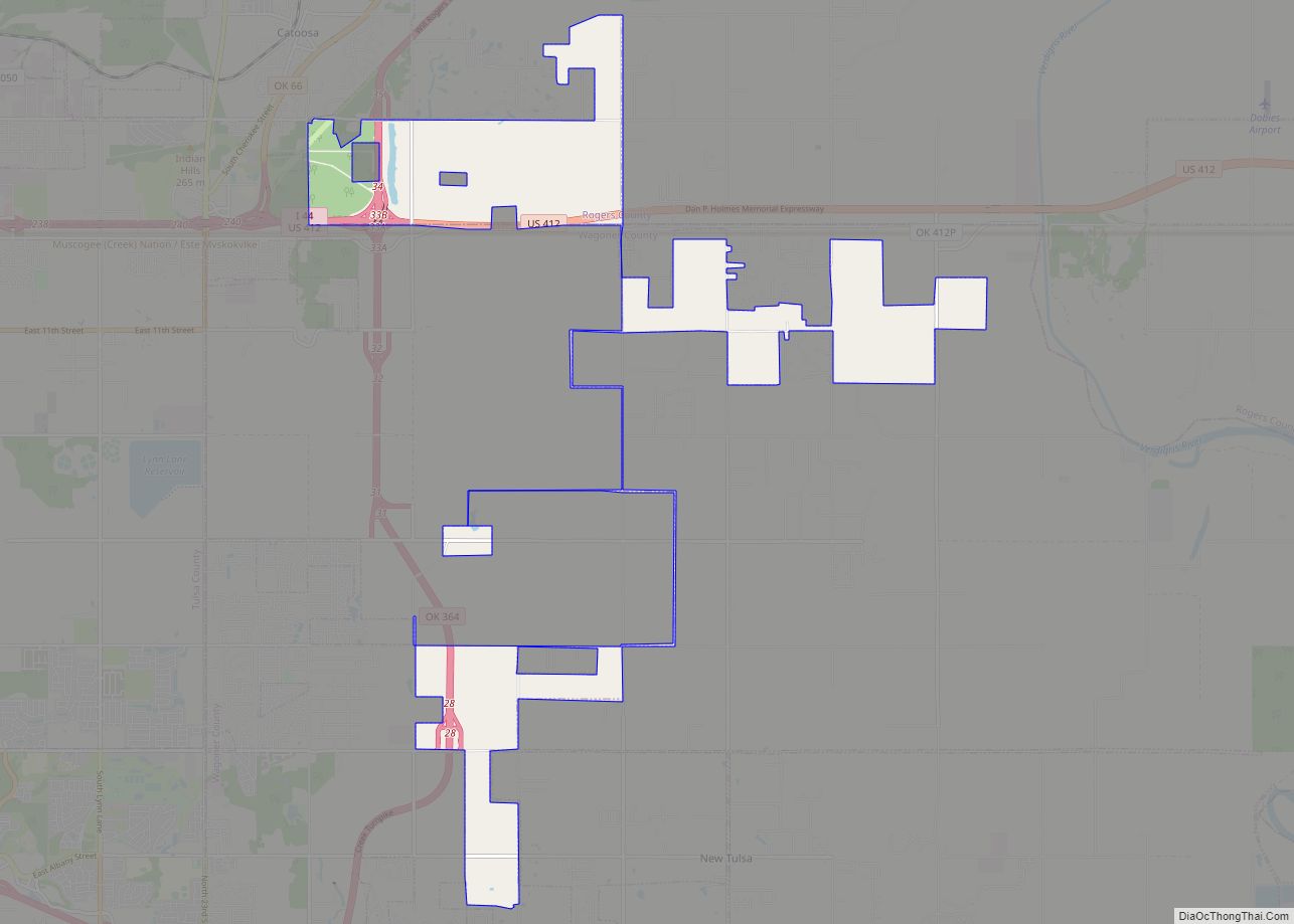
Online Interactive Map
Click on ![]() to view map in "full screen" mode.
to view map in "full screen" mode.
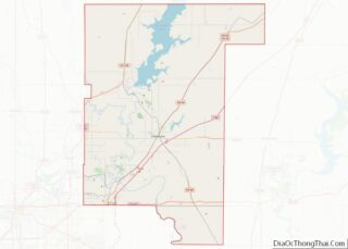
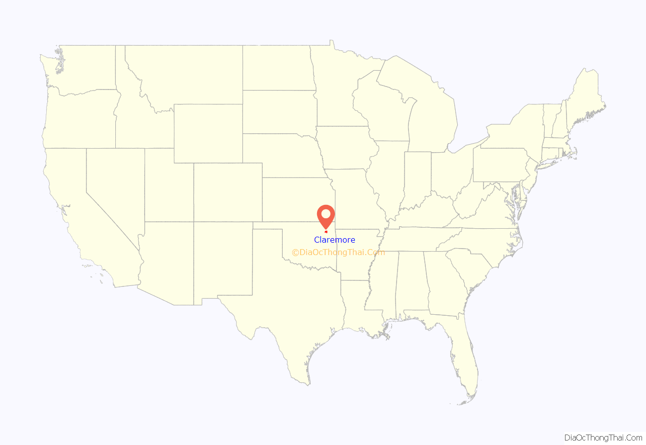
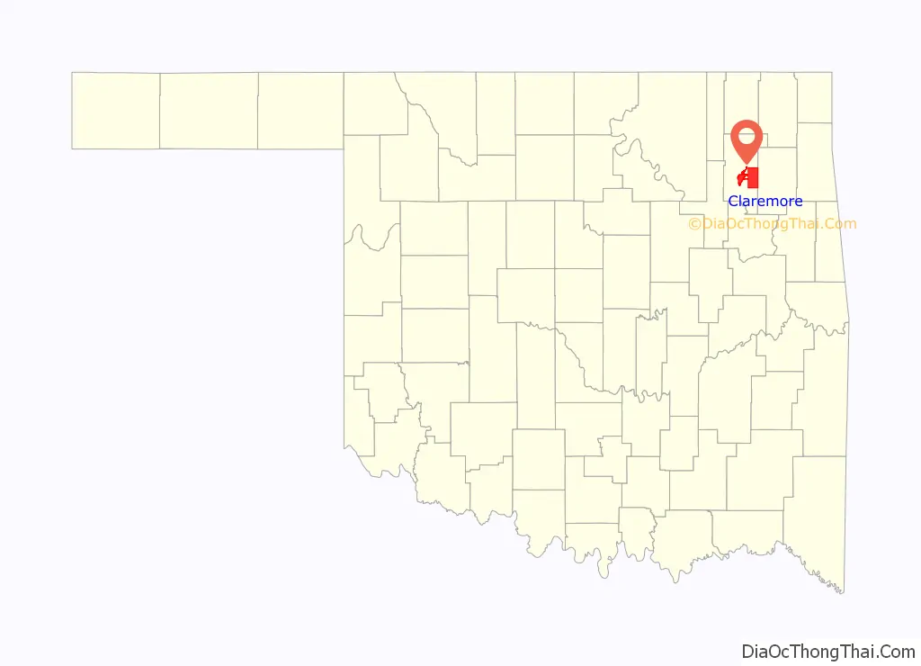
Claremore location map. Where is Claremore city?
History
Around 1802, bands of Osage Indians settled in this area of what is now northeastern Oklahoma. Black Dog was the chief of a band that settled at Pasona, where Claremore later developed. He shared power with chiefs Clermont (aka Claremore), and Pawhuska. Clermont, named by French traders, settled with his band in a village known as Pasuga, meaning “Big Cedar”, which was located on an ancient platform earthwork mound in this area.
The Osage village of Pasuga was destroyed by Cherokee in June 1817, during the Battle of Claremore Mound, also known as the Battle of the Strawberry Moon. These Western Cherokee had moved into the region from the southeastern United States and were perpetually competing with the Osage, who looked down on them. At the time of the attack, most of the men were out of the villages to hunt bison on the plains. The Cherokee killed the men in the village, and took more than 100 women and children captive, selling them to eastern Cherokee. Accounts differ as to whether chief Clermont was killed in the raid.
After the Indian Removal Act of 1830 was passed by Congress, this area was designated as part of Indian Territory and the Cherokee Nation were assigned much of this territory. Claremore and the mound were within a part of the Cooweescoowee District in the northwestern part of the Cherokee Nation.
The Rogers family, for whom the county is named, were among the first European-American settlers. Clem Rogers, father of the famous entertainer Will Rogers, moved to the county in 1856. He acquired lands for his Dog Iron Ranch that eventually consisted of more than 60,000 acres (240 km). The Clem Rogers home (Will Rogers’ birthplace), still stands outside Oologah, and is considered an important historical site. Clem Rogers was a major advocate of Oklahoma statehood; he was the oldest delegate to the state’s Constitutional Convention in 1907 at age 69. He and other members of his family were buried at the Will Rogers Memorial.
A post office was established on June 25, 1874. The coming of railways to Indian Territory was the driving factor in early growth. Two early lines intersected in the center of town. The town changed the spelling of its name from Clermont to Claremore on September 19, 1882. A clerk recording the town as having a post office had spelled the name incorrectly, and it stuck. The town was incorporated in the Cherokee Nation on May 2, 1903. newspaper, the Claremore Daily Progress, was founded in 1893 by cowboy Joe Klein and is still published daily. It is the oldest business in Rogers County.
Growth was aided by the popularity of sulphur springs among Americans in the late 19th and early 20th centuries. They believed bathing in such springs to have medical benefits. George Eaton had settled with his family in the Claremore area in 1874 and conducted farming and cattle raising. He later branched into the mercantile business, real estate, and oil exploration. While drilling just east of Claremore in 1903, Easton struck an underground pool of water that smelled of sulfur. Local physician Dr. W. G. Williams tested the water and marketed it as a cure. Known as “Radium Water”, it contained no radium, but hydrogen sulfide and sulfur compounds that were believed to make it medically useful. Eaton built a bath house and promoted the pool area as Radium Town. Radium Town was centered on 9th Street between Seminole and Dorothy. Bath houses were built by promoters all over this area of Claremore, and for a time attracted travelers and tourists for the waters. Only one was still standing as of 2008. first hospital was established in the early 1900s along what is now known as Will Rogers Boulevard, or Oklahoma State Highway 20. The building is standing and is currently being renovated.
The town has many historic homes and other buildings, with several located in the old business district. In 2002, Claremore received a grant from the state’s Oklahoma Main Street program to redevelop its business district with improved urban design and enhancement of historic properties. Renovation work on the downtown was completed in 2007. On July 9, 2020, the Supreme Court of the United States determined in McGirt v. Oklahoma that the reservations of the Five Tribes, comprising much of Eastern Oklahoma, were never disestablished by Congress and thus are still “Indian Country” for the purposes of criminal law.
Claremore Road Map
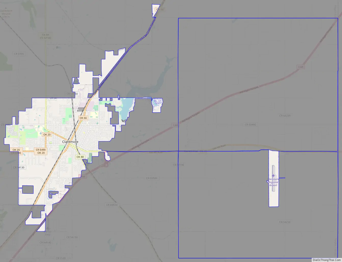
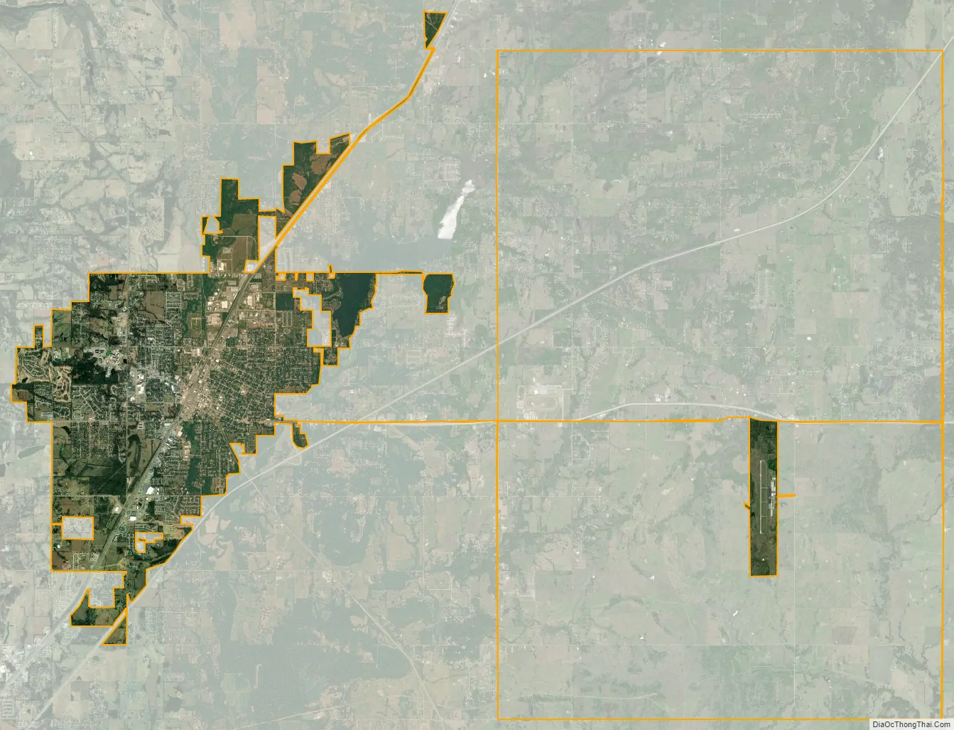
Claremore city Satellite Map
Geography
Claremore is located at 36°18′55″N 95°36′46″W / 36.31528°N 95.61278°W / 36.31528; -95.61278 (36.315181, -95.612784). According to the United States Census Bureau, the town has a total area of 12.3 square miles (32 km), of which 12.0 square miles (31 km) is land and 0.2 square miles (0.52 km) (1.96%) is water.
The city is located in Green Country, a popular nickname for northeast Oklahoma that stems from the region’s green vegetation and relatively high number of hills and lakes compared to central and western areas of Oklahoma. Claremore lies near the Verdigris River with undulating terrain producing hills and valleys. The town primary water sources are the Claremore and Oologah lakes, both within the drainage basin of the Verdigris River.
Climate
Claremore experiences a humid subtropical climate with cold winters and hot summers.
See also
Map of Oklahoma State and its subdivision:- Adair
- Alfalfa
- Atoka
- Beaver
- Beckham
- Blaine
- Bryan
- Caddo
- Canadian
- Carter
- Cherokee
- Choctaw
- Cimarron
- Cleveland
- Coal
- Comanche
- Cotton
- Craig
- Creek
- Custer
- Delaware
- Dewey
- Ellis
- Garfield
- Garvin
- Grady
- Grant
- Greer
- Harmon
- Harper
- Haskell
- Hughes
- Jackson
- Jefferson
- Johnston
- Kay
- Kingfisher
- Kiowa
- Latimer
- Le Flore
- Lincoln
- Logan
- Love
- Major
- Marshall
- Mayes
- McClain
- McCurtain
- McIntosh
- Murray
- Muskogee
- Noble
- Nowata
- Okfuskee
- Oklahoma
- Okmulgee
- Osage
- Ottawa
- Pawnee
- Payne
- Pittsburg
- Pontotoc
- Pottawatomie
- Pushmataha
- Roger Mills
- Rogers
- Seminole
- Sequoyah
- Stephens
- Texas
- Tillman
- Tulsa
- Wagoner
- Washington
- Washita
- Woods
- Woodward
- Alabama
- Alaska
- Arizona
- Arkansas
- California
- Colorado
- Connecticut
- Delaware
- District of Columbia
- Florida
- Georgia
- Hawaii
- Idaho
- Illinois
- Indiana
- Iowa
- Kansas
- Kentucky
- Louisiana
- Maine
- Maryland
- Massachusetts
- Michigan
- Minnesota
- Mississippi
- Missouri
- Montana
- Nebraska
- Nevada
- New Hampshire
- New Jersey
- New Mexico
- New York
- North Carolina
- North Dakota
- Ohio
- Oklahoma
- Oregon
- Pennsylvania
- Rhode Island
- South Carolina
- South Dakota
- Tennessee
- Texas
- Utah
- Vermont
- Virginia
- Washington
- West Virginia
- Wisconsin
- Wyoming