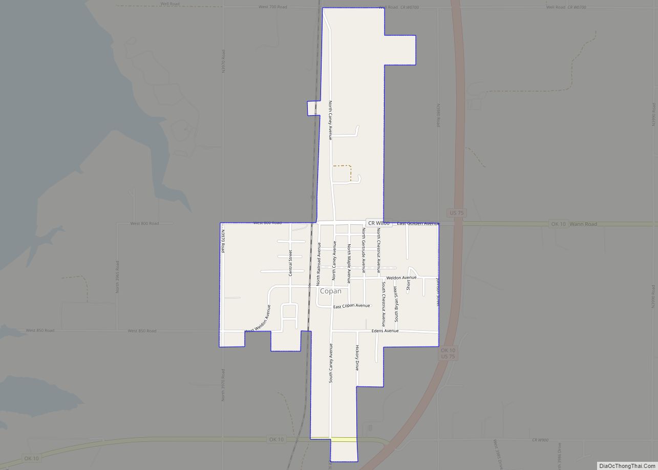
Copan is a town in Washington County, Oklahoma, United States. The population was 733 at the 2010 census, a decline of 7.9 percent from the figure of 796 recorded in 2000.
| Name: | Copan town |
|---|---|
| LSAD Code: | 43 |
| LSAD Description: | town (suffix) |
| State: | Oklahoma |
| County: | Washington County |
| Elevation: | 768 ft (234 m) |
| Total Area: | 1.05 sq mi (2.73 km²) |
| Land Area: | 1.05 sq mi (2.73 km²) |
| Water Area: | 0.00 sq mi (0.00 km²) |
| Total Population: | 710 |
| Population Density: | 674.26/sq mi (260.32/km²) |
| ZIP code: | 74022 |
| Area code: | 539/918 |
| FIPS code: | 4017100 |
| GNISfeature ID: | 1091678 |
Online Interactive Map
Click on ![]() to view map in "full screen" mode.
to view map in "full screen" mode.
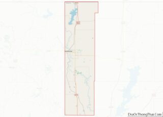
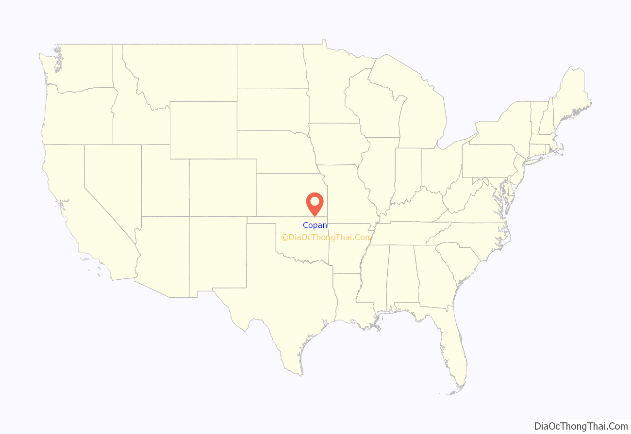
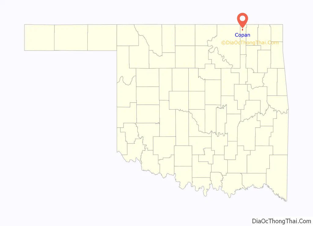
Copan location map. Where is Copan town?
History
The Atchison, Topeka & Santa Fe Railway built a station at this site in 1899, which it named Copan, after the city of Copán, Honduras. However, when a post office was established here in 1900, it was designated as Lawton. The settlement was renamed Weldon in 1901, but reverted to Copan in 1904. It was incorporated under that name in Indian Territory in 1906. The Copan school district was founded in 1906, as well. By 1907, the town had 305 residents.
The blossoming oil industry in Washington County spurred the growth of Copan. The Prairie Oil and Gas Company built Oklahoma’s first trunk pipeline, which ran from Bartlesville, Oklahoma to Humboldt, Kansas in 1904. It also included an oil storage terminal near Copan, with 107 tanks, designed to hold 35,000 barrels of crude oil. The Copan oil field was discovered in 1907, and had nearly 2,200 producing wells by 1915.
The town managed to survive and recover from major fires in 1906, 1911 and 1912. It enjoyed a spurt of growth after the creation of nearby Lake Hulah in 1951, and Lake Copan in 1983. Population reached a high of 960 in 1980, largely because the lakes increased tourism. The town economy is now largely based on travel and recreation.
Transportation History
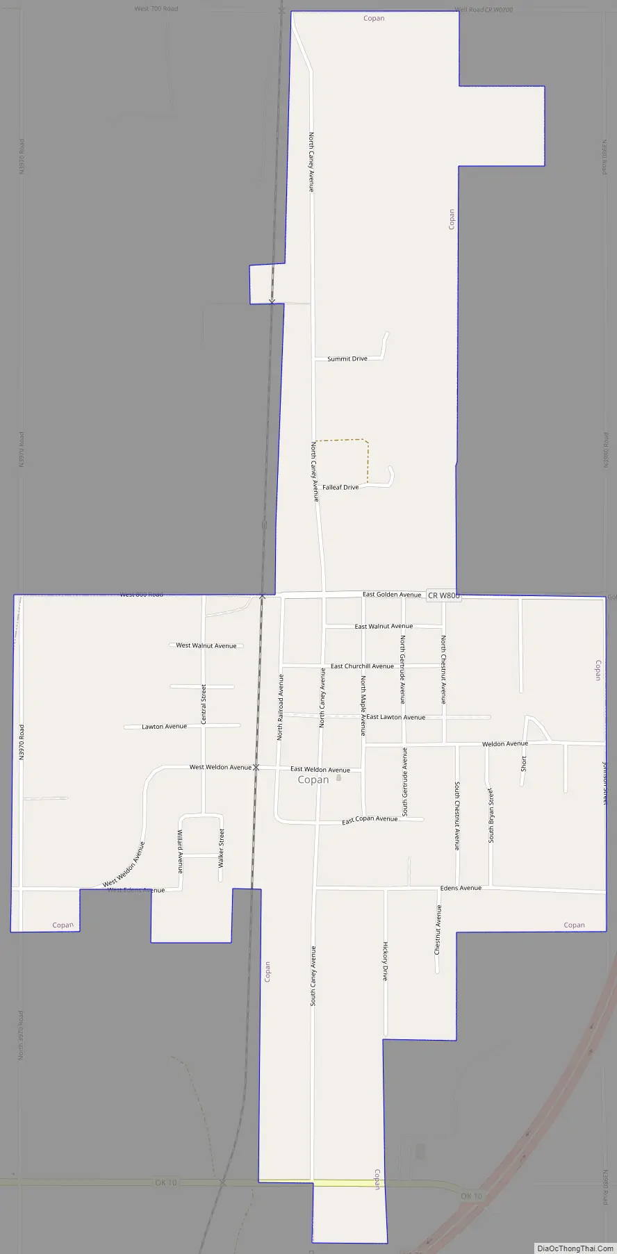
Prior to the construction of Copan Dam west of town, US-75 and OK-10 came through downtown Copan. US-75 entered Washington County from High Street in nearby Caney Kansas. As the old Highway 75 came south, it entered the town on Caney Street. As it exited south of town, it rejoined the current alignment at Washington County Road N 3975 Rd. OK-10 came out of the town of Wann Oklahoma in northern Nowata County Oklahoma, entered the town at Golden Avenue, then came south on Caney Street (old U-75) for 0.3 miles, then continued west on Weldon Avenue. There were two 90 degree curves on the town’s west side, the first took the highway south for 0.1 miles, the second took the highway back toward the west and had it concurrency with Washington County W. 850 Rd and intersected Washington County N. 3970 Rd, and crossed the Little Caney River, and rejoined the current alignment of OK-10 west of the now Copan Lake into Osage County Oklahoma.
The current alignment on US-75 comes off of McGee Street in Caney Kansas, continues south along the east side of Copan Lake, then continues east of Copan. The current alignment of OK-10 in Copan that it has its concurrency with US-75 east of town beginning at Golden Avenue, then continues south for 1.1 miles, then turns to the west, and continues over Copan Dam. It continues north, then west into Osage County Oklahoma.
The Burlington Northern and Atchison Topeka & Santa Fe Merger
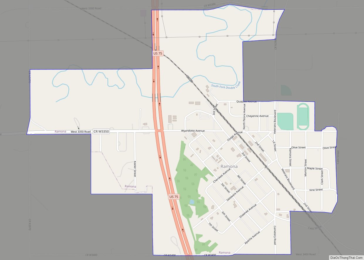
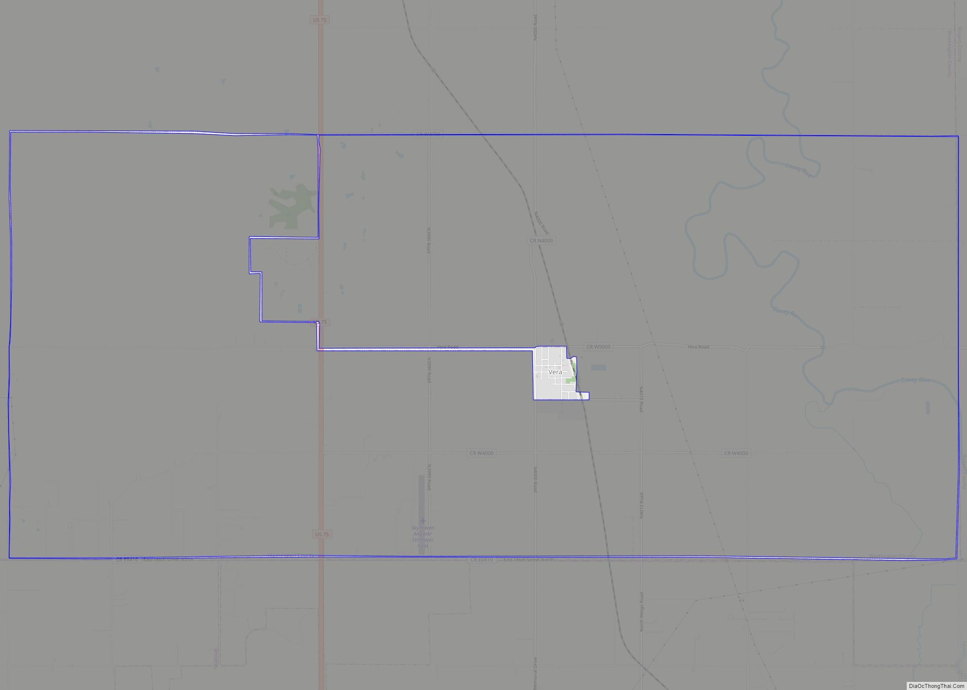
Prior to the merger between the Burlington Northern and the Atchison Topeka & Santa Fe in 1995, the line between nearby Caney Kansas into Tulsa Oklahoma was the main north-south rail line through Washington County Oklahoma. The line came out of Caney Kansas on the town’s west side, then continued south into the town of Copan. It ran roughly parallel with Caney Street, and continued on the west side of downtown Copan, then exited the town to the south. Towns and cities in Washington County Oklahoma that were served by the line were, Owen Township, Copan, Dewey, Bartlesville, Ochelata, Ramona, and Vera. It continued south into Tulsa County Oklahoma through Collinsville, Owasso, into Tulsa. The existing switch is located west of Greenwood Avenue where it merges with the current BNSF Cherokee Subdivision through downtown Tulsa. There were as many as eight trains a day that ran this line. It was fully signaled.
The line was to be abandoned by the newly formed Burlington Northern & Santa Fe (BNSF). This would have left Washington County Oklahoma including Copan without rail service. This line also served the Montgomery Kansas towns of Caney, Havana, Wayside, Bolton, Independence, and Cherryvale. WATCO purchased the line from BNSF post merger, and BNSF still has trackage rights. The line is now Southern Kansas & Oklahoma Line (SKOL) now headquartered in Cherryvale Kansas. .As a consequence of the merger, BNSF continued to maintain the Afton Subdivision that comes off the Cherokee Subdivision in Afton Oklahoma, and the Fort Scott Subdivision from Springfield Missouri. There is no Class 1 rail service in Washington County Oklahoma and Copan.
Copan Road Map
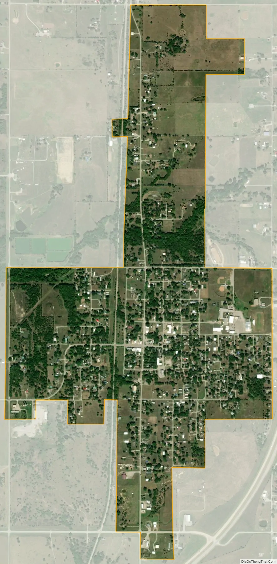
Copan city Satellite Map
Geography
Copan is located at 36°54′0″N 95°55′35″W / 36.90000°N 95.92639°W / 36.90000; -95.92639 (36.899926, -95.926447). It is 14 miles (23 km) north of Bartlesville on U.S. Highway 75.
According to the United States Census Bureau, the town has a total area of 1.0 square mile (2.6 km), all land.
See also
Map of Oklahoma State and its subdivision:- Adair
- Alfalfa
- Atoka
- Beaver
- Beckham
- Blaine
- Bryan
- Caddo
- Canadian
- Carter
- Cherokee
- Choctaw
- Cimarron
- Cleveland
- Coal
- Comanche
- Cotton
- Craig
- Creek
- Custer
- Delaware
- Dewey
- Ellis
- Garfield
- Garvin
- Grady
- Grant
- Greer
- Harmon
- Harper
- Haskell
- Hughes
- Jackson
- Jefferson
- Johnston
- Kay
- Kingfisher
- Kiowa
- Latimer
- Le Flore
- Lincoln
- Logan
- Love
- Major
- Marshall
- Mayes
- McClain
- McCurtain
- McIntosh
- Murray
- Muskogee
- Noble
- Nowata
- Okfuskee
- Oklahoma
- Okmulgee
- Osage
- Ottawa
- Pawnee
- Payne
- Pittsburg
- Pontotoc
- Pottawatomie
- Pushmataha
- Roger Mills
- Rogers
- Seminole
- Sequoyah
- Stephens
- Texas
- Tillman
- Tulsa
- Wagoner
- Washington
- Washita
- Woods
- Woodward
- Alabama
- Alaska
- Arizona
- Arkansas
- California
- Colorado
- Connecticut
- Delaware
- District of Columbia
- Florida
- Georgia
- Hawaii
- Idaho
- Illinois
- Indiana
- Iowa
- Kansas
- Kentucky
- Louisiana
- Maine
- Maryland
- Massachusetts
- Michigan
- Minnesota
- Mississippi
- Missouri
- Montana
- Nebraska
- Nevada
- New Hampshire
- New Jersey
- New Mexico
- New York
- North Carolina
- North Dakota
- Ohio
- Oklahoma
- Oregon
- Pennsylvania
- Rhode Island
- South Carolina
- South Dakota
- Tennessee
- Texas
- Utah
- Vermont
- Virginia
- Washington
- West Virginia
- Wisconsin
- Wyoming