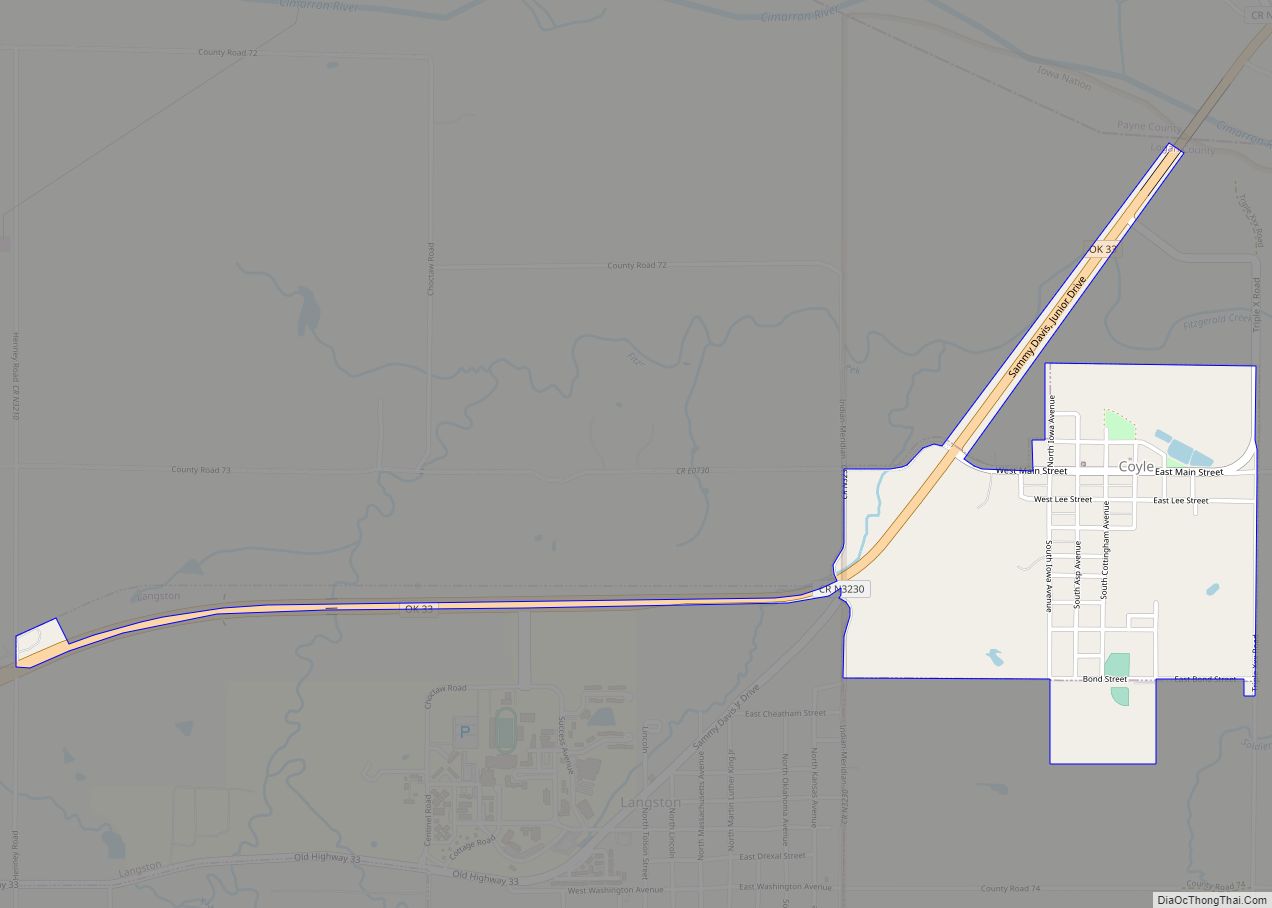
Coyle is a town in Logan County, Oklahoma, United States. The population was 325 at the 2010 census, compared to the figure of 337 in 2000. It is part of the Oklahoma City metropolitan area. The town was named for William Coyle, an influential Guthrie business man.
Founded in Oklahoma Territory before statehood, Coyle initially prospered as an agricultural town and because of the arrival of the railroad. However, the demand for the area’s principal crop, cotton, declined sharply after World War I. Rail service ended during the 1950s. By 2000, it was estimated that 95 percent of the employed residents commuted to work in larger towns nearby.
| Name: | Coyle town |
|---|---|
| LSAD Code: | 43 |
| LSAD Description: | town (suffix) |
| State: | Oklahoma |
| County: | Logan County |
| Elevation: | 873 ft (266 m) |
| Total Area: | 0.79 sq mi (2.03 km²) |
| Land Area: | 0.79 sq mi (2.03 km²) |
| Water Area: | 0.00 sq mi (0.00 km²) |
| Total Population: | 350 |
| Population Density: | 445.86/sq mi (172.19/km²) |
| ZIP code: | 73027 |
| Area code: | 405/572 |
| FIPS code: | 4017950 |
| GNISfeature ID: | 1091796 |
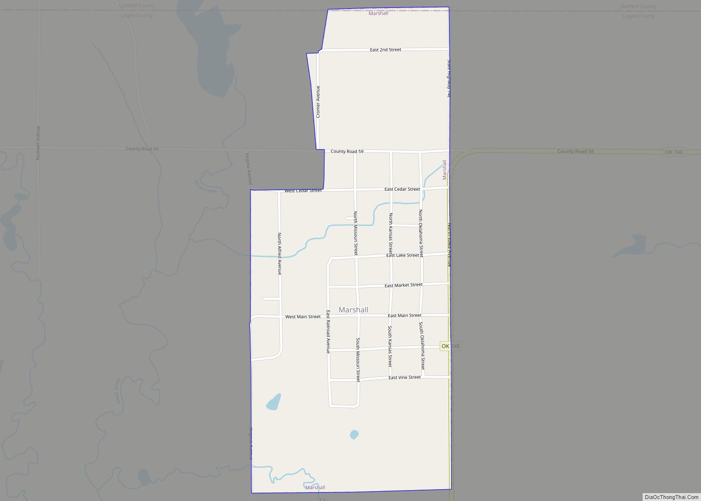
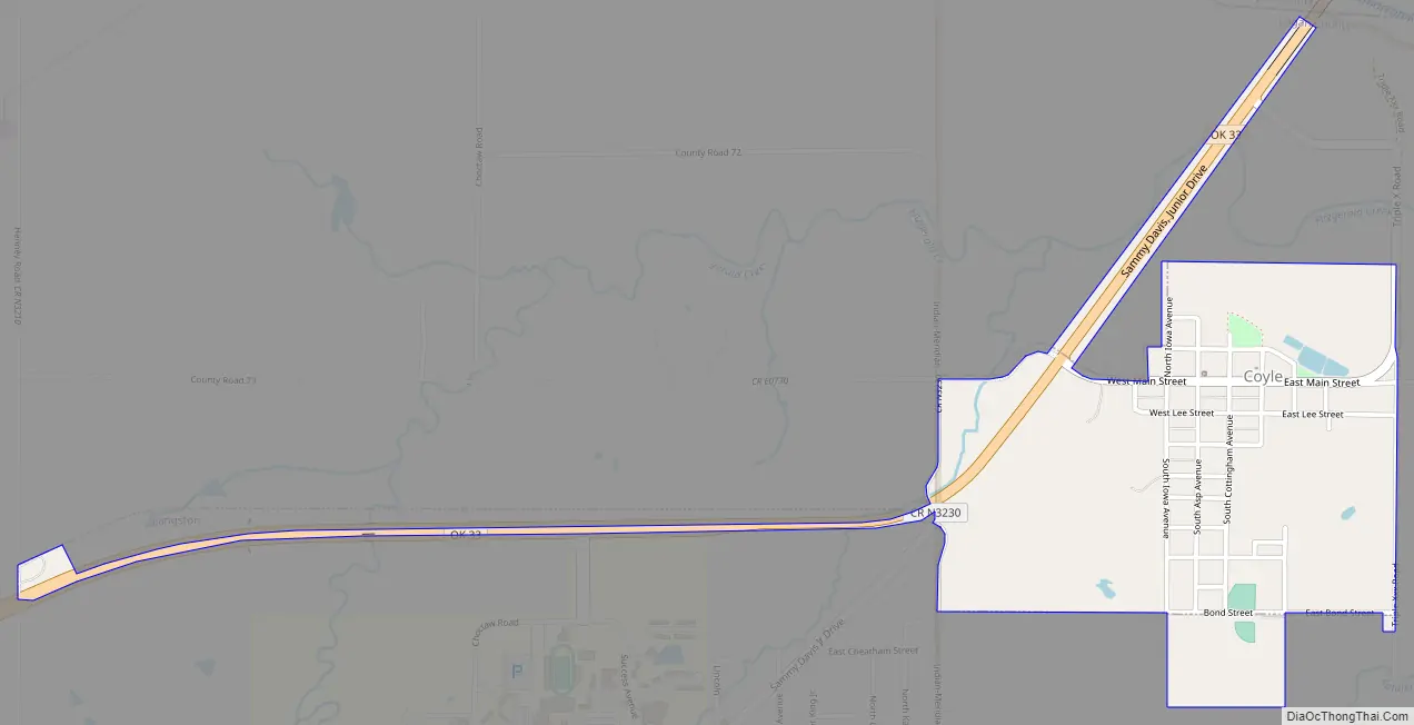
Online Interactive Map
Click on ![]() to view map in "full screen" mode.
to view map in "full screen" mode.
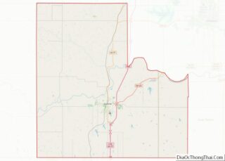
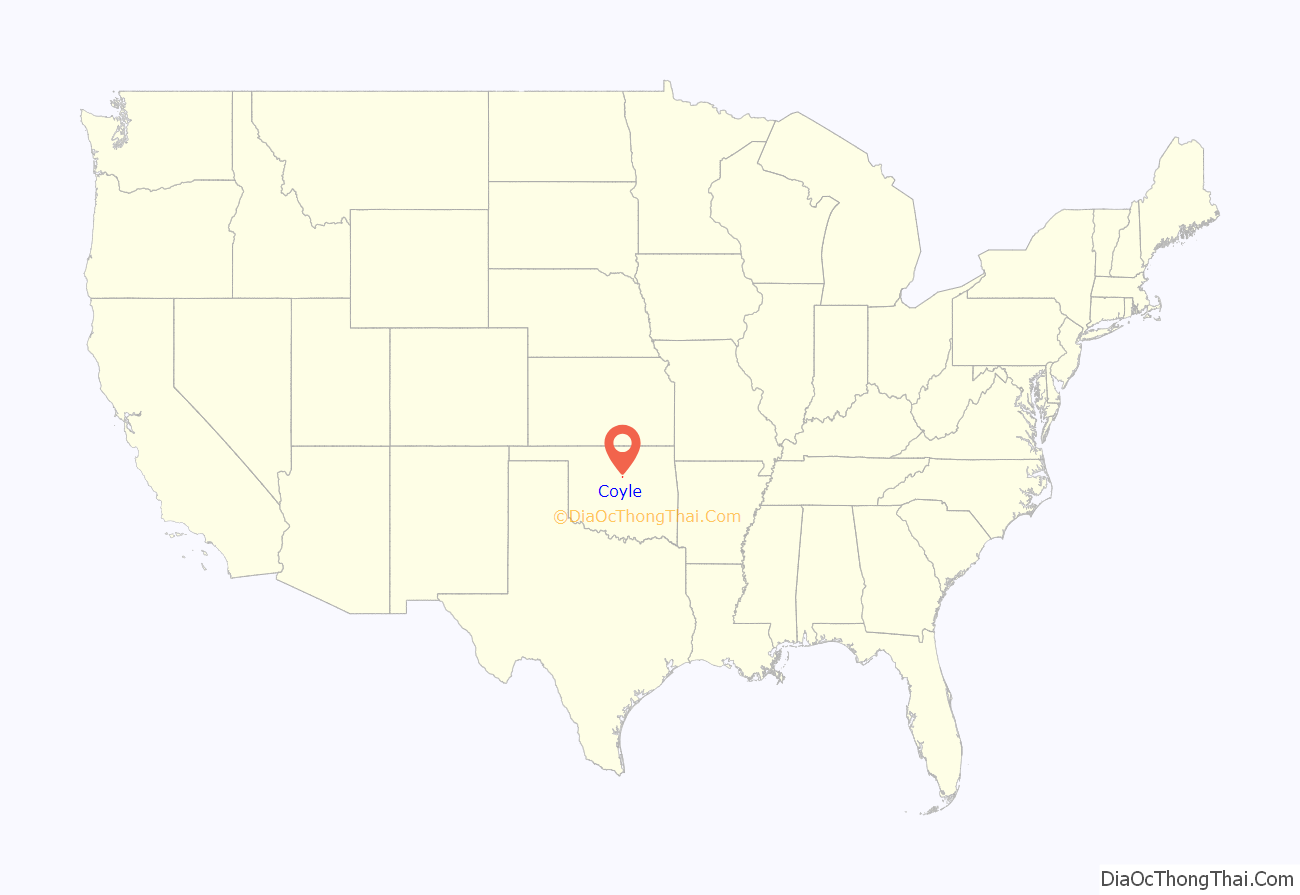
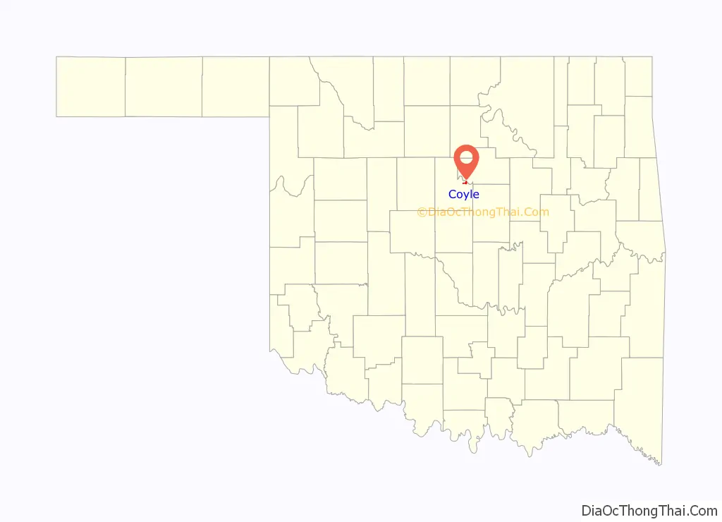
Coyle location map. Where is Coyle town?
History
Coyle began as an agricultural community in 1899 when the Eastern Oklahoma Railway, a subsidiary of the Atchison, Topeka & Santa Fe Railway built a branch line from Guthrie to Cushing. William H. Coyle, a Guthrie entrepreneur, and U. C. Guss were employed as purchasing agents by the railroad company to acquire right of way, and were awarded an opportunity to select a townsite as a bonus for their successful work. They chose a location 2 miles (3.2 km) south of Iowa City, a community previously established on the Cimarron River. Almost all of the Iowa City residents moved to the new location as soon as they became aware that the railroad route would bypass Iowa City. The Iowa City post office remained at the old location, while a new post office was established in the new town, which was named Coyle after its founder. The Coyle post office opened May 5, 1900. Iowa City became a ghost town even before Oklahoma Territory became part of the state of Oklahoma.
Agriculture supported the town’s economy, with cotton being the main crop. Early businesses in Coyle included a bank, a blacksmith, cotton gins, a drug store, a furniture store, some general stores, a lumberyard, and a photographer. The Cimarron Valley Clipper newspaper began publication in 1900 and continued until 1949. The town had two saloons until 1904, when temperance crusader Carrie Nation visited Coyle and held a public debate with Coyle’s Superintendent of Schools, Martin E. Trapp. Immediately afterward, the city government outlawed the saloons.
After WWI, the demand for cotton declined sharply, causing many local farms to become unprofitable. The population of Coyle continued to increase, reaching a peak of 440 at the 1940 census. Railroad service ended in the late 1950s. Since then, about 95 percent of the employed residents of Coyle have commuted to work in larger towns nearby, such as Stillwater, Guthrie, and Oklahoma City.
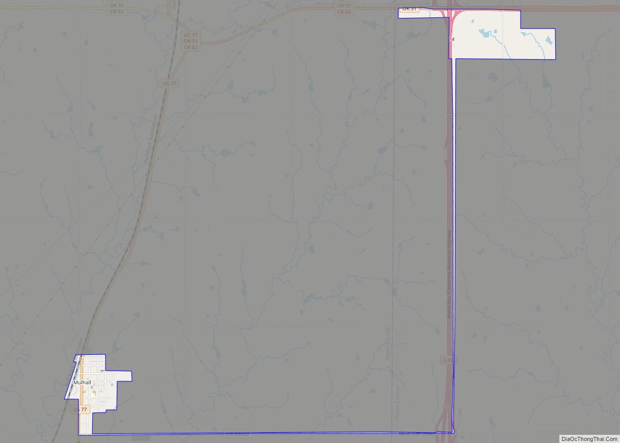
Coyle Road Map
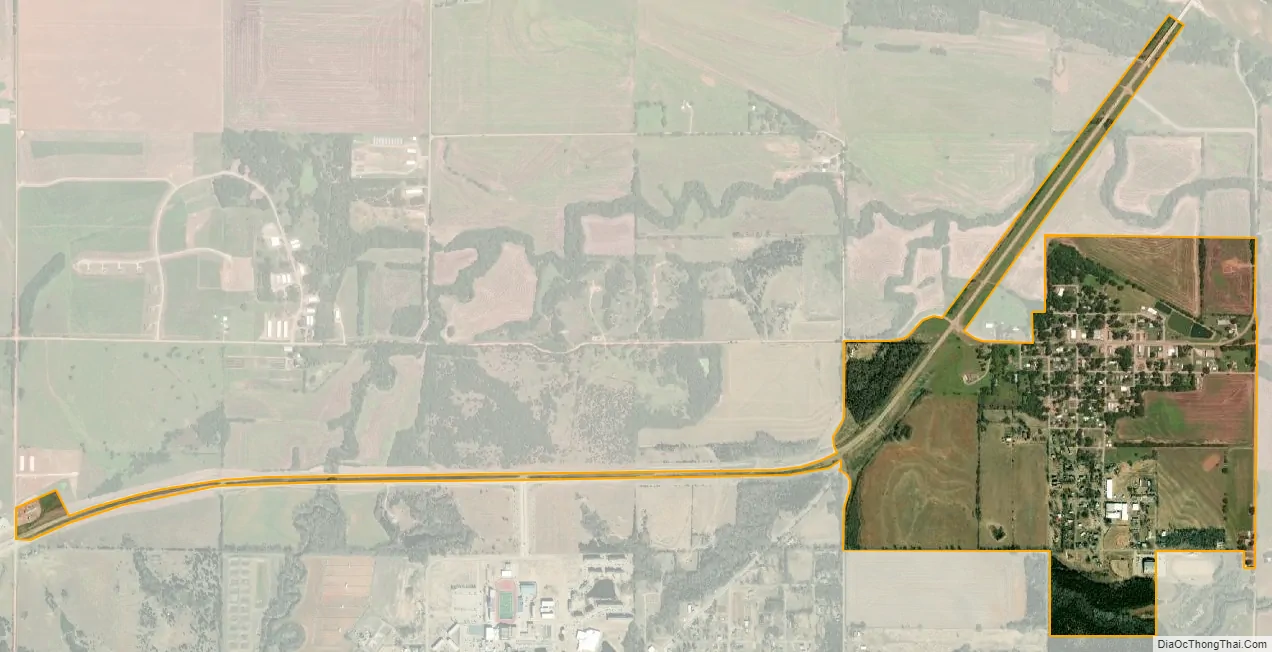
Coyle city Satellite Map
Geography
Coyle is located at 35°57′15″N 97°14′11″W / 35.95417°N 97.23639°W / 35.95417; -97.23639 (35.954065, -97.236459). It is 14 miles (23 km) northeast of Guthrie, the seat of Logan County and 1 mile (1.6 km) west of the confluence of Fitzgerald Creek and the Cimarron River. Coyle is located in North Cimarron Township of Logan County.
According to the United States Census Bureau, the town has a total area of 0.6 square miles (1.6 km), all land.
See also
Map of Oklahoma State and its subdivision:- Adair
- Alfalfa
- Atoka
- Beaver
- Beckham
- Blaine
- Bryan
- Caddo
- Canadian
- Carter
- Cherokee
- Choctaw
- Cimarron
- Cleveland
- Coal
- Comanche
- Cotton
- Craig
- Creek
- Custer
- Delaware
- Dewey
- Ellis
- Garfield
- Garvin
- Grady
- Grant
- Greer
- Harmon
- Harper
- Haskell
- Hughes
- Jackson
- Jefferson
- Johnston
- Kay
- Kingfisher
- Kiowa
- Latimer
- Le Flore
- Lincoln
- Logan
- Love
- Major
- Marshall
- Mayes
- McClain
- McCurtain
- McIntosh
- Murray
- Muskogee
- Noble
- Nowata
- Okfuskee
- Oklahoma
- Okmulgee
- Osage
- Ottawa
- Pawnee
- Payne
- Pittsburg
- Pontotoc
- Pottawatomie
- Pushmataha
- Roger Mills
- Rogers
- Seminole
- Sequoyah
- Stephens
- Texas
- Tillman
- Tulsa
- Wagoner
- Washington
- Washita
- Woods
- Woodward
- Alabama
- Alaska
- Arizona
- Arkansas
- California
- Colorado
- Connecticut
- Delaware
- District of Columbia
- Florida
- Georgia
- Hawaii
- Idaho
- Illinois
- Indiana
- Iowa
- Kansas
- Kentucky
- Louisiana
- Maine
- Maryland
- Massachusetts
- Michigan
- Minnesota
- Mississippi
- Missouri
- Montana
- Nebraska
- Nevada
- New Hampshire
- New Jersey
- New Mexico
- New York
- North Carolina
- North Dakota
- Ohio
- Oklahoma
- Oregon
- Pennsylvania
- Rhode Island
- South Carolina
- South Dakota
- Tennessee
- Texas
- Utah
- Vermont
- Virginia
- Washington
- West Virginia
- Wisconsin
- Wyoming