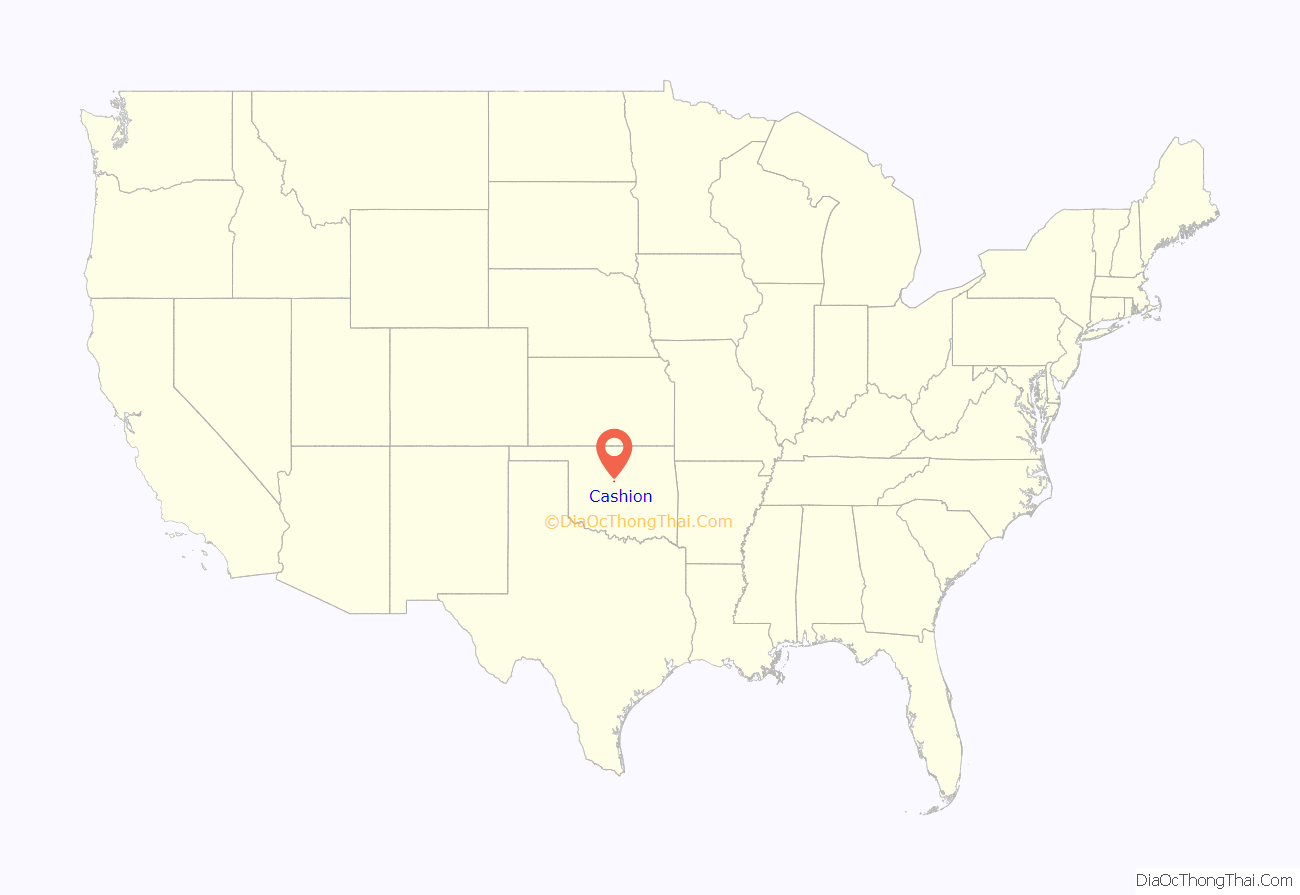
Cashion is a town in Kingfisher and Logan counties in the U.S. state of Oklahoma. The Logan County portion of Cashion is part of the Oklahoma City Metropolitan Statistical Area. The town population was 802 at the 2010 census, up from 643 in 2000.
| Name: | Cashion town |
|---|---|
| LSAD Code: | 43 |
| LSAD Description: | town (suffix) |
| State: | Oklahoma |
| County: | Kingfisher County, Logan County |
| Elevation: | 1,129 ft (344 m) |
| Total Area: | 1.30 sq mi (3.38 km²) |
| Land Area: | 1.30 sq mi (3.38 km²) |
| Water Area: | 0.00 sq mi (0.00 km²) |
| Total Population: | 850 |
| Population Density: | 651.84/sq mi (251.74/km²) |
| ZIP code: | 73016 |
| Area code: | 405/572 |
| FIPS code: | 4012650 |
| GNISfeature ID: | 2413177 |
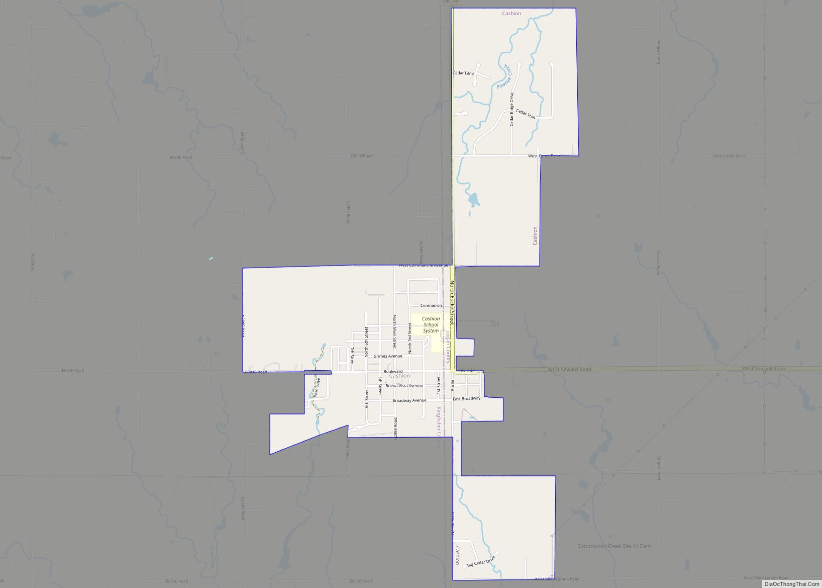
Online Interactive Map
Click on ![]() to view map in "full screen" mode.
to view map in "full screen" mode.
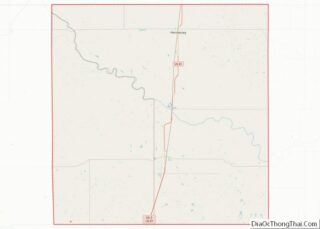
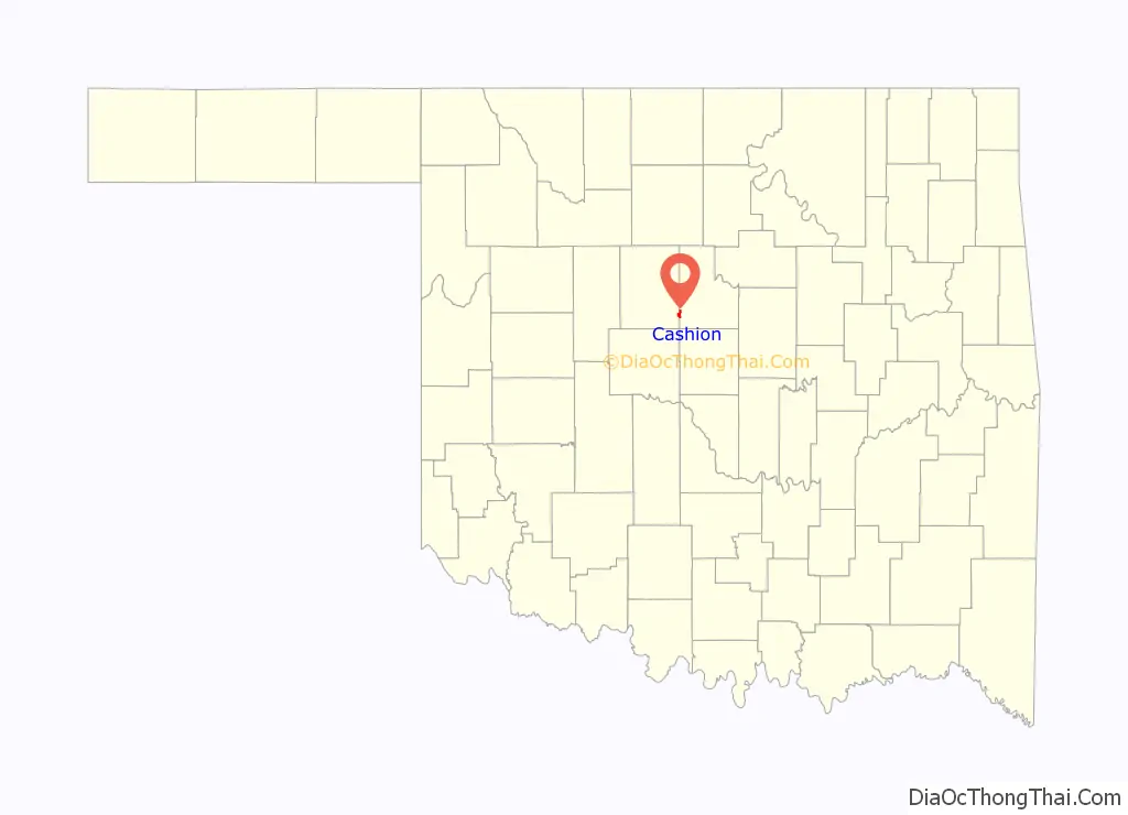
Cashion location map. Where is Cashion town?
History
Cashion began as the town of Downs, Oklahoma on a hill 3 miles (5 km) south of the Cimarron River. The Oklahoma legislature had once passed a bill to make Downs the capitol of Oklahoma Territory, but the bill was vetoed a few days later by George W. Steele, the first governor of the territory. Once when later Governor A.J. Seay was on the road and spent the night in Downs, the townspeople claimed they were the capitol for that night because the governor had the Great Seal of Oklahoma Territory with him at the time.
In 1900, the Guthrie and Kingfisher Railway (later part of the Rock Island Railroad), which was building east from Kingfisher, and the Guthrie and Western Railway (an affiliate of the Santa Fe Railroad), building west from Seward, agreed to connect at a point a half-mile south of Downs. The site was on land owned by the Guthrie & Kingfisher Improvement Company, which sold lots, with the area becoming the town of Cashion. Since supplies to Downs had up to this point only been moved by wagons, the merchants in Downs, wanting to be on the rail line, relocated to Cashion along with most of the residences, leaving the former Downs site as agricultural land.
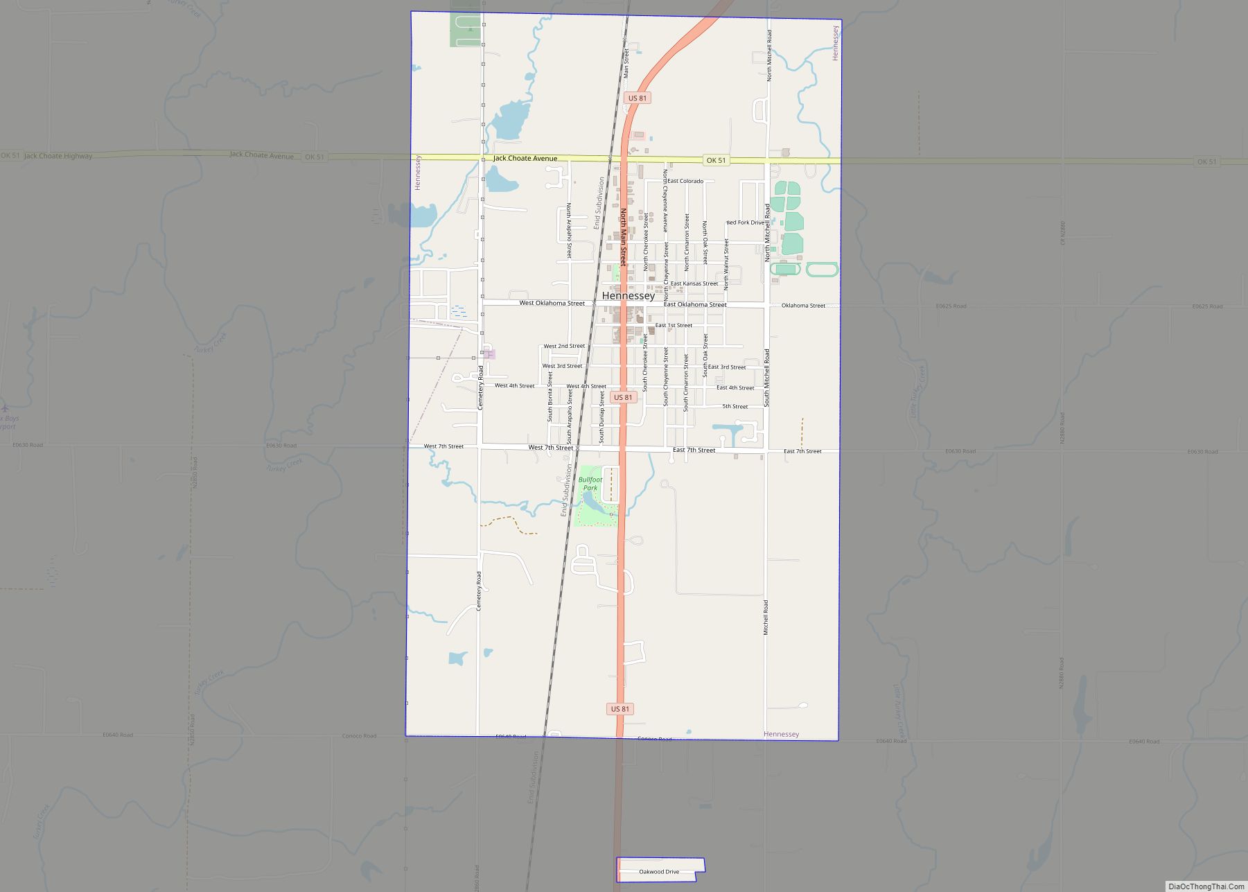
Cashion was named for Roy Cashion of Hennessey, Oklahoma. Roy, a graduate of the Hennessy Class of 1897, had a strong passion and belief in the freedom of the Cuban people. His graduation speech was entitled “Liberty for Cuba”. When the territorial governor asked for volunteers, Cashion’s name was first one on the list. He passed through this area on his way to join Teddy Roosevelt’s Rough Riders in the Spanish–American War. On July 1, 1898, Cashion was killed by a gunshot to the head in the famous charge on San Juan Hill in Cuba. He is believed to be the first Oklahoman to die in battle on foreign soil.
Incorporated in Oklahoma Territory in 1901, Cashion experienced a boom. Its growth peaked by 1915 and 1916. At this time, two railroads were running two trains a day into town from both Guthrie (the Santa Fe) and Kingfisher (the Rock Island). An oil boom brought in the “Cashion Pool”, which was considered the largest single pool ever discovered. It ran from south of Cashion to just west of Enid.
Cashion was known as “The Town Too Tough to Die”. While the neighboring towns of Downs, Wandell, Big Four, Lockridge, Navina, Reeding, Columbia and Lincoln Town all folded up and vanished in the Great Depression or shortly thereafter, Cashion hung on. However, the population declined as farms failed in the surrounding area. The Santa Fe Railroad abandoned its line in 1934, and the Rock Island removed its track in 1937. The population dropped from 291 in 1930 to 232 in 1940, then to its all-time low of 182 in 1950.
A resurgent economy created more jobs in nearby Guthrie and Kingfisher, causing new residents to move into Cashion. In 1960, the census recorded 221 residents. The 1970 census recorded 329. The 2020 census reports the population of the town as 850.
Cashion made national news after a police officer tasered a 65 year old woman after a traffic stop for a broken car light. The woman was said by the officer to be “resisting arrest” The woman later accepted a plea bargain for misdemeanor charges of “resisting an officer, obstruction, eluding and officer and operating a vehicle with defective equipment.”
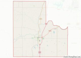
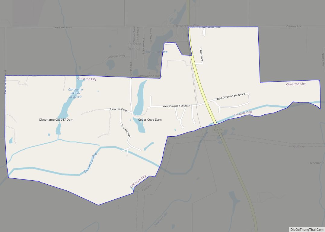
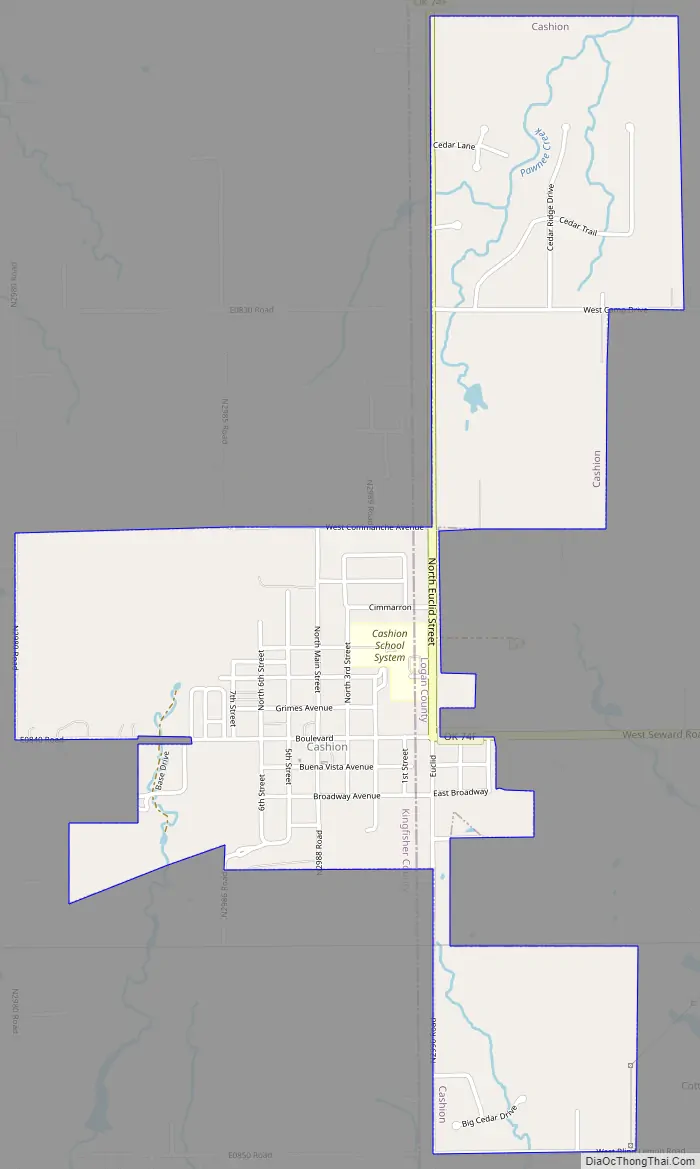
Cashion Road Map
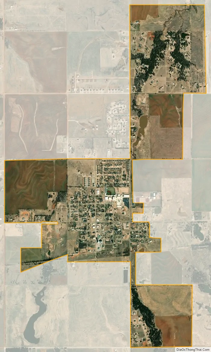
Cashion city Satellite Map
Geography
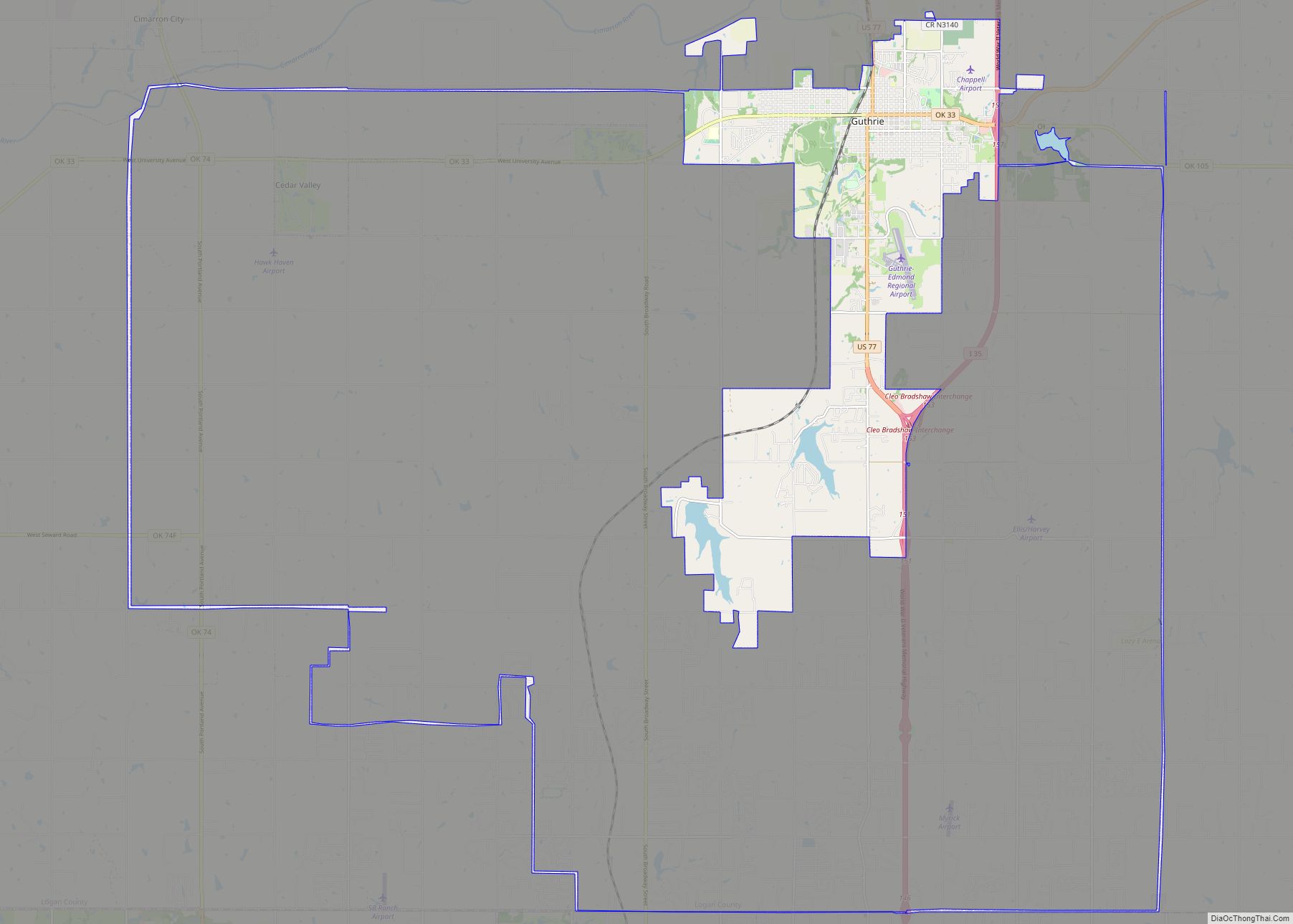
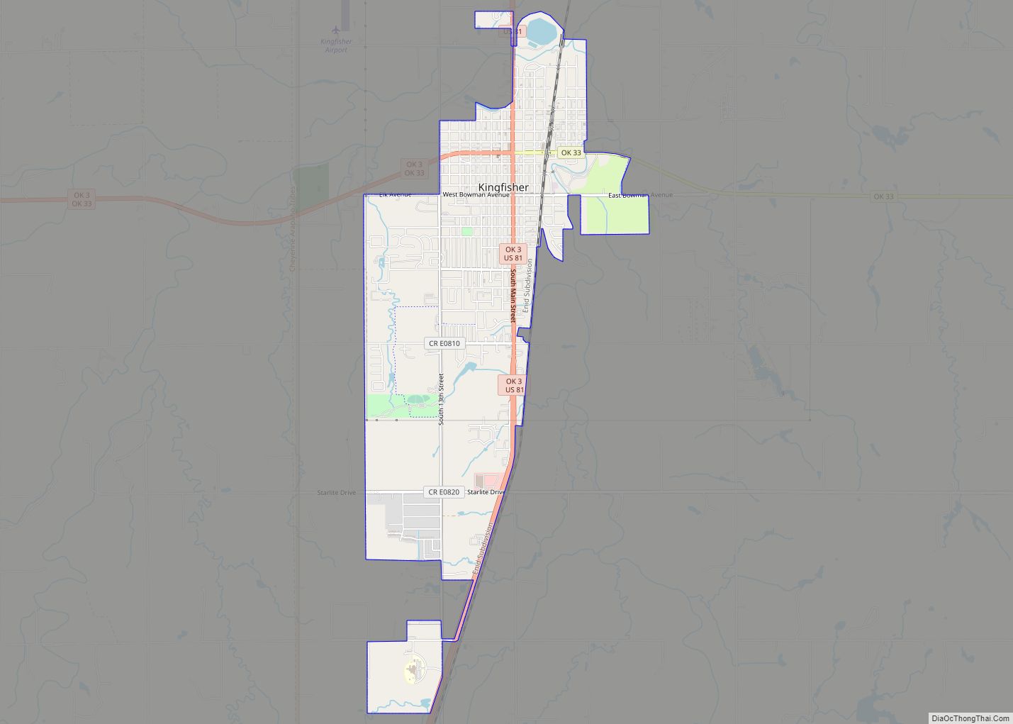
Cashion is located in southeastern Kingfisher County with the town limits extending east into Logan County. It is 18 miles (29 km) east-southeast of Kingfisher and the same distance southwest of Guthrie.
According to the United States Census Bureau, Cashion has a total area of 1.7 square miles (4.4 km), of which 1.9 acres (7,576 m), or 0.17%, are water.
See also
Map of Oklahoma State and its subdivision:- Adair
- Alfalfa
- Atoka
- Beaver
- Beckham
- Blaine
- Bryan
- Caddo
- Canadian
- Carter
- Cherokee
- Choctaw
- Cimarron
- Cleveland
- Coal
- Comanche
- Cotton
- Craig
- Creek
- Custer
- Delaware
- Dewey
- Ellis
- Garfield
- Garvin
- Grady
- Grant
- Greer
- Harmon
- Harper
- Haskell
- Hughes
- Jackson
- Jefferson
- Johnston
- Kay
- Kingfisher
- Kiowa
- Latimer
- Le Flore
- Lincoln
- Logan
- Love
- Major
- Marshall
- Mayes
- McClain
- McCurtain
- McIntosh
- Murray
- Muskogee
- Noble
- Nowata
- Okfuskee
- Oklahoma
- Okmulgee
- Osage
- Ottawa
- Pawnee
- Payne
- Pittsburg
- Pontotoc
- Pottawatomie
- Pushmataha
- Roger Mills
- Rogers
- Seminole
- Sequoyah
- Stephens
- Texas
- Tillman
- Tulsa
- Wagoner
- Washington
- Washita
- Woods
- Woodward
- Alabama
- Alaska
- Arizona
- Arkansas
- California
- Colorado
- Connecticut
- Delaware
- District of Columbia
- Florida
- Georgia
- Hawaii
- Idaho
- Illinois
- Indiana
- Iowa
- Kansas
- Kentucky
- Louisiana
- Maine
- Maryland
- Massachusetts
- Michigan
- Minnesota
- Mississippi
- Missouri
- Montana
- Nebraska
- Nevada
- New Hampshire
- New Jersey
- New Mexico
- New York
- North Carolina
- North Dakota
- Ohio
- Oklahoma
- Oregon
- Pennsylvania
- Rhode Island
- South Carolina
- South Dakota
- Tennessee
- Texas
- Utah
- Vermont
- Virginia
- Washington
- West Virginia
- Wisconsin
- Wyoming