Cyril is a town in Caddo County, Oklahoma, United States. The population was 1,059 at the 2010 census.
| Name: | Cyril town |
|---|---|
| LSAD Code: | 43 |
| LSAD Description: | town (suffix) |
| State: | Oklahoma |
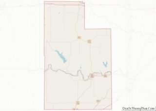
| County: | Caddo County |
| Elevation: | 1,362 ft (415 m) |
| Total Area: | 0.57 sq mi (1.48 km²) |
| Land Area: | 0.57 sq mi (1.48 km²) |
| Water Area: | 0.00 sq mi (0.00 km²) |
| Total Population: | 827 |
| Population Density: | 1,443.28/sq mi (557.23/km²) |
| ZIP code: | 73029 |
| Area code: | 580 |
| FIPS code: | 4019000 |
| GNISfeature ID: | 1091906 |
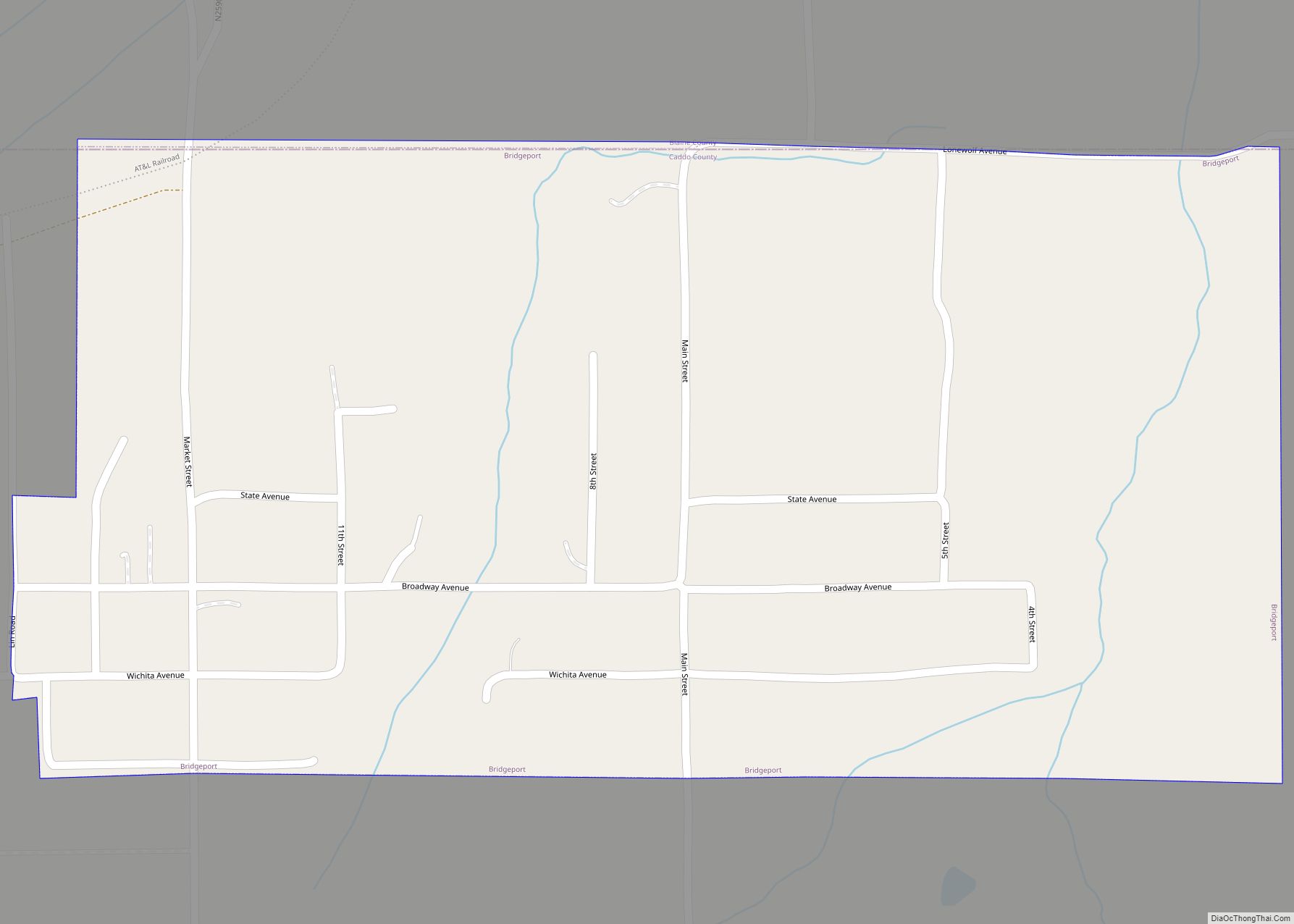
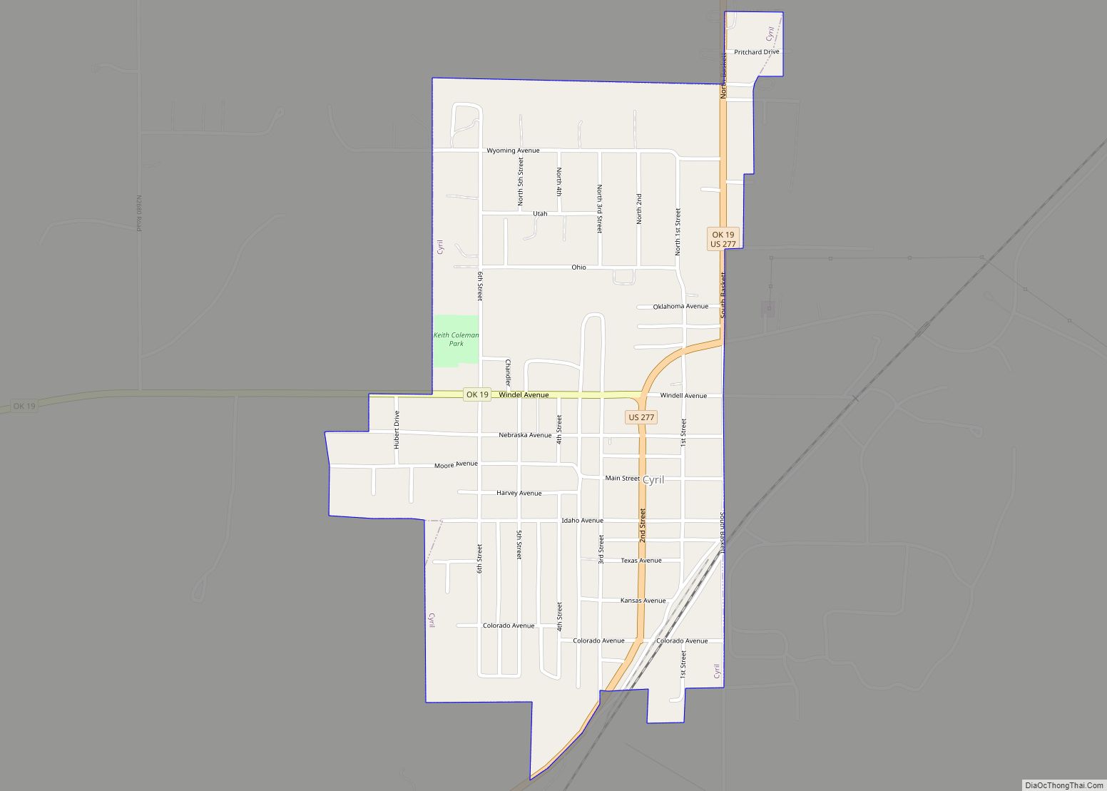
Online Interactive Map
Click on ![]() to view map in "full screen" mode.
to view map in "full screen" mode.
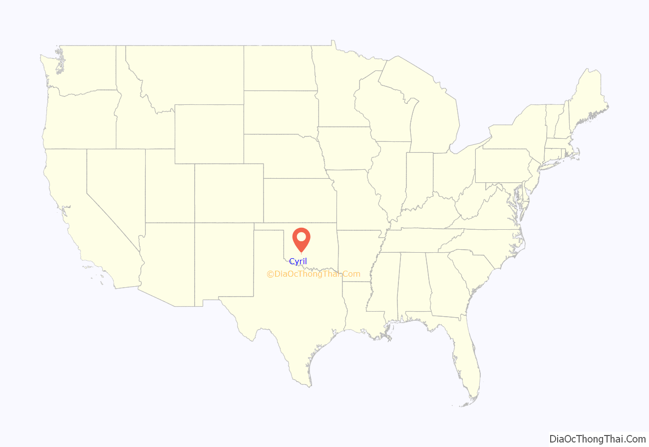
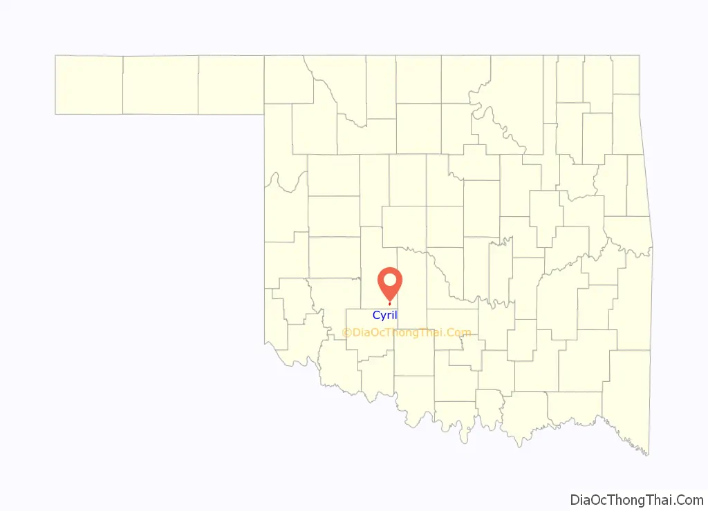
Cyril location map. Where is Cyril town?
History
On August 25, 1901, Louise (probably called Cyril) Lookingglass, the infant daughter of Bayard (Monapahrah) and Laura (Tit-tah-ter-way) Lookingglass, was allotted 160 acres (0.65 km) of land that would become the Cyril townsite. Louise Lookingglass died in 1903. Bayard Lookingglass sold one-half of the allotment to Mr. and Mrs. Pierson on July 26, 1907. The Piersons sold the land to the Cyril Townsite and Development Company on September 10, 1907.
Although there is some dispute, the Cyril Station appears to have been named circa 1902 after Bayard and Laura Lookingglasses’ daughter when they granted the railroad permission to build a section house next to the railroad stop. Some believed that the town of Cyril was named after the Cyril Station of the St. Louis-San Francisco Railroad. However a diligent search of all sources including Frisco Railroad, found no supporting evidence.
The townsite was surveyed, plotted out and dedicated in September 1907. Construction began in early 1908 and by April there were 200 inhabitants, 3 hardware stores, 3 grocery stores, a general tin and pump house, restaurant, rooming house, pool hall, two barber shops, blacksmith shop, lumberyard, feed yard and feed mill.
The town was the site of an oil refinery from the early 1920s until it was closed in 1984. During that time, the refinery was operated by Anderson-Prichard Refining, APCO, and later Oklahoma Refining. It was the major economic driver for the town, employing 160 people at the time of closure. An unsuccessful attempt was made in the early 1990s to restart part of the refinery. As of 2010, the refinery had been demolished and the site was a Superfund environmental cleanup site.
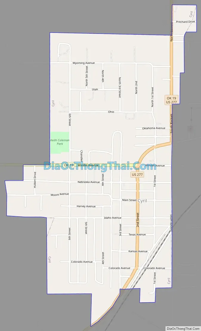
Cyril Road Map
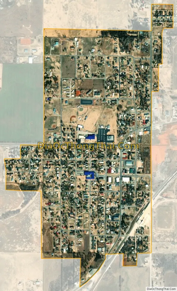
Cyril city Satellite Map
Geography
Cyril is located in southeastern Caddo County at 34°53′53″N 98°12′10″W / 34.89806°N 98.20278°W / 34.89806; -98.20278 (34.897969, -98.202843). U.S. Route 277 passes through the town, leading northeast 23 miles (37 km) to Chickasha and southwest 28 miles (45 km) to Lawton. Oklahoma City is 66 miles (106 km) to the northeast via US 277 and Interstate 44.
According to the United States Census Bureau, Cyril has a total area of 0.58 square miles (1.5 km), all land.
See also
Map of Oklahoma State and its subdivision:- Adair
- Alfalfa
- Atoka
- Beaver
- Beckham
- Blaine
- Bryan
- Caddo
- Canadian
- Carter
- Cherokee
- Choctaw
- Cimarron
- Cleveland
- Coal
- Comanche
- Cotton
- Craig
- Creek
- Custer
- Delaware
- Dewey
- Ellis
- Garfield
- Garvin
- Grady
- Grant
- Greer
- Harmon
- Harper
- Haskell
- Hughes
- Jackson
- Jefferson
- Johnston
- Kay
- Kingfisher
- Kiowa
- Latimer
- Le Flore
- Lincoln
- Logan
- Love
- Major
- Marshall
- Mayes
- McClain
- McCurtain
- McIntosh
- Murray
- Muskogee
- Noble
- Nowata
- Okfuskee
- Oklahoma
- Okmulgee
- Osage
- Ottawa
- Pawnee
- Payne
- Pittsburg
- Pontotoc
- Pottawatomie
- Pushmataha
- Roger Mills
- Rogers
- Seminole
- Sequoyah
- Stephens
- Texas
- Tillman
- Tulsa
- Wagoner
- Washington
- Washita
- Woods
- Woodward
- Alabama
- Alaska
- Arizona
- Arkansas
- California
- Colorado
- Connecticut
- Delaware
- District of Columbia
- Florida
- Georgia
- Hawaii
- Idaho
- Illinois
- Indiana
- Iowa
- Kansas
- Kentucky
- Louisiana
- Maine
- Maryland
- Massachusetts
- Michigan
- Minnesota
- Mississippi
- Missouri
- Montana
- Nebraska
- Nevada
- New Hampshire
- New Jersey
- New Mexico
- New York
- North Carolina
- North Dakota
- Ohio
- Oklahoma
- Oregon
- Pennsylvania
- Rhode Island
- South Carolina
- South Dakota
- Tennessee
- Texas
- Utah
- Vermont
- Virginia
- Washington
- West Virginia
- Wisconsin
- Wyoming