Freedom is a town in Woods County, Oklahoma, United States. It lies twenty-five miles west of Alva, on the banks of the Cimarron River. As of the 2010 census, the city population was 289.
| Name: | Freedom town |
|---|---|
| LSAD Code: | 43 |
| LSAD Description: | town (suffix) |
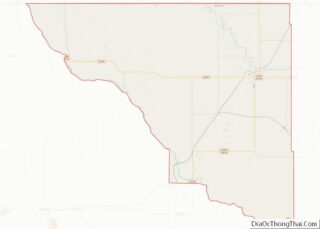
| State: | Oklahoma |
| County: | Woods County |
| Incorporated: | 1925 |
| Elevation: | 1,529 ft (466 m) |
| Total Area: | 0.39 sq mi (1.01 km²) |
| Land Area: | 0.39 sq mi (1.01 km²) |
| Water Area: | 0.00 sq mi (0.00 km²) |
| Total Population: | 174 |
| Population Density: | 445.01/sq mi (171.96/km²) |
| ZIP code: | 73842 |
| Area code: | 580 |
| FIPS code: | 4027850 |
| GNISfeature ID: | 1093038 |
| Website: | freedomokla.com |
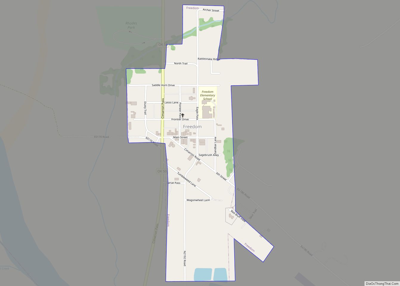
Online Interactive Map
Click on ![]() to view map in "full screen" mode.
to view map in "full screen" mode.
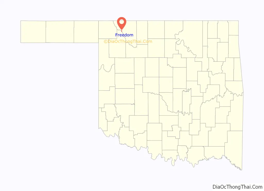
Freedom location map. Where is Freedom town?

History
On September 13 and 14, 1878, the Battle of Turkey Springs was fought approximately ten miles northeast of present-day Freedom. It was the last known encounter between the United States Cavalry and American Indians in Oklahoma.
In the late 1800s, following the Cherokee Strip Land Run, farmers and ranchers began a small settlement in the area. This 1893 land run, combined with the building of the Buffalo and Northwestern Railroad in 1919–20, incentivized many settlers to homestead 160-acre tracts in the area. The community of Freedom – so-named by the postal service – was granted a post office in 1901, with Mrs. Adlah Annis serving as its first postmaster. However, it wouldn’t be until 1925 that Freedom was officially incorporated, with a population of 251.
The community of Freedom is known as the smallest certified city (as opposed to a town) in the state of Oklahoma.
Freedom Road Map

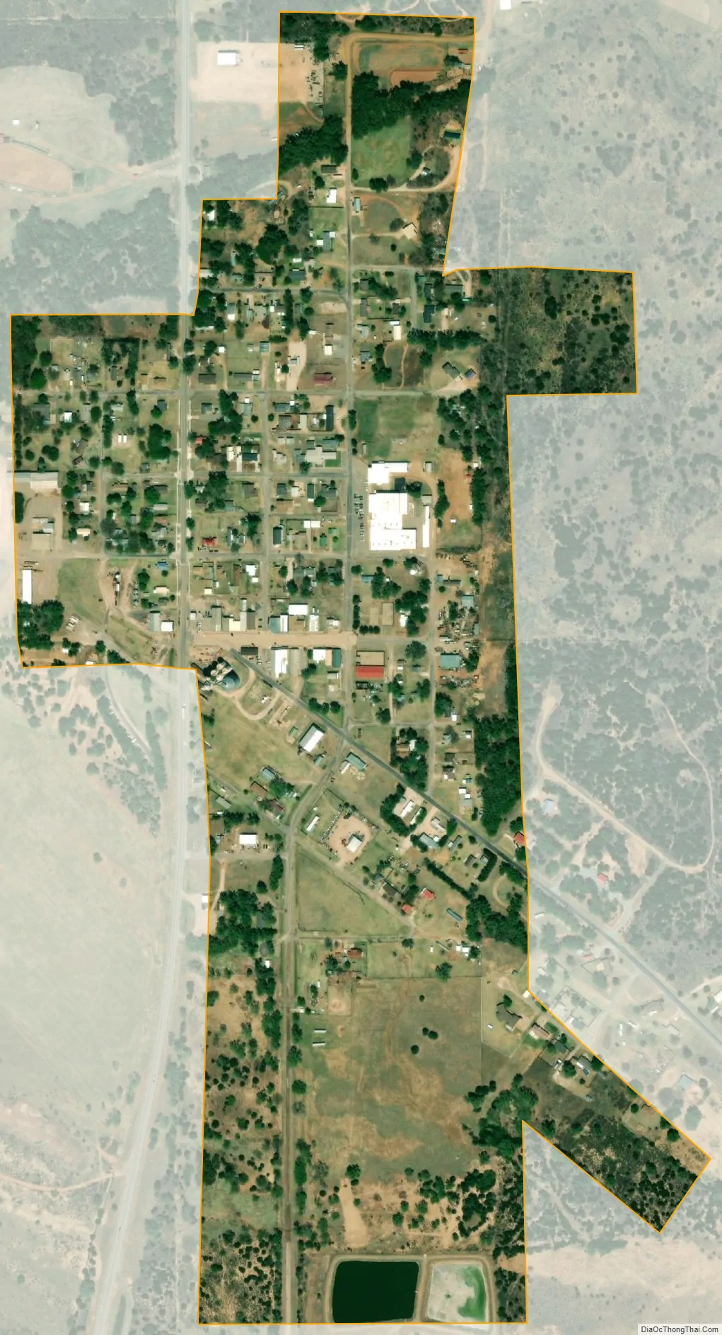
Freedom city Satellite Map
Geography
Freedom is located at 36°46′09″N 99°06′48″W / 36.769179°N 99.113415°W / 36.769179; -99.113415. According to the United States Census Bureau, the town has a total area of 0.3 square miles (0.78 km), all land.
Climate
See also
Map of Oklahoma State and its subdivision:- Adair
- Alfalfa
- Atoka
- Beaver
- Beckham
- Blaine
- Bryan
- Caddo
- Canadian
- Carter
- Cherokee
- Choctaw
- Cimarron
- Cleveland
- Coal
- Comanche
- Cotton
- Craig
- Creek
- Custer
- Delaware
- Dewey
- Ellis
- Garfield
- Garvin
- Grady
- Grant
- Greer
- Harmon
- Harper
- Haskell
- Hughes
- Jackson
- Jefferson
- Johnston
- Kay
- Kingfisher
- Kiowa
- Latimer
- Le Flore
- Lincoln
- Logan
- Love
- Major
- Marshall
- Mayes
- McClain
- McCurtain
- McIntosh
- Murray
- Muskogee
- Noble
- Nowata
- Okfuskee
- Oklahoma
- Okmulgee
- Osage
- Ottawa
- Pawnee
- Payne
- Pittsburg
- Pontotoc
- Pottawatomie
- Pushmataha
- Roger Mills
- Rogers
- Seminole
- Sequoyah
- Stephens
- Texas
- Tillman
- Tulsa
- Wagoner
- Washington
- Washita
- Woods
- Woodward
- Alabama
- Alaska
- Arizona
- Arkansas
- California
- Colorado
- Connecticut
- Delaware
- District of Columbia
- Florida
- Georgia
- Hawaii
- Idaho
- Illinois
- Indiana
- Iowa
- Kansas
- Kentucky
- Louisiana
- Maine
- Maryland
- Massachusetts
- Michigan
- Minnesota
- Mississippi
- Missouri
- Montana
- Nebraska
- Nevada
- New Hampshire
- New Jersey
- New Mexico
- New York
- North Carolina
- North Dakota
- Ohio
- Oklahoma
- Oregon
- Pennsylvania
- Rhode Island
- South Carolina
- South Dakota
- Tennessee
- Texas
- Utah
- Vermont
- Virginia
- Washington
- West Virginia
- Wisconsin
- Wyoming