Alva is a city in and the county seat of Woods County, Oklahoma, United States, along the Salt Fork Arkansas River. The population was 4,945 at the 2010 census. Northwestern Oklahoma State University is located in Alva.
| Name: | Alva city |
|---|---|
| LSAD Code: | 25 |
| LSAD Description: | city (suffix) |
| State: | Oklahoma |
| County: | Woods County |
| Incorporated: | 1893; 130 years ago (1893) |
| Elevation: | 1,345 ft (410 m) |
| Total Area: | 6.30 sq mi (16.33 km²) |
| Land Area: | 6.30 sq mi (16.33 km²) |
| Water Area: | 0.00 sq mi (0.00 km²) |
| Total Population: | 5,028 |
| Population Density: | 797.46/sq mi (307.91/km²) |
| ZIP code: | 73717 |
| Area code: | 580 |
| FIPS code: | 4001800 |
| Website: | alvaok.org |
Online Interactive Map
Click on ![]() to view map in "full screen" mode.
to view map in "full screen" mode.
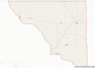
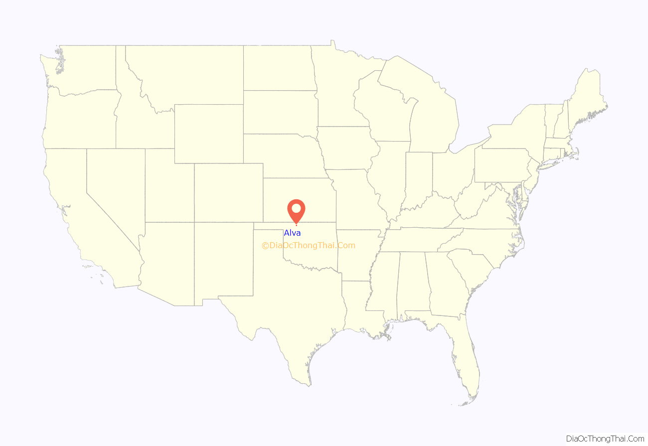
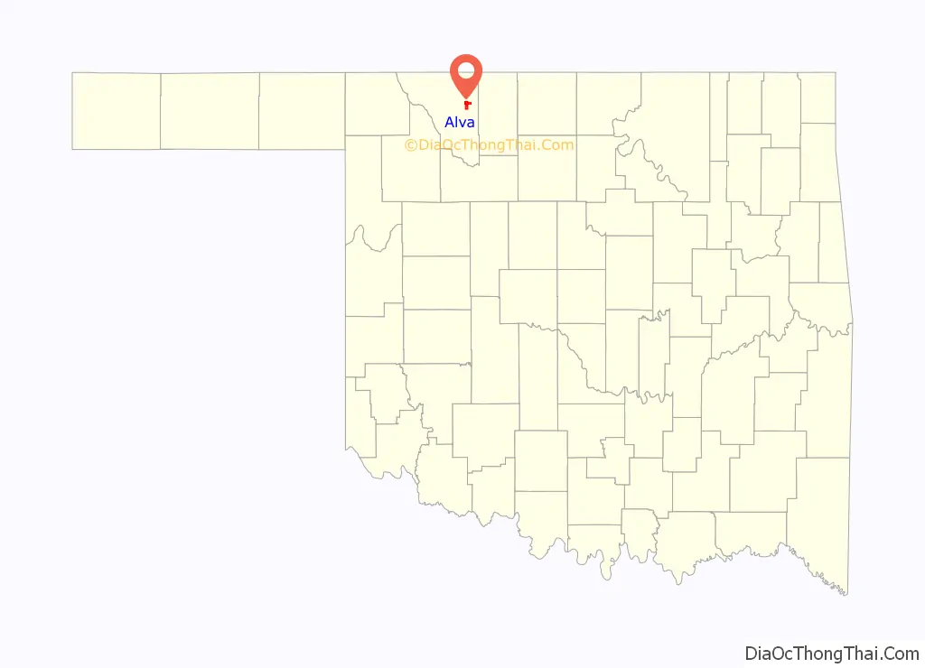
Alva location map. Where is Alva city?
History
Alva was established in 1893 as a General Land Office for the Cherokee Outlet land run, the largest of the land rushes that settled western and central Oklahoma. The site was chosen for its location on the Atchison, Topeka & Santa Fe Railway and likely named for a railroad attorney, Alva Adams, who had become governor of Colorado.
When the Southern Kansas Railway, began extending its line from Kiowa, Kansas across the Cherokee Outlet in 1886, Alva became the first railroad station southwest of Kiowa. The line was operational in 1887, in time for the opening of the Unassigned Lands.
The United States Secretary of the Interior chose Alva as the seat of County M when Oklahoma Territory was organized in 1890. A U.S. government land office opened there before a presidential proclamation on August 19, 1893, opened the Cherokee Outlet for general settlement. The actual land run occurred September 16, 1893. By then, Alva’s 320 acres (1.3 km) site had been formally surveyed and platted.
In 1896, three years after the land run, George Cromwell and “Coal Oil Johnny” Broughan created and managed the Alva Giants, the city’s first traveling baseball team including pitcher Bill McGill, who went on to join the St. Louis Browns in 1907.
Northwestern Territorial Normal School, now Northwestern Oklahoma State University, was established in 1897 in Alva by the Oklahoma Territorial Legislature.
During World War II, Alva was the site of a prisoner of war camp for German POWs. On July 19, 1943, the United States Department of War ordered that Camp Alva would be the place for the internment of the most troublesome German prisoners of war – “Nazi leaders, Gestapo agents, and extremists”.
Alva is also the location of the Oklahoma Department of Corrections minimum-security Charles E. Johnson Correctional Center housing 630 male felon drug offenders.
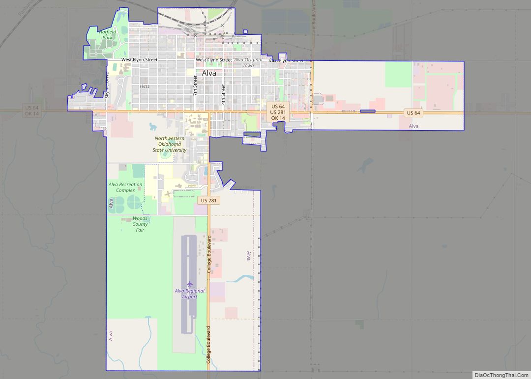
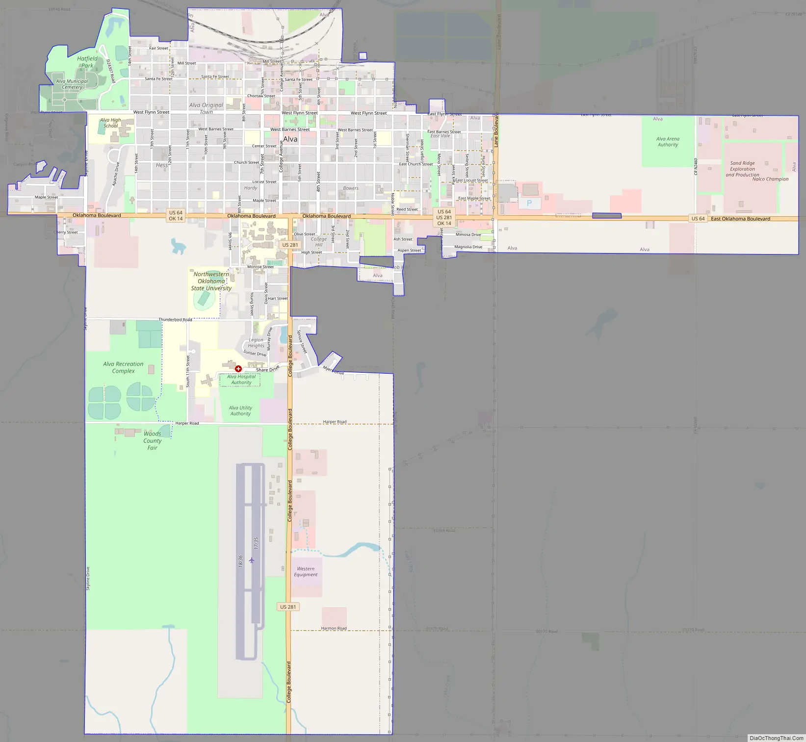
Alva Road Map
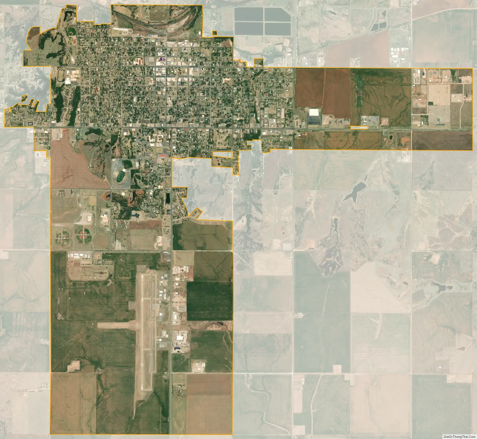
Alva city Satellite Map
Geography
Alva is located in the northeastern quadrant of Woods County, 65 miles (105 km) northeast of Woodward, 72 miles (116 km) northwest of Enid and 119 miles (192 km) southwest of Wichita, Kansas. Its geographic coordinates are 36°48′7″N 98°39′57″W / 36.80194°N 98.66583°W / 36.80194; -98.66583 (36.801931, -98.665959). According to the United States Census Bureau, the city has a total area of 2.4 square miles (6.2 km), all land.
Climate
See also
Map of Oklahoma State and its subdivision:- Adair
- Alfalfa
- Atoka
- Beaver
- Beckham
- Blaine
- Bryan
- Caddo
- Canadian
- Carter
- Cherokee
- Choctaw
- Cimarron
- Cleveland
- Coal
- Comanche
- Cotton
- Craig
- Creek
- Custer
- Delaware
- Dewey
- Ellis
- Garfield
- Garvin
- Grady
- Grant
- Greer
- Harmon
- Harper
- Haskell
- Hughes
- Jackson
- Jefferson
- Johnston
- Kay
- Kingfisher
- Kiowa
- Latimer
- Le Flore
- Lincoln
- Logan
- Love
- Major
- Marshall
- Mayes
- McClain
- McCurtain
- McIntosh
- Murray
- Muskogee
- Noble
- Nowata
- Okfuskee
- Oklahoma
- Okmulgee
- Osage
- Ottawa
- Pawnee
- Payne
- Pittsburg
- Pontotoc
- Pottawatomie
- Pushmataha
- Roger Mills
- Rogers
- Seminole
- Sequoyah
- Stephens
- Texas
- Tillman
- Tulsa
- Wagoner
- Washington
- Washita
- Woods
- Woodward
- Alabama
- Alaska
- Arizona
- Arkansas
- California
- Colorado
- Connecticut
- Delaware
- District of Columbia
- Florida
- Georgia
- Hawaii
- Idaho
- Illinois
- Indiana
- Iowa
- Kansas
- Kentucky
- Louisiana
- Maine
- Maryland
- Massachusetts
- Michigan
- Minnesota
- Mississippi
- Missouri
- Montana
- Nebraska
- Nevada
- New Hampshire
- New Jersey
- New Mexico
- New York
- North Carolina
- North Dakota
- Ohio
- Oklahoma
- Oregon
- Pennsylvania
- Rhode Island
- South Carolina
- South Dakota
- Tennessee
- Texas
- Utah
- Vermont
- Virginia
- Washington
- West Virginia
- Wisconsin
- Wyoming