Geary is a city in Blaine and Canadian counties in the U.S. state of Oklahoma. The population was 994 at the 2020 census. The town was named for Edmund Guerrier, a scout and an interpreter for the U.S. Army.
| Name: | Geary city |
|---|---|
| LSAD Code: | 25 |
| LSAD Description: | city (suffix) |
| State: | Oklahoma |
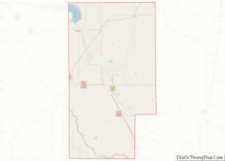
| County: | Blaine County, Canadian County |
| Elevation: | 1,598 ft (487 m) |
| Total Area: | 4.14 sq mi (10.73 km²) |
| Land Area: | 4.14 sq mi (10.73 km²) |
| Water Area: | 0.00 sq mi (0.01 km²) |
| Total Population: | 994 |
| Population Density: | 240.04/sq mi (92.68/km²) |
| ZIP code: | 73040 |
| Area code: | 405/572 |
| FIPS code: | 4028900 |
| GNISfeature ID: | 2410579 |
| Website: | www.cityofgeary.com |
Online Interactive Map
Click on ![]() to view map in "full screen" mode.
to view map in "full screen" mode.
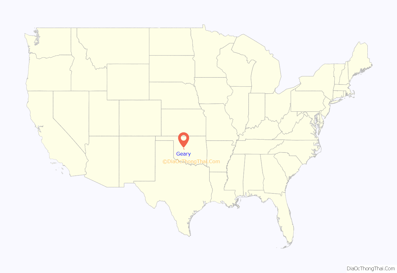
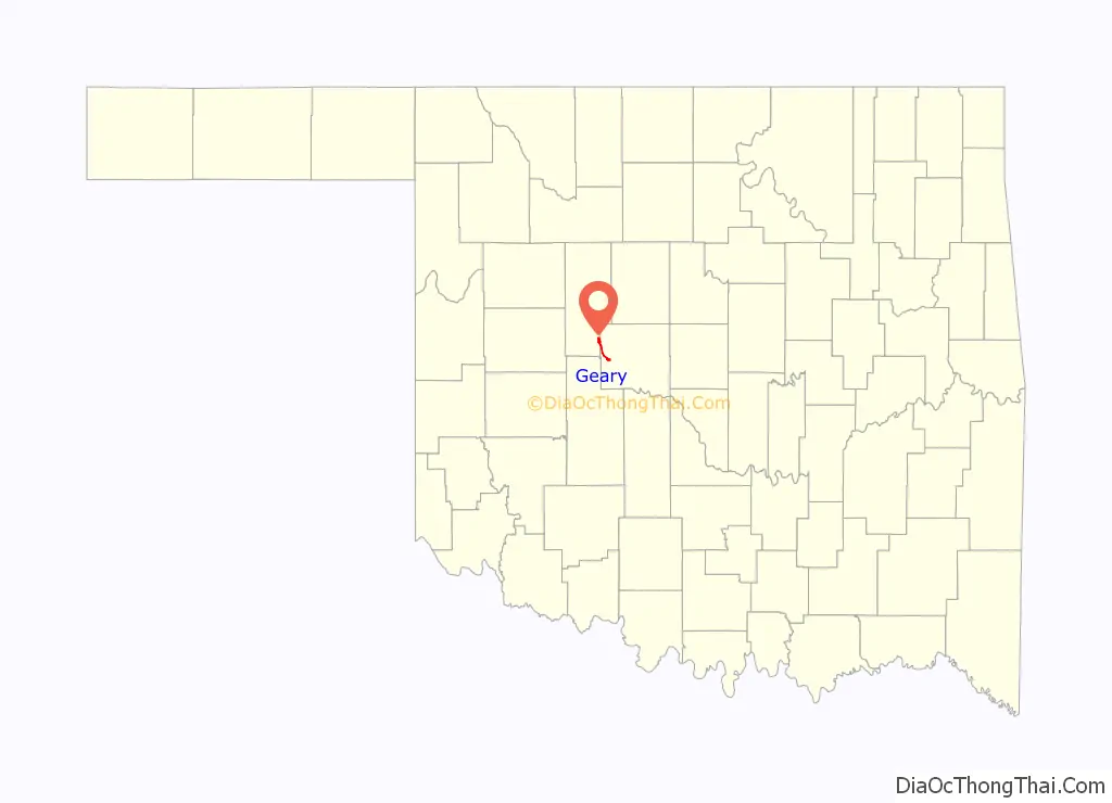
Geary location map. Where is Geary city?
History
The area occupied by the present city of Geary was previously part of the Cheyenne-Arapaho reservation until it was opened in April, 1892 for settlement by non-Indians. Shuffle Huff and his son, William, filed several land claims in the area and sold two quarter sections to a land development company. A community was begun about 1.5 miles (2.4 km) northwest of its present location. Settlers moved the town to the present site to be located on the proposed route of the Choctaw, Oklahoma and Gulf Railroad line that was to be built west from El Reno.
Edmund Guerriere, of French – Cheyenne ancestry and a former Army scout and interpreter, had acquired a land allotment about 3 miles (4.8 km) northeast of the town. According to the Encyclopedia of Oklahoma History and Culture, the town name was spelled “Geary” because the settlers had difficulty spelling and pronouncing the original name. The Geary post office was established October 12, 1892.
In the 1901-1902 timeframe, the town became the starting point for a second railway, the Choctaw Northern Railroad, which ran north all the way to Anthony, Kansas. Quickly becoming a trade center for the agricultural area that surrounded it, Geary was established as a “first-class city” in Oklahoma Territory in 1902. The population had grown to 2,561 in that year. That number declined to 1,565 by the time of statehood in 1907.
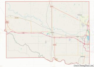
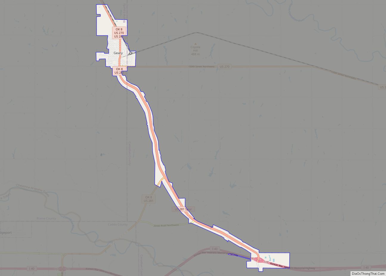
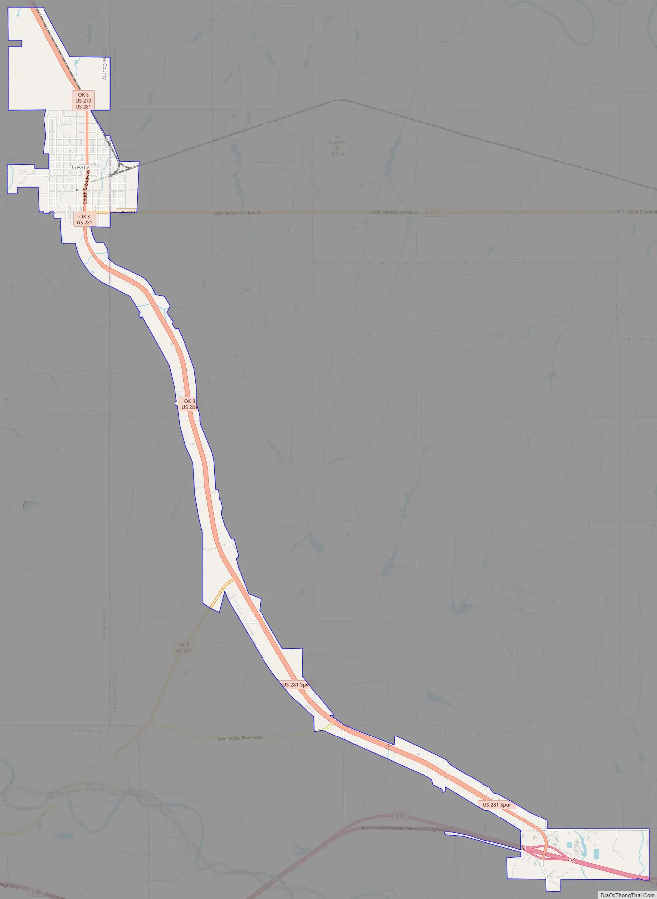
Geary Road Map
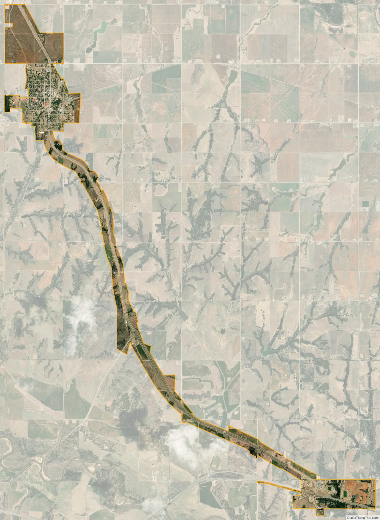
Geary city Satellite Map
Geography
Geary is located in southern Blaine County and northwestern Canadian County at 35°37′46″N 98°19′5″W / 35.62944°N 98.31806°W / 35.62944; -98.31806 (35.629486, −98.318176). The city limits extend southeast along U.S. Route 281 8 miles (13 km) from the center of town to Exit 108 on Interstate 40. From this point it is 43 miles (69 km) east to downtown Oklahoma City. U.S. Route 270 leads east from Geary 11 miles (18 km) to Calumet. U.S. 281 and 270 together lead northwest 17 miles (27 km) to Watonga.
According to the United States Census Bureau, as of 2010 the city has a total area of 4.15 square miles (10.75 km), of which 0.004 square miles (0.01 km), or 0.06%, is water.
See also
Map of Oklahoma State and its subdivision:- Adair
- Alfalfa
- Atoka
- Beaver
- Beckham
- Blaine
- Bryan
- Caddo
- Canadian
- Carter
- Cherokee
- Choctaw
- Cimarron
- Cleveland
- Coal
- Comanche
- Cotton
- Craig
- Creek
- Custer
- Delaware
- Dewey
- Ellis
- Garfield
- Garvin
- Grady
- Grant
- Greer
- Harmon
- Harper
- Haskell
- Hughes
- Jackson
- Jefferson
- Johnston
- Kay
- Kingfisher
- Kiowa
- Latimer
- Le Flore
- Lincoln
- Logan
- Love
- Major
- Marshall
- Mayes
- McClain
- McCurtain
- McIntosh
- Murray
- Muskogee
- Noble
- Nowata
- Okfuskee
- Oklahoma
- Okmulgee
- Osage
- Ottawa
- Pawnee
- Payne
- Pittsburg
- Pontotoc
- Pottawatomie
- Pushmataha
- Roger Mills
- Rogers
- Seminole
- Sequoyah
- Stephens
- Texas
- Tillman
- Tulsa
- Wagoner
- Washington
- Washita
- Woods
- Woodward
- Alabama
- Alaska
- Arizona
- Arkansas
- California
- Colorado
- Connecticut
- Delaware
- District of Columbia
- Florida
- Georgia
- Hawaii
- Idaho
- Illinois
- Indiana
- Iowa
- Kansas
- Kentucky
- Louisiana
- Maine
- Maryland
- Massachusetts
- Michigan
- Minnesota
- Mississippi
- Missouri
- Montana
- Nebraska
- Nevada
- New Hampshire
- New Jersey
- New Mexico
- New York
- North Carolina
- North Dakota
- Ohio
- Oklahoma
- Oregon
- Pennsylvania
- Rhode Island
- South Carolina
- South Dakota
- Tennessee
- Texas
- Utah
- Vermont
- Virginia
- Washington
- West Virginia
- Wisconsin
- Wyoming