Hartshorne (pronounced “Hearts-orn”) is a city in Pittsburg County, Oklahoma, United States. It is the second largest city in the county. The population was 2,125 at the 2010 census.
| Name: | Hartshorne city |
|---|---|
| LSAD Code: | 25 |
| LSAD Description: | city (suffix) |
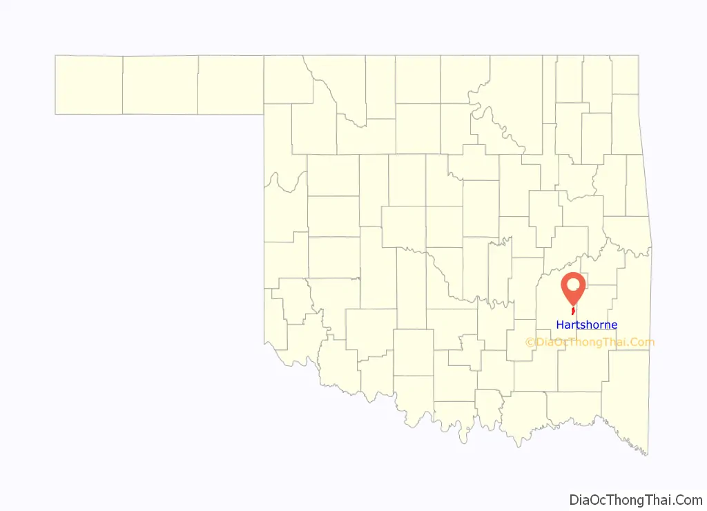
| State: | Oklahoma |
| County: | Pittsburg County |
| Elevation: | 702 ft (214 m) |
| Total Area: | 3.39 sq mi (8.79 km²) |
| Land Area: | 3.25 sq mi (8.42 km²) |
| Water Area: | 0.14 sq mi (0.36 km²) |
| Total Population: | 1,947 |
| Population Density: | 598.52/sq mi (231.12/km²) |
| ZIP code: | 74547 |
| Area code: | 539/918 |
| FIPS code: | 4032850 |
| GNISfeature ID: | 1093586 |
| Website: | www.cityofhartshorne.com |
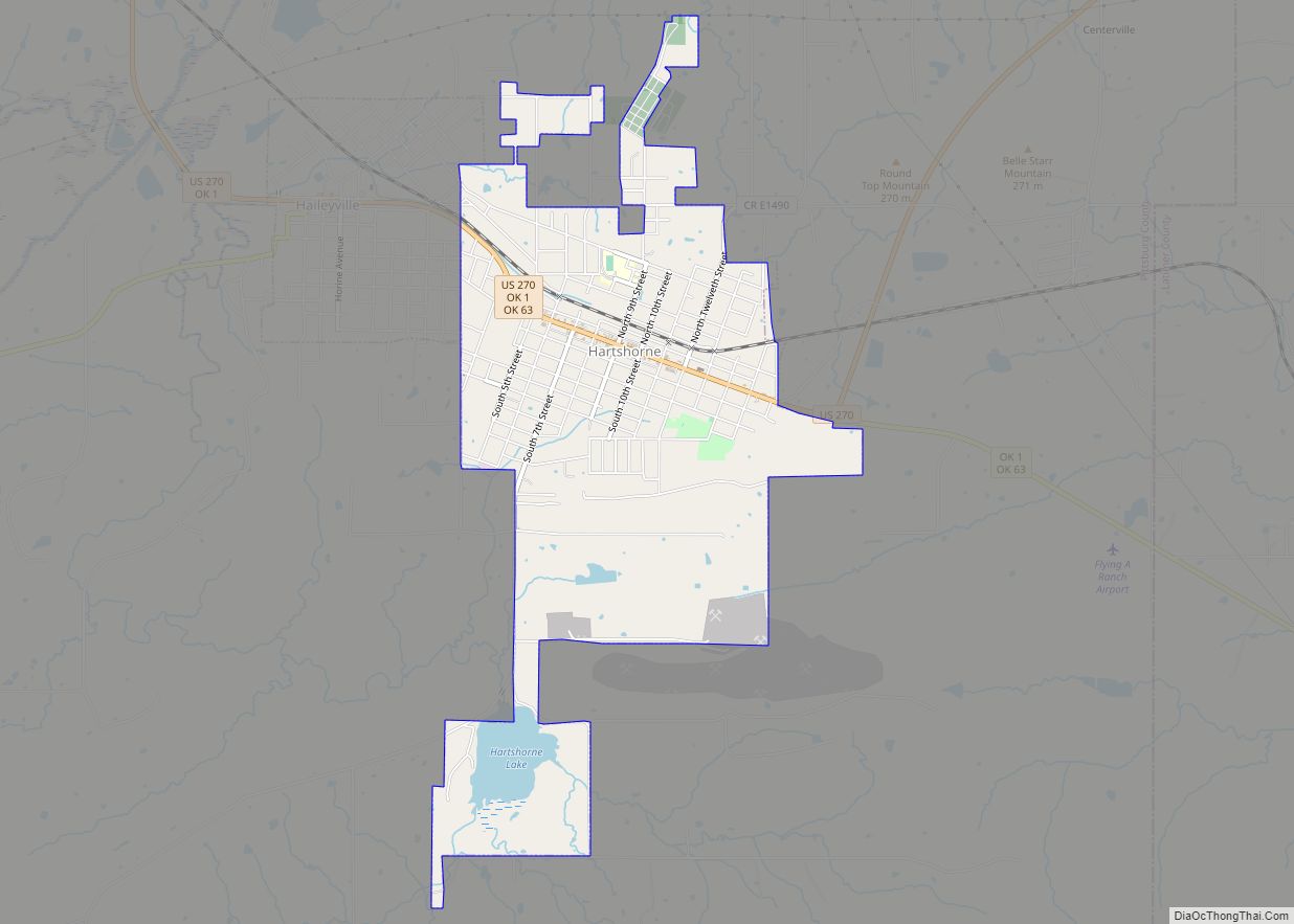
Online Interactive Map
Click on ![]() to view map in "full screen" mode.
to view map in "full screen" mode.
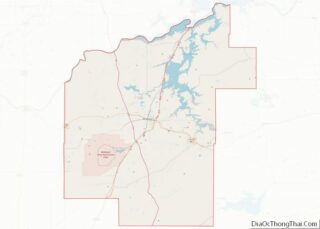
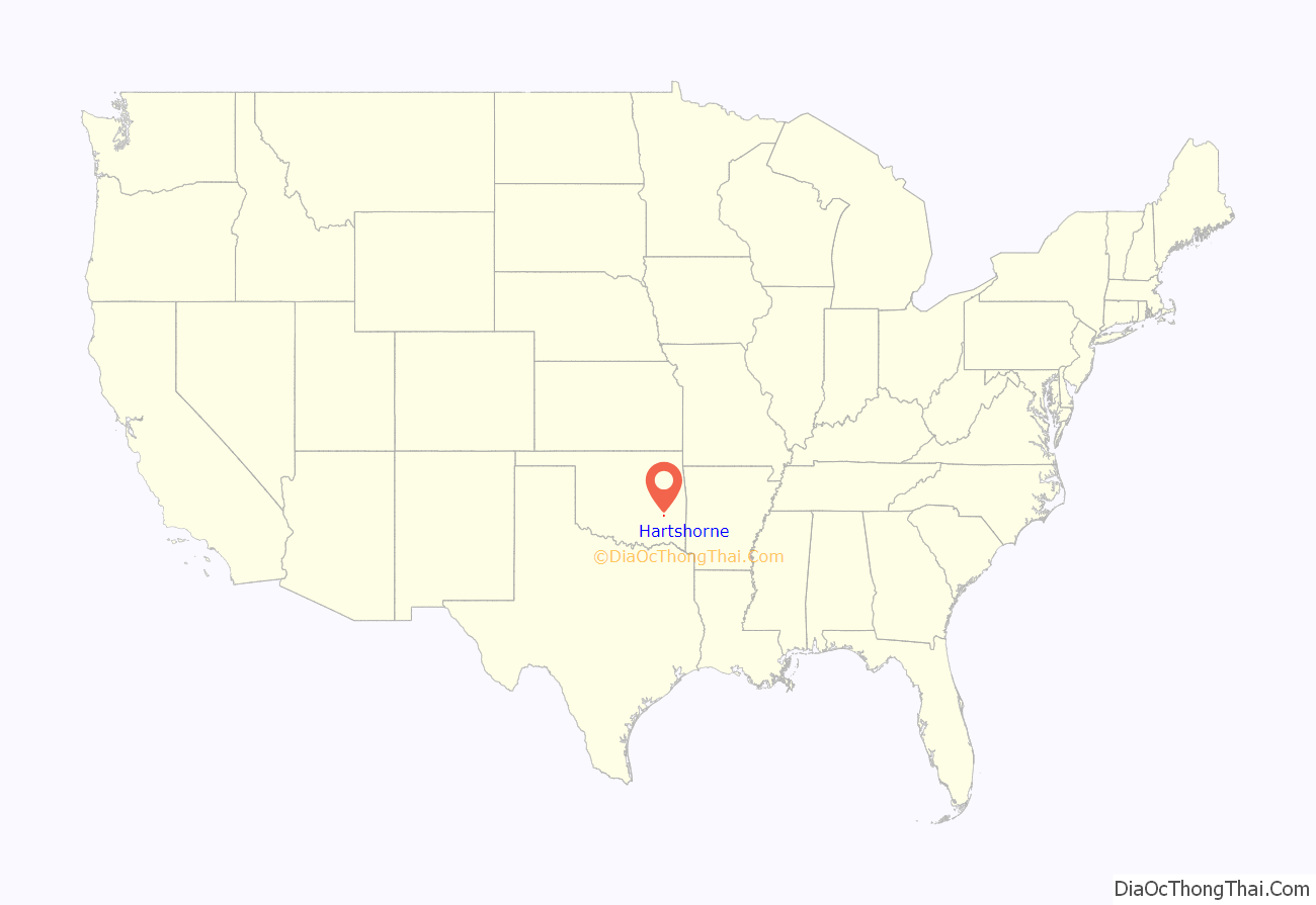
Hartshorne location map. Where is Hartshorne city?
History
The present-day city of Hartshorne began as a coal mining community about 1850. Coal mine operators in the Indian Territory recruited European immigrants to work the mines. The first workers were probably English and Irish, but other ethnic groups soon joined them. These included Italians and eastern Europeans. Like many other such communities, this was a company town, built very close to the mine, with rudimentary houses and a company store.
A post office opened at Hartshorne, Indian Territory on March 5, 1850. It was named for Dr. Charles Hartshorne, a railroad official. Jones Academy was established southwest of Hartshorne in 1881. At the time of its founding, Hartshorne was located in Gaines County, a part of the Moshulatubbee District of the Choctaw Nation.
The Choctaw Coal and Railway (CC&R) line, acquired by the town, was incorporated in 1887 and began building a 67 miles (108 km) line between Wister and South McAlester. In 1894, the CC&R was reorganized and renamed the Choctaw, Oklahoma and Gulf Railroad (CO&G) in 1894. The Wister – South McAlester line was completed in 1900, and also linked to Wilburton, Alderson and Hartshorne. In 1902, the Chicago, Rock Island and Pacific Railway gained control of the CO&G. In 1904 an electric interurban began service from McAlester to Hartshorne.
The Holy Rosary Church, complete with a rectory, a convent, and a parochial school, was built in 1895 by Russian and other Eastern European immigrants. Other churches constructed before the 20th Century were: Baptist, Methodist, Christian, Presbyterian, and Episcopal. The Saints Cyril and Methodius Russian Orthodox Greek Catholic Church, remains a landmark. Completed in 1916, it replaced an earlier 1897 version that immigrants from Russia and other eastern European countries constructed.
The Saints Cyril and Methodius church had been owned by the Sts. Cyril Methodius Orthodox Church, Inc. On March 20, 2016, a man named Bill Melancon filed a quitclaim deed in the Pittsburg County Clerk’s office, transferring ownership of the property to Melancon. The quitclaim deed had been signed by Bill O’Nesky, a church member, who Melancon claimed was a church trustee. Melanin also presented a Special Warranty Deed dated in 2010, by Bill O’Nesky, Tanya O’Nesky, and Foy Ledbetter, identified as successor trustees of the church. A group of church members first learned about the alleged sale soon afterward, when they found strangers on and inside the property. They filed suit in District Court. The case came before Judge James Bland in April 2016. Judge Bland issued a restraining order to bar Melancon, his agents and representatives from coming on or within 100 yards (91 m) of the property, or removing anything or making any changes before Bland revisited the case in June 2010. An out of court settlement between the church members before the date set by the judge resulted in the dismissal of the case, and a deed signed by Melanin transferring ownership back to the church.
The community incorporated in Tobucksy County of the Choctaw Nation by order of the U.S. District Court, Central District, Indian Territory, on March 1, 1900.
Hartshorne became part of Pittsburg County at statehood on November 16, 1907.
Hartshorne Road Map
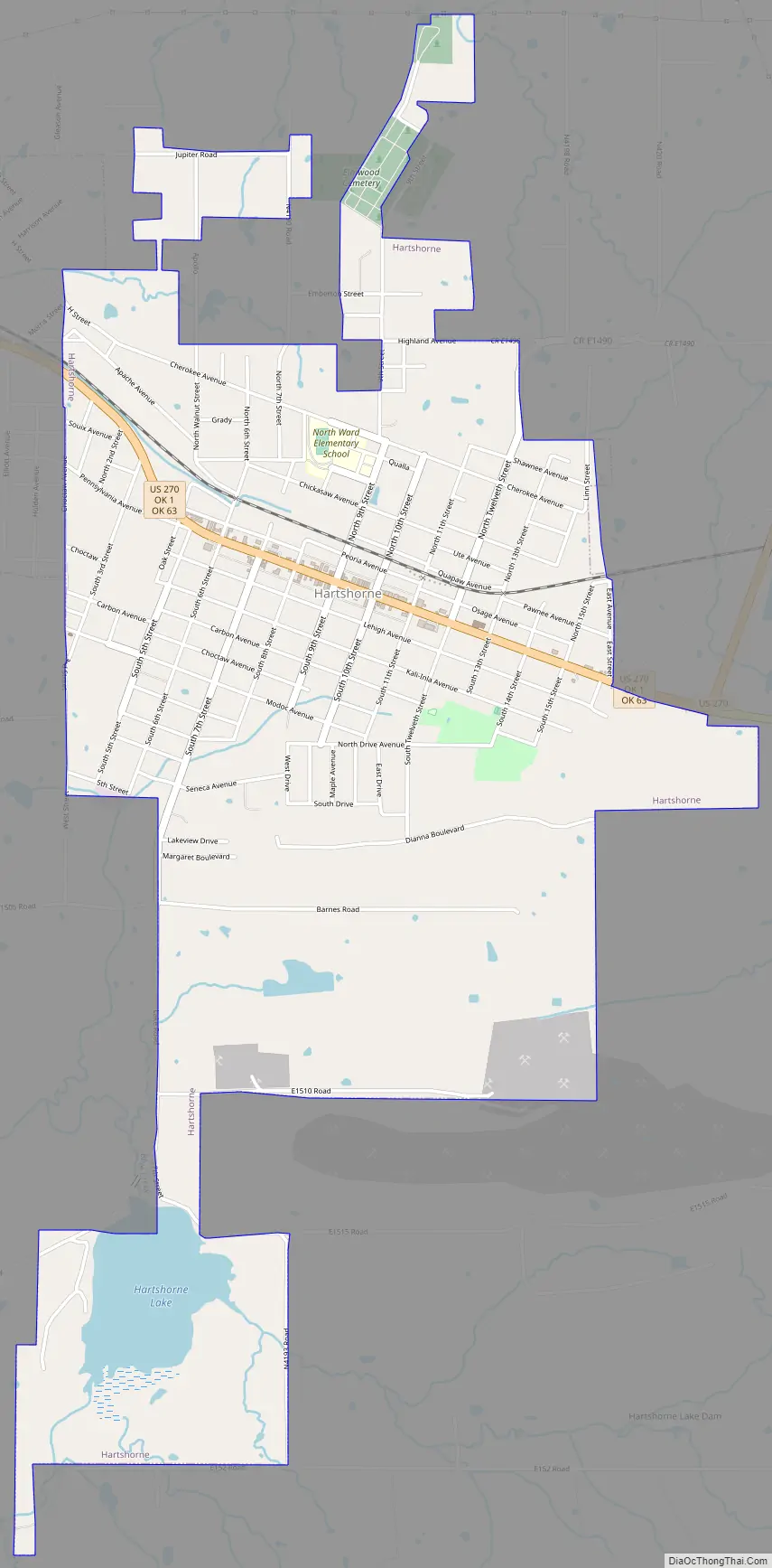
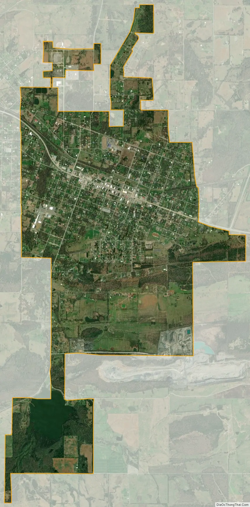
Hartshorne city Satellite Map
Geography
Hartshorne is located at 34°50′43″N 95°33′33″W / 34.84528°N 95.55917°W / 34.84528; -95.55917 (34.845198, -95.559265). According to the United States Census Bureau, the city has a total area of 3.6 square miles (9.3 km), of which 3.5 square miles (9.1 km) is land and 0.1 square miles (0.26 km), or 3.60%, is water. The city is located approximately 15 miles (24 km) east of McAlester on U.S. Highway 270.
See also
Map of Oklahoma State and its subdivision:- Adair
- Alfalfa
- Atoka
- Beaver
- Beckham
- Blaine
- Bryan
- Caddo
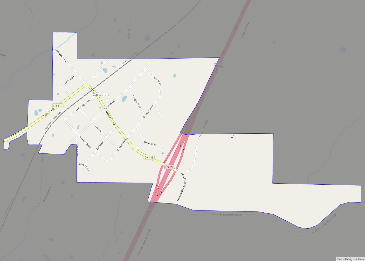
- Canadian
- Carter
- Cherokee
- Choctaw
- Cimarron
- Cleveland
- Coal
- Comanche
- Cotton
- Craig
- Creek
- Custer
- Delaware
- Dewey
- Ellis
- Garfield
- Garvin
- Grady
- Grant
- Greer
- Harmon
- Harper
- Haskell
- Hughes
- Jackson
- Jefferson
- Johnston
- Kay
- Kingfisher
- Kiowa
- Latimer
- Le Flore
- Lincoln
- Logan
- Love
- Major
- Marshall
- Mayes
- McClain
- McCurtain
- McIntosh
- Murray
- Muskogee
- Noble
- Nowata
- Okfuskee
- Oklahoma
- Okmulgee
- Osage
- Ottawa
- Pawnee
- Payne
- Pittsburg
- Pontotoc
- Pottawatomie
- Pushmataha
- Roger Mills
- Rogers
- Seminole
- Sequoyah
- Stephens
- Texas
- Tillman
- Tulsa
- Wagoner
- Washington
- Washita
- Woods
- Woodward
- Alabama
- Alaska
- Arizona
- Arkansas
- California
- Colorado
- Connecticut
- Delaware
- District of Columbia
- Florida
- Georgia
- Hawaii
- Idaho
- Illinois
- Indiana
- Iowa
- Kansas
- Kentucky
- Louisiana
- Maine
- Maryland
- Massachusetts
- Michigan
- Minnesota
- Mississippi
- Missouri
- Montana
- Nebraska
- Nevada
- New Hampshire
- New Jersey
- New Mexico
- New York
- North Carolina
- North Dakota
- Ohio
- Oklahoma
- Oregon
- Pennsylvania
- Rhode Island
- South Carolina
- South Dakota
- Tennessee
- Texas
- Utah
- Vermont
- Virginia
- Washington
- West Virginia
- Wisconsin
- Wyoming