McAlester is the county seat of Pittsburg County, Oklahoma. The population was 18,363 at the time of the 2010 census, a 3.4 percent increase from 17,783 at the 2000 census. The town gets its name from James Jackson McAlester, an early white settler and businessman who later became lieutenant governor of Oklahoma. Known as “J. J.”, McAlester married Rebecca Burney, the daughter of a full-blood Chickasaw family, which made him a citizen of the Chickasaw Nation.
McAlester is the home of the Oklahoma State Penitentiary, the former site of an “inside the walls” prison rodeo that ESPN’s SportsCenter once broadcast.
McAlester is home to many of the employees of the McAlester Army Ammunition Plant. This facility makes essentially all the bombs used by the United States military. In 1998 McAlester became the home of the Defense Ammunition Center (DAC), which moved from Savanna, Illinois, to McAlester Army Ammunition Plant.
| Name: | McAlester city |
|---|---|
| LSAD Code: | 25 |
| LSAD Description: | city (suffix) |
| State: | Oklahoma |
| County: | Pittsburg County |
| Elevation: | 735 ft (224 m) |
| Total Area: | 17.93 sq mi (46.43 km²) |
| Land Area: | 17.80 sq mi (46.10 km²) |
| Water Area: | 0.13 sq mi (0.33 km²) |
| Total Population: | 18,171 |
| Population Density: | 1,020.84/sq mi (394.16/km²) |
| Area code: | 539/918 |
| FIPS code: | 4044800 |
| GNISfeature ID: | 1095202 |
| Website: | www.cityofmcalester.com |
Online Interactive Map
Click on ![]() to view map in "full screen" mode.
to view map in "full screen" mode.
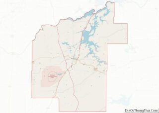
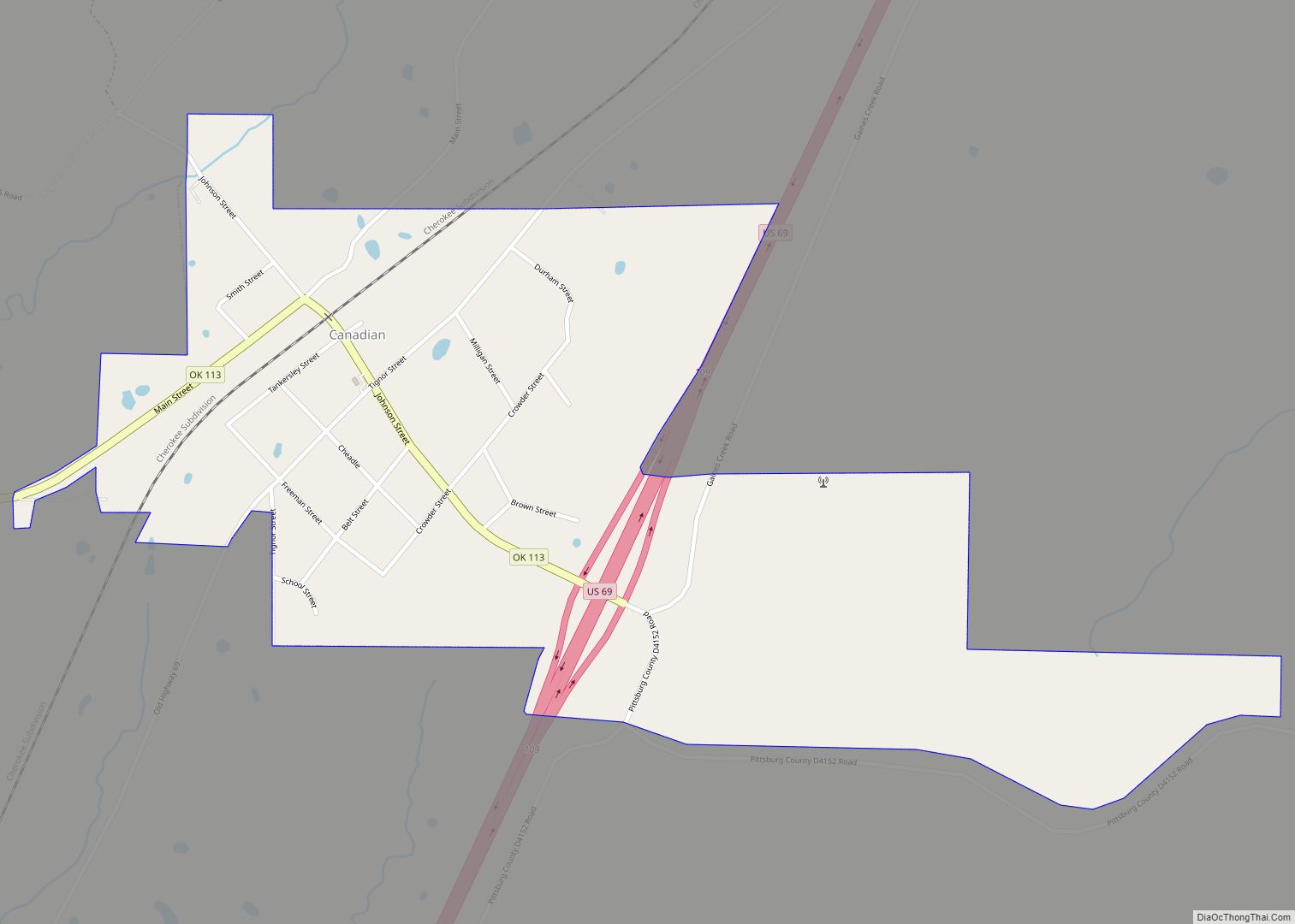
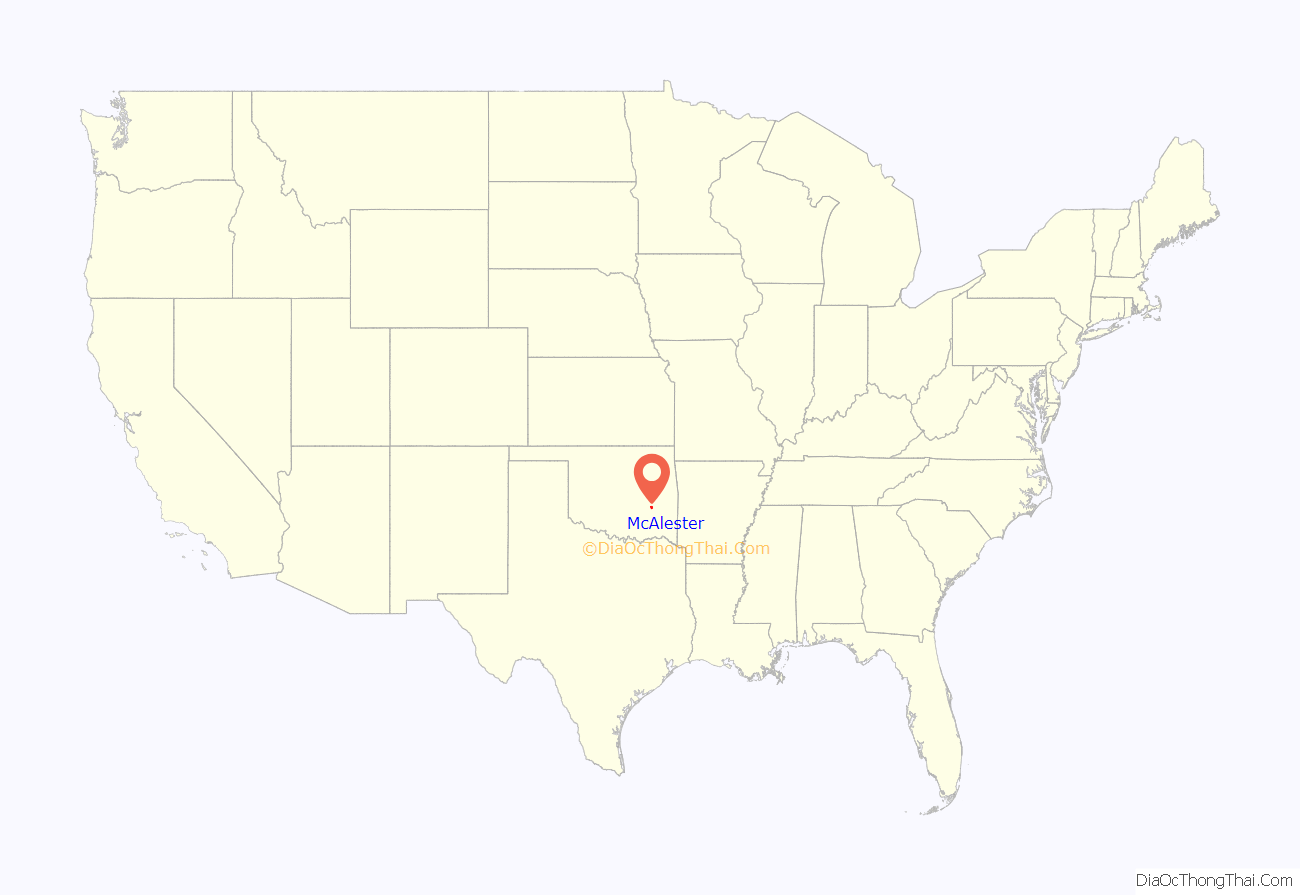
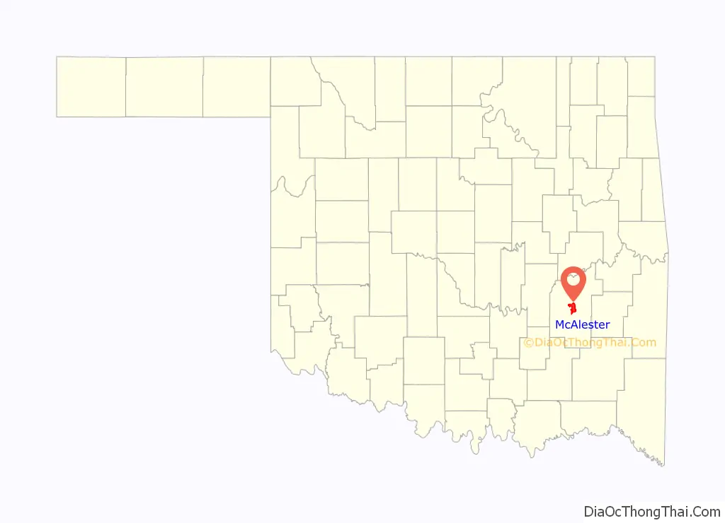
McAlester location map. Where is McAlester city?
History
The crossing of the east–west California Road with the north–south Texas Road formed a natural point of settlement. At the time of its founding, the site was located in Tobucksy County, a part of the Moshulatubbee District of the Choctaw Nation. Alyssia Young, who emigrated from Mississippi to the Indian Territory, first established a settlement at the intersection of the two roads in 1838. The town was named Perryville after James Perry, member of a Choctaw family, who established a trading post. At one time Perryville was the capital of the Choctaw Nation and County Seat of Tobucksy County. During the American Civil War, the Choctaw allied with the Confederate States of America (CSA) as the war reached Indian Territory.
A depot providing supplies to Confederate Forces in Indian Territory was set up at Perryville. On August 26, 1863, a force of 4,500 Union soldiers crossed the Canadian River and destroyed the Confederate munitions depot at Perryville. This became known as the Battle of Perryville, Indian Territory. Union Major General James G. Blunt, finding the Confederate supplies and realizing that Perryville was a major supply depot for Confederate forces, ordered the town burned. The town was rebuilt but never reached its prewar glory or population.
After the end of the Civil War in 1865, Captain J. J. McAlester obtained a job with the trading company of Reynolds and Hannaford. McAlester convinced the firm to locate a general store at Tupelo in the Choctaw Nation. He had learned of coal deposits in Indian Territory during the war while serving as a captain with the 22nd Arkansas Infantry Regiment (Confederate). At Fort Smith, Arkansas, before going to work with Reynolds and Hannaford, McAlester had received maps of the coal deposits from engineer Oliver Weldon, who served with McAlester during the war.
Weldon had worked for the U.S. surveying Indian Territory before the war and knew of the coal deposits. Hearing of the railroad plans to extend through Indian Territory and knowing that rich deposits of coal were in an area north of the town of Perryville, McAlester convinced Reynolds and Hannaford that Bucklucksy would be a more suitable and profitable site for the trading post. He constructed a trading post/general store there in late 1869 (Presley 1978, p. 72) harv error: no target: CITEREFPresley1978 (help). The Bucklucksy general store was an immediate success, but McAlester recognized an even greater opportunity in the abundance of coal deposits in the area, so he began obtaining rights to the deposits from the Choctaws, anticipating the impending construction of a rail line through Indian Territory.
As the first railroad to extend its line to the northern border of Indian Territory, the Union Pacific Railway Southern Branch earned right of way and a liberal bonus of land to extend the line to Texas. Several New York businessmen, including Levi P. Morton, Levi Parsons, August Belmont, J. Pierpont Morgan, George Denison and John D. Rockefeller, were interested in extending rail through Indian Territory, and the Missouri-Kansas-Texas Railroad, familiarly called the Katy Railroad, began its corporate existence in 1865 toward that end. Morton and Parsons selected a site near the Kansas Indian Territory border where they incorporated the settlement of Parsons, Kansas in 1871.
That same year, J. J. McAlester, after buying out Reynolds’s share of the trading post, journeyed with a sample of coal to the railroad town in hopes of persuading officials to locate the line near his store at Bucklucksy. The trading post’s location on the Texas Road weighed in its favor, given that the Katy line construction roughly followed the Shawnee Trail – Texas Road route south to the Red River. The line reached Bucklucksy in 1872, and Katy Railroad officials named the railway stop McAlester (Nesbitt 1933, pp. 760–61).
With the coming of the railroad, businesses in nearby Perryville began relocating to be near the McAlester Rail Depot, marking the end of Perryville and the beginning of McAlester. On August 22, 1872, J. J. McAlester married Rebecca Burney (1841–1919). She was a member of the Chickasaw Nation, which made it possible for McAlester to gain citizenship and the right to own property (including mineral rights to the coal deposits in both the Choctaw and Chickasaw nations). McAlester quickly obtained land near the intersection of the north–south and east–west rail lines, where he opened a second general store and continued selling coal to the railroads.
In 1885, Fritz Sittle (Sittel), a Choctaw citizen by marriage and one of the first settlers in the area, urged visiting newspaperman Edwin D. Chadick to pursue the possibility of an east–west rail line to run through the coal mining district at Krebs that would connect with the north–south line at McAlester. Chadick eventually found financing and established the Choctaw Coal and Railway in 1888, but was unable to come to terms with J. J. McAlester over the issue of right of way.
In the 1870s, miners from Pennsylvania arrived in McAlester to work in the coal mines. Miners of Italian origin arrived in McAlester in 1874.
Chadick and his investors purchased land to the south of McAlester’s General Store, and a natural trading crossroads formed where the two rail lines crossed, quickly becoming a bustling community called South McAlester. South McAlester grew much more rapidly than North McAlester. The 1900 census showed a population of 3,470 for the former and 642 for the latter.
The two towns operated as somewhat separate communities until 1907, when the United States Congress passed an act joining them as a single municipality, the action being required since the towns were under federal jurisdiction in Indian Territory. McAlester and South McAlester were combined under the single name McAlester, with South McAlester officeholders as officials of the single town. Designation as a single community by the United States Post Office came on July 1, 1907, nearly five months before Oklahoma statehood, which caused a redrawing of county lines and designations such that the majority of Tobucksy County fell within the new lines of Pittsburg County. The city had 8,144 inhabitants upon statehood, more than a fourth of whom were foreign-born.
McAlester was on the route of the Jefferson Highway established in 1915, with that road running more than 2,300 miles from Winnipeg, Manitoba to New Orleans, Louisiana.
McAlester was the site of the 2004 trial of Terry Nichols on Oklahoma state charges related to the 1995 Oklahoma City bombing. On December 25, 2000, an ice storm hit the area, leaving residents without electrical service and water for more than two weeks; in January 2007, another devastating ice storm crippled the city, leaving residents without power and water for more than a week.
McAlester Road Map
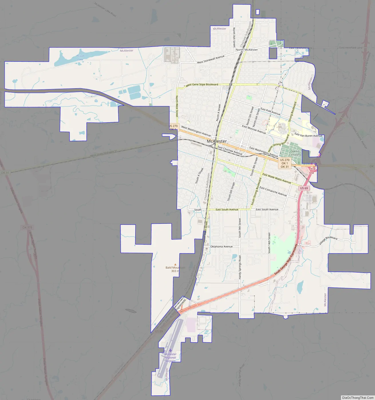
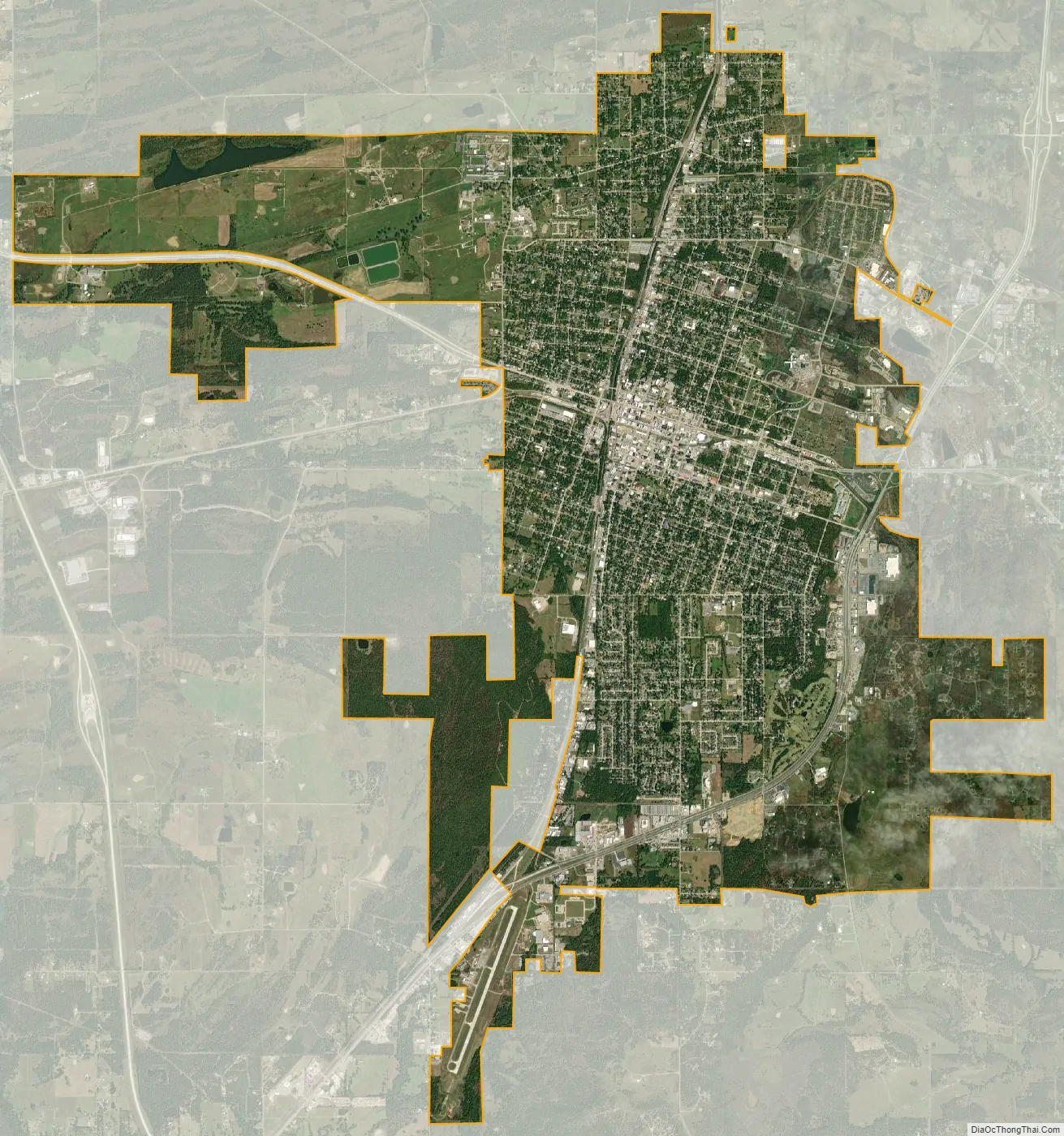
McAlester city Satellite Map
Geography
McAlester is at the intersection of U.S. Route 69 and U.S. Route 270, in Pittsburg County. According to the United States Census Bureau, the city has a total area of 41 square miles (110 km), of which 40.6 square miles (105 km) is land. It has a humid subtropical climate (Cfa) and average monthly temperatures range from 40.0 °F or 4.4 °C in January to 81.7 °F or 27.6 °C in July. PRISM Climate Group at Oregon State University The hardiness zone is 7b.
See also
Map of Oklahoma State and its subdivision:- Adair
- Alfalfa
- Atoka
- Beaver
- Beckham
- Blaine
- Bryan
- Caddo
- Canadian
- Carter
- Cherokee
- Choctaw
- Cimarron
- Cleveland
- Coal
- Comanche
- Cotton
- Craig
- Creek
- Custer
- Delaware
- Dewey
- Ellis
- Garfield
- Garvin
- Grady
- Grant
- Greer
- Harmon
- Harper
- Haskell
- Hughes
- Jackson
- Jefferson
- Johnston
- Kay
- Kingfisher
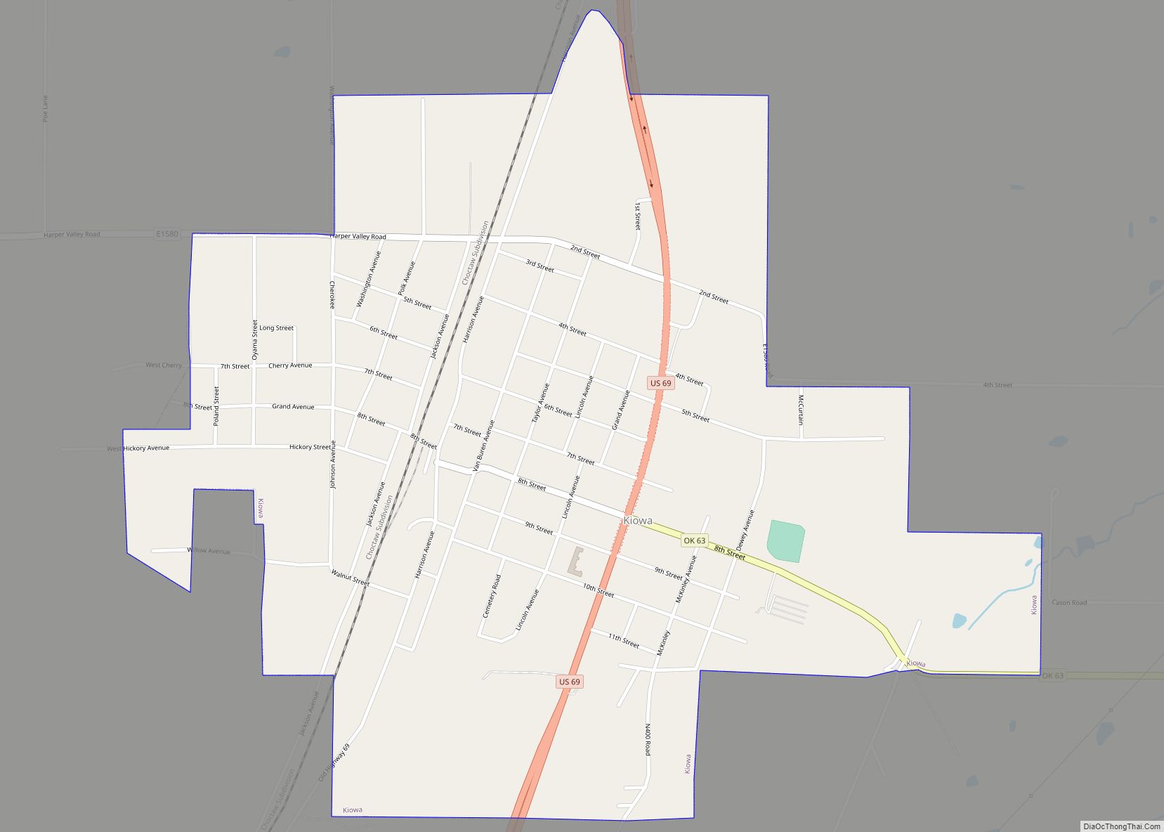
- Kiowa
- Latimer
- Le Flore
- Lincoln
- Logan
- Love
- Major
- Marshall
- Mayes
- McClain
- McCurtain
- McIntosh
- Murray
- Muskogee
- Noble
- Nowata
- Okfuskee
- Oklahoma
- Okmulgee
- Osage
- Ottawa
- Pawnee
- Payne
- Pittsburg
- Pontotoc
- Pottawatomie
- Pushmataha
- Roger Mills
- Rogers
- Seminole
- Sequoyah
- Stephens
- Texas
- Tillman
- Tulsa
- Wagoner
- Washington
- Washita
- Woods
- Woodward
- Alabama
- Alaska
- Arizona
- Arkansas
- California
- Colorado
- Connecticut
- Delaware
- District of Columbia
- Florida
- Georgia
- Hawaii
- Idaho
- Illinois
- Indiana
- Iowa
- Kansas
- Kentucky
- Louisiana
- Maine
- Maryland
- Massachusetts
- Michigan
- Minnesota
- Mississippi
- Missouri
- Montana
- Nebraska
- Nevada
- New Hampshire
- New Jersey
- New Mexico
- New York
- North Carolina
- North Dakota
- Ohio
- Oklahoma
- Oregon
- Pennsylvania
- Rhode Island
- South Carolina
- South Dakota
- Tennessee
- Texas
- Utah
- Vermont
- Virginia
- Washington
- West Virginia
- Wisconsin
- Wyoming